![Mountain Springtime [answer print]](/uploads/r/null/1/9/1956270/94c77115-67ec-41f5-911a-60a0227d8732-MI-553_142.jpg)
Mountain Springtime [answer print]
- AM1553-5-S4-: MI-553
- Item
- [1976]
Part of Yaletown Productions Inc. fonds
Film was a wildlife/educational piece presented by B.C. Hydro and narrated by Tommy Tompkins. Produced and edited by Michael Collier. Film features footage of swelling rivers, many different flora as well as wild animals, and their young, in their natural habitats. Wildlife featured include: moose, deer, beaver, squirrels, muskrats, geese, groundhogs, loons, osprey, fish, black bears, owls, raccoons, gyrfalcons, eagles, mountain goats, foxes, lynx, a lynx kitten, cougar kittens, marmots, and grizzly bears. This copy is in better shape than MI-275, and has unique introductory narration and footage as well as other editing differences throughout slightly changing the footage used as well as the narration.


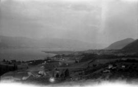


![Oroville, Wash[ington] from Anarchist M[oun]t[ain]](/uploads/r/null/c/6/c/c6cbb9de05dfd059413bfe53f740e3b92cbd2c230b73741ec481cea5e1e9694e/8de554c5-6470-4bc5-bb0a-675aef0b0760-CVA289-005_142.jpg)
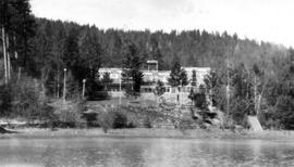
![P3 - Mike Collier - MC [Mike Collier] at work and Jason Pitt lk [lake]- w/p [workprint] - film l...](/uploads/r/null/1/9/1956948/30d5ceda-5342-42bb-926a-045fcfe17fc9-MI-582_142.jpg)


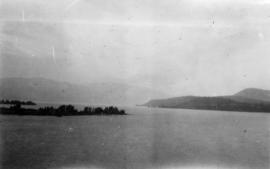
![Same lake [Kamloops Lake]](/uploads/r/null/9/1/3/913ef27e23a093f56481e0eabab63a8ed8811fe4edbbbdda8d09e7d949f92238/87ae6914-f4e8-4b42-b53a-2efa2a9c835d-CVA289-004_142.jpg)


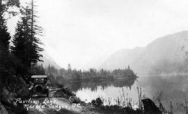
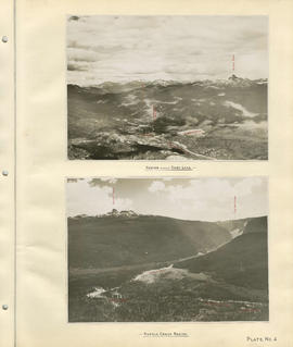
![Seton Lake from Mission M[oun]t[ain]](/uploads/r/null/8/e/2/8e2a4e0a92d677303bf60862e911ac4174a18858a2e7a06db4cf5ea042698767/c149f3eb-0dea-48f9-ad27-f48996f85dac-CVA289-005_142.jpg)