Vancouver Harbour : Sheet 1 (First Narrows to Second Narrows)
- AM1594-MAP 75-: 1972-103a
- Item
- Jan. 1933
Part of City of Vancouver Archives technical and cartographic drawing collection
1194 results with digital objects Show results with digital objects
Vancouver Harbour : Sheet 1 (First Narrows to Second Narrows)
Part of City of Vancouver Archives technical and cartographic drawing collection
Vancouver Harbour : Sheet 2 (Point Grey to Second Narrows)
Part of City of Vancouver Archives technical and cartographic drawing collection
Vancouver Harbour : Sheet 3 (Second Narrows to Port Moody)
Part of City of Vancouver Archives technical and cartographic drawing collection

Index to Streets and Index to Registered Plans
Part of City of Vancouver Archives technical and cartographic drawing collection
![Plate 115 [Twelfth Street to Tenth Avenue to Twentieth Street to Sixth Avenue]](/uploads/r/null/3/e/b/3eb1b1f2663b11b9151d3e22347f7b1fe922789a9a5866f3bf24b29d5b441606/74148ea4-ae2e-43f6-b969-bcdfff9ac71a-1972-472_142.jpg)
Plate 115 [Twelfth Street to Tenth Avenue to Twentieth Street to Sixth Avenue]
Part of City of Vancouver Archives technical and cartographic drawing collection
![Plate 116 [Second Street to Tenth Avenue to Twelfth Street to Sixth Avenue]](/uploads/r/null/9/4/a/94a2eaaee6d845d8743ef8c81252057bc025656a77c773dd17e5aa37113b3116/fe7612b5-f7f4-4f6f-b985-a278440f8554-1972-472_142.jpg)
Plate 116 [Second Street to Tenth Avenue to Twelfth Street to Sixth Avenue]
Part of City of Vancouver Archives technical and cartographic drawing collection
![Plate 117 [Richmond/Sherbrooke/Langley Streets to Tenth Avenue to Second Street to Sixth Avenue]](/uploads/r/null/9/a/e/9ae713ff3ad4c6eb7965c92b08a6609a1355df01d8464e5dc0a4cd5eb347daa3/42ac18ba-9e2f-47a3-9c4d-62090da71521-1972-472_142.jpg)
Plate 117 [Richmond/Sherbrooke/Langley Streets to Tenth Avenue to Second Street to Sixth Avenue]
Part of City of Vancouver Archives technical and cartographic drawing collection
![Plate 118 [Brunette River to Tenth Avenue to Langley/School/Keary Streets to Brunette Street]](/uploads/r/null/1/2/c/12c40d6d14f873e070ca2b0a5bfe05f2d1b13bcaf1775c8dc357e7ca81a55dda/1f12f0be-27cc-46e2-a722-0a8c209f762c-1972-472_142.jpg)
Plate 118 [Brunette River to Tenth Avenue to Langley/School/Keary Streets to Brunette Street]
Part of City of Vancouver Archives technical and cartographic drawing collection
![Plate 119 [Twelfth Street to Sixth Avenue to Twentieth Street/Lulu Island to Queens Avenue]](/uploads/r/null/7/c/5/7c5b58a5a6cc6d172d2c03c80829cda67864964df06d73df2acf92a075f3ac61/14e5f78e-0f29-4094-a1f1-0e18e3e413de-1972-472_142.jpg)
Plate 119 [Twelfth Street to Sixth Avenue to Twentieth Street/Lulu Island to Queens Avenue]
Part of City of Vancouver Archives technical and cartographic drawing collection
![Plate 120 [Second Street to Sixth Avenue to Twelfth Street to Queens Avenue]](/uploads/r/null/5/5/c/55c9677679407ee3ed1945edde4c9075d95bd4718a26b039ac09364740c4d69a/d6480416-ce8f-4c85-9e61-c26d7aab755f-1972-472_142.jpg)
Plate 120 [Second Street to Sixth Avenue to Twelfth Street to Queens Avenue]
Part of City of Vancouver Archives technical and cartographic drawing collection
![Plate 121 [Keary Street to Sixth Avenue to Second Street to Park Row/Fraser River]](/uploads/r/null/e/0/b/e0b9110e611fca8e7037073a608b76e7d8623e29f738c47ba3234626357a78c4/da4cc06d-e15e-47b9-8187-683773fb2ef5-1972-472_142.jpg)
Plate 121 [Keary Street to Sixth Avenue to Second Street to Park Row/Fraser River]
Part of City of Vancouver Archives technical and cartographic drawing collection
![Plate 122 [Brunette River to Brunette Street to S.B. III Block 5 to Fraser River]](/uploads/r/null/1/b/5/1b59e8167ff1f1ff2d6e31874f106bae417d748922ed50d678f528ec9ec0e187/0abdbdc1-6755-45b1-aefc-0f6dd819227c-1972-472_142.jpg)
Plate 122 [Brunette River to Brunette Street to S.B. III Block 5 to Fraser River]
Part of City of Vancouver Archives technical and cartographic drawing collection
![Plate 123 [Sixth Street to Queens Avenue to eastern tips of Poplar and Lulu Islands to Fraser River]](/uploads/r/null/9/6/d/96d1122e04715f2f5792c19254f6b90991bd8c8f67f1c7becfcc31e30d3fbca4/a6cd188b-876a-455e-976e-285546a198db-1972-472_142.jpg)
Plate 123 [Sixth Street to Queens Avenue to eastern tips of Poplar and Lulu Islands to Fraser River]
Part of City of Vancouver Archives technical and cartographic drawing collection
![Plate 124 [B.C. Penitentiary grounds to Queens Avenue to Sixth Street to Fraser River]](/uploads/r/null/d/6/1/d6109bdd8c80b7d668876a803cd92924e7a854073c637f53db4b2c4f2f56e7dd/f8d97cae-19cc-470a-868c-534f137994b1-1972-472_142.jpg)
Plate 124 [B.C. Penitentiary grounds to Queens Avenue to Sixth Street to Fraser River]
Part of City of Vancouver Archives technical and cartographic drawing collection

Plate 125 Queensborough - south-west
Part of City of Vancouver Archives technical and cartographic drawing collection

Plate 126 Queensborough - south-east
Part of City of Vancouver Archives technical and cartographic drawing collection

Plate 127 Queensborough - north-west
Part of City of Vancouver Archives technical and cartographic drawing collection

Plate 128 Queensborough - north-east
Part of City of Vancouver Archives technical and cartographic drawing collection

Part of City of Vancouver Archives technical and cartographic drawing collection
Item is the cover for the brochure of maps of the British Properties development.

Part of City of Vancouver Archives technical and cartographic drawing collection
Item is an index map for the other maps in the file, showing the British Properties development.

Part of City of Vancouver Archives technical and cartographic drawing collection
Item is a map depicting the area of the British Properties development bordered by Stevens Drive and Rabbit Lane.

Part of City of Vancouver Archives technical and cartographic drawing collection
Item is a map depicting the area of the British Properties development bordered by Stevens Drive and the golf course.
Part of City of Vancouver Archives technical and cartographic drawing collection
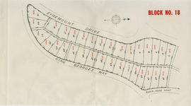
Item is a map depicting the area of the British Properties development bordered by Eyremount Drive, King George's Way and Robin Hood Road.

Part of City of Vancouver Archives technical and cartographic drawing collection
Item is a map depicting the area of the British Properties development bordered by King George's Way and Southborough Drive.

Part of City of Vancouver Archives technical and cartographic drawing collection
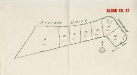
Item is a map depicting the area of the British Properties development bordered by Eyremount Drive, King George's Way and Fairmile Road.

Part of City of Vancouver Archives technical and cartographic drawing collection
Item is a map depicting the area of the British Properties development bordered by Fairmile Road, Eyremount Drive and Southborough Drive.

Part of City of Vancouver Archives technical and cartographic drawing collection
Item is a map depicting the area of the British Properties development bordered by Stevens Drive and Hadden Drive.
Part of City of Vancouver Archives technical and cartographic drawing collection
Item is a map depicting the area of the British Properties development bordered by Stevens Drive and Hadden Drive near Eastcot Road.

Part of City of Vancouver Archives technical and cartographic drawing collection
![Section 1 [Coal Harbour to Jervis Street]](/uploads/r/null/9/e/9/9e9001a91f4548dd7acb5cf68e9748a8fa0f3d8a10ad9a1235983466dfcc5e1f/d062ae77-a147-4ff8-8a2f-805b659ba7b3-1972-581_142.jpg)
Section 1 [Coal Harbour to Jervis Street]
Part of City of Vancouver Archives technical and cartographic drawing collection
![Section 2 [Jervis Street to Granville Street]](/uploads/r/null/c/f/5/cf5684518fb1cdac0f2d643c89acc078a47fe51a6a1896caf8fcfaf23999a562/c5097ebd-7d02-4ddb-be5e-d0f2658f2849-1972-581_142.jpg)
Section 2 [Jervis Street to Granville Street]
Part of City of Vancouver Archives technical and cartographic drawing collection
![Section 3 [Granville Street to Abbott Street]](/uploads/r/null/f/7/c/f7c18e536d617ec84d3c777f7d3bc02b98868d606842132c28166caaaa2dac3d/7e715850-e92f-48ba-bbc7-3678c5a832df-1972-581_142.jpg)
Section 3 [Granville Street to Abbott Street]
Part of City of Vancouver Archives technical and cartographic drawing collection
![Section 4 [Abbott Street to Gore Avenue]](/uploads/r/null/d/0/b/d0bdb5bfbb8ea9ebfe40ab12d3166035d9041c0874b44ccbcf0feaf7d343e90d/3d33023b-e416-4a39-b51c-f201b58c1e2c-1972-581_142.jpg)
Section 4 [Abbott Street to Gore Avenue]
Part of City of Vancouver Archives technical and cartographic drawing collection
![Section 5 [Gore Avenue to Heatley Avenue]](/uploads/r/null/c/a/9/ca9447df558507296e13d910ed22dcef00b730757d8104a6fdbd5d4e2955a8e1/f669a13d-c71c-4b3a-904d-555f84e054a3-1972-581_142.jpg)
Section 5 [Gore Avenue to Heatley Avenue]
Part of City of Vancouver Archives technical and cartographic drawing collection
![Section 6 [Heatley Avenue to Raymur Avenue]](/uploads/r/null/3/a/0/3a00a7d7ff2433b00b59b0d575006a89ff1e36eea4ecb961d585d3702308874e/61c58478-fbdc-4b03-b27d-4c69089913cd-1972-581_142.jpg)
Section 6 [Heatley Avenue to Raymur Avenue]
Part of City of Vancouver Archives technical and cartographic drawing collection
Item is a sheet of a fire insurance plan. The sheet includes undated revisions to include designs for a new pier west of the Great Northern Railway warehouse and pier.
![Section 7 [Raymur Avenue to McLean Drive]](/uploads/r/null/6/6/9/669640404bae29e74b38e879b94454a054f0417ed40580a028e0db5b976a2e80/614de88a-1a33-4127-8bdf-f328f3cd4e22-1972-581_142.jpg)
Section 7 [Raymur Avenue to McLean Drive]
Part of City of Vancouver Archives technical and cartographic drawing collection
![Section 8 [McLean Drive to Salisbury Drive]](/uploads/r/null/9/1/c/91cb699e74dcee955f380f79208650cd638e651fcce20dbaf91e0f6fd7309854/2dcab9c8-db56-41e3-934c-91dbdfccf6f8-1972-581_142.jpg)
Section 8 [McLean Drive to Salisbury Drive]
Part of City of Vancouver Archives technical and cartographic drawing collection
![Section 9 [Salisbury Drive to McGill and Wall Streets]](/uploads/r/null/2/c/a/2ca00124652bd05f6e2ba7a38be0913c343f9df3ba7b70bb934ceb836de2fa89/dd14b8fd-0710-4ff6-9a02-2a79e289941f-1972-581_142.jpg)
Section 9 [Salisbury Drive to McGill and Wall Streets]
Part of City of Vancouver Archives technical and cartographic drawing collection
![Plate 2 [Hornby Street to Burrard Inlet to Thurlow Street to Pender Street]](/uploads/r/null/8/6/e/86edaec51670e0342c610b1530e723e6bb9890d9ef2f3b0db31ad30f0b559c61/adee6b6a-0b86-4884-b86a-cbcb2773c325-1972-582_142.jpg)
Plate 2 [Hornby Street to Burrard Inlet to Thurlow Street to Pender Street]
Part of City of Vancouver Archives technical and cartographic drawing collection
![Plate 3 [Seymour Street to Burrard Inlet to Hornby Street to Pender Street]](/uploads/r/null/b/6/e/b6e52f14a0b98be97e608633aaf0e2cdd8d5a51d8772a2b1ef80d1b748c7ebdc/eecaa1fa-a58b-4079-bf99-7f62b81de43f-1972-582_142.jpg)
Plate 3 [Seymour Street to Burrard Inlet to Hornby Street to Pender Street]
Part of City of Vancouver Archives technical and cartographic drawing collection
![Plate 4 [Hamilton & Cambie Streets to CP Railway yards to Seymour Street to Pender Street]](/uploads/r/null/7/e/9/7e931c45a666b558ca27b156ef8b243f5244a2820199fe50e04a7aaed21eeb20/06bd9672-ba7d-4013-aaac-2d7c9d8c5188-1972-582_142.jpg)
Plate 4 [Hamilton & Cambie Streets to CP Railway yards to Seymour Street to Pender Street]
Part of City of Vancouver Archives technical and cartographic drawing collection
![Plate 5 [Abbott Street to CP Rail right-of-way to Cambie Street to Pender Street]](/uploads/r/null/6/b/0/6b0b7025ad796cf3c24bd82d3128128aeb9437211623e8b002f3aa257584f3d8/b2e8d0db-d7d6-463d-9eed-a04b68cd2033-1972-582_142.jpg)
Plate 5 [Abbott Street to CP Rail right-of-way to Cambie Street to Pender Street]
Part of City of Vancouver Archives technical and cartographic drawing collection
![Plate 6 [Carrall Street to Water Street to Abbott Street to Pender Street]](/uploads/r/null/2/9/d/29d9b87c8a0b2ec0ebe43b7a1b209cf540943a17fcdf02f7fbf229b97c9beb06/65cae868-4124-4b7f-bb47-c6364f18c039-1972-582_142.jpg)
Plate 6 [Carrall Street to Water Street to Abbott Street to Pender Street]
Part of City of Vancouver Archives technical and cartographic drawing collection
![Plate 7 [Main Street to Powell Street to Columbia Street to Pender Street]](/uploads/r/null/d/f/b/dfb6afa705be957fb1edcc4db4eebed9e70de2f7da4428a558a100303c04c15c/49c15b71-8829-4feb-b5c6-1643c02b3907-1972-582_142.jpg)
Plate 7 [Main Street to Powell Street to Columbia Street to Pender Street]
Part of City of Vancouver Archives technical and cartographic drawing collection
![Plate 10 [CPR yards between Pender Street and Georgia viaduct]](/uploads/r/null/4/d/f/4df4324d57fa032950845b1be5ae2e04c2707c20e598bf307101a36ba7929130/176fae2d-a49c-4f75-99db-5ec876a739ce-1972-582_142.jpg)
Plate 10 [CPR yards between Pender Street and Georgia viaduct]
Part of City of Vancouver Archives technical and cartographic drawing collection
![Plate 11 [Great Northern, Canadian Pacific and BC Electric rail wards south of Pender Street]](/uploads/r/null/e/3/8/e3845e99a86b7c63562774d7ac49596466047a1ef5d4daf1ede5be765cc5f434/7338b83f-7dd7-4768-832b-57a4c33a7cc2-1972-582_142.jpg)
Plate 11 [Great Northern, Canadian Pacific and BC Electric rail wards south of Pender Street]
Part of City of Vancouver Archives technical and cartographic drawing collection
![Plate 16 [Seymour Street to Pender Street to Hornby Street to Georgia Street]](/uploads/r/null/5/b/3/5b3e6b9c6b363ebf8647de3c6cbd08be134849a51c2afb6ae2d8270992423224/1bbec413-4808-4972-ba42-96d87508f044-1972-582_142.jpg)
Plate 16 [Seymour Street to Pender Street to Hornby Street to Georgia Street]
Part of City of Vancouver Archives technical and cartographic drawing collection
![Plate 17 [Hamilton Street to Pender Street to Seymour Street to Georgia Street]](/uploads/r/null/d/b/0/db02a6582e4c80b48f4280307b3a1bf96e118648e3076fd16fe61c9a33d078a4/9e87cf0f-995c-4324-92af-170d1a2248d5-1972-582_142.jpg)
Plate 17 [Hamilton Street to Pender Street to Seymour Street to Georgia Street]
Part of City of Vancouver Archives technical and cartographic drawing collection
![Plate 18 [Seymour Street to Georgia Street to Hornby Street to Smithe Street]](/uploads/r/null/1/a/4/1a4187cb3019a9f0a84f3d7a4ffed7e4cb88181cbd49481d7904d57b9dfd1cc6/bd298293-e0af-4e5a-b89c-faab9207fc67-1972-582_142.jpg)
Plate 18 [Seymour Street to Georgia Street to Hornby Street to Smithe Street]
Part of City of Vancouver Archives technical and cartographic drawing collection
![Plate 19 [Hamilton Street to Georgia Stret to Seymour Street to Smithe Street]](/uploads/r/null/0/e/c/0ecea3ead6474f95320d3370c410bde1bef129fc8bcb8e54709f6f4aae7e3461/561bca07-f000-4835-ad8e-9e2bda093863-1972-582_142.jpg)
Plate 19 [Hamilton Street to Georgia Stret to Seymour Street to Smithe Street]
Part of City of Vancouver Archives technical and cartographic drawing collection