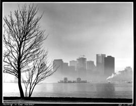
- AM1668-: CVA 293-023.1
- Item
- Feb. 22, 1973
5 results with digital objects Show results with digital objects


![Granville [Townsite], B.C. Aug., 1885](/uploads/r/null/1/a/4/1a45ddd637fe3f3726748d5096017a8461446b9a013c408ed2b1666c8433e1f9/405fdc0d-6d88-41b7-937f-36cc7f51518a-MAP553_142.jpg)
Granville [Townsite], B.C. Aug., 1885
Part of City of Vancouver Archives technical and cartographic drawing collection
Item is a fire insurance map of the "Coal Harbour" [south shore of Burrard Inlet] area. The Hastings Saw Mill Company and Coal Harbour Fishery are shown in detail. Other businesses along Front Street are identified including hotels and stores.
Part of City of Vancouver Archives technical and cartographic drawing collection
Item is a map showing dredging of Coal Harbour, with depth soundings given in feet (taken from Admiralty charts). The map hows which areas of land in Coal Harbour were dry at low water levels.
Canada. Department of Public Works