- AM1594-: MAP 837
- Item
- 19--
Part of City of Vancouver Archives technical and cartographic drawing collection
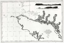
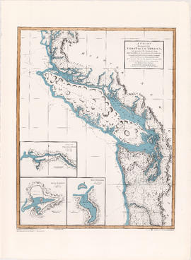
Item is a reproduction of a map depicting the Spanish explorations of the north-west coast of North American in 1795, specifically depicting the northern end of Vancouver Island and the adjacent mainland. Illustrations are views of the entrance to Nootka Sound, and a view of "Cabo Frondoso" (Cape Cook?).

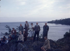
![Going to [Mitlenatch Island]](/uploads/r/null/f/e/d/fed3a763e66009cfb8891b4f95035241216736342d267a32fea3f87c7f72d946/5f3248d6-b738-4c1d-b7f9-51b3a58bd94e-2005-040_142.jpg)

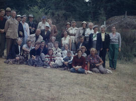
![Group on V. Is. [Vancouver Island] at Nanoose](/uploads/r/null/8/d/6/8d62aa8abb26e5649d3ff49903d0fda750ad864238bf0e4dc1d28ee24dd0b29c/c2584b8a-4cd9-4593-b9e3-8adaa0eeaafe-2005-040_142.jpg)


![Dr. Brink describing lupin in meadow on V. I. [Vancouver Island] Long Beach](/uploads/r/null/c/4/0/c401962f5de8a041ad64242a33a168a420e8e797e227738666e55e032bb833d9/23e9ca56-f6a9-4d42-b2f1-85890a243cd9-2005-040_142.jpg)