![[View of] Little Qualicum Falls](/uploads/r/null/4/4/444ce78ed582a5760d5e6672b65530e5e3b12f77ceabe62c2c58b992d206088c/f5dbd7cb-1ace-4bcf-ae6a-3812087bb189-A72038_142.jpg)
[View of] Little Qualicum Falls
- AM1663-: CVA 300-183
- Item
- [between 1936 and 1938]
Part of Karl Haspel fonds
199 results with digital objects Show results with digital objects
[View of] Little Qualicum Falls
Part of Karl Haspel fonds
![[View of] Little Qualicum Falls](/uploads/r/null/4/0/4063dff1ad52452b8c6450e735ed8a45e6dc84f3e366ea55b5d6e5d54e9e973a/c4b3a4b5-7cfc-43d1-a4ef-fa382dad3929-A72039_142.jpg)
[View of] Little Qualicum Falls
Part of Karl Haspel fonds
![[View of] Little Qualicum Falls](/uploads/r/null/8/9/8923e2a2e8b20b1d3f1ee14f346adef7beac44890a81e0397e832b764c0d85ee/b668948b-23f2-4c30-bb79-b13735ec9955-A72040_142.jpg)
[View of] Little Qualicum Falls
Part of Karl Haspel fonds

A river near Little Qualicum Falls
Part of Karl Haspel fonds
Maps of Victoria and Vancouver Island, mileage chart and traffic routes
Part of City of Vancouver Archives technical and cartographic drawing collection
Part contains a street map of Victoria with street index, a map of Victoria and vicinity showing major roads, a map of Vancouver Island showing highways, a mileage chart, and traffic rules for Vancouver and Victoria.

British Columbia Electric Railway Company Limited : Vancouver Island system and Mainland system
Part of City of Vancouver Archives technical and cartographic drawing collection
Part contains two maps showing city, suburban, and interurban railway lines, transmission lines, generating stations, substations, and transformers.

Map no. 1 shewing Union Steamship Company route and ports of call : lower run
Item is a map showing ports of call along Vancouver Island and the southern coast of British Columbia from Smith Sound to Vancouver.

Northerly portion Vancouver Island
Item is a map of northern Vancouver Island and the adjacent British Columbia coast showing Crown and reserve lands, timber leases, district, park, and provincial forest boundaries, cities, municipalities, villages, post offices, hospitals, roads, railways, seaplane ports and anchorages, airports, elevations of some geographical features, and marine distances in nautical miles.

Part of City of Vancouver Archives technical and cartographic drawing collection
Item is a map showing the Pacific Coast of British Columbia and Washington and Oregon states as surveyed by French explorer Jean-Francois de Galaup (Laperouse) in 1786, and the routes of his ships Astrolabe and Boussole. The map shows the Pacific coastline from Cap Rond (Tillamook Head) in Oregon at latitude 45 degrees and 40 minutes in the south to Baeie de Clonard (Beresford Bay, northwestern tip of Haida Gwaii) in British Columbia at latitude 54 degrees and 10 minutes in the north. Other major place names on the map include Nootka, Pointe Boisee, Baie St. Louis, Iles de Sartine, Mont Fleurieu, Cap Fleurieu, Cap Hector, Mont de la Touche, Baie de la Touche, and Baie de Clonard. Vancouver Island is shown as part of the mainland. Map includes latitudes and longtitudes as well as indication of elevations. Map is a plate from the "Atlas de Voyage de la Perouse".

Portions of New Westminster District and Vancouver Island
Part of City of Vancouver Archives technical and cartographic drawing collection
Item is an economic map which depicts the area of central Vancouver Island made up of the Comox, Nelson, and Newcastle land divisions, as well as portions of the Alberni, Cameron and Nanoose land district. The map includes the inside passage islands between Lasqueti and Sonora Islands, and the coastal portion of the New Westminster land district from Bute Inlet south to the mouth of the north arm of the Fraser River.
Information included on the map includes timber licenses, Indian reservations, other government reserves, District Lots, physical features (not including topography), and municipal boundaries.

Southerly portion. Vancouver Island
Part of City of Vancouver Archives technical and cartographic drawing collection
Item is an economic map which depicts Vancouver Island south of Buttle Lake, as well as coastal areas of the mainland from the approximate location of Britannia Beach, south and the northern coast of the Olympic Peninsula. Information included in the map include Timber Licenses, Indian reserves, other land reserves, municipal boundaries, District Lots outside municipalities, geographic features (not including topography), transportation routes, and parks.

Part of City of Vancouver Archives technical and cartographic drawing collection
Item is a map showing railway lines from Kamloops to the Vancouver, homesteads, lands disposed of by the provincial government, Indian reserves, forest reserves and parks, timber berths, grazing leases and land sales, land grants and mining land sales. Inset shows Vancouver Island and its railway line.

Map of south western British Columbia showing coastal lumber producers
Primary map shows lumber shippers and producers in the Lower Mainland and Vancouver Island. Inset maps show lumber shippers and producers in Greater Vancouver and the location of the primary map in relation to the rest of Canada.

Vancouver sheet, British Columbia
Part of City of Vancouver Archives technical and cartographic drawing collection
Item is a map of Vancouver Island and the southwest portion of mainland British Columbia from Bella Coola to Clinton, and south to New Westminster. Map shows geological, land district, and park boundaries; locations of mining recording offices and sub-offices; elevations in feet above sea level; mineral occurrences; and the development of geological formations by era.

Map of south western British Columbia showing coastal lumber producers
Primary map shows lumber shippers and producers in the Lower Mainland and Vancouver Island. Inset maps show lumber shippers and producers in Greater Vancouver and the location of the primary map in relation to the rest of Canada.

Portions of New Westminster District and Vancouver Island
Part of Bushnell family fonds
Item is an economic map which depicts the area of central Vancouver Island made up of the Comox, Nelson, and Newcastle land divisions, as well as portions of the Alberni, Cameron and Nanoose land district. The map includes the inside passage islands between Lasqueti and Sonora Islands, and the coastal portion of the New Westminster land district from Bute Inlet south to the mouth of the north arm of the Fraser River.
Information included on the map includes timber licenses, Indian reservations, other government reserves, District Lots, physical features (not including topography), and municipal boundaries.
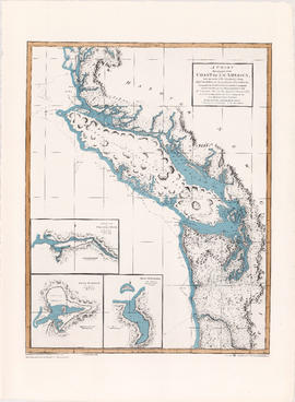
A chart shewing part of the coast of N.W. America
Part of City of Vancouver Archives technical and cartographic drawing collection
Item is a map, which is a coloured reproduction made in 1974 of one of the charts made in 1798 of George Vancouver's surveys of the Pacific coast of North America. The plate depicts the area from Cape Lookout, north to Cape Swain. The routes taken by Vancouver are marked. Inset map shows a survey of Port Stewart. Three inset maps show the entrance of the Columbia River, Port of Discovery and Gray's Harbour. The routes taken by Captain Vancouver are marked.
British Columbia and Vancouver Island
Part of City of Vancouver Archives technical and cartographic drawing collection
Item is a map showing the Pacific Coast, Hudson Bay territory, Indian territory, British Columbia, New Caledonia, Russian America, and the north-western United States.
![Art [Lord] and Myrtle [Kilpatrick]](/uploads/r/null/2/9/6/29681e7e966aaaadca36c2c242b75bf0f6265196b44867dea92348983e183cf0/7f38dafb-6bf6-4fbf-af24-ea549eb4adb5-CVA289-003_142.jpg)
Art [Lord] and Myrtle [Kilpatrick]
Part of William Orson Banfield fonds
![Myrtle [Kilpatrick]](/uploads/r/null/0/0/e/00eb0b77a13bfa824ec6d3f8ef73553f073ef19c95c4de4431d7880bb4fe78c0/0f25f379-7ce2-45a3-9701-e92d8743e8b1-CVA289-003_142.jpg)
Part of William Orson Banfield fonds
![W.O. B[anfield]](/uploads/r/null/5/6/b/56b3c079e2acbb602cbe399aef90076a27aa04da390a5d7e22eebedcf438345c/7bcc418c-5711-4c46-8c27-bcb5b3b5618b-CVA289-003_142.jpg)
Part of William Orson Banfield fonds
Part of William Orson Banfield fonds
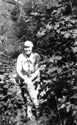
![Olive [Sadler] triumphant, Myrtle [Kilpatrick] recumbent](/uploads/r/null/3/c/d/3cdd092c58003b9f1564602cb27b75a6b6d9d5329ce8d2579ba5ae570dbfbbef/0ca04af8-9f49-47bf-b9ec-aafb07d8ec09-CVA289-003_142.jpg)
Olive [Sadler] triumphant, Myrtle [Kilpatrick] recumbent
Part of William Orson Banfield fonds
![[Olive Kilpatrick, Myrtle Kilpatrick and Olive Sadler] ready to start for Parksville](/uploads/r/null/8/4/e/84e5b76d02e75b8bf5aeb46b564dd3787ba2e3514d77cc54d275b5cba4575b50/bf7277c0-163e-486f-9ab0-524d2d6f6f1f-CVA289-003_142.jpg)
[Olive Kilpatrick, Myrtle Kilpatrick and Olive Sadler] ready to start for Parksville
Part of William Orson Banfield fonds

Part of William Orson Banfield fonds

Part of William Orson Banfield fonds

Part of William Orson Banfield fonds
![Art [Lord] and W.O. B[anfield]](/uploads/r/null/5/3/f/53f0fcdb44ccfece88214d9155d19b7cc9ecf2e60e0f0d62c93476dc2854f56c/a4f5dc37-3e26-4f8c-a051-133c646a43ed-CVA289-003_142.jpg)
Art [Lord] and W.O. B[anfield]
Part of William Orson Banfield fonds
![Olive arguing with Myrtle [Kilpatrick]](/uploads/r/null/f/b/5/fb5e43c6c9885b6013666776c041dbf07f6ecc2cc842ad061a6171a76617d2e2/242a8de0-b973-450f-b843-3390a5d5d031-CVA289-003_142.jpg)
Olive arguing with Myrtle [Kilpatrick]
Part of William Orson Banfield fonds
![Myrtle [Kilpatrick] and Olive [Sadler]](/uploads/r/null/2/2/a/22ae0074631268708a81b2647fa6c6d3a6d893c4b3007dcb789a11087d7dae2b/da34a586-a84c-4bbb-8416-fde3ccbf6515-CVA289-003_142.jpg)
Myrtle [Kilpatrick] and Olive [Sadler]
Part of William Orson Banfield fonds
![West Coast trip [with Sherwood Lett, Arthur Lord, W.O. Banfield] : Sherwood [Lett] in his dugout](/uploads/r/null/b/6/b/b6b93246213c96c15ebe8781d1f2260fd15eccace8f9e95c5eaa0c61512b333a/5b506369-d36d-42cd-99f3-6e526198a0e7-CVA289-003_142.jpg)
West Coast trip [with Sherwood Lett, Arthur Lord, W.O. Banfield] : Sherwood [Lett] in his dugout
Part of William Orson Banfield fonds
![West Coast trip [with Sherwood Lett, Arthur Lord, W.O. Banfield] : The picnic leaving the beach](/uploads/r/null/2/c/a/2caee8173fe25e1f11201a016da020341f0e7b41d8f2c5847af3cb033e85994e/542b242b-39ad-4112-b00c-dd96757f105a-CVA289-003_142.jpg)
West Coast trip [with Sherwood Lett, Arthur Lord, W.O. Banfield] : The picnic leaving the beach
Part of William Orson Banfield fonds
![West Coast trip [with Sherwood Lett, Arthur Lord, W.O. Banfield] : Lagoon in North Arm of Sidney ...](/uploads/r/null/d/a/3/da309305ba5dfbe6fc4d3a975b07fd3a6dc549f236160c2f0002ac52c62d961c/ce137057-6be8-4db2-bcb4-a64e073beadb-CVA289-003_142.jpg)
Part of William Orson Banfield fonds
![West Coast trip [with Sherwood Lett, Arthur Lord, W.O. Banfield] : Megin River](/uploads/r/null/f/7/2/f7279ddc914ac9b87843e908c97d6652752c2e844bdb916faf19ae7a890dfb89/c2b4ae58-ebd1-4b21-91d3-0d5cbbad0e3b-CVA289-003_142.jpg)
West Coast trip [with Sherwood Lett, Arthur Lord, W.O. Banfield] : Megin River
Part of William Orson Banfield fonds
![West Coast trip [with Sherwood Lett, Arthur Lord, W.O. Banfield] : Lagoon at Megin River](/uploads/r/null/f/2/e/f2ea2140c729b22a745d5966404ed3711eea353fbb7ff509df370ebf8429c98e/af7058e2-36ed-4a0b-bacd-5336166902df-CVA289-003_142.jpg)
West Coast trip [with Sherwood Lett, Arthur Lord, W.O. Banfield] : Lagoon at Megin River
Part of William Orson Banfield fonds
![West Coast trip [with Sherwood Lett, Arthur Lord, W.O. Banfield] : The "Bedouin" in Ril...](/uploads/r/null/0/3/5/035fa0a7507dbc91d4bb5fd635d88f7302bf09a91b80cc5e790885cff7d185cd/20a764f5-2a88-4039-a137-945598d04dc8-CVA289-003_142.jpg)
West Coast trip [with Sherwood Lett, Arthur Lord, W.O. Banfield] : The "Bedouin" in Riley's Cove
Part of William Orson Banfield fonds
![West Coast trip [with Sherwood Lett, Arthur Lord, W.O. Banfield] : Looking out of Riley's Cove](/uploads/r/null/9/4/1/9419eba203962b56153fcf59f5f913195937aabfd74062251cb908b04476f412/57ca2b33-fbb5-4664-b3b7-29224978fb5f-CVA289-003_142.jpg)
West Coast trip [with Sherwood Lett, Arthur Lord, W.O. Banfield] : Looking out of Riley's Cove
Part of William Orson Banfield fonds
![West Coast trip [with Sherwood Lett, Arthur Lord, W.O. Banfield] : Lower reaches of Trout River](/uploads/r/null/b/2/e/b2eef641593160732bc00be405bee31d18fcd91a4de91130c9bd34ee2729a531/6c3d55e6-de11-4dcf-b6fc-d5674240eb4c-CVA289-003_142.jpg)
West Coast trip [with Sherwood Lett, Arthur Lord, W.O. Banfield] : Lower reaches of Trout River
Part of William Orson Banfield fonds
![West Coast trip [with Sherwood Lett, Arthur Lord, W.O. Banfield] : Art [Lord] fishing in Trout River](/uploads/r/null/c/c/a/ccab4317f563529cebd8372c99467266b9bf5a80a0101d414ced94d21c286ae4/0798ff25-1601-4f04-8cf7-0fe8a7108d64-CVA289-003_142.jpg)
West Coast trip [with Sherwood Lett, Arthur Lord, W.O. Banfield] : Art [Lord] fishing in Trout River
Part of William Orson Banfield fonds
![West Coast trip [with Sherwood Lett, Arthur Lord, W.O. Banfield] : Sherwood [Lett] the fisherman](/uploads/r/null/d/8/b/d8bef33ca4b26b007589fcd07f6e9f858830e4076653b29b32fece04c16b16b0/b1895109-062f-4d40-b87f-24ea86fc4cb2-CVA289-003_142.jpg)
West Coast trip [with Sherwood Lett, Arthur Lord, W.O. Banfield] : Sherwood [Lett] the fisherman
Part of William Orson Banfield fonds
![West Coast trip [with Sherwood Lett, Arthur Lord, W.O. Banfield] : Our wolf fish](/uploads/r/null/2/0/f/20f109e479db7553825fec5d2918ae27aab724f9e3493bd3374e6a0999a40ad8/f3ed1610-09d6-4d7b-8374-908211993f19-CVA289-003_142.jpg)
West Coast trip [with Sherwood Lett, Arthur Lord, W.O. Banfield] : Our wolf fish
Part of William Orson Banfield fonds
![West Coast trip [with Sherwood Lett, Arthur Lord, W.O. Banfield] : Our wolf fish](/uploads/r/null/e/7/e/e7e85141590664ee1841d469cafe03cff3e9aeb691447bd426e0b9845a35da85/5857d61d-6092-4a4b-b617-785e31e77730-CVA289-003_142.jpg)
West Coast trip [with Sherwood Lett, Arthur Lord, W.O. Banfield] : Our wolf fish
Part of William Orson Banfield fonds
![West Coast trip [with Sherwood Lett, Arthur Lord, W.O. Banfield] : The set complete, lifting the ...](/uploads/r/null/2/f/b/2fb07228d267632e04d07604b9bd34d8219abb57b2b2f08f1cb9d10adb521ca5/2b8db0f5-25df-4eaf-a0fb-6d99ce46baa1-CVA289-003_142.jpg)
Part of William Orson Banfield fonds
![West Coast trip [with Sherwood Lett, Arthur Lord, W.O. Banfield] : Gathering the net in](/uploads/r/null/e/3/a/e3a3366241397bc9fa4b40afe97704d1bbd555369f8f1bfa50123ec9a339ffe1/ce17d5fa-4a10-4d4c-94d3-590a1a246d62-CVA289-003_142.jpg)
West Coast trip [with Sherwood Lett, Arthur Lord, W.O. Banfield] : Gathering the net in
Part of William Orson Banfield fonds
![West Coast trip [with Sherwood Lett, Arthur Lord, W.O. Banfield] : Starting the brail](/uploads/r/null/2/d/e/2de617b3392489d33f277e962ecd28184efd5f66d425d061b9fb7faaf9e2770a/c8eaff7c-5cc6-4e98-a83f-d36433242500-CVA289-003_142.jpg)
West Coast trip [with Sherwood Lett, Arthur Lord, W.O. Banfield] : Starting the brail
Part of William Orson Banfield fonds
![West Coast trip [with Sherwood Lett, Arthur Lord, W.O. Banfield] : Dumping the silver horde](/uploads/r/null/0/f/3/0f3e3d90e7bf32b7472b25ce46f3c6c63f78c68e71905c29a86a31077f37a9e4/d90c43e7-7e1e-4992-950b-3aead4760594-CVA289-003_142.jpg)
West Coast trip [with Sherwood Lett, Arthur Lord, W.O. Banfield] : Dumping the silver horde
Part of William Orson Banfield fonds
![West Coast trip [with Sherwood Lett, Arthur Lord, W.O. Banfield] : Some of our catch](/uploads/r/null/3/0/0/30024c016d3fd6a5d456fad118d31feb2b9cd0ecb41b53587b9b8854a96275aa/0a6a75b2-df01-451e-b062-8fb498b1c76f-CVA289-003_142.jpg)
West Coast trip [with Sherwood Lett, Arthur Lord, W.O. Banfield] : Some of our catch
Part of William Orson Banfield fonds
![West Coast trip [with Sherwood Lett, Arthur Lord, W.O. Banfield] : The scow being loaded](/uploads/r/null/6/5/1/6515c8ea886c23f029fd699b055dbfbd7b7ff3f3a7eecbabb212c244aef74630/0cfcce07-0894-4f15-98d9-84b1f4e60d59-CVA289-003_142.jpg)
West Coast trip [with Sherwood Lett, Arthur Lord, W.O. Banfield] : The scow being loaded
Part of William Orson Banfield fonds
![West Coast trip [with Sherwood Lett, Arthur Lord, W.O. Banfield] : Getting dinner on the "Be...](/uploads/r/null/6/3/2/6326b5d85f9f6e8ae0479b296399bfadef897844da1ebeb760704e402f41d52b/1a5659c2-116a-46f9-8088-cbca5c27066a-CVA289-003_142.jpg)
West Coast trip [with Sherwood Lett, Arthur Lord, W.O. Banfield] : Getting dinner on the "Bedouin"
Part of William Orson Banfield fonds
![West Coast trip [with Sherwood Lett, Arthur Lord, W.O. Banfield] : Brailing fish](/uploads/r/null/c/8/a/c8a0408a587b5f8aba7c66deeb0c6812ed37a0e32832894c9d8ecdb0ce7c31b0/00539abd-8467-4d4d-ab2f-37d8ec0cfc74-CVA289-003_142.jpg)
West Coast trip [with Sherwood Lett, Arthur Lord, W.O. Banfield] : Brailing fish
Part of William Orson Banfield fonds