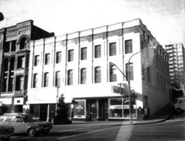
![[Burr and Guichon Block, 401-419 Columbia Street, New Westminster]](/uploads/r/null/0/f/0f44359f777e6fd8febc52123b251740579adb530f9037b9105098f13cf2d1bc/113130b6-081b-48ae-a300-ad1fb173770b-CVA810-67_142.jpg)
[Burr and Guichon Block, 401-419 Columbia Street, New Westminster]
- AM123-S4---: CVA 810-67
- Item
- 1982
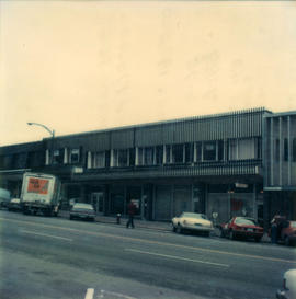
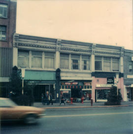
Photograph shows the Burr and Guichon blocks on Columbia Street from across Columbia Street. Street lights and wires and a car are visible in the photograph. Businesses shown include Butterfield Florists.
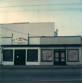
![[Rear view of Burr and Guichon Block, 401-419 Columbia Street, New Westminster]](/uploads/r/null/0/8/082af37313f5024fbdc04e691fb122ca1c057adbd5dfbe665062b94b3e9c88ab/98c2823c-6b85-47ec-8e47-18536c76d48f-CVA810-68_142.jpg)


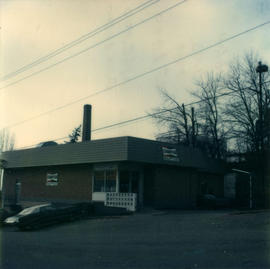
![[Retail and Office building on Columbia St., New Westminster]](/uploads/r/null/6/1/611ef86761a3abd14c8174edb58d4be410fc0273e4634942c8921c35723db0b9/889bfb27-3706-4882-b3d2-579b1d96dbc2-CVA810-40_142.jpg)
![[The King Edward Hotel 400-block Columbia St., New Westminster]](/uploads/r/null/9/8/9835ce24059bcaab32b6b8bd51ced5839e0679da3914f98154849d0076e2eb6f/4c737700-9ea9-4fc9-91e9-3be02e101995-CVA810-41_142.jpg)

![Building [Guichon Block] at 401-407 Columbia St. and Burr Block at 413-419 Columbia St., New West...](/uploads/r/null/7/f/7f39dbe26da177522375483a1a4a924622161f244e705d7884770f46dafa4b38/8a1a3876-8d57-466e-92fd-397404b27cb4-CVA810-29_142.jpg)


![[Guichon Block improvements, corner of Columbia St. and 4th Street, New Westminster]](/uploads/r/null/9/e/9eb04d90eed36b4ee5de96c87693d72a6e58fa8bae054bc0d8be559414570e70/fa71ef20-b378-4f1f-8924-b0de3b5216ab-CVA810-2_142.jpg)


![Columbia [Street] and 4th [Street] east side incoming](/uploads/r/null/0/8/0877a01fcd6e325812d187db25cd79278a2a59680799f44283247f8bd6a0a033/2f7f3ff3-9772-4a56-96cd-8ec58ea50716-A20213_142.jpg)

