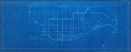
Dial map of Greater Vancouver and suburbs
- AM1594-: MAP 822-: LEG1279.1
- Part
- [ca. 1950]
Part of City of Vancouver Archives technical and cartographic drawing collection
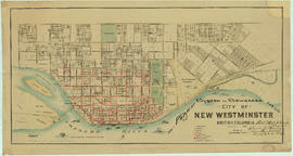
Part contains a street map of Vancouver, Burnaby, New Westminster, West Vancouver, and North Vancouver showing railways, hospitals, parks and block numbers. The map includes two dials (numbered circles, paper indicators, a grid of block numbers and a street index used to find locations).