![[Jean Baptiste Lolo St. Paul and family in front of a Hudson's Bay Company cabin, Kamloops, B.C.]](/uploads/r/null/f/4/f48aca9139c4a72c80c158cc7adaa191bb64e948a5688d0d8c56fce8cc2b9cb4/b0b78bc7-a3e4-4942-aab1-000b5f996d8b-A26501_142.jpg)
[Jean Baptiste Lolo St. Paul and family in front of a Hudson's Bay Company cabin, Kamloops, B.C.]
- AM54-S4-: In P147
- Item
- ca. 1865 ; reproduced 1958
Part of Major Matthews collection
106 results with digital objects Show results with digital objects
[Jean Baptiste Lolo St. Paul and family in front of a Hudson's Bay Company cabin, Kamloops, B.C.]
Part of Major Matthews collection
![[Sternwheelers "Kamloops" and "Peerless" on Kamloops Lake]](/uploads/r/null/4/3/43d59cce4a19c1b717f943be33a6a1d5d41ce790b1be9394f931bdb7781f4112/4f8459c8-9a50-437d-8cff-9c2bd6567d0a-A24060_142.jpg)
[Sternwheelers "Kamloops" and "Peerless" on Kamloops Lake]
Part of Major Matthews collection
Part of Major Matthews collection
J.S. Matthews' notes with print or negative in Archives.
![[View of Kamloops]](/uploads/r/null/7/f/7fdfa6614a4dd180d5f5af8b88ddaa1f8dcac1c23792389f9c2c614e193a2837/8a2b71ce-5930-44eb-b604-b28fe3a292e5-A26794_142.jpg)
Part of Major Matthews collection
![Kamloops, B.C. on C.P.R. [route]](/uploads/r/null/e/a/0/ea0443d7d78dee9c88ac6c16f93423611f318782a8cdc5b427c7748e0062d430/4dfe9e24-91b0-444f-b492-414c4529344e-CVA256-02_142.jpg)
Kamloops, B.C. on C.P.R. [route]
Part of Elizabeth Abbott fonds

Part of Major Matthews collection


Branding Cattle on the Ranges, Kamloops
Photograph shows cowboys
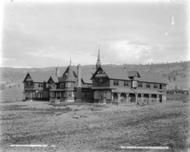
Old Man's Home, Kamloops, B.C.
![[View of Thompson River, near Kamloops, B.C.]](/uploads/r/null/d/4/d41446ea62d1c53c23452a3ddbd79d9103bb182c529ac63c0f625fd4331eb8e7/a7d7eb35-8d96-450b-98e9-6327992f322b-A04139_142.jpg)
[View of Thompson River, near Kamloops, B.C.]
Part of Major Matthews collection

Part of Major Matthews collection
Photograph shows two men on horseback in street.
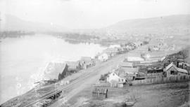
![[View of Kamloops showing range in the distance]](/uploads/r/null/9/6/96ff13748f3ac60fd53eab04576621642ef800760c4cd27db59c79f393fc4a92/b995a99a-05ca-4786-8fec-9644e2d6dd58-A04084_142.jpg)
[View of Kamloops showing range in the distance]
Part of Major Matthews collection
J.S. Matthews' notes with print or negative in Archives.
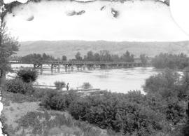
Bridge spanning North Thompson river, Kamloops, B.C.
Part of Major Matthews collection
![[Waterfront area of Kamloops, B.C.]](/uploads/r/null/c/2/c24f1b899bfd71bf12fd5c88c3a116a604333c3f5a0a96e164a65b8dfcfb5dbd/3b8ae989-2a22-4f6d-9781-a09f45f6d13b-A07954_142.jpg)
[Waterfront area of Kamloops, B.C.]
Part of Major Matthews collection
![[View of Kamloops]](/uploads/r/null/d/2/d2f7ea7c59039914d60f95937bfd0b621d5acdead1af006f71696650514e80f9/1bfb820a-3051-46c1-9e77-c205c7efce3e-A33695_142.jpg)
Part of Major Matthews collection
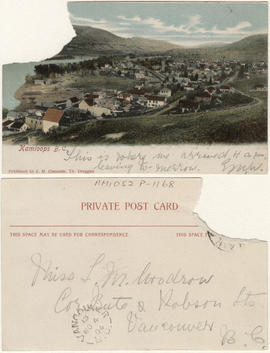
This postcard includes personal correspondence. Sent to Miss L.M. Woodrow of Vancouver, B.C.
![[View of Kamloops]](/uploads/r/null/4/3/43435086d538d0ff283cf875220be110b869573cc8d36826664a3e9d175b25be/5bcb8e06-8535-4dab-a254-0b4165cc73bb-A34104_142.jpg)
Part of Major Matthews collection
Panoramic view
![[Soldiers and bear cub]](/uploads/r/null/6/a/6a95a590ed563840a5a80e5b3519a0963dc205370c183107b56e4546c64f7f09/60414cf1-7588-412e-af41-0045306059e5-A32235_142.jpg)
Part of Major Matthews collection
![[Soldiers training on horses]](/uploads/r/null/0/7/075d03c241caecf124f017e0ccdaf1b8b95ae1d97775be13bbab29fe0aa10133/b147050c-93d9-4b2d-9298-79c20a8c2d89-A32242_142.jpg)
Part of Major Matthews collection
![[View of] Kamloops, B.C.](/uploads/r/null/3/7/373dfc39ba6af8d74ee12ec59df0ad0c1d5597d0987cf8be727856b5cb3b7827/4e3cdfd5-601e-4d16-8eab-b939dd6efa3c-A32240_142.jpg)
Part of Major Matthews collection
![[The 18th Field Ambulance in camp]](/uploads/r/null/f/7/f74c5ac376d0d1c3edd5093e8d24123e71ef26d1ce1b41883661f4f1b908f586/0427bf66-1dca-4093-bf83-6e00ae300903-A32232_142.jpg)
[The 18th Field Ambulance in camp]
Part of Major Matthews collection
Group portrait shows Lieutenant Colonel F.C. McTavish and others
![[Outdoor religious service in military camp]](/uploads/r/null/9/8/987afd112830baacd4d7ac0c14c08967376a7cd39202c535f5d62c955e47a4a7/0b0f2f80-1ea6-422d-9984-5d9cc140069f-A32237_142.jpg)
[Outdoor religious service in military camp]
Part of Major Matthews collection

Gold Range Rifle Association meet at Kamloops, B.C.
Part of Major Matthews collection
Group portrait
![[Members of the 104th Regiment "Westminster Fusiliers" in camp]](/uploads/r/null/d/3/d31baa78da3ae3eba2e646bc75b565269621486639487729276095b3899f720b/e0d8dc9f-d343-40d1-a31a-85d87f8ae95d-A60084_142.jpg)
[Members of the 104th Regiment "Westminster Fusiliers" in camp]
Part of Major Matthews collection
Group portrait
![[Tethered horses in military camp]](/uploads/r/null/e/7/e76da297bbb36799e052d7cc978540866511a0fd260a35dce55ff5ac899bdab0/a15db914-ce41-4d32-b1aa-5fa69a315bcd-A32238_142.jpg)
[Tethered horses in military camp]
Part of Major Matthews collection
![[Soldiers on horses]](/uploads/r/null/4/0/402b0f04a0083af045d0b994317b9febc3a06578c3d18aafa89e8628492fed46/e2336139-221b-47a5-81a0-774ea84b5292-A32243_142.jpg)
Part of Major Matthews collection
![[Soldiers practice manoeuvres on horseback]](/uploads/r/null/8/1/81fb8635131d16e1d5e3ca4f10ba0fe30a6794e29da6f6b196eddea7347a70cb/c7ad28a3-b3fa-47ec-8eb9-a369c9206bd6-A32234_142.jpg)
[Soldiers practice manoeuvres on horseback]
Part of Major Matthews collection
![[Soldiers prepare to ride their horses from camp]](/uploads/r/null/8/e/8e876b447dc8258de686984db4c23373890914642d9008893d5a7a95d460bc96/a1b4c1f4-9539-4ea4-86c6-230de22339d0-A32231_142.jpg)
[Soldiers prepare to ride their horses from camp]
Part of Major Matthews collection
![[Members of the 104th Regiment "Westminster Fusiliers" in camp]](/uploads/r/null/6/c/6ccd5b39f9e3db90c3561381189f6850d839b7bbebb3b3d572ca23d2f2a30419/66e921d6-0654-4936-81af-2502286ad4d8-A60085_142.jpg)
[Members of the 104th Regiment "Westminster Fusiliers" in camp]
Part of Major Matthews collection
Group portrait
![[View of military camp]](/uploads/r/null/a/5/a5388c4075132894b58c43ff33fa622b222457e9bfcd47dc7d843d83a212e4c1/12b75294-5bab-4018-afa3-72864d67334a-A32233_142.jpg)
Part of Major Matthews collection
![[Outdoor religious service in military camp]](/uploads/r/null/7/a/7af917886f5f1d1552c4efeb49f2b1c906c943d67781c7ba7165c87cf7b1ba63/9f45e5ad-b032-46a0-a2d2-f85e2f968987-A32241_142.jpg)
[Outdoor religious service in military camp]
Part of Major Matthews collection
![[Two soldiers on horses]](/uploads/r/null/4/d/4ddae19c67077522186e499794df7d2b4bfde098c06bb85b7bbf0a08379c5d73/98567bef-3e80-4baa-a6a6-92600d8faec3-A32236_142.jpg)
Part of Major Matthews collection
![[Outdoor religious service in military camp]](/uploads/r/null/d/3/d3df77e85f4d3927275150e58539a55d417050ba1a78dbf6a9dea46b337b9b4b/d63879e0-df93-4a98-9d98-1bf13f79e0f5-A32239_142.jpg)
[Outdoor religious service in military camp]
Part of Major Matthews collection
![[Soldiers and horses in camp]](/uploads/r/null/f/3/f3963479550a8ed8f3e034f968257ef40e4421b7c64262a5e070ce30fd97c510/18f48209-aa7d-4673-bb1f-df474bd2591f-A32244_142.jpg)
Part of Major Matthews collection
![[Soldiers on horses in military camp]](/uploads/r/null/a/d/adcd3722f777960e5014c0f4c744ba435752ce9d0dccce03da574cdcee29a688/91a5cd11-1703-43b9-aa48-ef83ddc02aa3-A32229_142.jpg)
[Soldiers on horses in military camp]
Part of Major Matthews collection
![[Military camp]](/uploads/r/null/a/8/a8aa66c2de3393a05f63357c20ffb486731ff857088b058b5b1ec70a190fcd01/910b4efa-dcdd-4321-a0bd-93e0a6d1d5f0-A32230_142.jpg)
Part of Major Matthews collection

Part of Major Matthews collection
Photograph shows part of St. Paul Mountain
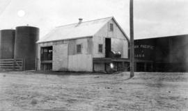
Kamloops substation with horse-drawn tank wagon
Part of Imperial Oil Company fonds

Hydro electric surveys. Plan showing location of water powers investigated by City of Vancouver
Part of City of Vancouver fonds
Item is a map which shows the locations and the dates of use of "gauging stations established" and "city gauging stations still in use" in the area of south-western British Columbia where the City of Vancouver conducted hydro-electric surveys up to 1923.

Hydro electric surveys. Plan showing location of water powers investigated by City of Vancouver
Part of City of Vancouver fonds
Item is a map which functions as a visual index to the locations of various hydro electric surveys carried out by the City of Vancouver along the following rivers: Squamish River, Cheakamus River, Green River, Lillooet River, Eagle River, Indian River, Pitt River, Chehalis River, Harrison River, Chilliwack River, the Fraser and Thompson Rivers, and Bridge River. The map lists the names of the surveyors responsible and the areas covered by each survey. Annotations include the locations and the dates of use of "gauging stations established" and "city gauging stations still in use."
![[Justice J.D. Swanson]](/uploads/r/null/2/a/2a96f9b3d9d8c440cee66751e450a913b3b4b4e174c802603f496f14a5ab5a96/e6160dca-f098-4d1e-b7b6-86a28d05d551-A34536_142.jpg)
Part of Major Matthews collection
Head and shoulders portrait
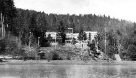
[Vancouver Board of Trade Excursion to Okanagan and Kootenays August 21 to September 5, 1926]
Part of L.D. Taylor family fonds
File consists of photographs of a British Columbia interior tour made by Mayor L.D. Taylor and thirty-eight other members of the Vancouver Board of Trade. Includes photographs of the East Kootenay Power Company on the Elk River, West Kootenay Power Company at Bonnington, Lower Bonnington Power Plant, Crow's Nest Coal Company, Dominion Experimental Station in Summerland, Eldorado Arms Hotel, Sicamous Hotel, Kootenay National Park, Invermere and Oliver.
![Same lake [Kamloops Lake]](/uploads/r/null/9/1/3/913ef27e23a093f56481e0eabab63a8ed8811fe4edbbbdda8d09e7d949f92238/87ae6914-f4e8-4b42-b53a-2efa2a9c835d-CVA289-004_142.jpg)
Part of William Orson Banfield fonds

Lobby and reception of Plaza hotel
Part of John Girvan fonds

Part of William Orson Banfield fonds

Part of William Orson Banfield fonds

Part of William Orson Banfield fonds
Part of William Orson Banfield fonds
Part of John Girvan fonds
Part of William Orson Banfield fonds