
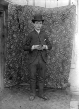
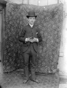
Portrait of Alexander Godfrey (left) and Chris Godfrey
- AM169-F17-: CVA 162-01
- Item
- [ca. 1860]
Part of Alexander Godfrey fonds
179 results with digital objects Show results with digital objects
Portrait of Alexander Godfrey (left) and Chris Godfrey
Part of Alexander Godfrey fonds
![[Sir Sandford Fleming]](/uploads/r/null/1/2/12dc7712a9a6229d5caf7c7b1afbe2dcf7acff10a6328b94503b7252194cc61b/004cab06-a03f-4af4-b783-f7f2721e4ac2-A36012_142.jpg)
Part of Major Matthews collection

Part of Major Matthews collection
Photograph shows images of individual members of parliament that were cut from various sources and collaged onto a hand-drawn background and then re-photographed to represent a group portrait
![[Margaret Pedden]](/uploads/r/null/2/0/201f8f02b56d0f237acf690619634e122096a6fe8db4d0761f74c352842bbf8f/b2b6b972-baf9-4e37-994d-302d7314663a-A71615_142.jpg)
Head and shoulders portrait of Margaret Pedden.

Map of Manitoba, Keewatin, British Columbia, and North West Territory
Part of City of Vancouver Archives technical and cartographic drawing collection
Item is a map showing the route of the Canadian Pacific Railway through western Canada.
![[Gideon Robertson]](/uploads/r/null/e/e/eeadd8c81d9a76415cc3bab8228df826fb654ba448669eb0ae763a81fbd5e58b/74b41be5-f2ae-4137-ada4-9fffa5601059-A34730_142.jpg)
Part of Major Matthews collection
Head and shoulders portrait

Part of City of Vancouver Archives technical and cartographic drawing collection
Item is a map showing the extent of the Canadian Pacific Railway Company (C.P.R.) in Canada in 1883. Map shows boundaries, roads, trails, telegraph lines, towns, rivers, lakes and mountainous terrain in British Columbia, the North West Territory (Alberta, Athabasca, Saskatchewan, Assiniboia), Manitoba and Kewaydin, as well as some of Ontario and Western Quebec. Map is folded inside a book titled "North West Territory, Canada."
![[Native women and children in front of Michpocoten Hudson's Bay Post on Lake Superior]](/uploads/r/null/8/5/8506963eec7d72e553bca02b8a08a00c6c1d6ae1bedd1e1a0e6a3d5238bd0791/16e2d131-3c50-4c7d-aad7-36e9fb0c57a8-A26442_142.jpg)
[Native women and children in front of Michpocoten Hudson's Bay Post on Lake Superior]
Part of Major Matthews collection
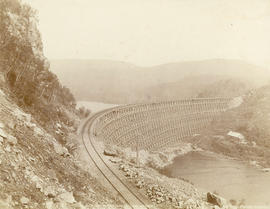
Red Sucker Trestle, Lake Superior on the Canadian Pacific Railway
Part of Major Matthews collection

Blackbird trestle, C.P.R. North Shore Lake Superior
Part of Major Matthews collection

C.P.R. Bridge over Nipigon River, Lake Superior
Part of Major Matthews collection

Jack Fish Point, North Shore Lake Superior
Part of Major Matthews collection
Photograph shows a trestle bridge near the shore of the lake.
![[Dr. Robert N. Fraser in his Masonic regalia]](/uploads/r/null/5/f/5ff88f8b5ba102a5dcd4a2ee024db80737a99bd11a081e09210e29d9be6030b7/6a237082-2b21-43f6-b630-876fcf76e238-A62941_142.jpg)
[Dr. Robert N. Fraser in his Masonic regalia]
Part of Major Matthews collection
Studio portrait

"Black Bird Trestle", North Shore Lake Superior
Part of Major Matthews collection
![Nepigon [Nipigon] River, Lake Superior. Famous trout fishing resort](/uploads/r/null/6/7/67d625fc05f62fe28345b1d449ee5d9d81b71c6605981e7d2363e328f9581ba1/d020d89f-2d61-4b5f-a205-f919ae934c1d-A04109_142.jpg)
Nepigon [Nipigon] River, Lake Superior. Famous trout fishing resort
Part of Major Matthews collection
Photograph shows buildings at the edge of the river, as well as surrounding hills.
![Esther [reclining in a garden]](/uploads/r/null/e/2/e2b1857d9f6235858b895f87200281a3bf09aea47b3bc1a317f2006671b725a8/0d2d9378-7f69-4334-8b0c-981589b4c87f-A43651_142.jpg)
Esther [reclining in a garden]
Item is a photograph that is a full-length portrait of George Frederick ("Fred") Timms.


Portrait of the Lee sisters, including Harriet Ellen Lee
Part of Alexander Godfrey fonds
Item is a photograph showing the Lee sisters, including Harriet Ellen Lee. Pictured standing (L-R): Harriet Ellen Lee, Sarah Lee. Pictured seated: Maggie Lee, unidentified, Belle lee.

Red Sucker trestle. C.P.R. North Shore Lake Superior
Part of Major Matthews collection
Item is a photograph that is a full-length portrait of George Frederick ("Fred") Timms.

![Old family picture [showing] Esther, Ted [and others]](/uploads/r/null/e/d/eddfc5155159f7b1ed225dd612945d567da4da540eb5723525b1a166336c342c/b981c9f8-10a4-4853-bc85-6576b47f5b07-A43653_142.jpg)
Old family picture [showing] Esther, Ted [and others]
Group portrait
![[Children riding a make-believe horse]](/uploads/r/null/a/7/a779b9c570f0d30b28d3f4d9cc2cd587176619517bc2b2eab940e2d81638ace2/2bfc2207-5f82-4fb5-b760-1185f0b95ca3-A43650_142.jpg)
[Children riding a make-believe horse]
Photograph shows the children sitting on a chair and a frame with an axe for the horse's head

Kakabeka Falls near Port Arthur, Ont., Height 170 feet
Part of Major Matthews collection

Red Sucker Trestle, from east side, North Shore
Part of Major Matthews collection

Part of Major Matthews collection

Grandfather and Grandmother Totten after their golden wedding
Part of Walter Hamilton fonds
Studio portrait
[Man and woman seated in wagon marked as L. Boorne, Todmorden]
Item is a photograph showing an unidentified couple. A photographer's stamp in the lower corner states "F.B. Whitton, 785 Queen E, Toronto."
![Our [Hamilton] wedding group on farm lawn](/uploads/r/null/6/e/6e847d2be06ffeac4c998a924fb2e881f3ed64e38e67001d83a12ccfc5523a45/8003b00c-c1df-4feb-90aa-c4b6fbd8a816-CVA587-20_142.jpg)
Our [Hamilton] wedding group on farm lawn
Part of Walter Hamilton fonds
Group portrait
![Niagara [River]](/uploads/r/null/c/a/cad69c8621d6a832800e61b217d0cec272195844f692d8c769548950de00ee3b/3ac2f72c-00db-41f7-b08b-23bf174d4eba-CVA7-334_142.jpg)
Part of James Luke Quiney fonds
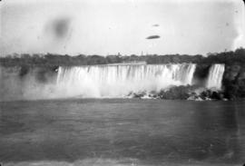
![Niagara [Falls]](/uploads/r/null/2/2/22620032287c20a25dd39ff1df72693ff24e25c17ff764f78155743349d10930/b5ca0824-8cf5-4347-904b-e2966e61f3e3-CVA7-335_142.jpg)
Part of James Luke Quiney fonds
![[Catherine Pedden]](/uploads/r/null/5/6/5672c0a68e4c650421d8ff42d515167aefb798589f22d8bac462cc210f326974/869bc2d4-2e3e-45e6-87f6-05019d40d0c5-A71617_142.jpg)
Studio portrait
![[Lonsdale]](/uploads/r/null/d/0/1/d0166c19245cf22a9edc172291370d111090a7959079a15e6d5e980b714d07a5/f32e54bf-8437-421b-a6f5-a67c929aea77-CVA260-1867_142.jpg)
Part of James Crookall fonds
Item is a photograph showing the Lazier Grist Mill and the Salmon River located in Lonsdale, Ontario. The remains of the Lazier Woollen mill building (with no roof) is also visible

Part of James Crookall fonds

Part of James Crookall fonds
![Group at Napanee [River]](/uploads/r/null/2/8/1/28117aa83350f36f3e5002ccdb1d1f7fe491fd4521c9050a6f3aacd165d1628e/cd0aba48-7590-4e8c-804e-d92ce7b11019-CVA260-2206_142.jpg)
Part of James Crookall fonds
![3 82nd crash near [Barracks] Mohawk](/uploads/r/null/e/4/d/e4d5777b146e0f18c5c6ffbae9433760f74bfecb40bb34487ce83e337e7968e8/dc8cb473-179c-4890-962f-8bdbf5bf1f71-CVA260-2213_142.jpg)
3 82nd crash near [Barracks] Mohawk
Part of James Crookall fonds
![2 Miller and [...?] "Flood"](/uploads/r/null/4/2/9/42971d364311308cb8161d8ccac8d56e39bdb54be277e45674c2786eff58f3fe/fd17be40-540a-470e-a804-000470ce7e4e-CVA260-2216_142.jpg)
Part of James Crookall fonds

Part of James Crookall fonds
![Self [James Crookall] in [tender]](/uploads/r/null/b/0/4/b04d8db50f077441789da79e920f09688179b1f00b1ffcdea52e2648d30752cb/69d3dffc-2392-4406-a78b-ad7c3c30eb1b-CVA260-2259_142.jpg)
Self [James Crookall] in [tender]
Part of James Crookall fonds

Part of James Crookall fonds
Part of James Crookall fonds
![J.C. [James Crookall] in R.F.C. [Royal Flying Corps] Headquarters, [N. Toronto?]](/uploads/r/null/e/f/3/ef34942bb0b3907bda0309fad496d5e315daacea5f101ebdbc6166b664b98ea6/39eb26b7-8a30-4a0c-a203-e952b97a1881-CVA260-2295_142.jpg)
J.C. [James Crookall] in R.F.C. [Royal Flying Corps] Headquarters, [N. Toronto?]
Part of James Crookall fonds
![Bridge [Whirlpool Rapids], Niagara](/uploads/r/null/4/6/0/46076f7cf4527e7d46bec2b12931c17df97ac06325bf739004174b4294e69ffd/e35c0b81-c856-47cd-8802-9fa94d50e45e-CVA260-2297_142.jpg)
Bridge [Whirlpool Rapids], Niagara
Part of James Crookall fonds

Part of James Crookall fonds

Part of James Crookall fonds
Part of James Crookall fonds
![["Tent 8"], Leaside](/uploads/r/null/5/2/d/52d3730fa9b66a185ab75d0a3b9074c9c41540455d23122e9fc65125ad0aa07a/85b2adf2-8458-4c4e-b8d9-435cc8788561-CVA260-2311_142.jpg)
Part of James Crookall fonds
![Aerodrome, N. [north] Toronto](/uploads/r/null/b/1/c/b1cfaa0c3c3db1982cb203831aca4bcb7d2b9779443088b533572a3247bfad57/a6d3a2d3-81e8-45d3-ab3b-16a0a3e9c9d8-CVA260-2313_142.jpg)
Part of James Crookall fonds