
British possessions in North America
- AM1594-: MAP 287
- Item
- 1834
Part of City of Vancouver Archives technical and cartographic drawing collection
Item is a map showing British territories and borders with Russian territories, the United States, and Mexico. Includes White population totals for Hudson Bay territory, Upper Canada, Lower Canada, New Brunswick, Nova Scotia, Cape Breton Is., Prince Edward Is., and Newfoundland as well as white population for United States claimed territory, broken down by state.

![[Caroline Little Pierce and niece Minnie Twitchell]](/uploads/r/null/7/3/734a49defbfc762e74db1a9e85380037f2bf726fb4f608b93e7b2cfe1d84fb44/6da02a11-2381-4e77-ae28-e3c5cce5808c-CVA1477-990_142.jpg)
![[Caroline Little Pierce and niece Minnie Twitchell]](/uploads/r/null/1/e/1ea31d593504e720aa746d169217b24366eb5d770d399f3004c461bef26558bb/be7cbbdd-2bcd-44a9-9d9b-0633e1754dfc-CVA1477-989_142.jpg)

![[Unidentified man with horses]](/uploads/r/null/0/f/0f8a6c7af2ac0d06ae3669e1f8e9daee105352ecf33959c774b17b52a1a5ad44/dbd99564-63a6-46a9-b834-bc39d8b856e8-A19760_142.jpg)
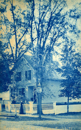
![[A large tree in front of an unidentified house]](/uploads/r/null/9/3/930fd8dbeb3e044600ca3ff6b49e60a157e4f1befd6900aa554018fb420f135c/0d2516fe-d9a1-406b-a14c-5c9fe41bba01-A19761_142.jpg)
![[Unidentified building with mansard roof]](/uploads/r/null/f/5/f57d8ff4dd687eb09353c8dc4725cbf7262cf39ccae799faf6f3e9e2961d77ef/e6c76683-50a6-416a-924f-b389ded2acf8-A19758_142.jpg)
![[Unidentified church tower]](/uploads/r/null/1/d/1da37f942891c7f0e1569cef816a109cd138415897fbb020a16cd9f15ba06c99/0aef81fc-694f-4d68-900b-a70a787f04ee-A19757_142.jpg)
![[Unidentified house behind trees]](/uploads/r/null/f/d/fd8e7fea6830ce9415e61bb92b197f0e73fdb173a7141d5cf0f711fb3a962957/8a97f076-29d1-4901-aa4a-9d99ba0bca0a-A19762_142.jpg)
![[Unidentified American city]](/uploads/r/null/6/4/64f366831e5bf7e968fb78fecba8be78803e6835349ea3e82333d6260ce3812d/01160494-6a5c-4589-a9a0-b92eaf2cfb96-A19756_142.jpg)
![[View of large stone building]](/uploads/r/null/b/3/b3ae5f739c2c605439eee1233a60ccd1486cd839b6ceb0c7e98c98fb92b22626/84a42ecf-82f7-4ef8-b3a8-e883dcc9e4d3-CVA1477-559_142.jpg)
![[View of pond with houses in the background]](/uploads/r/null/3/3/33e85d7cccea4bc298e7da4a435bf0e86f9705aece668c7b787495e78e3467c1/27e52fe9-4ca3-4539-83a3-d5fc2bfae2c7-CVA1477-559_142.jpg)
![[View of steamboats on the ocean, possibly off the coast of Kennebunkport, Maine.]](/uploads/r/null/c/7/c7cb44c718c46dbc292861dbe62a6fa0f3959fc605646abb8b14ed34c6793098/82238f70-40ae-4be5-8178-844602fb4e0b-CVA1477-559_142.jpg)
![[View of buildings down street]](/uploads/r/null/b/a/bae8af6e0783694d870c183a5fdae377b8563adb7e9fe8a984fa9d4347e90f86/c88f66ff-b26d-417f-bd65-1dcee0f679b0-CVA1477-559_142.jpg)
![[View of homes by ocean, possibly in Nantasket Beach, Hull, Massachusetts]](/uploads/r/null/c/0/c0393ea6900e69b9afa305b91904a64cb747832180049beddb9b4a68f1fe1278/84abdb9c-e374-42c8-b42b-c2606e7102f0-CVA1477-559_142.jpg)
![[View of house with four boys in foreground]](/uploads/r/null/6/1/61ec197655eb18e5a9279b3aa9c3b8151423c7fd5762bef68477528a240fa960/5075c39f-cb59-4888-8878-d8d2030f51a0-CVA1477-559_142.jpg)
![[View of mountains with large field in foreground]](/uploads/r/null/0/8/0882a831493e329933859ec77474c11703b6d9237e5b350ce82f1e3dd92be417/53b46718-0d07-44e0-bd83-17095ec1b5fe-CVA1477-559_142.jpg)
![[View of river under bridge]](/uploads/r/null/3/2/32151b03d64a040b34415aa30047391f27b6d7871873288a26e4eee704a350e4/6564af21-8395-45e3-b860-32a06cb035ad-CVA1477-559_142.jpg)
![[View of small building with buggy in front]](/uploads/r/null/5/1/513509e1784e566aa680be3b53448fee298d3cbb278e6e6128d5bc649b2fbf15/ad9c33c2-cb71-4db3-8d1a-05993c7dd997-CVA1477-559_142.jpg)
![Mrs. Sloan and her garden and [?] side of 44 Hamilton Avenue](/uploads/r/null/6/b/6ba98c1726039aec2d29ad0fb67abc4ba5146718a1e4d71d51cba79122439a98/c41ed3a0-a707-4d4e-9f76-3472acd9ca64-CVA1477-559_142.jpg)

![[View of edge of lagoon at Lincoln Park, Chicago Illinois]](/uploads/r/null/2/1/215188c49beacdfad586d0eaef1d784ddd82f43024490b259213f0608fcb9d77/be1983e1-ad23-499a-ab55-6da16c9071c3-CVA1477-559_142.jpg)
![[View of lagoon at Lincoln Park, Chicago Illinois]](/uploads/r/null/f/d/fd4b9e23e96bbca85c876bee74f969ae1cd8f737053d233d2f414abc216404fe/16a37d73-3353-4a05-9981-231813b66790-CVA1477-559_142.jpg)
![[Man and woman in horse drawn carriage in Plainfield, New Jersey]](/uploads/r/null/e/b/ebd9b7ae5fcc8b2256480120ddb8ccf72881e56046f5b76e9e9b9833aff41ea6/25213b6b-ee1e-4ab1-a89a-4df43ece202f-A50912_142.jpg)
![[Theodore Taylor, 4 years, 4 mo.]](/uploads/r/null/b/e/2/be2ed8e22a4a8ab336ae57e515c88352530ca73ef3eab3ced8b831ee20599b0f/39025aa6-e53b-409a-913a-9a3b90d7dbbc-CVA1477-409_142.jpg)
![[Two children with dogs in horse-drawn carriage in Plainfield, New Jersey]](/uploads/r/null/7/f/7f706cb4b3be6ff02f93d02855d6646ba6eb112d068281cfb1c88139072c1e2d/7b436a06-dee5-459d-bdc4-07780070c296-A50911_142.jpg)
![[Group photograph taken at a dinner party]](/uploads/r/null/8/a/8af289cb7e1db5519f3c8ed2e6929ee341ee4432b29c34291f116e2d7db8ab15/7dc4d2f4-cc62-4ce0-abc7-081fe43d7a18-CVA1477-481_142.jpg)
![[Group portrait of a man, two women and a boy on steps of building in Plainfield, New Jersey]](/uploads/r/null/3/a/3a0da5fa315fc8c61049fd5fc348e34e685c80b78ee4871531dd218ba6c41d8e/167b1478-954a-41ac-a940-0349431aa669-A50913_142.jpg)
![[Caroline Little Pierce raking grass]](/uploads/r/null/3/9/3928490e2d24eb40aa2dd454a7878b1ffd8d8734d2b248d2e01aa5ce9de79a87/4388a723-db3d-4155-8bc2-ad21bc0a998a-CVA1477-481_142.jpg)
![[Caroline Little Pierce and Winifred Mabel Pierce]](/uploads/r/null/0/e/0ec03999090022d5766c6fae08ba2bfc3d6bf37a5adfa361ac6f81b568359ecc/6b91484e-2510-480e-872a-f34ad2d53ea5-A64629_142.jpg)
![[Caroline Little Pierce outdoors with two unidentifed women and a man]](/uploads/r/null/6/4/64bc7fcc6d67a5414b81d084d8b3f89b45f3d495fc24e91bf569972a9e0ef48f/9f618498-2a6b-4d97-a7b4-3c1a96e42d60-CVA1477-481_142.jpg)
![[Winifred Mabel Pierce and Caroline Little Pierce on] the "Success of Vashon"](/uploads/r/null/e/6/e609ee1a5a418e6a128b5151511158a4acc9581da0f96d7f930ed7e1091ab0c9/e6bdf042-8d97-4eac-98b3-7122e8ea9a39-CVA1477-465_142.jpg)
![[Theodore Taylor]](/uploads/r/null/6/c/a/6ca130cbf9143ae578fcfe6c9d6ab0a9e941b9f8b01e0c0a2ef9b05d3b8aa2bd/f10db6ee-4ddc-438a-8d6e-ac9b6cccc762-CVA1477-2_142.jpg)
![[Man and boy in horse drawn carriage in Plainfield, New Jersey]](/uploads/r/null/d/0/d03c59668072720dc7be07c623eebbd5abd6b74f00ddb803cc457f7126df571f/ba3f0ee7-e557-41dd-beb7-7847f8478f2b-A50910_142.jpg)
![[Man sitting on horse]](/uploads/r/null/3/9/3986fc7f6463219507bd9e8674ad0f498d941fa089f77dc2fad4de0127db62c6/8976e79b-7af3-45d0-81af-0650eb6d8395-A50914_142.jpg)
![[Head and shoulders portrait of Eva Cooley?]](/uploads/r/null/c/0/b/c0b67eef5f2c201716145a42560a59395c971bf7fbcc72c78c07b1e87e52abe2/c7795839-1161-4a58-8dab-8abc7675d972-CVA1477-410_142.jpg)
![[Caroline Little Pierce in garden]](/uploads/r/null/3/1/31a601f441c5f36fa931b32c4e6dfadc7b74b40adf1c993ff3dd842319466949/3303d987-d105-4230-b509-b17a3b464c07-CVA1477-561_142.jpg)
![[A man and a woman walking along a tree-lined road]](/uploads/r/null/a/e/ae0696b17086c500fcc543306ebd09132c744a975767f95dce8a0385f9394dea/7a2460c7-a700-41ad-a46f-fe8afffbff79-CVA1477-550_142.jpg)
![[Man sitting in the forest]](/uploads/r/null/5/0/5022fec4e386eeca6a9e3a5f1512656a31d1d32901d53525eddc68ffdcd5c71a/1e9388cf-eeb3-4215-aa0b-f64d70fae9e5-CVA1477-551_142.jpg)

![[Edgar H. Cooke]](/uploads/r/null/0/1/010030be301356e6cba71682d10512a4b1daedb512828d99afdef06bf8a6764a/122053d4-7bcf-4998-8fd3-40c940ed75af-A37495_142.jpg)
![[Conductor Joseph E. Horne and Mr. Shepard]](/uploads/r/null/d/5/d5dcc814d98abce83ebb88a0c1b578a03d14977bd16f8c62847af64802aef823/2b62a9d8-5c0c-4d59-a026-ecc9113db693-A37494_142.jpg)
![[The Glidden automobile]](/uploads/r/null/3/1/31eabc028d07b1f6eda2910a1815b894ff7189dfaaf9c615b4ffd4d3c74c77c4/27a89dd4-4e4e-4965-b2cd-4bcd412ea1d3-A37475_142.jpg)

![[Steam propelled "Amoskeag" fire engine on way to fire]](/uploads/r/null/a/e/ae566bf30fbaab15065b93430b11de0b906e82c3d0af6d1d0a5b6a8c855adb1e/f2599f5d-56a2-495d-9e97-3792cbf5df90-A26164_142.jpg)
