Print preview Close
Showing 79 results
Archival description78 results with digital objects Show results with digital objects
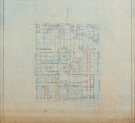
Water service map of South Vancouver
Water service map of South Vancouver

Vancouver, British Columbia, south-easterly portion, formerly South Vancouver : major street plan

Marine Drive in South Vancouver
![Marine Drive in South Vancouver [near Gilman Road]](/uploads/r/null/c/b/cb21c73d09af6b33588908064d3c486d5114e65b6b26605659414dffe283daad/c012cea0-6bed-47e5-822d-d4185dd65f60-A25926_142.jpg)
Marine Drive in South Vancouver [near Gilman Road]
![[View of Main Street, looking north from 26th Avenue]](/uploads/r/null/4/c/4cbdef125de15aa81c70e8709b292d5e4f274528f32b6cb2a2105258b3cafcb5/e6b7109b-66b4-4835-afc6-7609526820c9-A07868_142.jpg)
[View of Main Street, looking north from 26th Avenue]
![[Horse and cart travelling along] 34th Avenue [now 33rd Ave.] before paving](/uploads/r/null/1/b/1bea09e65d46b4109283423d33373961bada71fdd08bf41e25c639f1387eb3a6/ec202a7a-9fdb-4901-9fe9-d5885081dc3d-A19285_142.jpg)
[Horse and cart travelling along] 34th Avenue [now 33rd Ave.] before paving
![[Houses in South Vancouver]](/uploads/r/null/9/6/96beb114cdd36eb0925112d2fd5239b964d9de446cf79bd3c538c89ef082f0b8/090fc4d6-bd26-46bc-835f-1b2282ac15df-A19300_142.jpg)
[Houses in South Vancouver]
![[Street car outside the Winram Block, 17th and Main St.]](/uploads/r/null/e/1/e14e644a588b3f93678f4c964d20100150b12ddfe3bf74e33850981e29b76c8b/a52e4081-8f51-4943-a4c5-3fadd9085e6b-A19271_142.jpg)
[Street car outside the Winram Block, 17th and Main St.]
![[View of 33rd Avenue showing road work in progress]](/uploads/r/null/b/3/b3d6aa7eb8fb0bf11bef829f4930510c09435ec0ead8048f44cfbf1708600abf/b1595b8e-b135-4c1d-a4e8-8737f2850cd0-A19297_142.jpg)
[View of 33rd Avenue showing road work in progress]
![[View of a dirt road, possibly 33rd Avenue, with street car tracks along one side]](/uploads/r/null/c/6/c64e9d504cc9b533bf0c5d0399db85273e1137fd7e3945aa2e84aa82a215b053/db19eae9-2562-40d9-9249-b36cc0c36f0b-A19282_142.jpg)
[View of a dirt road, possibly 33rd Avenue, with street car tracks along one side]
![[View of the] Main St. bog [between 33rd Avenue and 41st Avenue]](/uploads/r/null/7/f/7fb80b09ebfd64e91e42bdfb033c7901f4187e4e47fb8a675f55ecce664255be/0d0df890-2794-44d1-b878-b21f154e60b1-A19256_142.jpg)
[View of the] Main St. bog [between 33rd Avenue and 41st Avenue]
![[View of] 56th Avenue](/uploads/r/null/5/e/5e6e63808539d76e2bb1611fb7f58e19d6ff2f5c79c8c0fb9a41ae096f1041e3/c876d1dc-483f-4911-be0a-4ea8219a7537-A19232_142.jpg)
[View of] 56th Avenue
![[View of an intersection on Kingsway]](/uploads/r/null/c/f/cfe400afd470037c32921b61c3e288beb498141a4ed40bba8a293220e8bfdf44/71808117-63ec-4d3d-a3fc-57f737009105-A19334_142.jpg)
[View of an intersection on Kingsway]
![[View of intersection probably River Avenue, now Marine Drive, and Fraser Street]](/uploads/r/null/6/4/6452707075abe1664e358d730eaeb4c51f71f6ce92a5dd0e0f63dfe4efc6b183/2af5de23-d671-4a66-bcb0-386ae624da78-A19355_142.jpg)
[View of intersection probably River Avenue, now Marine Drive, and Fraser Street]
![[View of road paving at the] Intersection Main St. and 34th Ave. [now 33rd Avenue]](/uploads/r/null/e/b/eb7cbb6633178207f5f6cba577f32455439dead88a072ac334180ac063701e1a/ee3c2d88-476a-4a4c-b0c8-13120cd63792-A19287_142.jpg)
[View of road paving at the] Intersection Main St. and 34th Ave. [now 33rd Avenue]
![[View of] 34th Ave [now 33rd Ave] showing bitulithic paving](/uploads/r/null/1/5/15414121a12f5fa073fca9e2c5389404bfae71a44dd49b8a52e6efc7ea4096d9/38ff3049-ffb8-490e-ba3d-9b6da6192256-A19286_142.jpg)
[View of] 34th Ave [now 33rd Ave] showing bitulithic paving
![Finished bitulithic pavement Fraser St. and 34th Ave. [now 33rd Ave.]](/uploads/r/null/c/e/ced8cd4412754133f7d8b463ccd8ac13af0a8edf3f6aa85b1badc6e4af86de92/2bf50e3c-64a8-4efa-b475-59422ab6f306-A19292_142.jpg)
Finished bitulithic pavement Fraser St. and 34th Ave. [now 33rd Ave.]
![[Horse and cart travelling along 34th Avenue (now 33rd Avenue) before paving]](/uploads/r/null/5/8/58accbe9066b3a5afac554e1ad18cdf02097c9d7ed41cdcb5fd1f274eecd26dd/9e97a0b1-fb21-43e0-bdb6-846e105fa9f6-A19268_142.jpg)
[Horse and cart travelling along 34th Avenue (now 33rd Avenue) before paving]
![[Surveyors on street in South Vancouver]](/uploads/r/null/b/0/b09502a2af3b99222d80fd5668c89eb6ad7f009934c53dd430cadad418ffe532/5b53049e-48db-4876-9ec4-b4adcbb0e6e0-A19303_142.jpg)
[Surveyors on street in South Vancouver]
![[View of Joyce Street looking south west towards Carleton School]](/uploads/r/null/6/5/65fddfb53fec807e9ed3476cea8eed909270066ae00a0cc4c69987f1c05de56e/5da90945-5972-46b9-8b35-bd078632aec3-A19313_142.jpg)
[View of Joyce Street looking south west towards Carleton School]
![[View of finished] Paving Main St. and 17th Ave. looking north [showing the Winram block]](/uploads/r/null/5/b/5bac016b96314bbeb917b4e377d1ee1841c46536089bb447fecfdd79e090d3ee/b572beb9-fb07-4eb5-bda9-9431a294e603-A19258_142.jpg)
[View of finished] Paving Main St. and 17th Ave. looking north [showing the Winram block]
![[View of] Main St. and 51st Ave. looking north](/uploads/r/null/f/8/f883edec5ff5f43b5a87451c288ebdd8ac155bbc70a6da73860b2397d6cd3d41/ba858f93-e41e-4f01-b6e1-113768409322-A19260_142.jpg)
[View of] Main St. and 51st Ave. looking north

Water service map of South Vancouver : Ontario Street to Fraser Street and King Edward Avenue to 34th Avenue (33rd Avenue)

Water service map of South Vancouver : Victoria Drive to Wales Street and 35th Avenue (34th Avenue) to 46th Avenue (45th Avenue)

Water service map of South Vancouver : Fraser Street to Sherbrooke Street and 43rd Avenue (41st Avenue) to 51st Avenue (49th Avenue)

Water service map of South Vancouver : Kerr Street to Tyne Street and 46th Avenue (45th Avenue) to 56th Avenue (54th Avenue)

Water service map of South Vancouver : Victoria Drive to Vivian Street and 56th Avenue (54th Avenue) to 67th Avenue (65th Avenue)

Water service map of South Vancouver : Kerr Street to Tyne Street and 56th Avenue (54th Avenue) to 67th Avenue (65th Avenue)
Water service map of South Vancouver : Knight Street to Commercial Street and 15th Avenue (16th Avenue) to 22nd Avenue

Water service map of South Vancouver : Knight Street to Victoria Drive and 22nd Avenue to 34th Ave (33rd Avenue)

Water service map of South Vancouver : Vivian Street to Kerr Street and 46th Avenue (45th Avenue) to 56th Avenue (54th Avenue)

Water service map of South Vancouver : Fraser Street to Knight Street and 51st Avenue (49th Avenue) to 61st Avenue (59th Avenue)

Water service map of South Vancouver : Vivian Street to Kerr Street and 56th Avenue (54th Avenue) to 67th Avenue (65th Avenue)

Water service map of South Vancouver : Knight Street to Victoria Drive and 61st Avenue (59th Avenue) to North Arm of Fraser River
![[View of the 3500 block Commercial Street looking north from 20th Avenue]](/uploads/r/null/f/1/f1b0bce3d006392eacb862cfcf2dcf83c3f8413c7c9f87b3a1112ba5d9f95899/45c4154f-fb02-4471-bfe7-f45508705373-A07869_142.jpg)
[View of the 3500 block Commercial Street looking north from 20th Avenue]
![[A part of Joyce Road (Street)]](/uploads/r/null/7/5/75473de28a4d07476fc7b54573c83f4ffa463e42bdd1649afdeb535feed7968a/9f5049ba-2311-4c7d-9589-f89a8e1a1896-A62740_142.jpg)
[A part of Joyce Road (Street)]

Water service map of South Vancouver : Victoria Drive to Vivian Street and 46th Avenue (45th Avenue) to 56th Avenue (54th Avenue)

Water service map of South Vancouver : Knight Street to Victoria Drive and 51st Avenue (49th Avenue) to 61st Avenue (59th Avenue)

Water service map of South Vancouver : Tyne Street to Park Street (Boundary Road) and 56th Avenue (54th Avenue) to 67th Avenue (65th Avenue)

Water service map of South Vancouver : Vivian Street to Doman Street and 67th Avenue (65th Avenue) to North Arm of Fraser River
![[View of Main Street looking north from the river bank]](/uploads/r/null/d/b/db98e883bbdc151f270cd3471629ad5f509b7c38028d1ca3c2913bfc7a2e6004/6ab1fd0d-8c7a-4104-a4f8-d74669739de2-A37158_142.jpg)
[View of Main Street looking north from the river bank]

Water service map of South Vancouver : Bridge Street (Cambie Street) to Main Street and 16th Avenue to 26th Avenue

Water service map of South Vancouver : Fraser Street to Knight Street and 25th Avenue to 34th Avenue (33rd Avenue)

Water service map of South Vancouver : Tyne Street to Park Street (Boundary Road) and 46th Avenue (45th Avenue) to 56th Avenue (54th Avenue)

Water service map of South Vancouver : Victoria Drive to Vivan Street and 67th Avenue (65th Avenue) to North Arm of Fraser River

Water service map of South Vancouver : Doman Street to Park Street (Boundary Road) and 67th Avenue (65th Avenue) to North Arm of Fraser River
![[Looking north from Kingsway at Joyce Road (Street)]](/uploads/r/null/5/4/54da2c7ede6039c5ec882ae8f4244c0a549f175dec50cf7a39402b7f5608511e/bd288290-b957-49b5-b2a1-da73bb7c7379-A62737_142.jpg)
[Looking north from Kingsway at Joyce Road (Street)]

Water service map of South Vancouver : Fraser Street to Knight Street and 61st Avenue (59th Avenue) to North Arm of Fraser River

Water service map of South Vancouver : Fraser Street to Knight Street and 34th Avenue (33rd Avenue) to 43rd Avenue (41st Avenue)

Water service map of South Vancouver : Wales Street to Churchill Street (Rupert Street) and New Westminster Road (Kingsway) to 46th Avenue (45th Avenue)
Results 1 to 50 of 79