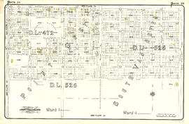
![Plate 113: Killarney [Park Street - Sixty-seventh Avenue - Rupert Street - Fraser River]](/uploads/r/null/d/c/6/dc6f37ebae27a37b14cb5b18025ffac1646066b421e01663f748b244aca25200/8c3aa04a-1f90-4780-a260-048c78490ec5-MAP342b_142.jpg)
Plate 113: Killarney [Park Street - Sixty-seventh Avenue - Rupert Street - Fraser River]
- AM1594-MAP 342b-: MAP 342b.49
- Item
- Dec. 1912
Part of City of Vancouver Archives technical and cartographic drawing collection
Item is a map depicting an area bounded by the following streets: Park Street (now Boundary Road) (west side only) to Sixty-seventh Avenue East (south side only) to Rupert Street (east side only) to the Fraser River.


![Plate 110: Sunset [Windsor Street - River Avenue - Ontario Street - Fraser River]](/uploads/r/null/0/5/1/0517315aa9f84af3bc4f564f523aaf9e067d9b2cd00a4aa1ae4c0fdeafa3e930/1c54d499-8d65-47ea-8942-f6a78a82a9ae-MAP342b_142.jpg)
![Plate 109: Killarney [Park Street - Fifty-sixth Avenue - Rupert Street - Sixty-seventh Avenue]](/uploads/r/null/4/a/c/4acecb61c004796981588a8886b2eb1fe6ed6b02344dd60ba3bc8ef0cc7e3ea4/b017a2f8-ed59-4eac-b2e3-104fc002e01c-MAP342b_142.jpg)


![Plate 106: Sunset [Windsor Street - Fifty-seventh Avenue - Ontario Street - River Avenue]](/uploads/r/null/b/7/c/b7cc0f09fe00083730411f233c5e11762eb97c1fc073492479217426ee16a808/f965ed04-f310-4ef4-91c8-74c88c6a0397-MAP342b_142.jpg)
![Plate 105: Killarney [Park Street - Forty-sixth Avenue - Rupert Street - Fifty-sixth Avenue]](/uploads/r/null/3/f/2/3f2506180ab01b1bb3e8b93fc8556eaf993c3fed6a652c75cb5f9c1d7a3e58b5/f47931f6-b379-41cb-a6a7-df51e419ab26-MAP342b_142.jpg)

![Plate 102: Sunset [Windsor Street - Forty-seventh Avenue - Ontario Street - Fifty-seventh Avenue]](/uploads/r/null/2/7/7/2774c2f1fba864e5a24bcce75925abb510bd59d91b4f731f0981d73a411a7d48/02a6a42f-7b26-4852-b5fc-247ec69ad7bc-MAP342b_142.jpg)


![Plate 99: Kensington [Victoria Drive - Thirty-sixth Avenue - Windsor Street - Forty-seventh Avenue]](/uploads/r/null/a/0/f/a0fb966d72afe4aad0c39ce661f39f9b3258d84f2a83c8554f16f4d99d70d7b1/f677ece0-b817-4129-91ee-58f1029c91f7-MAP342b_142.jpg)
![Plate 98: Kensington [Windsor Street - Thirty-sixth Avenue - Ontario Street - Forty-seventh Avenue]](/uploads/r/null/3/0/c/30cad07a6b13279619850b0cef141d2104cecdd68a36562e4bcc6ff4ae223f91/37a913a6-6608-4ba5-a22e-c4ae060e3cb6-MAP342b_142.jpg)

![Plate 95: Kensington [Victoria Drive - Twenty-sixth Avenue - Windsor Street - Thirty-sixth Avenue]](/uploads/r/null/d/a/0/da0400ba1633362b1d1fa2a8e8267deff6379e01f092aa442d97d33fc1d2d51b/c16f85fb-f801-405f-82e2-f17a6f7b22c7-MAP342b_142.jpg)
![Plate 94: Kensington [Windsor Street - King Edward Avenue - Ontario Street - Thirty-sixth Avenue]](/uploads/r/null/2/1/2/21289f7c15f79622dff7045fda88900f7c1945ee2e9cb9057fba0e68653b7818/3bbf66d1-de75-4d89-bcfb-21ba4173ebff-MAP342b_142.jpg)
![Plate 92: Cedar Cottage [Renfrew Street - Fifteenth Avenue - Victoria Drive - Twenty-seventh Avenue]](/uploads/r/null/a/b/b/abb7f25c911ce6ce2413a2bddb9e4d31d20604606dc24aa9fe3c57f738b558ed/5cb54521-8a89-4c87-aa94-ddbf1ded377e-MAP342b_142.jpg)
![Plate 91: Cedar Cottage [Victoria Drive - Fifteenth Avenue - Dock Street - Twenty-sixth Avenue]](/uploads/r/null/2/1/7/217edd89cad278dfc0bd1fc7e39c6e94ef810a749dcc25df6d8cf20b62aef543/eb359274-1a75-470b-8ae5-ec198732f39e-MAP342b_142.jpg)
![Plate 90: Mount Pleasant [Dock Street - Fifteenth Avenue - Ontario Street - King Edward Avenue]](/uploads/r/null/1/4/a/14a723151dc29add34dd378781a27b78829657362f3dce469dffb0c264f8b9e6/1f2977a4-639f-4884-9997-fe2cfc8e0113-MAP342b_142.jpg)


![Plate 28: Fairview [Ontario Street - Broadway/Ninth Avenue - Oak Street - Nineteenth Avenue]](/uploads/r/null/7/e/6/7e62aa80c58481466edbc9d0d7b745c557d25fdf62d02e52fa8c3f1cf37aff45/4bea1d2d-ba54-43ec-a23e-ba0cbb34f094-MAP342a_142.jpg)


![Plan shewing [showing] division of property belonging to Major C.W. Hill](/uploads/r/null/0/f/0f72067c788c91a520f5055e8b1241e0ee99f2c20c434b03eca0174baea425dc/d22e8a25-814f-4266-99a4-24c639764600-MAP787_142.jpg)

![Plan of re-subdivision of lots 3 to 14, subn [subdivision] 2 of bk [block] 3. D.L. 391 & 392](/uploads/r/null/4/a/4a0ea6aa076433c7bcad0c847f7acb3bb1046f7abf2801c48b97d9ca58f49a73/9bd508e4-c85e-4090-b266-27571c5d4dbc-MAP754_142.jpg)