Showing 18 results

Archival description
City of Vancouver Archives technical and cartographic drawing collection Stanley Park (B.C.)
Print preview View:

15 results with digital objects Show results with digital objects

Beautiful Stanley Park

Item is a brochure for tourists on Stanley park. The front sheet of the unfolded pamphlet includes text on attractions, as well as photographs of the park, petting zoo, monuments, trails and gardens, and Malkin Bowl. The reverse of the sheet contains a map of the park, showing roads, trails, geographical features and attractions.

City of Vancouver : Canadian Pacific town site

Primary map shows lot numbers and boundaries, streets, fire limits and "soundings in feet" (in English Bay, Burrard Inlet, Coal Harbour and False Creek) in downtown Vancouver, Stanley Park and parts of Kitsilano and Fairview. The ancillary maps show an "Index plan of Vancouver, B.C.", an "Index plan of [Vancouver] city limits" and "Canadian Pacific Mail Steamship Lines" (a map of Canadian Pacifc steamship routes around the world). On recto, the item also includes a description of Stanley Park and an illustration of Vancouver's inner harbour. On verso, the item includes descriptions of major Vancouver residences, imports, exports, businesses and other landmarks.

Map of Stanley Park [site plan]

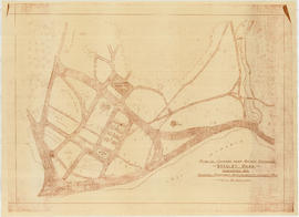
Item is a copy of a published map of Stanley Park which has been annotated to show proposed redevelopment plan for the western portion of Coal Harbour (currently Lost Lagoon) and surrounding area. It is believed that this is one of the sheets referred to by Thomas Mawson in his report to the Board of Parks Commissioners regarding various proposed development schemes for the entrance to Stanley Park and the Coal Harbour area.

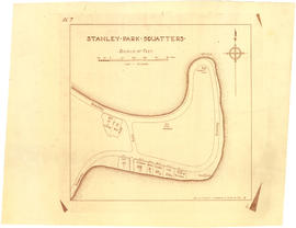
Plan showing lands occupied in Stanley Park near Brockton Point. City of Vancouver B.C.

Item is a map showing parcels of land in Coal Harbour from Park entrance to "Time Gun", annotated with names of owners in the hand of J.S. Matthews. Also shows Parcels 7 and 8 ("garden land" and Cummings). Building outlines, fences, wharves, etc., are indicated.

Vancouver (B.C.). Engineer's Office

Sketch showing traffic plan for night functions in Stanley Park during Golden Jubilee period

Item is a map showing provisions for parking, traffic movement, and pedestrian movement for special events related to the City's Golden Jubilee held in Stanley park. Restricted areas, pedestrian crossings, locations of police traffic officers, ticket collectors and fences and gates to be erected are shown.

Vancouver (B.C.). Engineer's Office