![125 - Maggie Trudeau - Mother Teresa [29 of 36]](/uploads/r/null/9/c/d/9cdfd9b95ff2fe5d03b5b7ce772b03f39460fb3ca8d64d4ac15bc95957b349c9/2cdd1c48-1013-40bb-ae69-cda40c76ddb9-CVA395-04234_142.jpg)
#125 - Maggie Trudeau - Mother Teresa [29 of 36]
- AM1671-: CVA 395-04234
- Item
- May 31, 1976
Part of Habitat Forum photographs
Item is a photograph showing Al Clapp, Paul Manning, Pierre Trudeau and others touring the Habitat Forum site.
10228 results with digital objects Show results with digital objects
#125 - Maggie Trudeau - Mother Teresa [29 of 36]
Part of Habitat Forum photographs
Item is a photograph showing Al Clapp, Paul Manning, Pierre Trudeau and others touring the Habitat Forum site.
![139 - Habitat Forum - Greenpeace - Water Day [24 of 33]](/uploads/r/null/4/4/9/449bd37eaf718a5ed89ac75198b828145c007fc6f55ed81444a7a684eab401ec/af841549-f6e2-489d-97f9-98ab06e8282a-CVA395-04705_142.jpg)
#139 - Habitat Forum - Greenpeace - Water Day [24 of 33]
Part of Habitat Forum photographs
Item is a photograph showing a group of people, including Barney Danson, Margaret Trudeau, Margaret Mead, and Ron Basford on stage for Water Day at the Habitat Forum site.
![139 - Habitat Forum - Greenpeace - Water Day [17 of 33]](/uploads/r/null/0/8/4/084b901bca289a340d916cebe2230389fba3df6b153db6086b5302364cbd77db/cda656d9-953f-44e0-b16e-822857c322d4-CVA395-04698_142.jpg)
#139 - Habitat Forum - Greenpeace - Water Day [17 of 33]
Part of Habitat Forum photographs
Item is a photograph showing Barney Danson and Margaret Trudeau on stage for Water Day at the Habitat Forum site.
![Trudeau (Conference) [18 of 40]](/uploads/r/null/3/3/6/33653a6b6da631f6cd124bd8f25e4d5b82c379dfa23615dc13ea3b4021bdebe6/86f3bea7-c2a9-489d-b21f-9c2d5fe39841-2011-130_142.jpg)
Trudeau (Conference) [18 of 40]
Part of Habitat Forum photographs
Item is a photograph showing Margaret Trudeau with baby Michel Trudeau at Habitat Forum.
![Trudeau visit (Conference) [12 of 16]](/uploads/r/null/9/3/8/938aa8943611f56311222c4b10bf19bf32d9c12096d79a30069a04e4c483962d/3a5ce2ae-1c8c-4e3a-b7ac-9b9e7e1041bb-CVA395-08573_142.jpg)
Trudeau visit (Conference) [12 of 16]
Part of Habitat Forum photographs
Item is a photograph showing Margaret Trudeau and an unidentified woman.
![Trudeau visit (Conference) [13 of 16]](/uploads/r/null/7/0/1/7010f0931103cd3241b0ce15f914e78a450f437aefcc576aa7284166b2ff1bc3/8b7ee6f8-83d6-4890-87a7-d7c6dc5e921a-CVA395-08574_142.jpg)
Trudeau visit (Conference) [13 of 16]
Part of Habitat Forum photographs
Item is a photograph showing Margaret Trudeau and an unidentified woman.

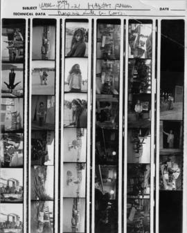
Week of May 17-21 Habitat Forum
Part of Habitat Forum photographs
Item is a contact sheet showing images of structures and people at the Habitat Forum. Writing on the top of the page: "Negs are with G. Coots."

Week of May 17-21 Habitat Forum
Part of Habitat Forum photographs
Item is a contact sheet showing images of totem poles, people at the Habitat Forum and Habitat staff identification photos. Writing on the top of the page: "Negs are with G. Coots."
Week of May 17-21 Habitat Forum
Part of Habitat Forum photographs
Item is a contact sheet showing images of people at the Habitat Forum. Writing on the top of the page: "Negs are with G. Coots."
Item is a photograph showing a group of people at the Habitat Forum site in Jericho Beach Park.
Item is a photograph showing a group of Indigenous people drumming surrounded by onlookers at the Habitat Forum site in Jericho Beach Park.
Item is a photograph showing the Bill Reid mural on Hangar 3 and other wood carvings at the Habitat Forum site in Jericho Beach Park.

Plan of Point Grey Municipality
Part of City of Vancouver Archives technical and cartographic drawing collection
The map is a street map of the Municipality of Point Grey and parts of the City of Vancouver. It shows street car lines, district lot boundaries, postal block numbers and some street names
Plan of Sewerage System Point Grey Municipality
Part of City of Vancouver fonds
The map shows the Point Grey Area and its district lot boundaries, street car lines, and postal block numbers. The map displays streets, parks, railways, and schools. Additionally, there are annotations red which mark the sewerage and drainage for the area. The size of the pipes is also incrementally listed.
The Northernmost point on the map is the English Bay and the Southernmost point is the North Arm of the Fraser River. The Easternmost is Ontario St. and Westernmost road on the map is Marine Drive beside UBC.
W.C. Grey was the engineer that produced the map.
![153 - Habitat Forum - last party - boat ride [36 of 37]](/uploads/r/null/9/3/c/93c193d0bec5c686b18e217545eb66b9b1d8aa7649f60e9b5c8bde0c26ecb676/cc2f0def-cbc6-4130-bec1-4a356f539947-CVA395-05211_142.jpg)
#153 - Habitat Forum - last party - boat ride [36 of 37]
Part of Habitat Forum photographs
![153 - Habitat Forum - last party - boat ride [35 of 37]](/uploads/r/null/c/f/b/cfb5bf9456989d1bb9329e4211f629d7d47d9867264e6c4c8748f80204369915/29c6d8c6-84e7-4ad8-bded-3294c7f4f8ce-CVA395-05210_142.jpg)
#153 - Habitat Forum - last party - boat ride [35 of 37]
Part of Habitat Forum photographs
![153 - Habitat Forum - last party - boat ride [34 of 37]](/uploads/r/null/6/2/8/628f608105627e6c724aca0ccbe978889fe4c29873b8cd93070edc594d97c799/674c57b0-be93-4380-8894-6c9d30eb3c47-CVA395-05209_142.jpg)
#153 - Habitat Forum - last party - boat ride [34 of 37]
Part of Habitat Forum photographs
![153 - Habitat Forum - last party - boat ride [33 of 37]](/uploads/r/null/c/2/e/c2e605fabc4d6b2e38e721793eaa6b8a21e666fb28b9eed9ce5406b75c942347/373efc3a-0ef7-42ab-b86c-071fe8319278-CVA395-05208_142.jpg)
#153 - Habitat Forum - last party - boat ride [33 of 37]
Part of Habitat Forum photographs
![153 - Habitat Forum - last party - boat ride [32 of 37]](/uploads/r/null/f/a/0/fa0e9acc0790a08df06082a372bc9192045a804fd2234966fd7198f0eaff1b9c/57f36c3d-5e44-4455-8592-295c212afa07-CVA395-05207_142.jpg)
#153 - Habitat Forum - last party - boat ride [32 of 37]
Part of Habitat Forum photographs
![153 - Habitat Forum - last party - boat ride [31 of 37]](/uploads/r/null/9/4/f/94f79676eaaaa5389dc7d4b1e8a300f981b9ac50ae7101038624575628806635/c25c3978-e936-44b1-86cd-e8b9553e3222-CVA395-05206_142.jpg)
#153 - Habitat Forum - last party - boat ride [31 of 37]
Part of Habitat Forum photographs
![153 - Habitat Forum - last party - boat ride [30 of 37]](/uploads/r/null/b/d/5/bd5739dca703b79adbfa81187482c889e8c02adb28d86ebe1ed24b4a5249a850/11619813-f019-425c-a6eb-158f44012012-CVA395-05205_142.jpg)
#153 - Habitat Forum - last party - boat ride [30 of 37]
Part of Habitat Forum photographs
![153 - Habitat Forum - last party - boat ride [29 of 37]](/uploads/r/null/7/5/8/758d5dba23aa936d406f449e583d03dacaed490d512cc90b07557053ad8de948/93edc6cf-338e-4f78-87c3-ea15e6609574-CVA395-05204_142.jpg)
#153 - Habitat Forum - last party - boat ride [29 of 37]
Part of Habitat Forum photographs
![153 - Habitat Forum - last party - boat ride [28 of 37]](/uploads/r/null/a/4/f/a4fea468d0de32dc1ad1af5e9e461c82159d712069a1768060a7713abfebc85a/f47ad7b9-977b-4e20-a71d-4fd8a1aa5ba2-CVA395-05203_142.jpg)
#153 - Habitat Forum - last party - boat ride [28 of 37]
Part of Habitat Forum photographs
![153 - Habitat Forum - last party - boat ride [27 of 37]](/uploads/r/null/d/7/8/d781899c3de3bb5a52380d6c7258f75a9a419d212f0200708c12bcafe8004d1f/12cb128c-4065-4fdb-9fe9-78b6f8a5ec29-CVA395-05202_142.jpg)
#153 - Habitat Forum - last party - boat ride [27 of 37]
Part of Habitat Forum photographs
![153 - Habitat Forum - last party - boat ride [26 of 37]](/uploads/r/null/5/8/6/5864861e54b89b4fbc5223c6c98b1d6fbeb42af8f823cca40c1fc969189996ec/4f1e6593-1266-4a5c-b574-4fbc8886686f-CVA395-05201_142.jpg)
#153 - Habitat Forum - last party - boat ride [26 of 37]
Part of Habitat Forum photographs
![153 - Habitat Forum - last party - boat ride [25 of 37]](/uploads/r/null/c/6/f/c6fbfc20047581e2a3b20f258a64650fb3f1b7acd3d1168d8ea0c5a75db40b7d/8f423c2b-9bf2-41cc-b137-92d0ec5e303e-CVA395-05200_142.jpg)
#153 - Habitat Forum - last party - boat ride [25 of 37]
Part of Habitat Forum photographs
![153 - Habitat Forum - last party - boat ride [24 of 37]](/uploads/r/null/4/f/3/4f3f798f05577c3acc144c4af599666677325a80c2e537cf9a3f7a5f60ac1991/5b7914d9-f845-4ed8-a70e-76bc91e54947-CVA395-05199_142.jpg)
#153 - Habitat Forum - last party - boat ride [24 of 37]
Part of Habitat Forum photographs
![153 - Habitat Forum - last party - boat ride [23 of 37]](/uploads/r/null/4/6/7/4672ccbc98909d1bd6489766375082610eab9b12eaf9a04aa064d28afe301885/ee02912e-924e-4da2-9ea7-2aea2ed33846-CVA395-05198_142.jpg)
#153 - Habitat Forum - last party - boat ride [23 of 37]
Part of Habitat Forum photographs
![153 - Habitat Forum - last party - boat ride [22 of 37]](/uploads/r/null/0/0/4/004b835aba5cd10068e0c8274fe3a4d9b2225730705e35b2dfbdef7f8cbf9dbb/eceae0fd-e049-4822-aa3a-146f830b133e-CVA395-05197_142.jpg)
#153 - Habitat Forum - last party - boat ride [22 of 37]
Part of Habitat Forum photographs
![153 - Habitat Forum - last party - boat ride [21 of 37]](/uploads/r/null/1/9/a/19a806219026fe4ddf6b4b30f0295c267b4bf38064e2f289fe7fe8da4190fe20/e5dc0649-0955-4df0-9645-23193fc65f9f-CVA395-05196_142.jpg)
#153 - Habitat Forum - last party - boat ride [21 of 37]
Part of Habitat Forum photographs
![153 - Habitat Forum - last party - boat ride [20 of 37]](/uploads/r/null/8/1/a/81adee063e9e4c81bb7fb4ced6541565eeb64edd602525c35bbb093148d55f30/015e7d8e-fb50-427a-a637-244fcf7559f1-CVA395-05195_142.jpg)
#153 - Habitat Forum - last party - boat ride [20 of 37]
Part of Habitat Forum photographs
![153 - Habitat Forum - last party - boat ride [19 of 37]](/uploads/r/null/1/4/a/14adaf7dacc8f61d993bf8f42cd120e736287b427218790a560a179590485fbe/0dc57a64-7420-4f77-8e28-1218f42c99e6-CVA395-05194_142.jpg)
#153 - Habitat Forum - last party - boat ride [19 of 37]
Part of Habitat Forum photographs
![153 - Habitat Forum - last party - boat ride [18 of 37]](/uploads/r/null/5/7/d/57de5724a1e93ab7df2ed8d0301b8494aebeb819cf28699db6ce142b8139338b/4a1db04f-4346-4d5c-b734-ee9bd19d7b05-CVA395-05193_142.jpg)
#153 - Habitat Forum - last party - boat ride [18 of 37]
Part of Habitat Forum photographs
![153 - Habitat Forum - last party - boat ride [17 of 37]](/uploads/r/null/3/e/4/3e4fbb8c7786808ddc0ad2518cf6e3e64d6c6ab2c7c072f8f0486620a874e989/aee2095a-da04-42c9-ae45-0b7e111f8984-CVA395-05192_142.jpg)
#153 - Habitat Forum - last party - boat ride [17 of 37]
Part of Habitat Forum photographs
![153 - Habitat Forum - last party - boat ride [16 of 37]](/uploads/r/null/1/7/a/17aadc098c5c2c048215017bb97f39a3a9f1df09c48a9edd79da91f2a8cb15f6/6b3cf461-1093-4a3f-9e83-009339dbb934-CVA395-05191_142.jpg)
#153 - Habitat Forum - last party - boat ride [16 of 37]
Part of Habitat Forum photographs
![153 - Habitat Forum - last party - boat ride [15 of 37]](/uploads/r/null/4/6/a/46a1d589feb6b069af1ca65d316724ef9982ab40eb820102cc55244764b9ca16/9b6c91a4-ddec-4468-bcea-d56ff27408fa-CVA395-05190_142.jpg)
#153 - Habitat Forum - last party - boat ride [15 of 37]
Part of Habitat Forum photographs
![153 - Habitat Forum - last party - boat ride [14 of 37]](/uploads/r/null/d/7/0/d70af5728e834b3ce84b6c9e74dbc9cfcd4f2c27f6c2c82eaaff61f00f9fad81/d504907a-3076-4b06-ac7e-db14523a7e0d-CVA395-05189_142.jpg)
#153 - Habitat Forum - last party - boat ride [14 of 37]
Part of Habitat Forum photographs
![153 - Habitat Forum - last party - boat ride [13 of 37]](/uploads/r/null/8/7/8/8781ac748b739b85f33bb604fdf0668c888cb4cb0fb976c1e622c35c1a3b61d8/fb638faa-5a32-465b-b0c4-ba652589d681-CVA395-05188_142.jpg)
#153 - Habitat Forum - last party - boat ride [13 of 37]
Part of Habitat Forum photographs
![153 - Habitat Forum - last party - boat ride [12 of 37]](/uploads/r/null/1/9/0/1908f0e1379fca96959195a027434232991a6bab3198305809e8309fdc221473/9753fbe2-2977-4873-bcd1-10d99e1b4f7f-CVA395-05187_142.jpg)
#153 - Habitat Forum - last party - boat ride [12 of 37]
Part of Habitat Forum photographs
![153 - Habitat Forum - last party - boat ride [11 of 37]](/uploads/r/null/5/9/c/59c81c1652b3f93fef821d4ae205088d4b19898fbefbd2cae8d246235e233104/d058dd42-30b4-4274-b1b0-b473f81a8e4d-CVA395-05186_142.jpg)
#153 - Habitat Forum - last party - boat ride [11 of 37]
Part of Habitat Forum photographs
![153 - Habitat Forum - last party - boat ride [10 of 37]](/uploads/r/null/f/a/9/fa9fc1a6caefee87a0210b798bf75c40e62bdfd5e69a0b7dc6c69906b23abc97/218be324-6462-4d00-b84b-1bae315e0b6d-CVA395-05185_142.jpg)
#153 - Habitat Forum - last party - boat ride [10 of 37]
Part of Habitat Forum photographs
![153 - Habitat Forum - last party - boat ride [9 of 37]](/uploads/r/null/1/3/d/13d58d7404cbb7844f8c0d2d6499b765f0b8e12d22b48af7139e65525b22893c/235fd18e-9d5c-48ee-b41e-90d72b841a5f-CVA395-05184_142.jpg)
#153 - Habitat Forum - last party - boat ride [9 of 37]
Part of Habitat Forum photographs
![153 - Habitat Forum - last party - boat ride [8 of 37]](/uploads/r/null/7/1/b/71be73659a0d25670e932ae35345b04d0b4f9003154bebd407cd7d37a6053986/83738dbf-591a-4518-beb6-c4509bc30acd-CVA395-05183_142.jpg)
#153 - Habitat Forum - last party - boat ride [8 of 37]
Part of Habitat Forum photographs
![153 - Habitat Forum - last party - boat ride [7 of 37]](/uploads/r/null/7/6/9/7691ee88c603a033cf27383ebe842353524628e63d7e30c7848fbe21e6e6dda6/d476748b-ef2d-4ac1-aaa2-e1532eb57e97-CVA395-05182_142.jpg)
#153 - Habitat Forum - last party - boat ride [7 of 37]
Part of Habitat Forum photographs