
Dial map of Greater Vancouver and suburbs

Street index (Gibson Street to William Street) and tram stations

City of Vancouver : east half

Map of West Vancouver and North Vancouver, street index, real estate information, and list of golf courses

Dial map of Greater Vancouver and suburbs
![North Shore Marine Drive [and] Point Atkinson, Vancouver, B.C., Canada](/uploads/r/null/b/3/1/b31126992eefcb817ddcd71e986e554566c5a7384d9b78337c6b98c541189b86/86aad77d-e1bb-4799-b9d0-da385dffbff1-AM1052P-2170_142.jpg)
North Shore Marine Drive [and] Point Atkinson, Vancouver, B.C., Canada

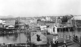
Ferry landing and Lonsdale Ave., North Vancouver
![[Fairmont Road washed out after the storm]](/uploads/r/null/f/d/fdac97656d097c1db744ea7ebff607ce140d236c2c466c08c6de0f6317783415/616b630a-7f25-40f6-9722-b0b838b2a7aa-A33735_142.jpg)
[Fairmont Road washed out after the storm]
![[Ferry line-up extends down Lonsdale Ave. from 8th St.]](/uploads/r/null/3/6/367ef713063c6e5458ccbd6abe9202e417d4a8156909c4fb1e3a7c2baada4cdc/daa5f6ad-1e38-4e0a-9038-59cfd6cd1edc-A24498_142.jpg)
[Ferry line-up extends down Lonsdale Ave. from 8th St.]
![[Northern view of Lonsdale Avenue]](/uploads/r/null/0/0/004f60b942e23702aaee6204aee266b4ad516e517df3f70971bf02819643b669/ae2e7cc4-bbec-4154-a6e4-c8fbf58beb95-A26824_142.jpg)
[Northern view of Lonsdale Avenue]
![[Moody Avenue and Seventh Street]](/uploads/r/null/4/a/4a47ba26ff022cbedb4c458cdaae1313c7d362a053c46d9cee5234510d242e07/35244082-830d-4917-8d46-0e6df8091c1d-A09195_142.jpg)
[Moody Avenue and Seventh Street]

Canadian Traffic Signal Corporation - Photo of New Signals

Map of West Vancouver and vicinity
North Vancouver

Ferry Wharf North Vancouver, B.C.

Lonsdale Avenue

Map of Fraser Valley
![[Foot of Lonsdale Avenue from ferry terminal]](/uploads/r/null/b/b/bb495757dd002adb23951152985e71388ce81c70ee373cf6557f1e8f7f203b16/b14d2b0d-a70b-4a21-b634-f75d1d883e1e-A02676_142.jpg)
[Foot of Lonsdale Avenue from ferry terminal]

Dial map of Greater Vancouver and suburbs

Dial map of Greater Vancouver and suburbs
![[Looking north along Lonsdale Avenue from the ferry wharf]](/uploads/r/null/1/e/1ef12d281e91fc1c1a49a731cfc31bb1cf33747b5be716973e17e8f0372b7a3f/319fd277-2b1f-4626-994b-3063bae557af-A62579_142.jpg)
[Looking north along Lonsdale Avenue from the ferry wharf]

Dial map of Greater Vancouver and suburbs
![[Ferry line-up on Lonsdale Avenue up to Eighth Street]](/uploads/r/null/0/7/07c1d194551657a593def712e867cd96259b6e82559677fc17d0b3c0ceceb28d/88726415-08cd-4424-9062-15ff90ff2cdf-A24499_142.jpg)
[Ferry line-up on Lonsdale Avenue up to Eighth Street]
![[Fifteenth Street looking east towards Grand Boulevard]](/uploads/r/null/7/3/73a89135f77f03c2170bc52234ba67e4d5b33dd68391be03e9ca3753fb8abd65/1332756e-55c4-4d2a-93f8-9e02d7c4bc28-A33961_142.jpg)
[Fifteenth Street looking east towards Grand Boulevard]
![[Northern view of Lonsdale Avenue from the ferry dock]](/uploads/r/null/2/a/2a7bb34b044a9f06e963b6af0e946ceb80777fcb87e3c08a59497c37a76f46fd/b72e1250-2f39-4a4a-91ff-3088c0f00501-A26823_142.jpg)
[Northern view of Lonsdale Avenue from the ferry dock]

Street index (Royal Oak Avenue, Vancouver to Frederick Road, North Vancouver)

City and District of North Vancouver