
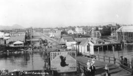
Ferry landing and Lonsdale Ave., North Vancouver
![North Shore Marine Drive [and] Point Atkinson, Vancouver, B.C., Canada](/uploads/r/null/b/3/1/b31126992eefcb817ddcd71e986e554566c5a7384d9b78337c6b98c541189b86/86aad77d-e1bb-4799-b9d0-da385dffbff1-AM1052P-2170_142.jpg)
North Shore Marine Drive [and] Point Atkinson, Vancouver, B.C., Canada

Dial map of Greater Vancouver and suburbs

Dial map of Greater Vancouver and suburbs

City of Vancouver : east half

Dial map of Greater Vancouver and suburbs

City and District of North Vancouver

Map of West Vancouver and North Vancouver, street index, real estate information, and list of golf courses
![[Foot of Lonsdale Avenue from ferry terminal]](/uploads/r/null/b/b/bb495757dd002adb23951152985e71388ce81c70ee373cf6557f1e8f7f203b16/b14d2b0d-a70b-4a21-b634-f75d1d883e1e-A02676_142.jpg)
[Foot of Lonsdale Avenue from ferry terminal]

Canadian Traffic Signal Corporation - Photo of New Signals

Map of Fraser Valley

Map of West Vancouver and vicinity

Dial map of Greater Vancouver and suburbs

Dial map of Greater Vancouver and suburbs

Street index (Gibson Street to William Street) and tram stations

Street index (Royal Oak Avenue, Vancouver to Frederick Road, North Vancouver)

Lonsdale Avenue
![[Looking north along Lonsdale Avenue from the ferry wharf]](/uploads/r/null/1/e/1ef12d281e91fc1c1a49a731cfc31bb1cf33747b5be716973e17e8f0372b7a3f/319fd277-2b1f-4626-994b-3063bae557af-A62579_142.jpg)
[Looking north along Lonsdale Avenue from the ferry wharf]
North Vancouver
![[Fifteenth Street looking east towards Grand Boulevard]](/uploads/r/null/7/3/73a89135f77f03c2170bc52234ba67e4d5b33dd68391be03e9ca3753fb8abd65/1332756e-55c4-4d2a-93f8-9e02d7c4bc28-A33961_142.jpg)
[Fifteenth Street looking east towards Grand Boulevard]
![[Fairmont Road washed out after the storm]](/uploads/r/null/f/d/fdac97656d097c1db744ea7ebff607ce140d236c2c466c08c6de0f6317783415/616b630a-7f25-40f6-9722-b0b838b2a7aa-A33735_142.jpg)
[Fairmont Road washed out after the storm]

Ferry Wharf North Vancouver, B.C.
![[Northern view of Lonsdale Avenue]](/uploads/r/null/0/0/004f60b942e23702aaee6204aee266b4ad516e517df3f70971bf02819643b669/ae2e7cc4-bbec-4154-a6e4-c8fbf58beb95-A26824_142.jpg)
[Northern view of Lonsdale Avenue]
![[Northern view of Lonsdale Avenue from the ferry dock]](/uploads/r/null/2/a/2a7bb34b044a9f06e963b6af0e946ceb80777fcb87e3c08a59497c37a76f46fd/b72e1250-2f39-4a4a-91ff-3088c0f00501-A26823_142.jpg)
[Northern view of Lonsdale Avenue from the ferry dock]
![[Ferry line-up on Lonsdale Avenue up to Eighth Street]](/uploads/r/null/0/7/07c1d194551657a593def712e867cd96259b6e82559677fc17d0b3c0ceceb28d/88726415-08cd-4424-9062-15ff90ff2cdf-A24499_142.jpg)
[Ferry line-up on Lonsdale Avenue up to Eighth Street]
![[Ferry line-up extends down Lonsdale Ave. from 8th St.]](/uploads/r/null/3/6/367ef713063c6e5458ccbd6abe9202e417d4a8156909c4fb1e3a7c2baada4cdc/daa5f6ad-1e38-4e0a-9038-59cfd6cd1edc-A24498_142.jpg)
[Ferry line-up extends down Lonsdale Ave. from 8th St.]
![[Moody Avenue and Seventh Street]](/uploads/r/null/4/a/4a47ba26ff022cbedb4c458cdaae1313c7d362a053c46d9cee5234510d242e07/35244082-830d-4917-8d46-0e6df8091c1d-A09195_142.jpg)
[Moody Avenue and Seventh Street]