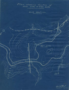
Plan showing locations of dam sites at Green Lake
- COV-S346-F01-: MAP 1143
- Item
- [1923?]
Part of City of Vancouver fonds
3 results with digital objects Show results with digital objects
Plan showing locations of dam sites at Green Lake
Part of City of Vancouver fonds
![Longitudinal section along [centre line] of dam sites at north end of Green Lake](/uploads/r/null/7/4/a/74af74789da62d7da66c012dd18dd964e4e83151ac5f0b139a53843bce6ccfe6/974ff05f-0f29-4e65-b818-c663b1a236e1-MAP1142_142.jpg)
Longitudinal section along [centre line] of dam sites at north end of Green Lake
Part of City of Vancouver fonds
Item is a sheet depicting 2 profiles: one of dam no. 1 at railway crossing at 2247+763 and one of dam no. 2 at the head of the Green River (Green Lake).
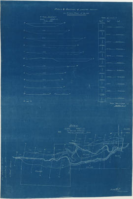
Plan & sections of possible reservoir on Green River
Part of City of Vancouver fonds
Item is a map sheet that depicts a portion of the Green River with a proposed dam site. Twelve cross-sections of the resultant reservoir are depicted, with estimated total cubit feet of water for each in an accompanying table.