Item is a portion of a topographical map showing Green Lake, the headwaters of the Green River, and the portions of 21 Mile Creek and Fitzsimmons Creek where they empty into Green Lake. The remaining portion of the map shows the Green Lake area from District Lot 2015 to 3336. The map is missing its right-hand portion and title block, though the style and hand are the same as other maps created by the City Engineer's Office as a result of the 1923 surveys of the Squamish, Cheakamus and Green rivers.
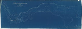
The sheet also contains three sections: one of Fitzsimmons Creek at the Pacific Great Easter Railway bridge 40.5, one of the Green River and one of the valley north-west of Green Lake along which the PGE line runs.
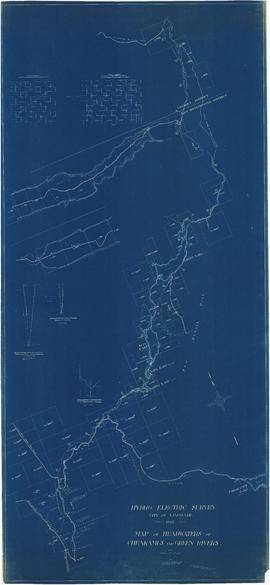
Item is a map which contains survey information relating to hydro-electric surveys conducted by the City. The map shows topography, physical features, District Lots, built structures and the right-of-way of the Pacific Great Eastern railway.
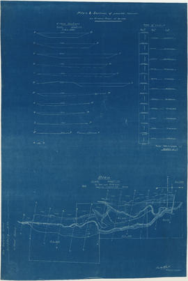
Item is a sheet depicting 2 profiles: one of dam no. 1 at railway crossing at 2247+763 and one of dam no. 2 at the head of the Green River (Green Lake).
Item is a map sheet showing the results of the hydroelectric surveys of the upper Cheakamus River, Green Lake and Green River. The sheet includes 3 cross sections of the Cheakamus River.
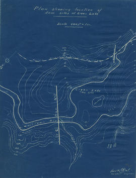
Item is a map sheet that depicts a portion of the Green River with a proposed dam site. Twelve cross-sections of the resultant reservoir are depicted, with estimated total cubit feet of water for each in an accompanying table.
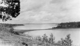
![Longitudinal section along [centre line] of dam sites at north end of Green Lake](/uploads/r/null/7/4/a/74af74789da62d7da66c012dd18dd964e4e83151ac5f0b139a53843bce6ccfe6/974ff05f-0f29-4e65-b818-c663b1a236e1-MAP1142_142.jpg)