
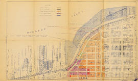
Proposed industrial subdivision - Joyce and Vanness
![[View of Mount Pleasant]](/uploads/r/null/0/c/9/0c9db5e81df211f273f5e890c4cf2f482734489cf47c53831e2f430410336c9b/259201ec-18df-4a3e-9317-7b6aa211e33b-CVA808-9_142.jpg)
[View of Mount Pleasant]
![[House at] 743 East Pender Street](/uploads/r/null/c/7/c7cb8ee7375a3f7c85b16d6bcac69252f03f7c76ae6b935d36a1953256db0d03/347d091d-7104-4d2a-813d-8f7daf51862c-A61546_142.jpg)
[House at] 743 East Pender Street
![[House at 727] Keefer Street](/uploads/r/null/c/4/c41bd7532c24c871c2ed8be83f67d581b21d06c4e1819f00079cee73d5982dea/4602d0e0-b009-4c67-8272-e4286b496b86-A61552_142.jpg)
[House at 727] Keefer Street
![[Buildings at] 886-898 Union Street](/uploads/r/null/0/9/0998c98e83ff573660605fb2e05e845a11f9807872f6f8eef620b2160352a8aa/78776bb6-68ae-449c-b26d-449b666e881b-A61555_142.jpg)
[Buildings at] 886-898 Union Street
![[Buildings at] 606 Union Street](/uploads/r/null/5/5/556bc3293559172a8a9849d9d55ac756b4c21caeeb58ffa5b2f607753cb9d958/61a17ec4-7c57-489e-8c5c-7c0726a3c713-A61558_142.jpg)
[Buildings at] 606 Union Street
![[Buildings at] 606 Union Street](/uploads/r/null/b/0/b057b3e56c0a625078b403bddd58250fc8e9ae22c257d73f648900eaaf78e740/70639922-761f-473b-84b4-065c3025f125-A61559_142.jpg)
[Buildings at] 606 Union Street

Project 2 : generalized plan of redevelopment

Project 2, part of area "a" : condition of buildings

Project 2, part of area "a" : existing utilities, water and sewer

Government precinct

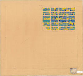
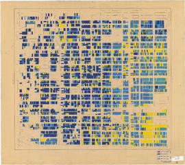
Age of buildings : Main Street to Clark Drive and Prior Street/Venables Street to Broadway

Age of buildings : Arbutus Street to Oak Street and Odgen Avenue to Broadway

Age of buildings : Slocan Street to Boundary Road and 5th Avenue to 22nd Avenue
Age of buildings : Blenheim Street to Arbutus Street and 57th Avenue to the North Arm of the Fraser River

Age of buildings : Crown Street to Blenheim Street and 41st Avenue to 55th Avenue
Age of buildings : Blanca Street to Discovery Street and 10th Avenue to 16th Avenue
Age of buildings : Clark Drive to Slocan Street and Hastings Street to 6th Avenue

Age of buildings : Main Street to Clark Drive and Railway Street/Powell Street to Prior Street/Venables Street

Age of buildings : Clark Drive to Slocan Street and Powell Street/Wall Street to Hastings Street

Age of buildings : Knight Street to Slocan Street/Wales Street and 22nd Avenue to 37th Avenue
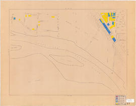
Industry : parking : on street
Industry : parking : on street
Industry : truck routes
Industry : truck routes
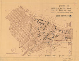
Figure 10 : parking as the major use of land in 1954
![City of Vancouver [Existing super-markets : date of erection, size and location]](/uploads/r/null/c/9/9/c994b91e283c9d37d539b5381734a5b8dd287c7cc8da9ba54b10a82d884e42b2/99137e02-fef1-48fe-8563-9abd1c74c42f-LEG1202_142.jpg)
City of Vancouver [Existing super-markets : date of erection, size and location]
![Age of bldgs. [buildings] : 1000-1300 Granville Street](/uploads/r/null/f/6/1/f616b7dd30e14793c36bdae78e7ac9d8a918586b9b1b461a4888b74a53c4c228/3f061937-ef69-4bc5-81ce-d99a0ad6e7ce-LEG1202_142.jpg)
Age of bldgs. [buildings] : 1000-1300 Granville Street
Land use : Semlin Drive to Nanaimo Street and Burrard Inlet to Triumph Street

Group of workers walking, carrying metal lunchboxes

Project 2, part of area "a" : existing gas, electricity and telephone

Project 2, area "h" and part of "b" : condition of buildings

Project 2, area a-2 : condition of buildings

Project 2: identification plan

Project 2, area a-2 : proposed property acquisitions project 2

Project 2, part of area "a" : aerial photograph

Project 2, part of area "a" : existing utilities, water and sewer

Project 2, part of area "a" : existing utilities, gas, electricity and telephone

Project 2, part of area "a" : utility diversions and rearrangements

Project 2, part of area "a" : identification plan

Redevelopment Project No. 2 Plan No. 1
City of Vancouver, east approach route. Alignment alternatives investigated
City of Vancouver, east approach route. Alignment alternatives investigated

Fourteenth Annual fireman's ball, 1912, invitation

Fourteenth Annual fireman's ball, 1912, dance program, front page
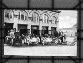
Firehall auto brigade, Vancouver, B.C.
Vancouver Fire Department - Hall No. 2

Vancouver Fire Department No. 18

Firefighters and equipment in action at G.H. Cottrell Warehouse, 139 Water Street

Firefighting equipment at scene of Imperial Oil Company fire, Smithe Street

Fire Department Band performing by pool in front of bleachers
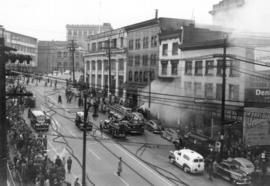
Fire engines and spectators at three alarm fire at Park Hotel

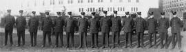
Group portrait of fire chiefs in civilian dress with reporter Simma Holt