Showing 22 results
Archival description
The official street name map of the City of Vancouver

Schedule "A" : polling districts, City of Vancouver
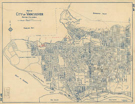
Map of City of Vancouver, British Columbia

Plan showing polling divisions, City of Vancouver, B.C.

Vancouver, British Columbia

Plan of portions of False Creek (Kitsilano) Indian Reserve, Vancouver, B.C., required for Burrard Street Bridge right-of-way

Reinforced concrete details, Hamilton Street convenience

Plan of public convenience, Hamilton Street, Vancouver B.C.

Drainage and electrical wiring plan, for public convenience, Hamilton Street, Vancouver B.C.

Plan of proposed public convenience, Georgia & Granville Sts., Vancouver, B.C.

Proposed sanitary convenience at S. end of Granville Bridge
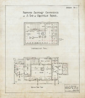
Proposed sanitary convenience at S. end of Granville Bridge.

Proposed sanitary convenience at S. end of Granville Bridge

Proposed sanitary convenience at S. end of Granville Bridge

4th Ave & Granville St. convenience

Proposed convenience at Kingsway & Main St.

Proposed store and sanitary convenience at S. end of Granville Bridge

Proposed convenience at south end of Granville Bridge
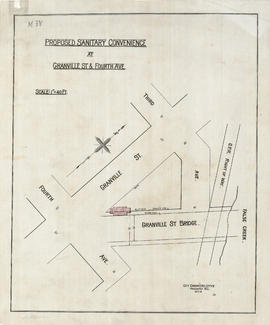
Proposed sanitary convenience at Granville Street & Fourth Avenue

Proposed sanitary convenience Fourth Ave & Granville St

Location of ferry pedestrian subway, Vancouver, B.C.

Plan of part of D.L. 540