Vancouver : spectacular by nature : official courtesy map
Vancouver : spectacular by nature : official courtesy map
Harbour Green Neighborhood; Hastings Street Elevation North
Harbour Green Neighborhood; Hastings Street Elevation North
Site plan of central downtown waterfront
Site plan of central downtown waterfront
Site plan of central downtown waterfront
Site plan of central downtown waterfront
Marathon Realty Company Limited Coal Harbour Redevelopment
Marathon Realty Company Limited Coal Harbour Redevelopment
Marathon Realty Company Limited Coal Harbour Redevelopment
Marathon Realty Company Limited Coal Harbour Redevelopment

Vancouver downtown property map
The city of Vancouver
The city of Vancouver

False Creek Basin
Vancouver 1886-1986 : yesterday, gateway to the Pacific : today, crossroads of the world
Vancouver 1886-1986 : yesterday, gateway to the Pacific : today, crossroads of the world

Vancouver : as seen from space : vue de l'espace
Cityscape: A map of downtown Vancouver
Cityscape: A map of downtown Vancouver
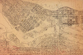
North-east False Creek Map
![Map of City of Vancouver [City services locations]](/uploads/r/null/5/7/7/577519f13333b5141f19d58696ae109b192fab0007ff302e15453cab74e21dd3/3a32f9e1-f624-41f7-980d-3b5df4397fb6-MAP225_142.jpg)
Map of City of Vancouver [City services locations]

City of Vancouver, British Columbia : co-ordinate street index map 12
Marathon Realty Co. Ltd. Coal Harbour Shoreline
Marathon Realty Co. Ltd. Coal Harbour Shoreline
Topographic Base Map; Marathon Realty Co. Ltd Coal Harbour Development
Topographic Base Map; Marathon Realty Co. Ltd Coal Harbour Development
Devonshire Block 41
Devonshire Block 41
![City of Vancouver [park sites June/80]](/uploads/r/null/9/4/9484add7c4684ea3838e4d00ee8add3ecf85d78d5aa8fe2780cae273e59556a5/bd2464d8-2aa9-4501-aba6-8b3f7d130a42-MAP1032_142.jpg)
City of Vancouver [park sites June/80]
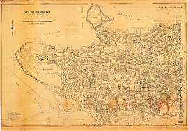
City of Vancouver
Fairview
Fairview
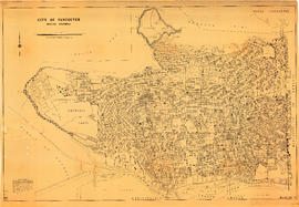
City of Vancouver
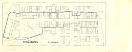
Chinatown existing

Chinatown existing

City of Vancouver
Vancouver, B.C.
Vancouver, B.C.

Vancouver, B.C. 1890 : built-on area
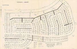
Champlain Heights : D.L. 334, group one, N.W.D.
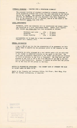
City of Vancouver : residential lots, Area B, Champlain Heights : page 2

Vancouver : urban growth, 1865-1970

City of Vancouver : residential lots, Area B, Champlain Heights : page 1
City of Vancouver : Residential lots, Area B, Champlain Heights
City of Vancouver : Residential lots, Area B, Champlain Heights
Vancouver : neighborhoods
Vancouver : neighborhoods
Downtown Peninsula; Vancouver, B.C. Canada; Lines at 100 Foot Intervals; Datum Line 100
Downtown Peninsula; Vancouver, B.C. Canada; Lines at 100 Foot Intervals; Datum Line 100
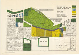
Redevelopment plan for Jericho Department of National Defence lands

Pacific National Exhibition grounds plan
City of Vancouver, Vancouver, British Columbia : sectional maps (printed 1970)
City of Vancouver, Vancouver, British Columbia : sectional maps (printed 1970)
![[Sheet 7 : Burrard Street to Main Street and Georgia Viaduct to Burrard Inlet]](/uploads/r/null/c/d/cd235086cbaf81487b8784fb32b6ef913f4fe27305678cd1961adf506324c250/8f72f6bd-1013-48ad-a56c-e6269cb6f5a8-MAP339_142.jpg)
[Sheet 7 : Burrard Street to Main Street and Georgia Viaduct to Burrard Inlet]
![[Sheet 9 : Main Street to Clark Drive and Prior Street to Burrard Inlet]](/uploads/r/null/c/a/ca4b4713bea0118fec812e6258afe5c1efa039db74073214703001a47b00f122/5e0d243a-99ae-42aa-8bb3-4a1abe9e1209-MAP339_142.jpg)
[Sheet 9 : Main Street to Clark Drive and Prior Street to Burrard Inlet]
[Sheet 20 : Main Street to Clark Drive and Great Northern Way to Prior Street]
[Sheet 20 : Main Street to Clark Drive and Great Northern Way to Prior Street]
![[Sheet 21 : Homer Street to Main Street and Fourth Avenue to Georgia Viaduct]](/uploads/r/null/8/c/8c7ce2ae32274b3000b670b2a47c1114fd3c3faf20caeaef1a64c8137aab4f37/d256dda0-fa87-4985-97d6-ed6431e5a608-MAP339_142.jpg)
[Sheet 21 : Homer Street to Main Street and Fourth Avenue to Georgia Viaduct]
![[Sheet 24 : Jericho Beach to Balaclava Street and Fourth Avenue to Cameron Avenue]](/uploads/r/null/e/7/e737857a87702a8fbd029d7bdb109697279cac537d45931818415e380dd2867c/67258081-9a3b-44c0-9191-8a3719f6c999-MAP339_142.jpg)
[Sheet 24 : Jericho Beach to Balaclava Street and Fourth Avenue to Cameron Avenue]

[Sheet 27 : University Endowment Lands and Drummond Drive to Camosun Street and Fourteenth Avenue to Fourth Avenue]
![[Sheet 29 : Balaclava Street to Maple Street and Fourteenth Avenue to Third Avenue]](/uploads/r/null/d/6/d672783fbbcdf46b6e25dc13c2f50caa22e19935f01490a9053af4afffc83c80/9a39458e-9f4b-43a8-a595-082419eecd5b-MAP339_142.jpg)
[Sheet 29 : Balaclava Street to Maple Street and Fourteenth Avenue to Third Avenue]
![[Sheet 35 : Rupert Street to Ardley Avenue and Grandview Highway to Fifth Avenue]](/uploads/r/null/b/9/b99ee96b798b34d2651dd213f0a858725b96bd6d586dd8d3701744c75c085139/a2e07931-8625-4adb-a51a-547f78416127-MAP339_142.jpg)
[Sheet 35 : Rupert Street to Ardley Avenue and Grandview Highway to Fifth Avenue]
![[Sheet 40 : Inverness Street to Nanaimo Street and Twenty-second Avenue to Thirteenth Avenue]](/uploads/r/null/9/3/9367a0c50f6fa513d717a1972b1bac72acde6d41b002fefcf48ddbd8c8122e8a/c7bfac0b-bf44-441b-b059-fd7bbc0bd4a0-MAP339_142.jpg)
[Sheet 40 : Inverness Street to Nanaimo Street and Twenty-second Avenue to Thirteenth Avenue]
![[Sheet 41 : Ontario Street to Inverness Street and Twenty-eighth Avenue to Sixteenth Avenue]](/uploads/r/null/c/2/c22ca2538905633f64373261ce970df6216075ce4de9e22d491c2e212ce17c1f/616ab944-e39a-4c66-abb4-918b17cc3252-MAP339_142.jpg)
[Sheet 41 : Ontario Street to Inverness Street and Twenty-eighth Avenue to Sixteenth Avenue]
![[Sheet 43 : East Boulevard to Oak Street and Laurier Avenue to Fourteenth Avenue]](/uploads/r/null/8/8/8846e3e6c19438103b656786c264d5dcccc37b59de3cf8fa85bb05f01b65d8f9/9fb3d6cb-93e9-48d0-be52-05cc55ad4ec4-MAP339_142.jpg)
[Sheet 43 : East Boulevard to Oak Street and Laurier Avenue to Fourteenth Avenue]

[Sheet 55 : Cecil Street and McHardy Street to Patterson Avenue and Kingsway to Monmouth Avenue and Price Street]
![[Sheet 56 : Doman Street and Joyce Street to Boundary Road and Forty-ninth Avenue to Kingsway]](/uploads/r/null/5/e/5ee0f6b78ce9f3b0e0e39795d6220cd37d587872bad7b41b67f4d29c7cb49d4c/f8a321d6-ea4f-4e1f-85da-6d12e149ea85-MAP339_142.jpg)
[Sheet 56 : Doman Street and Joyce Street to Boundary Road and Forty-ninth Avenue to Kingsway]


![Map of City of Vancouver [City services locations]](/uploads/r/null/5/7/7/577519f13333b5141f19d58696ae109b192fab0007ff302e15453cab74e21dd3/3a32f9e1-f624-41f7-980d-3b5df4397fb6-MAP225_142.jpg)

![City of Vancouver [park sites June/80]](/uploads/r/null/9/4/9484add7c4684ea3838e4d00ee8add3ecf85d78d5aa8fe2780cae273e59556a5/bd2464d8-2aa9-4501-aba6-8b3f7d130a42-MAP1032_142.jpg)


![[Sheet 7 : Burrard Street to Main Street and Georgia Viaduct to Burrard Inlet]](/uploads/r/null/c/d/cd235086cbaf81487b8784fb32b6ef913f4fe27305678cd1961adf506324c250/8f72f6bd-1013-48ad-a56c-e6269cb6f5a8-MAP339_142.jpg)
![[Sheet 9 : Main Street to Clark Drive and Prior Street to Burrard Inlet]](/uploads/r/null/c/a/ca4b4713bea0118fec812e6258afe5c1efa039db74073214703001a47b00f122/5e0d243a-99ae-42aa-8bb3-4a1abe9e1209-MAP339_142.jpg)
![[Sheet 21 : Homer Street to Main Street and Fourth Avenue to Georgia Viaduct]](/uploads/r/null/8/c/8c7ce2ae32274b3000b670b2a47c1114fd3c3faf20caeaef1a64c8137aab4f37/d256dda0-fa87-4985-97d6-ed6431e5a608-MAP339_142.jpg)
![[Sheet 24 : Jericho Beach to Balaclava Street and Fourth Avenue to Cameron Avenue]](/uploads/r/null/e/7/e737857a87702a8fbd029d7bdb109697279cac537d45931818415e380dd2867c/67258081-9a3b-44c0-9191-8a3719f6c999-MAP339_142.jpg)

![[Sheet 29 : Balaclava Street to Maple Street and Fourteenth Avenue to Third Avenue]](/uploads/r/null/d/6/d672783fbbcdf46b6e25dc13c2f50caa22e19935f01490a9053af4afffc83c80/9a39458e-9f4b-43a8-a595-082419eecd5b-MAP339_142.jpg)
![[Sheet 35 : Rupert Street to Ardley Avenue and Grandview Highway to Fifth Avenue]](/uploads/r/null/b/9/b99ee96b798b34d2651dd213f0a858725b96bd6d586dd8d3701744c75c085139/a2e07931-8625-4adb-a51a-547f78416127-MAP339_142.jpg)
![[Sheet 40 : Inverness Street to Nanaimo Street and Twenty-second Avenue to Thirteenth Avenue]](/uploads/r/null/9/3/9367a0c50f6fa513d717a1972b1bac72acde6d41b002fefcf48ddbd8c8122e8a/c7bfac0b-bf44-441b-b059-fd7bbc0bd4a0-MAP339_142.jpg)
![[Sheet 41 : Ontario Street to Inverness Street and Twenty-eighth Avenue to Sixteenth Avenue]](/uploads/r/null/c/2/c22ca2538905633f64373261ce970df6216075ce4de9e22d491c2e212ce17c1f/616ab944-e39a-4c66-abb4-918b17cc3252-MAP339_142.jpg)
![[Sheet 43 : East Boulevard to Oak Street and Laurier Avenue to Fourteenth Avenue]](/uploads/r/null/8/8/8846e3e6c19438103b656786c264d5dcccc37b59de3cf8fa85bb05f01b65d8f9/9fb3d6cb-93e9-48d0-be52-05cc55ad4ec4-MAP339_142.jpg)

![[Sheet 56 : Doman Street and Joyce Street to Boundary Road and Forty-ninth Avenue to Kingsway]](/uploads/r/null/5/e/5ee0f6b78ce9f3b0e0e39795d6220cd37d587872bad7b41b67f4d29c7cb49d4c/f8a321d6-ea4f-4e1f-85da-6d12e149ea85-MAP339_142.jpg)