Print preview Close

Showing 13 results

Archival description
City of Vancouver Archives technical and cartographic drawing collection British Columbia Electric Railway Company Vancouver (B.C.)
Print preview View:

7 results with digital objects Show results with digital objects

B.C. Electric Railway lines completed and under construction

Map shows B.C. Electric Railway lines completed (in red), B.C. Electric Railway lines under construction (in yellow), lot numbers and major roads in the Greater Vancouver area from Burrard Inlet in the north to the north arm of the Fraser River in the south and from New Westminster in the east to Point Grey in the west.

British Columbia Electric Railway Company Limited : Vancouver and New Westminster city and suburban lines and Alouette-Stave development, present and projected

Part contains a map showing street car, interurban, and motor bus lines in from Vancouver to New Westminster, a map showing existing and projected power plants near Alouette and Stave Lakes, and a profile showing the existing and proposed plants.

Bus routes, city of Vancouver, November 26th, 1937

Item is a hand-drawn map showing additions to bus routes, proposed additions to bus routes, dates of bus route additions and miles of bus route additions in Vancouver. A November 26, 1937 edition of "The Buzzer" containing information on bus routes and a reproduction of the hand-drawn map has been affixed to the verso.

Guide to Vancouver

Item is a pamphlet advertising BC Electric City routes, including observation car routes conducted by Teddy Lyons. The front side of the unfolded pamphlet includes information on City streetcar routes and interurban routes. The reverse side includes information on routes to major attractions and a map of Vancouver showing routes and attractions.

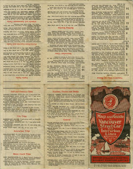
Map and Guide to Vancouver Street Car and Interurban Lines

Part is the front side of an informational pamphlet published by the BC Electric Railway Co. regarding City streetcar routes and interurban lines, golf and country clubs, city trips, interurban trips, motor coach trips, stations, ferries and docks, bathing beaches, public parks, North Shore canyons and parks, athletic and amusement parks.

Transit routes in downtown area Vancouver, B.C. effective July 18, 1952

Item is a sheet which contains maps of the downtown portions of 14 BC Electric transit routes: Dunbar, Arbutus, Granville - Kingsway - Victoria, Macdonald, 4th Ave. - West Pt. Grey, Powell - Stanley Park, Broadway East - Robson, Hastings East, Main, Davie - Fraser, Grandview, Oak, Cambie, North Vancouver - Intercity.