
- AM1594-: MAP 385-: 1972-585.2
- Part
- 1890
Part of City of Vancouver Archives technical and cartographic drawing collection
Part is the inner sheet of an unfolded brochure, showing lots offered for sale in the northern portion of District Lot 540.
504 results with digital objects Show results with digital objects
Part of City of Vancouver Archives technical and cartographic drawing collection
Part is the inner sheet of an unfolded brochure, showing lots offered for sale in the northern portion of District Lot 540.

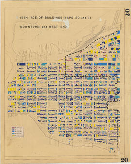
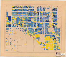
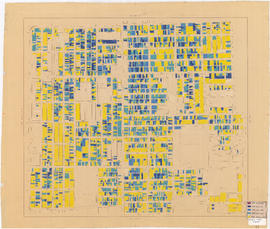
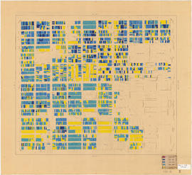
1954 : Age of buildings : Maps 20 and 21 : Downtown and West End
Part of City of Vancouver fonds
Sheet shows date of construction of buildings for the area bounded by Burrard Street, Main Street, Water Street, and the north shore of False Creek. A dotted line runs along a portion of the map, but the significance of the line is unknown.
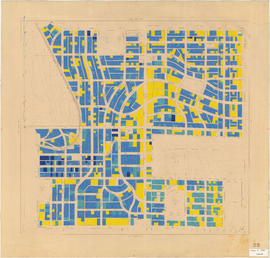
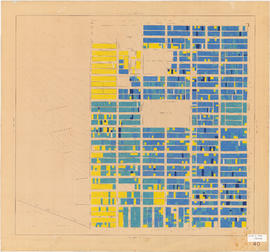
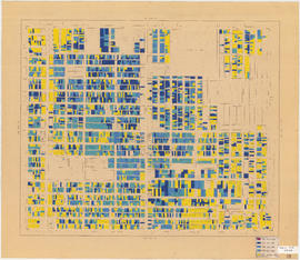
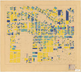
1954 : Age of buildings : Maps 20 and 21 : Downtown and West End
Part of City of Vancouver fonds
Sheet shows date of construction of buildings for the area bounded by Beach Avenue, Hastings Street, Lagoon Drive, and Burrard Street. A dotted line runs along a portion of the map, but the significance of the line is unknown. An annotation at the right edge of the map reads: "other half of "Age of buildings" map."

Part of City of Vancouver fonds

A souvenir and correct map of the location of all the fair buildings of the Vancouver Exhibition
Part of City of Vancouver Archives technical and cartographic drawing collection
Part contains text promoting the Western Canada Fair, Vancouver, and British Columbia.

A student to-day, a citizen tomorrow
Part of City of Vancouver Archives technical and cartographic drawing collection
Part contains textual information on Vancouver's growth and future planning initiatives.

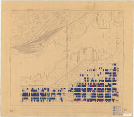
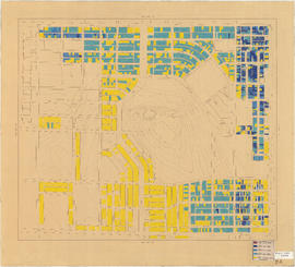
Advertisements for Vancouver real estate
Part of City of Vancouver Archives technical and cartographic drawing collection

Age of buildings : Arbutus Street to Oak Street and Broadway to King Edward Avenue
Part of City of Vancouver fonds
Age of buildings : Arbutus Street to Oak Street and King Edward Avenue to 41st Avenue
Part of City of Vancouver fonds

Age of buildings : Arbutus Street to Oak Street and Odgen Avenue to Broadway
Part of City of Vancouver fonds

Age of buildings : Arbutus Street/S.W. Marine Drive to Fremlin Street and 57th Avenue to 72nd Avenue
Part of City of Vancouver fonds
Age of buildings : Blanca Street to Discovery Street and 10th Avenue to 16th Avenue
Part of City of Vancouver fonds
Part of City of Vancouver fonds

Age of buildings : Blenheim Street to Arbutus Street and Broadway to King Edward Avenue
Part of City of Vancouver fonds

Age of buildings : Blenheim Street to Arbutus Street and Point Grey Road to Broadway
Part of City of Vancouver fonds

Age of buildings : Blenheim Street to Maple Street and King Edward Avenue to 41st Avenue
Part of City of Vancouver fonds
Age of buildings : Blenheim Street to Maple Street/Laburnum Street and 41st Avenue to 57th Avenue
Part of City of Vancouver fonds
Age of buildings : Camosun Street to Blenheim Street and King Edward Avenue to 41st Avenue
Part of City of Vancouver fonds
Age of buildings : Clark Drive to Slocan Street and Hastings Street to 6th Avenue
Part of City of Vancouver fonds

Age of buildings : Clark Drive to Slocan Street and Powell Street/Wall Street to Hastings Street
Part of City of Vancouver fonds

Age of buildings : Clark Drive/Knight Street to Slocan Street and 6th Avenue to 22nd Avenue
Part of City of Vancouver fonds

Age of buildings : Crown Street to Blenheim Street and 41st Avenue to 55th Avenue
Part of City of Vancouver fonds

Age of buildings : Discovery Street to Blenheim Street and 10th Avenue to King Edward Avenue
Part of City of Vancouver fonds

Age of buildings : Discovery Street to Blenheim Street and Point Grey Road to 10th Avenue
Part of City of Vancouver fonds

Age of buildings : Fremlin Street to Main Street and 57th Avenue to Kent Avenue
Part of City of Vancouver fonds

Age of buildings : Granville Street to Fremlin Street and 72nd Avenue to 75th Avenue
Part of City of Vancouver fonds
Annotations show date of construction of buildings for the area bounded by Granville Street, Fremlin Street, 72nd Avenue, and 75th Avenue. Base map shows the area bounded by Angus Drive, Cambie Street, 63rd Avenue, and the North Arm of the Fraser River.

Age of buildings : Jellicoe Street to Boundary Road and S.E. Marine Drive to Kent Avenue
Part of City of Vancouver fonds
Annotations show date of construction of buildings for the area bounded by Jellicoe Street, Boundary Road, S.E. Marine Drive, and Kent Avenue. Base map shows the area bounded by Jellicoe Street/Fraserview Golf Course, Boundary Road, 61st Avenue, and the North Arm of the Fraser River.
Age of buildings : Knight Street to Elliott Street and 53rd Avenue to Kent Avenue
Part of City of Vancouver fonds

Age of buildings : Knight Street to Slocan Street/Wales Street and 22nd Avenue to 37th Avenue
Part of City of Vancouver fonds
Age of buildings : Knight Street to Wales Street/Vivian Street and 37th Avenue to 53rd Avenue
Part of City of Vancouver fonds

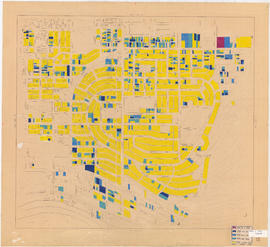
Age of buildings : Main Street to Clark Drive and Prior Street/Venables Street to Broadway
Part of City of Vancouver fonds
Sheet is annotated to show the boundary of Area 'H' for the Vancouver Redevelopment Study.

Part of City of Vancouver fonds

Age of buildings : Main Street to Clark Drive/Knight Street and Broadway to King Edward Avenue
Part of City of Vancouver fonds

Age of buildings : Main Street to Knight Street and 57th Avenue to Kent Avenue
Part of City of Vancouver fonds

Age of buildings : Main Street to Knight Street and King Edward Avenue to 41st Avenue
Part of City of Vancouver fonds

Age of buildings : Maple Street to Oak Street and 41st Avenue to 57th Avenue
Part of City of Vancouver fonds

Age of buildings : Nanaimo Street to Jellicoe Street and S.E. Marine Drive to Kent Avenue
Part of City of Vancouver fonds
Annotations show date of construction of buildings for the area bounded by Nanaimo Street, Jellicoe Street, S.E. Marine Drive, and Kent Avenue. Base map shows the area bounded by Knight Street, Elliott Street, East 61st Avenue, and the North Arm of the Fraser River.
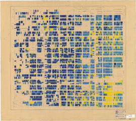
Age of buildings : Oak Street to Main Street and 6th Avenue/2nd Avenue to Broadway
Part of City of Vancouver fonds
Annotations show date of construction of buildings for the area bounded by Oak Street, Main Street, 6th and 2nd Avenues, and Broadway. Base map extends north to Davie Street at Hornby Street in the northwest and Union Street at Main Street in the northeast. The area extending from Yukon Street to Main Street and 6th Avenue to Broadway is outlined; the significance of the outline is unknown.

Age of buildings : Oak Street to Main Street and Broadway to King Edward Avenue
Part of City of Vancouver fonds
Age of buildings : Oak Street to Main Street and King Edward Avenue to 41st Avenue
Part of City of Vancouver fonds

Age of buildings : Oak Street to Quebec Street and 41st Avenue to 57th Avenue
Part of City of Vancouver fonds
Age of buildings : Quebec Street to Knight Street and 41st Avenue to 57th Avenue
Part of City of Vancouver fonds

Age of buildings : Slocan Street to Boundary Road and 22nd Avenue to Kingsway
Part of City of Vancouver fonds

Age of buildings : Slocan Street to Boundary Road and 5th Avenue to 22nd Avenue
Part of City of Vancouver fonds
Age of buildings : Slocan Street to Boundary Road and Pender Street to 5th Avenue
Part of City of Vancouver fonds
![Age of buildings : Slocan Street to Boundary Road and Wall Street/East Street [Edinburgh Street] ...](/uploads/r/null/e/9/2/e921e2151aed2f9a2fd506bbc7e781632de17633f5f2f1a410764a15e68501b4/01454f17-8dfb-417d-9fd9-0093f19fcd56-LEG1221_142.jpg)
Part of City of Vancouver fonds

Age of buildings : University Endowment Lands to Discovery Street and Hadden Avenue to 10th Avenue
Part of City of Vancouver fonds

Age of buildings : Vivian Street to Boundary Road and 52nd Avenue to S.E. Marine Drive
Part of City of Vancouver fonds
Age of buildings : Wales Street/Vivian Street to Boundary Road and Kingsway to 52nd Avenue
Part of City of Vancouver fonds

Attendees looking towards sign