Add to clipboard
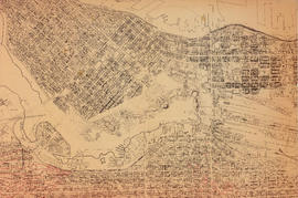
False Creek Basin
Add to clipboard
North-east False Creek Map
Add to clipboard
Vancouver downtown property map
Site plan of central downtown waterfront
Add to clipboard
Site plan of central downtown waterfront
Marathon Realty Company Limited Coal Harbour Redevelopment
Add to clipboard
Marathon Realty Company Limited Coal Harbour Redevelopment
Marathon Realty Company Limited Coal Harbour Redevelopment
Add to clipboard
Marathon Realty Company Limited Coal Harbour Redevelopment
Marathon Realty Co. Ltd. Coal Harbour Shoreline
Add to clipboard
Marathon Realty Co. Ltd. Coal Harbour Shoreline
Harbour Green Neighborhood; Hastings Street Elevation North
Add to clipboard
Harbour Green Neighborhood; Hastings Street Elevation North
Topographic Base Map; Marathon Realty Co. Ltd Coal Harbour Development
Add to clipboard
Topographic Base Map; Marathon Realty Co. Ltd Coal Harbour Development
Site plan of central downtown waterfront
Add to clipboard
Site plan of central downtown waterfront
Downtown Peninsula; Vancouver, B.C. Canada; Lines at 100 Foot Intervals; Datum Line 100
Add to clipboard
Downtown Peninsula; Vancouver, B.C. Canada; Lines at 100 Foot Intervals; Datum Line 100
Devonshire Block 41
Add to clipboard
Devonshire Block 41
City of Vancouver; British Columbia;
Add to clipboard
City of Vancouver; British Columbia;
Fairview
Add to clipboard
Fairview
Add to clipboard
Plan of the City of Vancouver
Add to clipboard
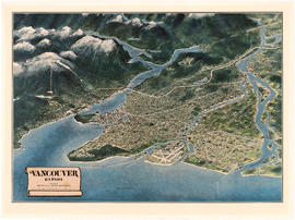
Vancouver, Canada
Add to clipboard
Composite aerial mosaic of metropolitan Vancouver
Add to clipboard
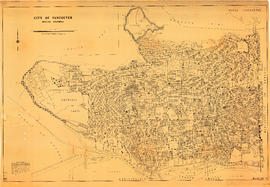
City of Vancouver [park sites June/80]
Add to clipboard
City of Vancouver
Add to clipboard
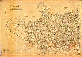
City of Vancouver
Add to clipboard
City of Vancouver, British Columbia
Add to clipboard
City of Vancouver, British Columbia
Vancouver 1886-1986 : yesterday, gateway to the Pacific : today, crossroads of the world
Add to clipboard
Vancouver 1886-1986 : yesterday, gateway to the Pacific : today, crossroads of the world
Add to clipboard
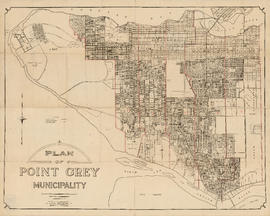
Plan of Point Grey Municipality
Add to clipboard
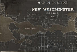
Map of portion New Westminster District
Add to clipboard
It might have been Albert City, 1858, New Georgia 1792 : it was Granville, 1870, British Columbia, 1871 : it is Vancouver, 1886, British Columbia, 1871 : it is Vancouver, 1886, Canada, 1867
City of Vancouver : Canadian Pacific town site
Add to clipboard
City of Vancouver : Canadian Pacific town site
Add to clipboard
Map of the business portion of the City of Vancouver, British Columbia [early street paving]
Add to clipboard
Plan of the City of Vancouver, B.C.
B.C. Electric Railway lines completed and under construction
Add to clipboard
B.C. Electric Railway lines completed and under construction
Vancouver, B.C.
Add to clipboard
Vancouver, B.C.
The city of Vancouver
Add to clipboard
The city of Vancouver
Vancouver, British Columbia : [urban analysis maps]
Add to clipboard
Vancouver, British Columbia : [urban analysis maps]
Vancouver : spectacular by nature : official courtesy map
Add to clipboard
Vancouver : spectacular by nature : official courtesy map
Add to clipboard
Vancouver : as seen from space : vue de l'espace
Granville Street
Add to clipboard
Granville Street
Add to clipboard
Map of the city of Vancouver, British Columbia
Sectional map and street directory of Vancouver : Dial map of the city of Vancouver including adjacent municipalities
Add to clipboard
Sectional map and street directory of Vancouver : Dial map of the city of Vancouver including adjacent municipalities
Vancouver, B.C. city map
Add to clipboard
Vancouver, B.C. city map
Add to clipboard
Plan of Point Grey Municipality
Vancouver Canada
Add to clipboard
Vancouver Canada
Visitors map of Vancouver
Add to clipboard
Visitors map of Vancouver
Map of Vancouver, British Columbia
Add to clipboard
Map of Vancouver, British Columbia
Vancouver, British Columbia. Souvenir from the lion gateway
Add to clipboard
Vancouver, British Columbia. Souvenir from the lion gateway
Add to clipboard
South Vancouver
Map of portion of New Westminster District with adjacent islands and part of Vancouver Island, B.C.
Add to clipboard
Map of portion of New Westminster District with adjacent islands and part of Vancouver Island, B.C.
Add to clipboard
Canadian Pacific Railway. Plan of part of branch line from Port Moody. A point on main line C.P.R. to English Bay, B.C.
Add to clipboard
Map of Vancouver, New Westminster, Steveston and the Lower Mainland District
Add to clipboard
City of Vancouver, British Columbia
Corporation of Point Grey : topographical plan of ABCDE D.L. 317 and HIJK D.L. 318 : Marine Drive & Vancouver & Lulu Railway to Fraser River between Angus St. [Drive] & Milton St
Add to clipboard
Corporation of Point Grey : topographical plan of ABCDE D.L. 317 and HIJK D.L. 318 : Marine Drive & Vancouver & Lulu Railway to Fraser River between Angus St. [Drive] & Milton St





![City of Vancouver [park sites June/80]](/uploads/r/null/9/4/9484add7c4684ea3838e4d00ee8add3ecf85d78d5aa8fe2780cae273e59556a5/bd2464d8-2aa9-4501-aba6-8b3f7d130a42-MAP1032_142.jpg)


![Map of the business portion of the City of Vancouver, British Columbia [early street paving]](/uploads/r/null/7/1/7187f671d2770050eb87f7f397a10ea92bf0bc593b0a186e3a4bf341b3d26e42/8770145a-b925-4eef-82ac-e397f61a65aa-Map1163_142.jpg)


