![Beatty and Robson [streets looking] south](/uploads/r/null/7/4/7481da06e4252abc9346b821d78587986408f381eb5b2f4d86289a6dd3507ab3/b4a42d0c-4c31-4557-af51-5dd14748d2e7-A42787_142.jpg)
Beatty and Robson [streets looking] south
- COV-S505-1-: CVA 772-131
- Item
- 1982
Part of City of Vancouver fonds
1696 results with digital objects Show results with digital objects
Beatty and Robson [streets looking] south
Part of City of Vancouver fonds
![Beatty and Robson [streets looking] east](/uploads/r/null/2/c/2c163d3ab49dc2469f3b79215bfa7d1a6d2efb116f4043a54549fd47b393da8d/b87bf5c7-60dc-4daf-8e7e-9fb886af6fdc-A42785_142.jpg)
Beatty and Robson [streets looking] east
Part of City of Vancouver fonds
Photograph shows a part of BC Place Stadium
![C.P. Exhibition [parade float] Fred Deeley [Ltd.]](/uploads/r/null/3/7/371e86ba01dd6e9865d3041f2f68564a05780eb81ea3df6d54aec8709cd45126/69c955aa-d024-49ff-846c-1917ae417a15-A16678_142.jpg)
C.P. Exhibition [parade float] Fred Deeley [Ltd.]
Part of Stuart Thomson fonds
![Boundary [Road] and Schow [intersection, 3 of 4]](/uploads/r/null/3/e/4/3e46e101effe703e0618eb0ba4b56c6238acfe509551055da9fc3aa480eccadd/f40084de-0dc4-49ab-85ca-31a3c1d02eed-2019-103.0712_142.jpg)
Boundary [Road] and Schow [intersection, 3 of 4]
Part of City of Vancouver fonds
![Boundary [Road] and Schow [intersection, 1 of 4]](/uploads/r/null/9/d/e/9de504013f062deedb17bb01bb59afdd66410ac1d6421740ad2a0c3cc6e29f38/a5ff20f5-8d1a-49f8-9bcd-d74c95538908-2019-103.0710_142.jpg)
Boundary [Road] and Schow [intersection, 1 of 4]
Part of City of Vancouver fonds
![Boundary [Road] and Superial [intersection, 2 of 4]](/uploads/r/null/e/3/2/e3235a0caa4953812559ad5cf0c0684d1ece77e3eab0c1c9aa180a75f73327c2/1f296166-0e9e-427d-85dd-95715ff95fcb-2019-103.0706_142.jpg)
Boundary [Road] and Superial [intersection, 2 of 4]
Part of City of Vancouver fonds
![Boundary [Road] and Superial [intersection, 1 of 4]](/uploads/r/null/2/f/0/2f008ab64e1ef8a7366004ba0346fee8d0768b1153242d8af2e9e324140824ae/99c8a02c-17b6-4abd-9430-5c42113be8b0-2019-103.0705_142.jpg)
Boundary [Road] and Superial [intersection, 1 of 4]
Part of City of Vancouver fonds
![Cassiar [Street] and [Highway] 401 [traffic controller]](/uploads/r/null/b/d/0/bd0e2388f24d27e28dec07806e6440b83687233a38ac5ad89c0cbfd6303d5053/9bd4321e-024d-4b29-86b1-321ed762a7fe-2019-103.0545_142.jpg)
Cassiar [Street] and [Highway] 401 [traffic controller]
Part of City of Vancouver fonds
![Cassiar [Street] and [Highway] 401 [5 of 7]](/uploads/r/null/d/5/5/d55876baf2e7963f7c2d7bedaeae7d4f60e336bf135546b3da810e838ad4920b/1c7fcca8-470f-42ee-92a9-c65a29c13f38-2019-103.0541_142.jpg)
Cassiar [Street] and [Highway] 401 [5 of 7]
Part of City of Vancouver fonds
![Cassiar [Street] and [Highway] 401 [4 of 7]](/uploads/r/null/3/8/d/38d7115bff9526ca7c5034b8abeef664f039dcd1d443cf38520ddbde19c2a61e/6efb9cd8-9b85-4ad5-9c1c-0016ed26f58f-2019-103.0540_142.jpg)
Cassiar [Street] and [Highway] 401 [4 of 7]
Part of City of Vancouver fonds
![Cassiar [Street] and [Highway] 401 [3 of 7]](/uploads/r/null/6/5/9/6597641edc353946d6f7c3d8bb4fef779568944b08b8257bdd559dd15f0fa732/ad6b3c4f-fead-49c1-9038-6239ccda4c53-2019-103.0539_142.jpg)
Cassiar [Street] and [Highway] 401 [3 of 7]
Part of City of Vancouver fonds
![RLS [Intersection]](/uploads/r/null/6/d/f/6dfe88a0d740cf69f057aa49afaac2c09edd88135ab5d099050e2a9fd0d6d68a/f6cf2dc2-f41c-4d10-89a8-5511543dfd33-2019-103.0066_142.jpg)
Part of City of Vancouver fonds
![RLS [Intersection]](/uploads/r/null/9/a/5/9a50e1cf72cf7dcd74c15366f787afd9cacdc69be54a99ddbf30e5f032c21f2e/799b6320-49e5-4eb4-83b6-ed260800df48-2019-103.0065_142.jpg)
Part of City of Vancouver fonds
![RLS [Cars on side street, 2 of 2]](/uploads/r/null/3/1/d/31d266c99981ea03ba885de387fa5c8db128ba15ce3983a781f19ce296d547be/4fec0eb5-524e-46d6-98b8-12ec557b55dd-2019-103.0064_142.jpg)
RLS [Cars on side street, 2 of 2]
Part of City of Vancouver fonds
![RLS [Cars on side street, 1 of 2]](/uploads/r/null/d/1/b/d1bf7de3bef544b3810b340164177c6c5f78ad3070b552f59e7f92348047a641/b39c90cc-f4d8-45f5-aa0c-95688166c02a-2019-103.0063_142.jpg)
RLS [Cars on side street, 1 of 2]
Part of City of Vancouver fonds
![Roll "A" [Parked cars on street]](/uploads/r/null/1/8/a/18a4c53216377962506c12c71f0ee9702f13cc1f46fc9f5b6fa0d62ba127d532/b1136924-de0d-4160-9606-a081bbe84b33-2019-103.0004_142.jpg)
Roll "A" [Parked cars on street]
Part of City of Vancouver fonds
![[Parking lot, buildings, and trees]](/uploads/r/null/f/0/0/f0007ff9b6f10f7398ff7eaada567f8045b4dd0b180760012983b40ea9478c12/0e744724-02c7-4da4-ac75-5e4da245df90-CVA1095-15240_142.jpg)
[Parking lot, buildings, and trees]
Part of City of Vancouver fonds
![[Cars on downtown street]](/uploads/r/null/3/7/0/370161e5c83baa350fb19962992c2cef314e83e1c8892e90f21fc1a516302003/6132a451-7e8c-4d90-b4a0-3e38d9d28a0a-CVA1095-15067_142.jpg)
Part of City of Vancouver fonds
![[Parking lot, 4 of 4]](/uploads/r/null/d/f/c/dfc65b9ecae4e7ebe2b3eab47863041cba1ec56e45f16c0d044d28640ae3bca9/cf5ea65b-c864-4e2f-8567-28ec16d9e94c-CVA1095-14394_142.jpg)
Part of City of Vancouver fonds
![[Parking lot, 3 of 4]](/uploads/r/null/8/9/9/8994b253d8f55a319fff26871cdf32b30d510666c9b637c7c58d4bb06bc1789e/297da9fc-511e-4d71-b05b-512e6b2bbfc5-CVA1095-14393_142.jpg)
Part of City of Vancouver fonds
![[Parking lot, 2 of 4]](/uploads/r/null/1/e/6/1e6b72340139c88c57e681bf495ca51419551659fa506d0d0731bbf34ff4b8d7/51fc62db-233e-4733-8077-5187fcba5017-CVA1095-14392_142.jpg)
Part of City of Vancouver fonds
![[Parking lot, 1 of 4]](/uploads/r/null/3/4/e/34e048420f3906d139c7564810c8ddbf55dfbf5da8197b808d1bba16a8d3dde3/918ad8c3-f3fd-4a1a-986a-bc9402aef9b8-CVA1095-14391_142.jpg)
Part of City of Vancouver fonds
![[Cement truck and buildings]](/uploads/r/null/b/0/2/b0276df1352734ab21424f4d2a3dc49856f2f9ef352b9271d842f816bb3e7ab1/9c7ddf9c-7408-4140-bb1b-656ffda9322f-CVA1095-14390_142.jpg)
Part of City of Vancouver fonds
![[Truck between buildings]](/uploads/r/null/a/d/8/ad87bb16ca348dc79ac9fb721676a0c80b71f881f022c9467f02cd2d5604fca2/948641f0-7cf0-46e6-bc6a-362fa8976b3e-CVA1095-14389_142.jpg)
Part of City of Vancouver fonds
![[Buildings and parking lot, 2 of 2]](/uploads/r/null/8/0/8/80803fd09bb1610f3910c910a9f1b7bfa1e9f4e452da3f17827cc52f492eb469/627ea89e-de0b-49a4-a45d-2c27771ec479-CVA1095-14317_142.jpg)
[Buildings and parking lot, 2 of 2]
Part of City of Vancouver fonds
![[Buildings and parking lot, 1 of 2]](/uploads/r/null/5/1/0/510f5638237eebaebaa4c47fedae886e5514fe763fb9340e994de0e941ecfbf3/18ca8660-ba49-493e-a97c-16f9d54371d0-CVA1095-14316_142.jpg)
[Buildings and parking lot, 1 of 2]
Part of City of Vancouver fonds
![[Truck and construction, 2 of 2]](/uploads/r/null/7/c/a/7ca71abfefdd7ad617757ce55068ecca154befdde926ee42a882e9d2036155f7/26a67e99-865c-47b9-a153-9a2eb2235098-CVA1095-14300_142.jpg)
[Truck and construction, 2 of 2]
Part of City of Vancouver fonds
![[Truck and construction, 1 of 2]](/uploads/r/null/0/2/8/02876c37e87086cda71c6b7af0267fde6a244dab74f950fe119e24d2e802809b/bb868312-539d-4630-981e-61a24b26f011-CVA1095-14299_142.jpg)
[Truck and construction, 1 of 2]
Part of City of Vancouver fonds
![[200 block parking and buildings, street unidentified]](/uploads/r/null/f/a/3/fa396298898dd1c01d935e05366d50f13d29b7bb63e73e5bf9b2698f4e539f2b/32d87750-2d57-4f6b-a268-f0434d754658-CVA1095-14291_142.jpg)
[200 block parking and buildings, street unidentified]
Part of City of Vancouver fonds
![[Parking lot at Carrall Street and East Cordova Street intersection]](/uploads/r/null/a/3/d/a3d5f60e607fff05305b75e01a372efd9baa9daed6d7e232221a9481b0c0b1f1/69442ed1-52b1-4dab-bcb0-690a2b22143c-CVA1095-14284_142.jpg)
[Parking lot at Carrall Street and East Cordova Street intersection]
Part of City of Vancouver fonds
![[Parking lot]](/uploads/r/null/1/b/8/1b88e98992fd201cff8394dc6056e75f53247d360566544e78280ff32c4c087e/2a92117f-271f-4fe5-bc8b-64999a899784-CVA1095-14282_142.jpg)
Part of City of Vancouver fonds
![[Intersection and parking lot]](/uploads/r/null/5/0/5/505139f3e8b87cf477d43c21560966a8167b7836a717e67707fcddd3c872e36a/20e17223-aef2-4b05-af56-e1c42400b88c-CVA1095-14249_142.jpg)
[Intersection and parking lot]
Part of City of Vancouver fonds
![[Alley and parking lot]](/uploads/r/null/7/8/d/78d8b442e6a163c0d0ad0453a0f8b0a2fa853e4292e2e518e6467593859f7c5a/2c2a0701-49d2-4dbb-841c-7f55ba7f4deb-CVA1095-14109_142.jpg)
Part of City of Vancouver fonds
![[105 Keefer Street - Texaco]](/uploads/r/null/8/0/a/80aa66587612730106e4824e57b212d65aaf3f627e366956f140d0f24ce1dd65/b9e93e21-05e4-46f5-9761-7aeb000cf20e-CVA1095-13046_142.jpg)
Part of City of Vancouver fonds
![Funeral - Mr. Sayers, Senter and Hannas [Center and Hanna Funeral Home?] photo for Mr. Horner](/uploads/r/null/1/6/163068faf48ad880697245340a1e3135cde3648edaf2125a88c662d80b1c68bf/b4fea975-0a0e-475f-bdb5-744077e0d08c-A15753_142.jpg)
Funeral - Mr. Sayers, Senter and Hannas [Center and Hanna Funeral Home?] photo for Mr. Horner
Part of Stuart Thomson fonds
![[44 West Pender Street]](/uploads/r/null/1/8/7/1871414c7bb511713ca7e7d9210b69b5336212aa0560aa586650e1f94837edfc/64bdd938-bfb5-48d0-8700-39de6ddf7bef-CVA1095-09347_142.jpg)
Part of City of Vancouver fonds
![Miscellaneous - 422 [Parking lot and alley]](/uploads/r/null/f/d/4/fd47d9ba7eae43774cd5d28f785f7cef4c06124c76402b905988f797995060da/3861883f-2c4c-4b87-9b05-dd650ab8cb09-CVA1095-09257_142.jpg)
Miscellaneous - 422 [Parking lot and alley]
Part of City of Vancouver fonds
Visible is the sign for Van Horne Supply at 550 Cambie Street.
![Miscellaneous - 422 [Multi-storey parking garage]](/uploads/r/null/0/8/0/080723974bb4e376a2232718a443beb77042a438458dca266a5297d0569416f4/c87d4513-b38e-401c-b1c7-fecf0da61a08-CVA1095-09255_142.jpg)
Miscellaneous - 422 [Multi-storey parking garage]
Part of City of Vancouver fonds
![[West Pender Street parking lot below sign for Canadian Imperial Bank of Commerce]](/uploads/r/null/c/4/6/c463104d8ad78b47d9d60b3eb5d4474e53a4f367da06a186b7fc047cc142c775/7ae934b1-4d1e-431f-8753-6c0f89908d3e-CVA1095-09073_142.jpg)
[West Pender Street parking lot below sign for Canadian Imperial Bank of Commerce]
Part of City of Vancouver fonds
![[View of 900 block Seymour Street]](/uploads/r/null/8/a/8a5b02b2c474bf4b469da2d909bb54224b911318574331cce7bc62d4574553c8/7f06889b-efed-40ae-b34c-c6615fa12dd1-CVA810-93_142.jpg)
[View of 900 block Seymour Street]
Sign for Dominion Motors can be seen.
![[Stores on Denman Street]](/uploads/r/null/4/c/4c50ef8af2f205f0da986037226f64b960e8b264d1d6785c129b28a600b9b83b/4252ecbf-7b81-4c5f-99c1-d7b02f1d1061-A09806_142.jpg)
Part of Major Matthews collection
Photograph shows trucks and a horse-drawn delivery wagon in front of the English Meat Market, So. Van. Produce Co., Sterling Confectionery and the Lending Library at the 1000 block of Denman Street. The stores are attached to houses.
![[Pender Street at Cambie Street, looking west]](/uploads/r/null/3/d/3d91c3d4cd2181022a308d60e8fad6da587efcfa17cc0a68527eb95c215bc009/5a8ff240-1741-4881-b137-7b3a66b98a1d-A43705_142.jpg)
[Pender Street at Cambie Street, looking west]
Part of City of Vancouver fonds
Photograph shows the Vancouver Sun sign, City Health Department building and Central Public School
![[View of road with horse-drawn buggy and motor vehicles at Stanley Park Pavilion]](/uploads/r/null/2/b/2bb86cfd48d67d4308d0ca0b3611ea21ffa19e50785318180a7af793bb49f9d2/1d1e6476-1ae4-4d5e-824a-c2e21375cf75-A37837_142.jpg)
[View of road with horse-drawn buggy and motor vehicles at Stanley Park Pavilion]
Photograph shows a roadway at the side of Stanley Park Pavilion with a horse-drawn buggy, motor vehicles and people walking.
Item is a photograph showing a view of a Gibb's café with cars parked outside and a Renfrew bus approaching.
[Jackson's Florists greenhouse]
Item is a photograph showing the Charlie Kaufmann service station at 3191 Dunbar Street.
![[One way traffic Seymour St. at Georgia Street, looking south]](/uploads/r/null/6/a/6ab5722dd80ce8659c50534737b97713ef7378106e8777583f6504275d6eb353/28fb7cc1-f428-4efb-9354-3631dfad7020-A43714_142.jpg)
[One way traffic Seymour St. at Georgia Street, looking south]
Part of City of Vancouver fonds
![[Exterior of the Hudson's Bay Co. store - corner of Granville and Georgia Streets]](/uploads/r/null/6/e/6efd871a4c69ba8a4ccd56fd9f489e1b9a93c3d7f8afe78e47c24902ad6dd0c0/9f9027b1-8713-444c-a29f-10d5a9edbe6a-A24874_142.jpg)
[Exterior of the Hudson's Bay Co. store - corner of Granville and Georgia Streets]
Part of Major Matthews collection
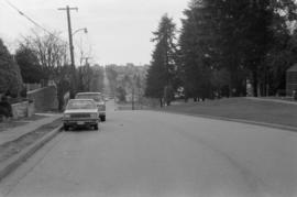
Looking west on East 15th Ave. toward Knight St.
Photograph shows depression in 15th Avenue where China Creek once flowed. To the right is Clark Park. Additional descriptive information on back of print.
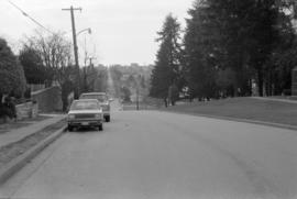
Looking west on East 15th Ave. toward Knight St.
Photograph shows depression in 15th Avenue where China Creek once flowed. To the right is Clark Park.