Common bonds : a history of Greater Vancouver Community Credit Union
Common bonds : a history of Greater Vancouver Community Credit Union
Vancouver : spectacular by nature : official courtesy map
Vancouver : spectacular by nature : official courtesy map
Railroads of the Lower Mainland of British Columbia, 1882-1992
Railroads of the Lower Mainland of British Columbia, 1882-1992
Railroads of the Lower Mainland of British Columbia
Railroads of the Lower Mainland of British Columbia
The city of Vancouver
The city of Vancouver
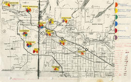
General overview of high-tech industry demographics
![Vancouver's high-tech industry location map plus G.V.R.D. [Greater Vancouver Regional District] d...](/uploads/r/null/2/b/7/2b7c912f51dd7827d1a0ac60042357a631d2c8fdc3487bc37f286d2945c4ea4c/7a17e6a4-d593-45c5-9625-f03c471efb68-LEG1362_142.jpg)
Vancouver's high-tech industry location map plus G.V.R.D. [Greater Vancouver Regional District] demographic of same as at Sept. 15, 1986

Vancouver, New Westminster, Delta and Surrey : postal area
Generalized land use : Greater Vancouver Regional District
Generalized land use : Greater Vancouver Regional District
Regional roads policy. Fast bus network
Regional roads policy. Fast bus network
Regional roads policy. Municipal truck routes
Regional roads policy. Municipal truck routes
Regional road policy . Provincial highways
Regional road policy . Provincial highways
Visitors map. Southwestern British Columbia & Greater Vancouver, Canada
Visitors map. Southwestern British Columbia & Greater Vancouver, Canada
Map of Greater Vancouver
Map of Greater Vancouver
Vancouver, B.C.
Vancouver, B.C.

Railroad map of Greater Vancouver, British Columbia
[1971 Census of Canada]
[1971 Census of Canada]
Railroad map of Greater Vancouver, British Columbia
Railroad map of Greater Vancouver, British Columbia
Official regional plan schedule C : current stage plan
Official regional plan schedule C : current stage plan
New Westminster Land District : Vancouver Land Recording District and Assessment District
New Westminster Land District : Vancouver Land Recording District and Assessment District
Existing development, 1970
Existing development, 1970
Composite industrial map of the metropolitan area, Lower Mainland, British Columbia
Composite industrial map of the metropolitan area, Lower Mainland, British Columbia
Canadian National Railways mountain region : Vancouver, B.C.
Canadian National Railways mountain region : Vancouver, B.C.
Road map of the lower Fraser Valley, western portion
Road map of the lower Fraser Valley, western portion
Street map of Greater Vancouver
Street map of Greater Vancouver

Vancouver, Canada

Street Map of Greater Vancouver, B.C.
Composite density based on current municipal zoning
Composite density based on current municipal zoning
Vancouver harbour, British Columbia
Vancouver harbour, British Columbia
Street map of Vancouver, Burnaby, New Westminster, British Columbia
Street map of Vancouver, Burnaby, New Westminster, British Columbia
[Map showing proposed electoral district boundaries within the Greater Vancouver area]
[Map showing proposed electoral district boundaries within the Greater Vancouver area]
Industrial survey districts
Industrial survey districts
Provincial electoral districts
Provincial electoral districts
Map of Greater Vancouver and Lower Mainland area
Map of Greater Vancouver and Lower Mainland area
Future pattern of major commercial and transportation facilities : eastern Burrard Inlet
Future pattern of major commercial and transportation facilities : eastern Burrard Inlet
Vancouver, British Columbia : [urban analysis maps]
Vancouver, British Columbia : [urban analysis maps]
Map of Greater Vancouver and Lower Mainland area
Map of Greater Vancouver and Lower Mainland area
![McRoberts Island [Sea Island]](/uploads/r/null/6/9/6981a571c6d3102ee36ac270cce0eca9727531a3a9b4dd09f46f6f61adbbadbe/b8c696f2-5181-4f84-9e76-6420f9b2e916-Map800_142.jpg)
McRoberts Island [Sea Island]
Vancouver, British Columbia : population distribution, 1961
Vancouver, British Columbia : population distribution, 1961
Vancouver, British Columbia : port facilities
Vancouver, British Columbia : port facilities
Vancouver, British Columbia : distribution of young children and adults, 1961
Vancouver, British Columbia : distribution of young children and adults, 1961
Vancouver, British Columbia : Population distribution, 1961 generalized
Vancouver, British Columbia : Population distribution, 1961 generalized
Vancouver, British Columbia : Daytime population distribution, 1961 generalized
Vancouver, British Columbia : Daytime population distribution, 1961 generalized
Map of Greater Vancouver
Map of Greater Vancouver

Street map of Greater Vancouver, B.C.
Vancouver, British Columbia, land transportation
Vancouver, British Columbia, land transportation

Vancouver, British Columbia
The service route to - from - through industrial southwestern British Columbia
The service route to - from - through industrial southwestern British Columbia

Street map of Vancouver
Vancouver and Victoria street and vicinity maps
Vancouver and Victoria street and vicinity maps