Showing 93 results

Archival description
City of Vancouver Archives technical and cartographic drawing collection Greater Vancouver (B.C.) Item
Print preview View:

28 results with digital objects Show results with digital objects

Greater Vancouver and Fraser Valley

Item is a pamphlet containing a map of Greater Vancouver and the Fraser Valley on one side and text promoting British Columbia and the services of Western Development and Power Limited on the other. Map shows the B.C. Electric railway line within the Greater Vancouver and Fraser Valley area, other railway lines, main roads, municipal boundaries, industrial sites, airports and ports. An inset map shows the total area served by B.C. Electric within British Columbia and the location of Greater Vancouver and the Fraser Valley within that area.

Metropolitan areas of Vancouver and Victoria, B.C. road map

Item is road map designed to be folded into a pamphlet and containing three maps showing streets in Greater Vancouver, major roads from the North Shore to Bellingham, Washington, and major roads in and around Victoria. Item also includes information about traffic rules in Vancouver and the use of the imperial gallon in British Columbia.

Western Canada

Item is a two-sided road map containing a map of Saskatchewan, Manitoba and the adjoining U.S. states; a map showing Canada and the United States from Labrador and Prince Rupert, B.C. in the north to Richmond, Virginia and San Francisco, California in the south; a map of British Columbia and Alberta; and an illustrated map of Greater Vancouver. The item includes road indexes, a mileage chart for Western Canada, and information on national parks in Western Canada.

New Westminster

Item is a map showing topography, roads, trails, railways, bridges, boundaries, reserves, power lines, telephone lines, triangulation stations, camera stations, bench marks, houses, barns, mills, factories, schools, churches, post offices, telephone exchanges, mines and geographic features in the Pitt Meadows area and extending south through Cloverdale and Langley to the United States border. A small index map shows the area covered by the primary map in relation to other maps in the series.

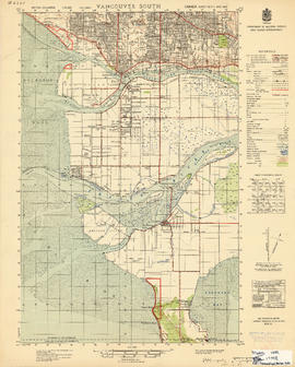
Vancouver South

Item is a map showing topography, roads, trails, railways, bridges, boundaries, reserves, power lines, telephone lines, triangulation stations, camera stations, bench marks, houses, barns, mills, factories, schools, churches, post offices, telephone exchanges, mines and geographic features in the area of southern Vancouver and Richmond, extending south to the United States border. A small index map shows the area covered by the primary map in relation to other maps in the series.

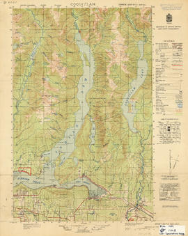
Coquitlam

Item is a map showing topography, roads, trails, railways, bridges, boundaries, reserves, power lines, telephone lines, triangulation stations, camera stations, bench marks, houses, barns, mills, factories, schools, churches, post offices, telephone exchanges, mines and geographic features in the area of Indian Arm and Coquitlam Lake, extending south to Port Moody, Port Coquitlam, and the northeast part of Burnaby. A small index map shows the area covered by the primary map in relation to other maps in the series.

Vancouver North

Item is a map showing topography, roads, trails, railways, bridges, boundaries, reserves, power lines, telephone lines, triangulation stations, camera stations, bench marks, houses, barns, mills, factories, schools, churches, post offices, telephone exchanges, mines and geographic features in the area of southern Gambier Island, Bowen Island, Whytecliff, and Caulfeild. A small index map shows the area covered by the primary map in relation to other maps in the series.

Vancouver North

Item is a map showing topography, roads, trails, railways, bridges, boundaries, reserves, power lines, telephone lines, triangulation stations, camera stations, bench marks, houses, barns, mills, factories, schools, churches, post offices, telephone exchanges, mines and geographic features in the area from Mount Hanover in the north through West Vancouver and North Vancouver, extending south to the northern part of Vancouver. A small index map shows the area covered by the primary map in relation to other maps in the series.

Coquitlam

Item is a map showing topography, roads, trails, railways, bridges, boundaries, reserves, power lines, telephone lines, triangulation stations, camera stations, bench marks, houses, barns, mills, factories, schools, churches, post offices, telephone exchanges, mines and geographic features in the Pitt Lake area, including Coquitlam Mountain, Mount Blanshard, and Siwash Island. A small index map shows the area covered by the primary map in relation to other maps in the series.

New Westminster

Item is a map showing topography, roads, trails, railways, bridges, boundaries, reserves, power lines, telephone lines, triangulation stations, camera stations, bench marks, houses, barns, mills, factories, schools, churches, post offices, telephone exchanges, mines and geographic features in the area of South Burnaby and New Westminster, extending south through Surrey and White Rock to the United States border. A small index map shows the area covered by the primary map in relation to other maps in the series.

Perspective of Greater Vancouver from Grouse Mountain (elevation 4000 ft.)

item is an illustrated, map-like pictorial view of Greater Vancouver. Locations of districts, waterways, beaches, golf courses, principal parks and significant buildings are identified by matching an index list to corresponding letters and numbers on the vertical and horizontal axes along the border of the map.

Metropolitan Vancouver

Item is a map showing the locations and names of major businesses and corporations in the Greater Vancouver area. The map also shows major roads, highways, railways and proposed highway routes. 5 mile and 10 mile radius circles are depicted around the "geographical centre of metropolitan Vancouver." Map background is a mosaic of aerial photographs.

Pictorial map of Greater Vancouver showing dates of settlement in specific areas and opening dates of regional landmarks

Item consists of an illustrated map of the Vancouver area and an overlay showing dates of settlement in various areas and the opening dates of regional landmarks. A poem about the growth of Vancouver has been included on the right-hand side of the map. Verso contains a seemingly unrelated drawing dated 1911 and showing front and side elevations for a church building.

Generalized land use : Greater Vancouver Regional District

Item is a map showing the general patterns of development in the member municipalities and electoral areas of the Greater Vancouver Regional District as of June 1979. Land use has been categorized according to the following categories : rural residential; single family residential; medium density residential; high density residential; commercial; industrial; extractive; transportation, communications and utilities; institutional; recreational areas and parks; farm; and open and undeveloped areas.

Results 1 to 50 of 93