Print preview Close

Showing 39 results

Archival description
Lower Mainland (B.C.) With digital objects
Print preview View:
Lower Mainland municipalities with planning departments 1962
Metropolitan area, Lower Mainland, British Columbia [Analysis of major suburban commercial centre...
Metropolitan area, Lower Mainland, British Columbia [Analysis of major suburban commercial centres - 1976]
Hydro electric surveys. Plan showing location of water powers investigated by City of Vancouver
Map of south western British Columbia showing coastal lumber producers
Map of Fraser Valley
Map of Fraser Valley ; Street map of New Westminster ; Map of Greater Vancouver transit lines
Greater Vancouver
Greater Vancouver
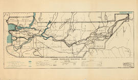
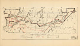
Lower Mainland Regional Plan : harbour areas
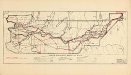
Lower Mainland Regional Plan : dykes
Lower Mainland Regional Plan : water supply
Lower Mainland Regional Plan : light and power distribution
Lower Mainland Regional Plan : telephones
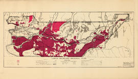
Lower Mainland Regional Plan : land use
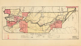
Lower Mainland Regional Plan : population distribution
Lower Mainland Regional Plan : base map
Map of New Westminster District, B.C., Canada, and Whatcom County, Washington, U.S.A., showing th...
Map of New Westminster District, B.C., Canada, and Whatcom County, Washington, U.S.A., showing the distribution system of Western Canada Power Co. Ltd.
Plan 3
Plan 3
Map of Fraser Valley
Freight lines : British Columbia Electric Railway Company Limited, Vancouver and Lulu Island Rail...
Freight lines : British Columbia Electric Railway Company Limited, Vancouver and Lulu Island Railway Company (Canadian Pacific Railway Company, Lessee)
British Columbia : Port Moody sheet : west of seventh, east and west of coast meridians
Enjoyable trips on our interurban lines
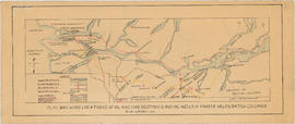
Plan showing locations of oil and gas seepages and oil wells in Fraser Valley, British Columbia
Map of the Lower Mainland showing municipal boundaries and lot numbers
Development in the western portion of the Lower Mainland region, 1968
Map showing route Vancouver to Mission
Lower Mainland, B.C. : land subdivision
North America. West Coast. Fraser River and Burrard Inlet
British Columbia. Port Moody
Fraser River Delta, British Columbia
North America. West Coast. Fraser River and Burrard Inlet
Howe Sound - Burrard Inlet [Burrard Inlet portion]
Map and information concerning the City and District of New Westminster and Province of British C...
Map and information concerning the City and District of New Westminster and Province of British Columbia
Map of the municipalities of New Westminster City and District, British Columbia
Map of Vancouver, New Westminster, Steveston and the Lower Mainland District
Vancouver : as seen from space : vue de l'espace
Map of New Westminster District, B.C.