Sectional map and street directory of Vancouver : Dial map of the city of Vancouver including adjacent municipalities
Map of Fraser Valley ; Street map of New Westminster ; Map of Greater Vancouver transit lines
Greater Vancouver
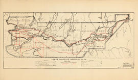
Lower Mainland Regional Plan : harbour areas
Lower Mainland Regional Plan : dykes
Lower Mainland Regional Plan : water supply
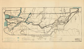
Lower Mainland Regional Plan : light and power distribution
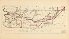
Lower Mainland Regional Plan : telephones
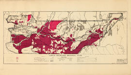
Lower Mainland Regional Plan : land use
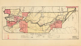
Lower Mainland Regional Plan : population distribution
Lower Mainland Regional Plan : base map
Map of New Westminster District, B.C., Canada, and Whatcom County, Washington, U.S.A., showing the distribution system of Western Canada Power Co. Ltd.
British Columbia Electric Railway Company systems : Vancouver Island, Lower Mainland, Vancouver and New Westminster; Alouette-Stave development, present and projected
Freight lines : British Columbia Electric Railway Company Limited, Vancouver and Lulu Island Railway Company (Canadian Pacific Railway Company, Lessee)
British Columbia : Port Moody sheet : west of seventh, east and west of coast meridians
Enjoyable trips on our interurban lines
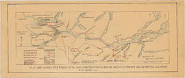
Plan showing locations of oil and gas seepages and oil wells in Fraser Valley, British Columbia
Plan showing locations of oil and gas seepages and oil wells in Fraser Valley, British Columbia
Map of the Lower Mainland showing municipal boundaries and lot numbers
Development in the western portion of the Lower Mainland region, 1968


![Howe Sound - Burrard Inlet [Burrard Inlet portion]](/uploads/r/null/f/8/5/f8523992bb5d5e0c1391f2dea183041a54a2d2470eb4047bb29958a0d835ae95/fdf9563d-923e-468a-a494-3ff190294b91-MAP30b_142.jpg)


