- AM1519-: PAM 1993-51
- Item
- 1993
Information package: loose sheets plus business card.
2749 results with digital objects Show results with digital objects
Information package: loose sheets plus business card.
Item includes photographs, advertisements, and news articles.
Fascinating Fourth Avenue : Kitsilano, Vancouver, B.C., Canada : summer 1984
Item is a guide including a map with places of interest on a walking tour, summer events and a short history of the area.
Item is a souvenir program for June, July, and August 1983.
Kitsilano Chamber of Commerce : membership directory
Public meeting to discuss plan for Kitsilano Point
Kitsilano Community Resources Board
Item contains election information on the establishment of local resources boards.
The Kitsilano Information Centre newsletter
Folder contains eleven issues of a community newspaper, July 1973-May 1974.
Kitsilano Chamber of Commerce : Showboat concerts
Kitsilano Chamber of Commerce : Showboat concerts
Item announces events featuring Chief Dan George and his family, April 6, 1962.
Kitsilano Chamber of Commerce : Showboat concerts

Part of City of Vancouver Archives sound recording and moving image collection
Film shows children and adults roasting wieners over a fire and eating hotdogs outside a small house or cabin. Scenes of children playing on the beach and in the sand at Hadden Park.
Gabriel, Margaret (nee Kruger)
![Be-In at Kits [Kitsilano] Beach](/uploads/r/null/e/0/2/e02581acee80a617122f28024fdaf04bd3bbcba12b25722e9b7dde1a001fbc97/45bd99a8-93e1-499d-9a94-2f7c13aa6d79-MI-590_142.jpg)
Be-In at Kits [Kitsilano] Beach
Part of City of Vancouver Archives sound recording and moving image collection
Film shows a crowd including adults and children dancing in the rain, a young man addressing crowd, bongo drums and a flute being played, children playing in puddles and mountain views from Kitsilano Beach.
Gabriel, Margaret (nee Kruger)
Item is a site plan for the R.C.A.F site at Jericho Beach from English Bay in the north to 8th Avenue in the south and from Highbury in the east to Trimble in the west. The map contains a number of annotations (in red).
Canada. Department of National Defence
R.C.A.F. [Royal Canadian Air Force] station : Vancouver, Jericho Beach
Part of City of Vancouver Archives technical and cartographic drawing collection
Item is a site plan of the R.C.A.F. station on Kitsilano Point (currently Vanier Park), as well as adjacent areas. The map shows lot numbers, roads, buildings, breakwaters, hangars and barbed wire entanglements on the base. Buildings are numbered, so it is likely the map was created to accompany a report or other document.
Part of City of Vancouver Archives technical and cartographic drawing collection
Item is a survey map of the Kitsilano Indian Reserve located on Kitsilano Point (now Vanier Park). The map shows lot numbers, bearings, boundaries and landmarks.
Hermon and Hermon

Plan of Lot 6311, Vancouver, B.C. fronting on Kitsilano Indian Reserve No. 6
Part of City of Vancouver Archives technical and cartographic drawing collection
Item is a survey map showing lot numbers, boundaries, pipelines, bearings and landmarks on the Kitsilano Indian Reserve, as well as shorelines and the rights-of-way for the Burrard Bridge and Canadian Pacific Railway.

Part of City of Vancouver fonds
Item is a land survey plan showing locations of survey posts, boundaries between reserve and non-reserve lands, streets, rights of way, and high water marks.
Plan of Kitsilano Indian Reserve, No. 6 (contours)
Part of City of Vancouver Archives technical and cartographic drawing collection
Item is a topographical map used as a base for showing surveying information such as lot numbers, boundaries, contours, bearings, pipelines, bridge and rail rights-of-way and other landmarks on the Kitsilano Indian Reserve. The map was likely used in planning the development of Vanier Park and/or the Vancouver Museum in the mid-late 1960s. Annotations show "most likely entrance" at McNicoll Avenue.
Vancouver (B.C.). Engineer's Office
Ground Services Plan. Kitsilano Site
Part of City of Vancouver Archives technical and cartographic drawing collection
Item is a site plan of the Kitsilano Air Force Base, showing the locations and identifications of various buildings, and the C.P. Rail and B.C.E.R. rights-of-way through the southern portion of the site.
Canada. Canadian Armed Forces. Royal Canadian Air Force
Vancouver Centennial Museum : proposed new building services
Part of City of Vancouver Archives technical and cartographic drawing collection
Item is a site plan for a proposed museum complex at the former Department of National Defence site at Kitsilano Point / Vanier Park. The map shows sewers, water mains, and other site servicing infrastructure.
Part of City of Vancouver Archives technical and cartographic drawing collection
Item is a map showing agreement dates associated with lands and landmarks surrounding D.L. 3610, or Kitsilano Indian Reserve No. 6 of the Squamish Band.

Part of City of Vancouver Archives technical and cartographic drawing collection
Item is a subdivision map, showing lot and block numbers for Kitsilano area from English Bay in the north to 1st Avenue in the south and from Chesnut Street in the east to Yew Street in the west.
Garden & Taylor, B.C. Land Surveyors
Kitsilano and the Municipality of Point Grey
Part of City of Vancouver Archives technical and cartographic drawing collection
Item is a map showing building lots and block numbers in Kitsilano and the Municipality of Point Grey, from English Bay in the north to Marine Drive in the south and from Granville Street in the east to Blanca in the west.

City of Vancouver : Canadian Pacific town site
Part of Major Matthews collection
Item is a map showing lot numbers and street names in Vancouver's West End from Boundary Avenue (now Glen Drive) in the east to Chilco Street in the west and Kitsilano (from First Avenue in the north to Fifth Avenue in the south and from Heather Street in the east to Vine Street in the west). The three inset maps are a map of "Canadian Pacific mail steamship lines" around the world, an "Index plan of Vancouver, B.C." and an "Index plan city limits".
Brochure regarding sales of provincial government property in Vancouver
Part of City of Vancouver Archives technical and cartographic drawing collection
Item is a brochure advertising the sale of land in Vancouver owned by the provincial government. One side of the unfolded brochure is promotional text and an index map showing the general location of the lands to be sold. The reverse of the sheet shows a portion of District Lot 192 and the lots available for sale.

Part of D.L. 526 (Vancouver section 29)
Part of City of Vancouver Archives technical and cartographic drawing collection
Item is a sectional plan which shows the area of Kitsilano Point and the adjacent area of Kitsilano south to 1st Avenue in the south and Arbutus Street to the west. The map includes the CPR right of way and harbour headlines, as well as the Vancouver and Lulu Island railway (CPR).
Part of City of Vancouver Archives technical and cartographic drawing collection
Map is a plan of the Kitsilano Point area showing the area currently known as Kitsilano Beach and Vanier Park, and streets and blocks between Maple Street and Centre Street (Granville Street) and First Avenue to Third Avenue. The plan shows in detail the land designated as the Kitsilano Indian Reserve, including the original reserve as constituted prior to Confederation, the addition made by the Joint Commission on 15th June 1877, and land leased to Harrison Mills T. and T. Co. Map also shows the location of Canadian Pacific Railway land, the Vancouver and Lulu Island Railroad, Rat Portage Lumber Company, Tait's Mill, the Third Avenue Bridge and bathing beach. Annotations in ink indicate the location of Sam Greer's house and garden and nearby spring on what is now known as Kitsilano Beach. A note made on the front of the map by J.S. Matthews in 1930 reads "This blueprint was given me about 1928 by Mrs. J.Z. Hall, dau[ghter] of Sam Greer, and had evidently been attached to a letter from Hon. H.H. Stevens, M.P. to Mr. Greer, dated Ottawa, May 15, 1923 with enclosure from Dr. Scott Indian Office, Ottawa, 9th May 1923. The notation "House" and "Garden" were, when first received by me, on pencil, rudely written, perhaps by Mr. Greer himself (quite and most likely). The marks were inked in with Indian ink by me."
False Creek Indian Reserve, Burrard Inlet, B.C.
Part of Major Matthews collection
Map is a plan of Kitsilano Point showing the area currently known as Kitsilano Beach and Vanier Park. The map shows in detail the land designated as the Kitsilano Indian Reserve, including the location of the First Nations village on False Creek and the older village of Snauq. Indicated are the boundaries of the original reserve as constituted prior to Confederation, and the addition made by the Joint Commission on 15th June 1877. The map shows the location of First Nations homes and their owners as well as orchards, hops growing area, and cemetery; a legend on the right side of the map provides further explanation. Map also shows the location of the Canadian Pacific right of way, Tait's Mill, the Third Avenue Bridge, Sam Greer's house and garden on what is now known as Kitsilano Beach, as well as creeks and other physical characteristics of the land.
![Canadian Pacific map of Vancouver [west half]](/uploads/r/null/f/a/fa49266d21715d75ce93883012d471657dd058b90843927ec82b44d2bb42b007/f12ea9a5-4914-4db8-bda9-312aa2e2ccef-MAP10_142.jpg)
Canadian Pacific map of Vancouver [west half]
Part of City of Vancouver Archives technical and cartographic drawing collection
Item is a portion of a map depicting lands granted to the Canadian Pacific Railway in Vancouver. The portion depicts the West End and northern Kitsilano.
Proposed new Bath House for Kitsilano
By-law for $35,000 will not cost you a cent! Vote for it Saturday next

Message for Peace: The Lighting of the Peace Flame Monument
Part of City of Vancouver fonds
Item is a videotape that contains a newscast reporting on the ceremonial lighting of the Peace Flame Monument in Seaforth Park. Hosted by Michael Blacklock and Helen Griffiths, the newscast begins with stock images of war and Hiroshima. Newscast contains previously recorded interviews with: Kinuko Laskey (Hiroshima survivor and founder of the Canadian Society of Atomic Bomb Survivors), Larry Beasley (Manager of Legacies project), Joy Leach (Chairman of board at Vancity Savings), Sam Carter (Project Sculptor) and Judith Reid (Design Team Coordinator). After the interviews the feed switches to live footage of the ceremonial lighting of the Peace Flame Monument and speeches. David Leary is Master of Ceremonies. Speakers include: Mayor Gordon Campbell, Chris Richardson (Vancouver Park Board), H.P. Bell-Irving, Thelma Ruck Keene (Activist for Canadian Peace Movement), Walter Krawciw (Petro Canada), and Joy Leach. Gordon Campbell presents certificates to sponsors of the monument. Kinuko Laskey and Gordon Campbell light the flame (no audio). When they return to the stage a children's choir sings "Let there be peace on earth." Gordon Campbell then reads a message from the mayor of Hiroshima, Takeshi Araki. Kinuko Laskey concludes by speaking about her experience at the time of Hiroshima and the work she has been a part of since.
![Vancouver, B.C. Plan showing location of water pipes, hydrants, etc. [Kitsilano]](/uploads/r/null/0/e/0e33cc4d2f081f551fe6919d35ea37236a6e237a2f5927834d275556995fccfc/0f6ac1ff-8457-41f3-a386-26328c66a4b0-MAP72_142.jpg)
Vancouver, B.C. Plan showing location of water pipes, hydrants, etc. [Kitsilano]
Part of City of Vancouver Archives technical and cartographic drawing collection
Item is a map showing the location of water pipes and hydrants for the area from Spruce Street to False Creek to Vine Street to Tenth Avenue (D.L. 526). Pipes and hydrants are shown in various coloured inks to indicate Installation date. Includes annotations as to whether pipes are wood or steel. Annotations have been added to a base map that is part of a larger map.
Vancouver (B.C.). Water Works Department

Part of City of Vancouver fonds
Item is a map showing ownership of property included in the acquisition program. Further annotations show the status of property acquisition and demolition. Base map is bounded by Arbutus Street, Hemlock Street, York Avenue, and Broadway, and shows streets, legal addresses, lot sizes, schools, parks and railway lines.
![[View looking northeast from First Avenue showing the Burrard Bridge]](/uploads/r/null/5/3/533c19a9698ad9d74e09c288dc0d51d4299e9b82b35f9409a5e27cf3e468ae4e/0eb6cc5d-59c1-44e7-a0fc-c6ecd92b7a35-A19156_142.jpg)
[View looking northeast from First Avenue showing the Burrard Bridge]
Part of Stuart Thomson fonds
Item is a photograph showing a view of the area around the 1800 block of West 1st Avenue.

Pinus sp.: 3272 West 1st Avenue (N.I.I.)
Part of City of Vancouver fonds

Pinus sp.: 3272 West 1st Avenue (N.I.I.)
Part of City of Vancouver fonds

Pinus sp.: 3272 West 1st Avenue (N.I.I.)
Part of City of Vancouver fonds

Pinus sp. on Point Grey Road (N.I.I.)
Part of City of Vancouver fonds

Pinus sp. on Point Grey Road (N.I.I.)
Part of City of Vancouver fonds
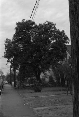
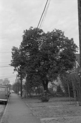
Arbutus menziesii: 2857 West 5th Avenue (N.I.I.)
Part of City of Vancouver fonds
Arbutus menziesii: 2857 West 5th Avenue (N.I.I.)
Part of City of Vancouver fonds

Connaught Park - 12th Avenue landscaping
Part of City of Vancouver fonds

Connaught Park - 12th Avenue landscaping
Part of City of Vancouver fonds