
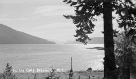
Lt. Governor and Mrs. Hamber visit Gulf Islands
- AM1036-S4-: CVA 703-4.47.2
- Item
- July 1939
Part of Hamber family fonds
7 results with digital objects Show results with digital objects
Lt. Governor and Mrs. Hamber visit Gulf Islands
Part of Hamber family fonds

Lt. Governor and Mrs. Hamber visit Gulf Islands
Part of Hamber family fonds

Part of City of Vancouver Archives technical and cartographic drawing collection
Item is a map showing subdivisions of townships in Coquitlam, Port Moody, Pitt Meadows, Surrey, Langley, Sumas, Sardis and Chilliwack. The west coast of British Columbia from Burrard Inlet to the Sechelt peninsula is shown as well as Vancouver Island and the surrounding Gulf Islands. Trails, post offices and railway stations are included.
Part of George Thompson fonds
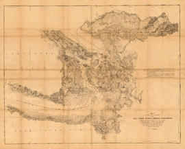
Map of portion of New Westminster District with adjacent islands and part of Vancouver Island, B.C.
Part of City of Vancouver Archives technical and cartographic drawing collection
Item is a map which shows parts of the east coast of Vancouver Island of southern Vancouver Island, the Strait of Georgia, the Gulf Islands, the Sechelt Peninsula, and Greater Vancouver. The map shows the numbers of the district lots for all of the New Westminster Land District.
![[Cross sections of ocean floor between Vancouver Island and mainland of British Columbia]](/uploads/r/null/c/a/6/ca687b43e46696a0c1d9223ef1e80ebe50bba0ea48092c458b525fc90f7b517c/7d458083-64ae-4682-be03-8fd1211e38c9-MAP8b_142.jpg)
[Cross sections of ocean floor between Vancouver Island and mainland of British Columbia]
Part of City of Vancouver Archives technical and cartographic drawing collection
Item shows ocean floor cross sections at 49 degrees latitude, 48 degrees 45', 48 degrees 35', and 48 degrees 25'. Islands and other geographical features are indicated.
Map showing the line of boundary between the United States and British possessions
Part of City of Vancouver Archives technical and cartographic drawing collection
Item is a map showing four proposed boundaries between the United States and British possessions in the Salish Sea region. The explanations of the lines read in part: "[1] Boundary line contemplated by the Treaty as shown by contemporaneous evidence; [2] Boundary line as claimed by the British Commissioner; [3] Boundary line proposed by the British Commissioner as a compromise ( . . . ); [4] Boundary line in accordance with the strict letter of the Treaty ( . . . ). Item also shows soundings, and the "track of steamers plying between Victoria and Fraser river since discovery of gold."

A B.C. ferry in the Gulf Islands
Part of Karl Haspel fonds