![Howe Sound - Burrard Inlet [Burrard Inlet portion]](/uploads/r/null/f/8/5/f8523992bb5d5e0c1391f2dea183041a54a2d2470eb4047bb29958a0d835ae95/fdf9563d-923e-468a-a494-3ff190294b91-MAP30b_142.jpg)
Howe Sound - Burrard Inlet [Burrard Inlet portion]

Burrard Inlet - Vancouver sheet

Burrard Inlet - Dollarton sheet

Burrard Inlet - Second Narrows sheet

Burrard Inlet - Barnet sheet

Burrard Inlet - Port Moody sheet

Burrard Inlet - triangulation control

Plan of Vancouver Harbour and False Creek, Vancouver, B.C., showing proposed improvements as outlined in Jos. R. Roy's reports dated 15th Sept. 1906

Vancouver Harbour. British Columbia

North America. West Coast. Fraser River and Burrard Inlet

North America - West Coast. British Columbia. Burrard Inlet

Tourist guide map of Vancouver City and Park

Burrard Inlet

Sketch of proposed interurban canal and harbour development for Greater Vancouver, B.C.

Plan of proposed dam, locks and wharves. Second Narrows, Burrard Inlet

Plan of the Burrard Inlet and Pitt River canal location

Portion of Burrard Inlet

Portion of Burrard Inlet

Vancouver Harbour : Sheet 3 (Second Narrows to Port Moody)

Vancouver Harbour : Sheet 1 (First Narrows to Second Narrows)

Vancouver Harbour : Sheet 2 (Point Grey to Second Narrows)

Vancouver North. British Columbia
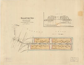
Ballantyne Pier, Burrard Inlet, Vancouver, B.C.
![Granville [Townsite], B.C. Aug., 1885](/uploads/r/null/1/a/4/1a45ddd637fe3f3726748d5096017a8461446b9a013c408ed2b1666c8433e1f9/405fdc0d-6d88-41b7-937f-36cc7f51518a-MAP553_142.jpg)
Granville [Townsite], B.C. Aug., 1885

Burrard Inlet : Vancouver sheet : British Columbia

North America. West Coast. Fraser River and Burrard Inlet

Port of the City of Vancouver. Isometric view from the south-west

City of Vancouver, Canadian Pacific Town Site

First Narrows, Burrard Inlet, B.C. showing Parthia and Burnaby shoals

Second Narrows crossing