Vancouver Harbour, British Columbia
Vancouver Harbour, British Columbia

Port of the City of Vancouver. Isometric view from the south-west
Vancouver Harbour : plan of south shore, Burrard Inlet between Heatley Ave. and Victoria Dr.
Vancouver Harbour : plan of south shore, Burrard Inlet between Heatley Ave. and Victoria Dr.
![Granville [Townsite], B.C. Aug., 1885](/uploads/r/null/1/a/4/1a45ddd637fe3f3726748d5096017a8461446b9a013c408ed2b1666c8433e1f9/405fdc0d-6d88-41b7-937f-36cc7f51518a-MAP553_142.jpg)
Granville [Townsite], B.C. Aug., 1885

First Narrows, Burrard Inlet, B.C. showing Parthia and Burnaby shoals

Burrard Inlet

Vancouver Harbour. British Columbia

Vancouver Harbour : Sheet 3 (Second Narrows to Port Moody)

Vancouver Harbour : Sheet 2 (Point Grey to Second Narrows)

Vancouver Harbour : Sheet 1 (First Narrows to Second Narrows)
Tidal current charts : Vancouver Harbour, British Columbia
Tidal current charts : Vancouver Harbour, British Columbia

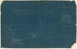
Plan of Vancouver Harbour and False Creek, Vancouver, B.C., showing proposed improvements as outlined in Jos. R. Roy's reports dated 15th Sept. 1906
Suggested harbour improvements Burrard Inlet
![Second Narrows [on] harbour tour](/uploads/r/null/b/2/e/b2ea67536bdb443ce9ad21b9ce328068de0d7aa9252a7ea17ab7aeb9cec67c8f/78042a33-bebb-41f2-ac8e-edfa5de1b752-CVA289-266_142.jpg)
Second Narrows [on] harbour tour

Harbour tour

Harbour tour