Suggested harbour improvements Burrard Inlet
Tidal current charts : Vancouver Harbour, British Columbia
Tidal current charts : Vancouver Harbour, British Columbia
Vancouver Harbour : plan of south shore, Burrard Inlet between Heatley Ave. and Victoria Dr.
Vancouver Harbour : plan of south shore, Burrard Inlet between Heatley Ave. and Victoria Dr.
![Second Narrows [on] harbour tour](/uploads/r/null/b/2/e/b2ea67536bdb443ce9ad21b9ce328068de0d7aa9252a7ea17ab7aeb9cec67c8f/78042a33-bebb-41f2-ac8e-edfa5de1b752-CVA289-266_142.jpg)
Second Narrows [on] harbour tour

Plan of Vancouver Harbour and False Creek, Vancouver, B.C., showing proposed improvements as outlined in Jos. R. Roy's reports dated 15th Sept. 1906

Vancouver Harbour : Sheet 1 (First Narrows to Second Narrows)

Vancouver Harbour : Sheet 2 (Point Grey to Second Narrows)

Vancouver Harbour. British Columbia
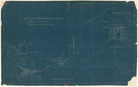
Vancouver Harbour, British Columbia
Vancouver Harbour, British Columbia

Burrard Inlet
![Granville [Townsite], B.C. Aug., 1885](/uploads/r/null/1/a/4/1a45ddd637fe3f3726748d5096017a8461446b9a013c408ed2b1666c8433e1f9/405fdc0d-6d88-41b7-937f-36cc7f51518a-MAP553_142.jpg)
Granville [Townsite], B.C. Aug., 1885

Port of the City of Vancouver. Isometric view from the south-west

Harbour tour

Harbour tour

Vancouver Harbour : Sheet 3 (Second Narrows to Port Moody)

First Narrows, Burrard Inlet, B.C. showing Parthia and Burnaby shoals