![Elliott [Street] and 54th [Avenue looking] east](/uploads/r/null/6/8/68c267fb8bc5d628eeb91a82fb962d0c9fb28255c8adafb3c57c2f2c78b8f6b2/4e8cd44f-834f-4a0b-9289-a9e257574964-A43463_142.jpg)
Elliott [Street] and 54th [Avenue looking] east
- COV-S505-1-: CVA 772-584
- Item
- [between 1980 and 1997]
Part of City of Vancouver fonds
6048 results with digital objects Show results with digital objects
Elliott [Street] and 54th [Avenue looking] east
Part of City of Vancouver fonds
![Elliott [Street] and 54th [Avenue] facing south](/uploads/r/null/2/b/2b9303f22295292f07d6d7ef1cde2ab90bc21617ad9f902ab0933361a5090e4f/bd42cba2-ddd2-4a24-ba47-5da1a1eecafe-A43460_142.jpg)
Elliott [Street] and 54th [Avenue] facing south
Part of City of Vancouver fonds
![Elliott [Street] and 54th [Avenue] facing north](/uploads/r/null/b/f/bf1f9efbf450df439084aae9fe31e1ceacbce3290f6be344a75dab4c7e0a3cdb/0ad10ab2-0ea1-4b2b-9858-e64992221ee2-A43459_142.jpg)
Elliott [Street] and 54th [Avenue] facing north
Part of City of Vancouver fonds
![Elliott [Street] and 54th. [Avenue] facing east](/uploads/r/null/8/c/8cbd1e2aac370943d2a8d5a543cb15164fe850243b57053131f701f58a751f1d/85d95adf-907e-4765-a334-a30540725554-A43462_142.jpg)
Elliott [Street] and 54th. [Avenue] facing east
Part of City of Vancouver fonds
![Elliott [Street] and 54th [Avenue] facing west](/uploads/r/null/f/2/f2727bda0e1750edd9f6af10c16c3af2124f3ec2357d49eccbb9bd8d7215cb67/2766aacd-0f5a-4a29-bd7a-918eb9a65fb0-A43461_142.jpg)
Elliott [Street] and 54th [Avenue] facing west
Part of City of Vancouver fonds
![Elliott [Street] and 49th [Avenue looking] west](/uploads/r/null/0/e/0e9d473a88cca030acdf545c659b6f8c49103634b1a87e3deb8bd1be0c85db06/e2d34965-0718-44fc-9858-3c64b0a63cc0-A43458_142.jpg)
Elliott [Street] and 49th [Avenue looking] west
Part of City of Vancouver fonds
![Elliott [Street] and 49th [Avenue looking] south](/uploads/r/null/d/f/df8a8db45ef341b8cf1d57f52bc9daa0d913c68ca781724f51720cb8bdb610a2/5efa29c1-35e6-4680-8926-d801b325af5a-A43475_142.jpg)
Elliott [Street] and 49th [Avenue looking] south
Part of City of Vancouver fonds
![Elliott [Street] and 49th [Avenue looking] north](/uploads/r/null/7/c/7c1581c9ac642344563e5bdc13a7396329ad7326ba2d0b875e27d959f1cb01a4/d71b8541-69a7-4f7b-bca1-b538990cada0-A43457_142.jpg)
Elliott [Street] and 49th [Avenue looking] north
Part of City of Vancouver fonds
![Elliott [Street] and 49th [Avenue looking] east](/uploads/r/null/f/a/fa71672dd1b6e2d1e37ab9ebc15014aad22ae2dbe049a219e55243e9b52cb8d9/5a5142f2-3252-42f2-95cd-1527cc2bb940-A43456_142.jpg)
Elliott [Street] and 49th [Avenue looking] east
Part of City of Vancouver fonds
![[Electric power lines running above lane west of Main Street]](/uploads/r/null/1/6/169d806ac875cb03ae3dc6935038c6e322fdedc719e8419662594da3739c042e/553430ca-2120-4dd5-ae83-82d0db85e329-A08384_142.jpg)
[Electric power lines running above lane west of Main Street]
Part of Major Matthews collection
![[Electric power lines running above lane west of Granville Street]](/uploads/r/null/3/0/309d219e95d2dc852bfd1efbcce2be57cb6e098a88a684e3141e9c02a123dd6a/52c5f0f8-9b65-47a0-a706-5280635d922e-A08385_142.jpg)
[Electric power lines running above lane west of Granville Street]
Part of Major Matthews collection
J.S. Matthews' notes with print or negative in Archives.
![[Electric power lines running above lane east of Granville Street]](/uploads/r/null/3/3/3324f373f9cba7df3b8f570a1813fb5b056fc9304c04a7ee87978ff8874b3d2f/53a93d20-1465-45e3-829f-e1034e13d850-A08386_142.jpg)
[Electric power lines running above lane east of Granville Street]
Part of Major Matthews collection
![[Electric power lines above lane behind Carnegie Library at Hastings and Main Streets]](/uploads/r/null/3/e/3ef3d07c60f4029ab9e2dc8b9989ec843b7da5f5b19264a5c715ad0b50927a7b/12beffe9-b809-4696-9fc7-92ea7546faaf-A08478_142.jpg)
[Electric power lines above lane behind Carnegie Library at Hastings and Main Streets]
Part of Major Matthews collection
![EL [electrical? ]Pole, Abbot and Pender](/uploads/r/null/0/8/0846e1ecd813e8c1a09247f0875209d538c950a2a4bf4331a5b58d2be88926d0/774ce90f-22d5-4563-b8ed-c7ca1480a9ac-A16541_142.jpg)
EL [electrical? ]Pole, Abbot and Pender
Part of City of Vancouver fonds
Photograph shows Hotel Lotus.
Edwards Hotel - 300 Water Street
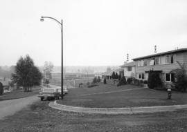
Eddington Drive, south side, from Paton Street to Haggarts Street
Part of City of Vancouver fonds
Photograph shows 2404 and 2406 Eddington Drive
Eddington Drive, south side, from Haggart Street to Paton Street - view west
Part of City of Vancouver fonds
Photograph shows 4675 Haggart Street and 2404 and 2406 Eddington Drive

Eddington Drive, south side between Paton Street and Puget Drive - view southeast
Part of City of Vancouver fonds
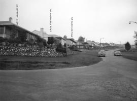
Photograph shows 2430, 2450 and 2484 Eddington Drive and 4662 Puget Drive
Eddington Avenue, south side, between Paton Street and Puget Drive - view southeast
Part of City of Vancouver fonds
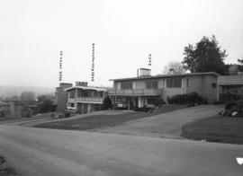
Photograph shows 4662 Paton Street, 2430 and 2450 Eddington Drive

Eddington Avenue, south side, between Paton Street and Puget Drive - view south west
Part of City of Vancouver fonds
Photograph shows 2450 and 2484 Eddington Avenue

Eddington Avenue and Paton Street - southwest corner - view west
Part of City of Vancouver fonds
Photograph shows 4701 Paton Street, 2430 and 2450 Eddington Drive
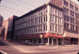
![Eaton's [73 Water Street]](/uploads/r/null/e/f/efffbe7541e9c786725d223540782783ca09254430a2f2857e65bb3cd39091f3/7b145e73-e3e4-47ae-959b-bfc17c3181a9-CVA810-263_142.jpg)
![[Eastern view of road paving on 41st Avenue from the Boulevard]](/uploads/r/null/c/8/c8bf97a87a0f59d39ec695f093e434482ce6c414586c15916b08489c97024a65/75e24a73-8b16-49cb-b7d0-7979d3482e4d-A37221_142.jpg)
[Eastern view of road paving on 41st Avenue from the Boulevard]
Part of Major Matthews collection
![[Eastern view of 41st Avenue from East Boulevard]](/uploads/r/null/1/2/122c5971e183c9022cb9c0a3497f4d988373af58c89d857373c36e1410167faa/a4f74b60-6415-473b-8bb9-f791327e8a8e-A25961_142.jpg)
[Eastern view of 41st Avenue from East Boulevard]
Part of Major Matthews collection
Photograph shows the north side of the 2000 block
![[East side of the intersection of Carrall Street and East Pender Street, 5 of 5]](/uploads/r/null/9/0/0/900683290e1c4d9f1717f5b9bdfecee920f0b28996057565eadafc3344f23b0c/ec325cae-4759-4625-8b98-a2a186e3877c-CVA1095-06759_142.jpg)
[East side of the intersection of Carrall Street and East Pender Street, 5 of 5]
Part of City of Vancouver fonds
![[East side of the intersection of Carrall Street and East Pender Street, 4 of 5]](/uploads/r/null/0/a/0/0a056a952f909b3179bc7cab6ab9ac1d65018bed1ccee6f339238c22d7f242ef/cfc242f1-5bbd-43e7-9509-61a10edda8a1-CVA1095-06758_142.jpg)
[East side of the intersection of Carrall Street and East Pender Street, 4 of 5]
Part of City of Vancouver fonds
![[East side of the intersection of Carrall Street and East Pender Street, 3 of 5]](/uploads/r/null/a/a/5/aa5a3cecae46a38785c458864b9e25401f687bda230b561e706627780b679bc2/35a83867-ea63-435a-9f3a-32f46b209337-CVA1095-06757_142.jpg)
[East side of the intersection of Carrall Street and East Pender Street, 3 of 5]
Part of City of Vancouver fonds
![[East side of the intersection of Carrall Street and East Pender Street, 2 of 5]](/uploads/r/null/3/d/6/3d6bf1ed92f7999fc666105510033a2d353f656509bb0b58a60a01a3cd5fa906/e84278ed-cc8d-46ac-8e8b-494a6f8afee4-CVA1095-06756_142.jpg)
[East side of the intersection of Carrall Street and East Pender Street, 2 of 5]
Part of City of Vancouver fonds
![[East side of the intersection of Carrall Street and East Pender Street, 1 of 5]](/uploads/r/null/a/3/b/a3be0f62f3de59606b877725a1dc994638a755ec7c9107d55ab22fea86141374/b842868b-9746-44bd-b6ea-18fdd234ce30-CVA1095-06755_142.jpg)
[East side of the intersection of Carrall Street and East Pender Street, 1 of 5]
Part of City of Vancouver fonds
![[East side of the intersection of Carrall Street and East Hastings Street, 2 of 2]](/uploads/r/null/3/0/1/3019b1e77e1ff0d5e6b865cba804333524145d1ebc43d253a9dcb1717862ee95/042825f5-9e1c-48f6-bce0-63255385b2c7-CVA1095-06737_142.jpg)
[East side of the intersection of Carrall Street and East Hastings Street, 2 of 2]
Part of City of Vancouver fonds
![[East side of the intersection of Carrall Street and East Hastings Street, 1 of 2]](/uploads/r/null/e/4/e/e4e08f9291035d09dcab86eae2a4f0e7126696452dde1785edb3c063ed6a9630/b4fff7a6-d43d-4cd5-939b-8fa71b2a3902-CVA1095-06736_142.jpg)
[East side of the intersection of Carrall Street and East Hastings Street, 1 of 2]
Part of City of Vancouver fonds

East side of Howe Street between Smithe and Robson Streets
Part of City of Vancouver fonds
Item is a photograph that includes the Eatons building.

East side of Howe Street between Smithe and Robson Streets
Part of City of Vancouver fonds
Item is a photograph that includes the Eatons building.

East side of Hornby Street near West Georgia Street
Part of City of Vancouver fonds

East side of Hornby Street looking north to Robson
Part of City of Vancouver fonds

East side of Hornby Street between Robson and West Georgia Streets
Part of City of Vancouver fonds

East side of Hornby Street between Robson and West Georgia Streets
Part of City of Vancouver fonds

East side of Granville Street between Robson and Smithe Streets
Part of City of Vancouver fonds
![[East Pender Street and Main Street intersection]](/uploads/r/null/f/9/0/f9018cce7e8da614a2bf9305ca466484f667d0aa2a807f2e6906cd86f72a9cad/523e32cf-fc5c-40af-9730-90f0997d23d4-CVA1095-09424_142.jpg)
[East Pender Street and Main Street intersection]
Part of City of Vancouver fonds
![[East Pender Street and Gore Avenue intersection]](/uploads/r/null/5/2/1/521b3dca0dc28ad355d6824b6783381400e948608051a8ed8f09c9f655e9bd4b/b4e88bbc-ca2e-42ac-9384-d0a4cb0ac3a7-CVA1095-09295_142.jpg)
[East Pender Street and Gore Avenue intersection]
Part of City of Vancouver fonds
Image is a photograph that depicts the intersection of East Pender Street and Gore Avenue. Visible is the sign for the East Hotel at 445 Gore Avenue.
![[East Pender Street and Gore Avenue intersection]](/uploads/r/null/2/1/d/21d9cea8d1627bd36d8f38af1df129896c716441ca4fa749f3c88f61cee3018c/a04c9ed0-ed7d-4cbb-8c7c-46b94c25db04-CVA1095-09294_142.jpg)
[East Pender Street and Gore Avenue intersection]
Part of City of Vancouver fonds
![[East Pender Street and Columbia Street intersection]](/uploads/r/null/c/c/3/cc3b878307c3a3703bcc7fa6f3d10a5a1ac7fcfddd22e082d4db2ccf0200a71e/cee9583d-6bdc-428c-855a-bf9eadd90745-CVA1095-09602_142.jpg)
[East Pender Street and Columbia Street intersection]
Part of City of Vancouver fonds
Item is a photograph that depicts the intersection of East Pender Street and Columbia Street. Visible is the sign for the Transnation Emporium at 89 East Pender Street.
![[East Pender Street and Carrall Street intersection - Chinese Times at 1 East Pender Street]](/uploads/r/null/9/3/3/9331aaa1ba29ccefc5a6715d6b9d3f8b0e58784378c876403ecd74195ec21918/549e3bff-77b5-4958-b615-a0688f48d58f-CVA1095-09212_142.jpg)
[East Pender Street and Carrall Street intersection - Chinese Times at 1 East Pender Street]
Part of City of Vancouver fonds
![[East Pender Street and Carrall Street intersection]](/uploads/r/null/6/4/9/649c1a9209d9373b9c2f49326f73e07556d25267ea84b0ef744f0878973c32f6/4af8eb64-d5be-4805-bf3e-a7ff85b11f4e-CVA1095-08732_142.jpg)
[East Pender Street and Carrall Street intersection]
Part of City of Vancouver fonds
Visible are signs for Marshall Wells, Chinese Times at 1 East Pender Street, and the Dominion Building at 207 West Hastings Street.
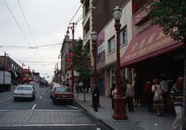
East Pender Street - Chinatown
Part of City of Vancouver fonds
Photographs shows East Pender Street with the Kam Gok Yeun Restaurant in the right foreground.

![[East Hastings Street and Columbia Street intersection]](/uploads/r/null/a/f/7/af794980aa19e082661366cd2948158b9c8c73d1e9309862ef1a3b6602d5bbeb/b635f8d9-40ec-4aca-b650-c8b51c449556-CVA1095-08745_142.jpg)
[East Hastings Street and Columbia Street intersection]
Part of City of Vancouver fonds
Item is a photograph that depicts the storefronts along East Hastings Street at Columbia Street. Visible are signs for The Bank of Nova Scotia, Honey Tailors, Steam's Hot Dogs and Gulf Club.
![[East Georgia Street and Princess Street intersection, 2 of 2]](/uploads/r/null/e/e/d/eedeeebb1b1343b1c4aa4b8d85c6f80ea20fe62889895ccd4d8bc76ad4aef35a/56c8b80b-1bae-4a48-85c5-87365ebc1a79-CVA1095-15340_142.jpg)
[East Georgia Street and Princess Street intersection, 2 of 2]
Part of City of Vancouver fonds
![[East Georgia Street and Princess Street intersection, 1 of 2]](/uploads/r/null/1/6/f/16fcdbf39e379be1e1ab6fe331a7a2f788f803421cbde594c0ff49944b1ebe07/590ea895-6016-49b8-a25c-7fe07058bde9-CVA1095-15339_142.jpg)
[East Georgia Street and Princess Street intersection, 1 of 2]
Part of City of Vancouver fonds
![[East facing cityscape view of] Water St[reet and West Cordova Street]](/uploads/r/null/4/c/4ce1044a578de08f6b0c6694f11dab01ef1134bd26eacefa6b31b9eccd465ead/e75dbf34-7999-40e0-be07-94dd0603fa79-A59644_142.jpg)
[East facing cityscape view of] Water St[reet and West Cordova Street]
Part of City of Vancouver fonds