![[North to south east view of Shaughnessy from near 37th Avenue]](/uploads/r/null/d/4/d4c834e288fd04bd34d58725b1bc564f0157ca7ada05c57d7ac44e3f0b6243f9/6512333f-72f0-486b-b711-db2e459d8216-A63970_142.jpg)
[North to south east view of Shaughnessy from near 37th Avenue]
- AM54-S4-3-: PAN N257B
- Item
- Apr. 1919
Part of Major Matthews collection
Photograph shows the Shaughnessy Golf Club and a Fire Hall in the distance.
6048 results with digital objects Show results with digital objects
[North to south east view of Shaughnessy from near 37th Avenue]
Part of Major Matthews collection
Photograph shows the Shaughnessy Golf Club and a Fire Hall in the distance.

Vancouver, B.C. "The livest and most beautifully located city in Canada"
Part of Major Matthews collection
Panoramic view (280 degrees) taken from the dome of the World Building showing the Beatty Street Armouries, the Cambie Street Grounds, Central High School, Vancouver High School, the Dominion Building, the railway yards and the eastern industrial areas
![[Panoramic view of downtown, Vancouver from Granville and Hastings Streets]](/uploads/r/null/b/6/b/b6b44d6ac0fb2fd61907ae9bad2a5792f8dce904b90fa1406d9c99ea2d36ee94/a76ddde8-2b68-4786-82cb-14470e682cd1-PANP92_142.jpg)
[Panoramic view of downtown, Vancouver from Granville and Hastings Streets]
Part of Major Matthews collection
Item is a photograph of downtown Vancouver. This is a cropped version of PAN P92.1.
![[Panoramic view of downtown, Vancouver from Granville and Hastings Streets]](/uploads/r/null/2/1/6/216cf899114250d1b31f38600b649f3b49bbd0c5882c6b5a6a9519d124d69cd5/addbb40b-0fc9-430e-8ebb-76d531606378-PANP92_142.jpg)
[Panoramic view of downtown, Vancouver from Granville and Hastings Streets]
Part of Major Matthews collection
Photograph is almost a 360 degree view. Buildings and some landmarks are identified in ink on print. This is a cropped version of PAN P92.1.
Written on the back of the print in what appears to be Major J.S. Matthews writing:
"Building permits issued.
Court House, superstructure, 7 Dec 1907 (addition, 30/3/1912)
excavation, 8 Mar 1907
Dominion Trust 21 Apr 1908
Carter-Cotton Bldg (Province Bldg) 5 Oct 1908 (addition Pender St 14/11/10)
Street cars and vehicles:- left hand rule of the road until 1921.
Have not investigated but this looks July or August 1908 or perhaps July-Aug 1909"
![[Panoramic view of Vancouver looking east, south and west from the Post Office tower]](/uploads/r/null/3/4/3440da1e98108d2cb1b9e915b9d5784f1ce26f037ac1f6597fb6f283670ef6fa/d87fd6ce-c19b-43e2-af52-69db5b1e0d1e-A63166_142.jpg)
[Panoramic view of Vancouver looking east, south and west from the Post Office tower]
Part of Major Matthews collection
J.S. Matthews identification notes on print.
![[Horse and cart travelling along 34th Avenue (now 33rd Avenue) before paving]](/uploads/r/null/5/8/58accbe9066b3a5afac554e1ad18cdf02097c9d7ed41cdcb5fd1f274eecd26dd/9e97a0b1-fb21-43e0-bdb6-846e105fa9f6-A19268_142.jpg)
[Horse and cart travelling along 34th Avenue (now 33rd Avenue) before paving]
Part of Major Matthews collection
![[Horse and cart travelling along] 34th Avenue [now 33rd Ave.] before paving](/uploads/r/null/1/b/1bea09e65d46b4109283423d33373961bada71fdd08bf41e25c639f1387eb3a6/ec202a7a-9fdb-4901-9fe9-d5885081dc3d-A19285_142.jpg)
[Horse and cart travelling along] 34th Avenue [now 33rd Ave.] before paving
Part of Major Matthews collection
![[Houses in South Vancouver]](/uploads/r/null/9/6/96beb114cdd36eb0925112d2fd5239b964d9de446cf79bd3c538c89ef082f0b8/090fc4d6-bd26-46bc-835f-1b2282ac15df-A19300_142.jpg)
Part of Major Matthews collection
Photograph shows houses on a residential street with wooden sidewalks and an unpaved road.
![[Street car outside the Winram Block, 17th and Main St.]](/uploads/r/null/e/1/e14e644a588b3f93678f4c964d20100150b12ddfe3bf74e33850981e29b76c8b/a52e4081-8f51-4943-a4c5-3fadd9085e6b-A19271_142.jpg)
[Street car outside the Winram Block, 17th and Main St.]
Part of Major Matthews collection
![[Surveyors on street in South Vancouver]](/uploads/r/null/b/0/b09502a2af3b99222d80fd5668c89eb6ad7f009934c53dd430cadad418ffe532/5b53049e-48db-4876-9ec4-b4adcbb0e6e0-A19303_142.jpg)
[Surveyors on street in South Vancouver]
Part of Major Matthews collection
![[View of 33rd Avenue showing road work in progress]](/uploads/r/null/b/3/b3d6aa7eb8fb0bf11bef829f4930510c09435ec0ead8048f44cfbf1708600abf/b1595b8e-b135-4c1d-a4e8-8737f2850cd0-A19297_142.jpg)
[View of 33rd Avenue showing road work in progress]
Part of Major Matthews collection
![[View of a dirt road, possibly 33rd Avenue, with street car tracks along one side]](/uploads/r/null/c/6/c64e9d504cc9b533bf0c5d0399db85273e1137fd7e3945aa2e84aa82a215b053/db19eae9-2562-40d9-9249-b36cc0c36f0b-A19282_142.jpg)
[View of a dirt road, possibly 33rd Avenue, with street car tracks along one side]
Part of Major Matthews collection
![[View of an intersection on Kingsway]](/uploads/r/null/c/f/cfe400afd470037c32921b61c3e288beb498141a4ed40bba8a293220e8bfdf44/71808117-63ec-4d3d-a3fc-57f737009105-A19334_142.jpg)
[View of an intersection on Kingsway]
Part of Major Matthews collection
![[View of finished] Paving Main St. and 17th Ave. looking north [showing the Winram block]](/uploads/r/null/5/b/5bac016b96314bbeb917b4e377d1ee1841c46536089bb447fecfdd79e090d3ee/b572beb9-fb07-4eb5-bda9-9431a294e603-A19258_142.jpg)
[View of finished] Paving Main St. and 17th Ave. looking north [showing the Winram block]
Part of Major Matthews collection
![[View of intersection probably River Avenue, now Marine Drive, and Fraser Street]](/uploads/r/null/6/4/6452707075abe1664e358d730eaeb4c51f71f6ce92a5dd0e0f63dfe4efc6b183/2af5de23-d671-4a66-bcb0-386ae624da78-A19355_142.jpg)
[View of intersection probably River Avenue, now Marine Drive, and Fraser Street]
Part of Major Matthews collection
![[View of Joyce Street looking south west towards Carleton School]](/uploads/r/null/6/5/65fddfb53fec807e9ed3476cea8eed909270066ae00a0cc4c69987f1c05de56e/5da90945-5972-46b9-8b35-bd078632aec3-A19313_142.jpg)
[View of Joyce Street looking south west towards Carleton School]
Part of Major Matthews collection
![[View of road paving at the] Intersection Main St. and 34th Ave. [now 33rd Avenue]](/uploads/r/null/e/b/eb7cbb6633178207f5f6cba577f32455439dead88a072ac334180ac063701e1a/ee3c2d88-476a-4a4c-b0c8-13120cd63792-A19287_142.jpg)
[View of road paving at the] Intersection Main St. and 34th Ave. [now 33rd Avenue]
Part of Major Matthews collection
![[View of the] Main St. bog [between 33rd Avenue and 41st Avenue]](/uploads/r/null/7/f/7fb80b09ebfd64e91e42bdfb033c7901f4187e4e47fb8a675f55ecce664255be/0d0df890-2794-44d1-b878-b21f154e60b1-A19256_142.jpg)
[View of the] Main St. bog [between 33rd Avenue and 41st Avenue]
Part of Major Matthews collection
![[View of] 34th Ave [now 33rd Ave] showing bitulithic paving](/uploads/r/null/1/5/15414121a12f5fa073fca9e2c5389404bfae71a44dd49b8a52e6efc7ea4096d9/38ff3049-ffb8-490e-ba3d-9b6da6192256-A19286_142.jpg)
[View of] 34th Ave [now 33rd Ave] showing bitulithic paving
Part of Major Matthews collection
![[View of] 56th Avenue](/uploads/r/null/5/e/5e6e63808539d76e2bb1611fb7f58e19d6ff2f5c79c8c0fb9a41ae096f1041e3/c876d1dc-483f-4911-be0a-4ea8219a7537-A19232_142.jpg)
Part of Major Matthews collection
![[View of] Main St. and 51st Ave. looking north](/uploads/r/null/f/8/f883edec5ff5f43b5a87451c288ebdd8ac155bbc70a6da73860b2397d6cd3d41/ba858f93-e41e-4f01-b6e1-113768409322-A19260_142.jpg)
[View of] Main St. and 51st Ave. looking north
Part of Major Matthews collection
![Finished bitulithic pavement Fraser St. and 34th Ave. [now 33rd Ave.]](/uploads/r/null/c/e/ced8cd4412754133f7d8b463ccd8ac13af0a8edf3f6aa85b1badc6e4af86de92/2bf50e3c-64a8-4efa-b475-59422ab6f306-A19292_142.jpg)
Finished bitulithic pavement Fraser St. and 34th Ave. [now 33rd Ave.]
Part of Major Matthews collection
![[Granville Street looking north from about Dunsmuir Street]](/uploads/r/null/9/7/97ead2853467a47e096b6533ca8b64418e751d5859d0c9f0c0e4cf01aac168ca/13f76c26-8671-4abe-a36c-5d7a92e7feb4-A37343_142.jpg)
[Granville Street looking north from about Dunsmuir Street]
Part of Major Matthews collection
Photograph shows a woman riding a bicycle

Part of City of Vancouver Archives technical and cartographic drawing collection
Map shows Hastings Town-site, Granville Town-site, Burnaby, and the City of New Westminster. Map also shows the Road from Granville and the False Creek Trail, as well as the names of places and soil types found along these roads. Other places and structures noted include Burrard Inlet, Coal Harbour (Coal Harbor on map), False Creek, False Creek Bridge, Burnaby Lake, Fraser River, New Westminster and Burrard Inlet Road, Douglas Road, Edinburgh Street, Columbia Street, Richards Street, and the New Westminster Cemetery. Two notes on map read "Plan to accompany Report of 1st May 1883, Joseph Hunter" and "Memo: Mr. Ross will place [?] this map to the [Engs.] Office Victoria [?]." 14T3 Roads & Trails is printed on the side of the map.

Part of City of Vancouver Archives technical and cartographic drawing collection
Item contains both nautical chart and map data. Nautical chart data includes soundings, anchorages, ferry lines, wharves, and waterfront businesses. Map features include district lots, streets, railways, and municipal boundaries.

False Creek development survey occupation plan
Item is a copy of a City of Vancouver Engineer's Office map of the False Creek area from Walnut Street to Main Street and downtown to Sixth Avenue. Map shows streets, railway lines, names of businesses occupying sites on the waterfront, and former high tide waterlines.
Street map of the Fraser Valley
Item is a street map of the Lower Mainland and Fraser Valley from Vancouver to Chilliwack.
Part of Major Matthews collection
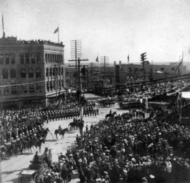
Photograph shows the Flack Block and Northwest Mounted Police
![Unidentified street in Point Grey [4700 block of Belmont Avenue]](/uploads/r/null/e/2/f/e2fcb9deb7c5796ad6bb91a89e1c9c6b545ad7eabf824d20dd91bb2a9b851015/33eae8b7-c304-4261-9102-5140636a4ea3-CVA798-3_142.jpg)
Unidentified street in Point Grey [4700 block of Belmont Avenue]
Photograph taken in Point Grey along Belmont Avenue near Langara Avenue. English Bay, Stanley Park and Downtown peninsula visible in background

Pender Street at Main : Chinatown looking west toward the downtown core
Item is a postcard printed with an image showing Pender Street in Chinatown looking west.


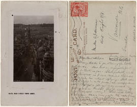
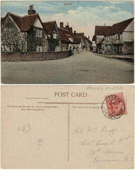
![West Looe [Cornwall]](/uploads/r/null/4/0/2/4024d3c4740bc9711cc7c7270ee91d2c53037dfd9770ecc0417cff586a15765a/82f0d961-d8b6-48d7-9574-b834799e3550-AM1052P-1370_142.jpg)
This postcard includes personal correspondence. Sent to Mrs. Bert Harrison of Vancouver, B.C.
![[Milsom Street, Bath, decorated for a special event]](/uploads/r/null/9/a/4/9a4f308a49203dcd1fe7f7492a5eb8d5b694362820ec10c9b45700c390a544b5/16c193a4-fb19-4512-9655-d9e6d4e8737d-AM1052P-1402_142.jpg)
[Milsom Street, Bath, decorated for a special event]
![[A commercial street in Bath decorated for a special event]](/uploads/r/null/8/2/1/821fa62ca468a1eddbac9b844121c9d86b19be8032976b188547f9c0f5ed4612/8e72885d-a631-471e-b949-c3e46691aa97-AM1052P-1403_142.jpg)
[A commercial street in Bath decorated for a special event]
![[A street in Bath decorated for a special event]](/uploads/r/null/f/2/3/f234de2f39a266c9f1565554f4336b62b15c23b74f9856fd4364b59cc0515867/cc755d0b-fb93-4b27-b2b0-d59aedb4f9a0-AM1052P-1404_142.jpg)
[A street in Bath decorated for a special event]
This postcard includes personal correspondence. Sent to Mr. and Mrs. A.J. Harrison of Vancouver, B.C.

This postcard includes personal correspondence. Due to damage on the verso, sender and recipient cannot be distinguished.
This postcard includes personal correspondence. Sent to Mr. A. Harrison of Vancouver, B.C.

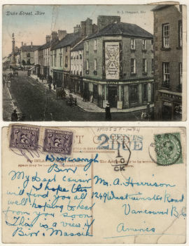
Item is a postcard printed with images of key places in Camborne. This postcard was presented to Mrs. Harrison.

This postcard includes personal correspondence. Sent to Mrs. E. Baggs of Bath, England.

This postcard includes personal correspondence. Sent to Miss. H. Baggs of Bath, England.
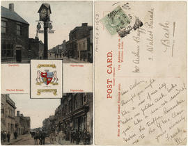
Cornhill and Market street, Highbridge.
Item is a postcard printed with images of two main streets of Highbridge and the town's coat of arms. This postcard includes personal correspondence. Sent to Mr. Arthur Baggs of Bath, England.
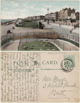
King's road, looking towards Hove.
This postcard includes personal correspondence. Sent to Mrs. Baggs of Bath, England.
This postcard includes personal correspondence. Sent to Miss H. C. Baggs of Vancouver, B.C.

This postcard includes personal correspondence. Sent to Miss Hilda Baggs of Weston Super Mare, England.


The Cenotaph, Whitehall, London.
This postcard includes personal correspondence. Sent to J. [McKersock?] Esq. of Vancouver, B.C. from A. J. Harrison.

Piccadilly, the Green park and the Quadriga, London.
This postcard includes personal correspondence. Sent to [J?] Robison of Vancouver, B.C. from A. J. Harrison.