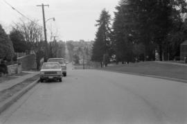
Looking west on East 15th Ave. toward Knight St.
- AM757-S2-F3-: CVA 798-5.11
- Item
- 1989
Photograph shows depression in 15th Avenue where China Creek once flowed. To the right is Clark Park. Additional descriptive information on back of print.
6035 results with digital objects Show results with digital objects
Looking west on East 15th Ave. toward Knight St.
Photograph shows depression in 15th Avenue where China Creek once flowed. To the right is Clark Park. Additional descriptive information on back of print.

East 15th Ave., facing west towards Knight St.
Photograph taken from corner of East 15th Avenue and Fleming Street, showing dip in land where China Creek once flowed. To the right is Clark Park.

East 15th Ave., facing west towards Knight St.
Photograph taken from corner of East 15th Avenue and Fleming Street, showing dip in land where China Creek once flowed. To the right is Clark Park.

Photograph of Kerrisdale Arena
Photograph shows Kerrisdale Arena and view down East Boulevard. Arena address is 5670 East Boulevard

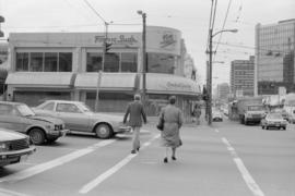
Intersection at Cambie St. and Broadway
Photograph taken facing west down Broadway. Visible in photograph are signs for Fogg n' Sudds restaurant, Orchid Garden restaurant, and London Drugs
Intersection at Cambie St. and Broadway
Photograph taken facing west down Broadway. Visible in photograph are signs for Fogg n' Sudds restaurant and Orchid Garden restaurant

Intersection at Broadway and Cambie St.
Photograph taken from south-west corner, facing south. Trolley bus visible in foreground, Royal Bank building visible in background

Looking down East 1st Ave. towards downtown
Photograph taken from intersection of East 1st Avenue and Prince Edward Street, facing north-west. Visible in backgound are BC Place, Science World, and Scotia Tower

Looking east on Hastings Street from Homer Street showing sidewalks filled with people
Photograph shows businesses on the north side of the 300 Block of Hastings Street and the Dominion Trust Building
![Walks [2 of 3]](/uploads/r/null/1/e/1e83f91f6ef81f3820c37864fc9e84e53810be41cd4afe2e105d5e04254df8da/46a44585-1c9c-418e-8ae3-9e067cab679d-A64110_142.jpg)
Part of City of Vancouver fonds
Image shows street intersection at 5600 W. Boulevard.
![Streets [1 of 139]](/uploads/r/null/3/b/3b53b48c72fe26d12272b70abf4a5ee342b395704644dd18b381b4b428d0020f/3ba0d037-8c52-4ab1-80a6-8f7114e8038a-A64139_142.jpg)
Part of City of Vancouver fonds
Residential street
![Bus shelter [7 of 20]](/uploads/r/null/9/0/90366d60b9ea8b4c5fc9f07dbeabb3416de4e17cec5f3222e56ba3ae96d5aa66/a50f4b3e-84fe-4e5a-9404-37ecfc9d8335-A64140_142.jpg)
Part of City of Vancouver fonds
![Streets [2 of 139]](/uploads/r/null/6/9/691f5428eb0d996cc54bb5b3f09b24bf233cbf58710438a6fef12f18e55aaacd/753597c6-33be-41a0-a531-46cd27b9d2c6-A64143_142.jpg)
Part of City of Vancouver fonds
Residential street
![Streets [3 of 139]](/uploads/r/null/a/3/a3a90fc2cfd778a0b6e23d9da5db0620edc6853a61f9e347de8efadc5dabab05/1b2b7b47-6c4b-4741-b612-6b01e5262a2e-A64144_142.jpg)
Part of City of Vancouver fonds
![Streets [4 of 139]](/uploads/r/null/d/d/dd049ec81db95bf491167b50a5336ddc2f73ded529e9fdbc8abb81121f325d7e/93e8e3b5-59bf-442e-ab6a-a22bfaf83557-A64145_142.jpg)
Part of City of Vancouver fonds
Residential street
![Streets [5 of 139]](/uploads/r/null/f/8/f8dbc0ce615e2082db6f5549982187d6cf800abc92ff65a5a2872f9ca14f621a/66b27d54-c832-4292-bada-cdbe8823692d-A64154_142.jpg)
Part of City of Vancouver fonds
Residential street
![Streets [6 of 139]](/uploads/r/null/e/0/e0b5a01b87a62ae4da05a1b593cb6258f47976e81c535779bbdca09f305625af/8be394e4-80a7-453b-a2e1-50cb0ce1a4e8-A64157_142.jpg)
Part of City of Vancouver fonds
Residential street
![Streets [7 of 139]](/uploads/r/null/4/6/46133e3d7b0e678679bd03b38d6235ff74fcde55411a6cb692d3ec33a9ebf924/8304b75f-82b9-4441-ad87-b1e39b4698d8-A64169_142.jpg)
Part of City of Vancouver fonds
Residential street
![Streets [8 of 139]](/uploads/r/null/a/4/a417fa77654e254e3ee85b757eef3226b255f72a9ed8f7fe3644f862f1f9dc6b/9a504b31-fb39-42ac-930b-28a0134114ef-A64170_142.jpg)
Part of City of Vancouver fonds
![Streets [9 of 139]](/uploads/r/null/b/9/b9305a4911ec14dc1fd19107c82a0d0d0a917b2ea9b8d3ebe9b0ca5a1919fdbe/4a406fa6-b29e-402c-a7dd-7b7e14151469-A64171_142.jpg)
Part of City of Vancouver fonds
![Streets [10 of 139]](/uploads/r/null/0/a/0ae4e35b96275ac70ee0c6fa3893aa168313f1be5c398df03112417ee3c58a0e/ea2e8b04-28c6-4c94-81e3-3f36e8b0a203-A64172_142.jpg)
Part of City of Vancouver fonds
Residential street
![Streets [12 of 139]](/uploads/r/null/9/7/97a4c1890b151c61a984b624211371774250bf8a642ec8e0307c36a6b2a3057f/9a9ab631-19f9-41fc-a005-0aee0cf24f71-A64196_142.jpg)
Part of City of Vancouver fonds
![Streets [13 of 139]](/uploads/r/null/6/4/642ad8851d130d3ffd9d74401849d14c8878f07337aa24e947f8fc317ec16bba/cb7ef3d0-0dde-4dfe-a878-debae96f8fc0-A64197_142.jpg)
Part of City of Vancouver fonds
Image shows Hawkes Ave. and Union St.
![Streets [14 of 139]](/uploads/r/null/a/8/a804277b826e31b33f9ec484fc8fb93ef5e55f04e8ed091d0a2efa843195c6e0/6e75bb7c-b570-43d3-a094-170c296d96ad-A64198_142.jpg)
Part of City of Vancouver fonds
![Old Hastings Viaduct [2 of 2]](/uploads/r/null/9/2/92d1b27ea2e53247bdd3e2ca6b33367a90480807041c7440ac711f0bd20c2194/c9ea8be8-21f3-4ecc-9acc-bd1ba2ea1151-A64200_142.jpg)
Part of City of Vancouver fonds
Image shows Valley Drive between 23rd Ave - 22nd Ave.
![Lighting [14 of 47]](/uploads/r/null/8/7/87c9df8d4dcf078323c3e4f873fa030ac151ec9cb68dd41bbb04bb1932e9c320/224f7dc6-dfea-4b74-b2c2-b745267fabfa-A64201_142.jpg)
Part of City of Vancouver fonds
Image shows cracked pole at north west corner of 36th Ave and Pine Crescent.
![Lighting [15 of 47]](/uploads/r/null/1/7/17eb0169829f16b09a1984ccceff4bd1e6ba5fb8cce7c0bacb71ecfd849255eb/64234bd4-65d3-40f5-ba1a-1059999a684e-A64202_142.jpg)
Part of City of Vancouver fonds
Image shows Prior St. between Hawkes and Heatley avenues.
![Streets [15 of 139]](/uploads/r/null/6/0/6072bde468594860c98442dc9af5a75a81aba2a0e94f688e20945cd415590789/23c888c0-c109-40e0-a4f1-ff4b174b025e-A64203_142.jpg)
Part of City of Vancouver fonds
Image shows Georgia St. between Salsbury Dr. and Victoria Dr.
![Streets [16 of 139]](/uploads/r/null/e/e/eeec68d957eb0921ced4f1403c4156d5030e7a71872fe3afd4baff2efab03281/07fef0b3-b08a-4622-b983-703d5f8c438b-A64204_142.jpg)
Part of City of Vancouver fonds
Image shows 47th Ave and Dunbar St.
![Streets [17 of 139]](/uploads/r/null/a/1/a1d661be81bad216c32bf62970800aa1f580f56db11c1cf77af83b148161630d/5e136205-7c00-4ff4-855c-c91352074d97-A64205_142.jpg)
Part of City of Vancouver fonds
Image shows north side of Prior Street between Heatley Avenue and Hawks Avenue (temporary sidewalk).
![Streets [18 of 139]](/uploads/r/null/d/a/da66acc78d9a3d20d21b88302def158b7a5b9645a02ac251579a0681a2c4f86b/ccdf3ee4-97b9-4fe6-ac81-0f1031dfc610-A64206_142.jpg)
Part of City of Vancouver fonds
Image shows north side of Prior Street between Heatley Avenue and Hawks Avenue (temporary sidewalk).
![Streets [19 of 139]](/uploads/r/null/e/9/e96230d9034940b1517a44b58d79d32491692a5e61950e8e82f4b6e62c1f5cba/ad724b71-1af8-4b87-ab3e-0ba48b4077d8-A64207_142.jpg)
Part of City of Vancouver fonds
Item is a photograph showing Prior Street between Hawks Avenue and Heatley Avenue.
![Streets [20 of 139]](/uploads/r/null/5/9/593c2bbbf2097de1ee8ebc008b0a5323dc4790c13e6f4de791f89a0da7a87ca8/89012a2a-4239-4aee-9a73-99df445170bc-A64208_142.jpg)
Part of City of Vancouver fonds
![Streets [21 of 139]](/uploads/r/null/4/2/42c260331d83858202c5ea49caa4a697c896032c8ed8d08189e06348e9bfc6ce/ae5416d8-b169-4490-88c0-3cebb6f0e5b5-A64209_142.jpg)
Part of City of Vancouver fonds
![Streets [22 of 139]](/uploads/r/null/7/f/7f2cae6d093e327fa72c2b0c580a6ad3187f1daecd646d88838527406c89c2f3/b2f0234f-5e7f-4879-a490-2a743968cafa-A64210_142.jpg)
Part of City of Vancouver fonds
Image shows Pender Street between Semlin Drive and Lakewood Drive.
![Streets [23 of 139]](/uploads/r/null/3/6/36e1e0e1e630053e92b8b28eab950a7490978a0651816c5057792a769d083474/d3ac16e6-ca36-4f36-8462-bc28ad54e293-A64211_142.jpg)
Part of City of Vancouver fonds
Image shows N.W. Marine Drive from Trimble Street to Discovery Street.
![Streets [24 of 139]](/uploads/r/null/a/2/a20e8603a05b4c60f0a8ded650eaadd63457041b6e4732ebffce6b362e4db913/e2dea87c-5e13-4e43-8b3f-8d256f554cd4-A64212_142.jpg)
Part of City of Vancouver fonds
Image shows 48th Avenue from Dunbar to Collingwood.
![Streets [25 of 139]](/uploads/r/null/6/2/628ad76bb0e9a48752a29dc0cf40be570b965017d3cea3fcaf6fad60361e5a20/848c840c-e0bd-4a15-beca-72392fc313b5-A64213_142.jpg)
Part of City of Vancouver fonds
Image shows Georgia St. from Commercial Drive to Woodland Drive.
![Streets [26 of 139]](/uploads/r/null/7/9/79170d39ecb86119b7f7c6ff61073159f531e9c9714e360c4031135e2a2d36c9/2de4f1c0-9fbc-4ef3-8bb7-d282ea347360-A64214_142.jpg)
Part of City of Vancouver fonds
Image shows Lime Street from 49th Ave looking south.
![Streets [27 of 139]](/uploads/r/null/0/1/01be2ecc09f4e85b432d4870e5540be839b9abb3319eefcd8488e7d8462914bf/50f6dbcb-471b-4255-9657-0432f88dff1f-A64215_142.jpg)
Part of City of Vancouver fonds
Image shows valley Drive from 21st Ave looking north.
![Streets [28 of 139]](/uploads/r/null/1/4/141a2e8a83526bc6f05229675811fdca0e9b8c1e2001fe341f32ef404d8a4984/aa0e6866-1981-482f-a5dd-6ad5b657359f-A64216_142.jpg)
Part of City of Vancouver fonds
Image shows Triumph St. from Victoria Drive to Semlin Drive.
![Streets [29 of 139]](/uploads/r/null/3/b/3bc727f7555bd950f300bf729804b4e17b70c663b7d3759b644b19352372957d/8798e623-d55a-4436-8d87-5ee9cc7868b1-A64217_142.jpg)
Part of City of Vancouver fonds
![Streets [30 of 139]](/uploads/r/null/0/0/00c9c75089c9fc282e37a3c9fec8b6301621188810c3f1d18362d6b4eb2de6ce/3cd91c88-228a-4b6e-977e-622b2b9490ec-A64218_142.jpg)
Part of City of Vancouver fonds
![Streets [31 of 139]](/uploads/r/null/c/c/ccff6ce28daae3a65f9c20201875257393ce843ab4465ac913b40f6662890085/6a3e057e-a830-40dc-9901-cb731ab6cc4b-A64219_142.jpg)
Part of City of Vancouver fonds
![Streets [32 of 139]](/uploads/r/null/9/8/98a103c58878ac4d75c03b3fabbe14af64954ea8ae5600241209d1983cc1f812/993448dd-522e-4fc8-90fb-79ce066c510c-A64220_142.jpg)
Part of City of Vancouver fonds
![Streets [33 of 139]](/uploads/r/null/7/a/7a11a01746e318eaeb8cebeae2316fd335a87fd357108637df02ed8059772c10/7cf93a58-cf10-4687-b64b-c7cb77f31c13-A64221_142.jpg)
Part of City of Vancouver fonds
Item is a photograph showing the 1600 block of Franklin Street.
![Streets [34 of 139]](/uploads/r/null/9/7/9706fc2b24a8486559211a059a9685c27e6e2417a6118d19bb2f1b9b4e100508/3c00c869-6cf2-45a5-88a1-714dfbfefac3-A64222_142.jpg)
Part of City of Vancouver fonds
Item is a photograph showing the 1700 block of Pandora Street.
![Streets [35 of 139]](/uploads/r/null/8/7/871447a69a31be2eb2c4116c4ff5f239f7159dd0121b8b2d45f7cee523a0ac6b/2b48d55f-815e-46d8-bd41-ff1b0b1369b8-A64223_142.jpg)
Part of City of Vancouver fonds
![Streets [36 of 139]](/uploads/r/null/9/5/95112a41844b9f74a8b34c68cc0fe9ce6ec5541f97204e197cd9720cc5e47045/9d0aa579-2b86-45e2-8705-8c4814ab8b0b-A64224_142.jpg)
Part of City of Vancouver fonds
Item is a photograph showing the 1800 block of Pandora Street at Salsbury Drive.
![Streets [37 of 139]](/uploads/r/null/d/1/d1f8d22c9f8772535580d9b83324893affe7a3694658130fdc32fb8031a0ccd0/8a42f96c-835e-46b0-9881-e43d8b34d050-A64225_142.jpg)
Part of City of Vancouver fonds
Item is a photograph showing Commercial Drive and Franklin Street.