
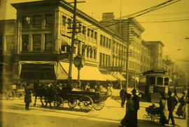
Hastings Street looking east from Granville Street, Vancouver, B.C.
![[Looking south on Granville Street from Hastings Street]](/uploads/r/null/6/c/6c12f9006f4ecd3c6a8a46802133e4f2030df9c02bdd7e4a19e4e3a2f660f387/47ef6028-b90b-446f-bbeb-cacfba6456f1-A37146_142.jpg)
[Looking south on Granville Street from Hastings Street]
![[Milsom Street, Bath, decorated for a special event]](/uploads/r/null/9/a/4/9a4f308a49203dcd1fe7f7492a5eb8d5b694362820ec10c9b45700c390a544b5/16c193a4-fb19-4512-9655-d9e6d4e8737d-AM1052P-1402_142.jpg)
[Milsom Street, Bath, decorated for a special event]

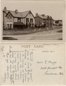
Waldegrave Road Upper Norwood
![Hastings Street west of Cambie [Street]](/uploads/r/null/6/a/6aa673b9bef0429c1d255a21cd9fc5c22c65ed081d1e04f57567c3d2ff9f5c61/5213503a-b75c-4f07-a51d-d021efa576f8-CVA1376-721_142.jpg)
Hastings Street west of Cambie [Street]

Georgia Street at Hornby Street
![[A commercial street in Bath decorated for a special event]](/uploads/r/null/8/2/1/821fa62ca468a1eddbac9b844121c9d86b19be8032976b188547f9c0f5ed4612/8e72885d-a631-471e-b949-c3e46691aa97-AM1052P-1403_142.jpg)
[A commercial street in Bath decorated for a special event]
Woodend, Woodcot, Uplands and Enderby, Crapstone, Yelverton
![[A street in Bath decorated for a special event]](/uploads/r/null/f/2/3/f234de2f39a266c9f1565554f4336b62b15c23b74f9856fd4364b59cc0515867/cc755d0b-fb93-4b27-b2b0-d59aedb4f9a0-AM1052P-1404_142.jpg)
[A street in Bath decorated for a special event]

Corner of Sydenham Hill
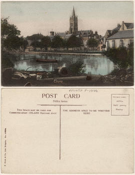
Truro
![London Rd. [Worcester]](/uploads/r/null/f/a/1/fa11e0b1cc5f16c57864e69c298514b3808aee1f3ac3a14681efd01ac68a7fa7/bbebbcd0-7292-48c9-902f-fc8b6c87f50e-AM1052P-1821_142.jpg)
London Rd. [Worcester]
![[Granville Street looking north]](/uploads/r/null/c/b/cb1f9194e0eedd66fc1b128f35e3b13e1fb435f5ac8ef246f08d4470933b38a2/b8314769-3706-451e-83da-76878e4a012f-A37477_142.jpg)
[Granville Street looking north]
![[Granville Street looking south]](/uploads/r/null/1/9/19fce682b0720f24b0d0558802a92dcc7ed4b269190a237ee607388a4899642c/319489f2-e160-415f-b0a9-18dc53e07e01-A37478_142.jpg)
[Granville Street looking south]
![[Western view of Fairview from the tower of King Edward High School on 12th Avenue and Oak Street]](/uploads/r/null/5/7/57f78634c36cdc44896b928e95b888dc11481e391bcf511d52692a2ee6953e09/d4c21e48-ce87-44ed-8181-22199bd4fa93-A43281_142.jpg)
[Western view of Fairview from the tower of King Edward High School on 12th Avenue and Oak Street]
![[Granville Street at Hastings Street]](/uploads/r/null/9/8/989c779b3cca90842a77330c01fc1c8884cf1ed839f0ec960ee8e16b86ff5962/180b61cd-b8dc-4f21-9fc7-bcb435aca70e-A02414_142.jpg)
[Granville Street at Hastings Street]

Hastings St. east of Cambie, Vancouver, B.C.
![[Looking west on Hastings Street from Carrall Street]](/uploads/r/null/7/5/750ff2e99353c56ec9b8068d2cae81ccf567d071f611f2a9ed15521d40057351/612ef3d0-c4b6-47b5-a6db-91f36a339c09-A62563_142.jpg)
[Looking west on Hastings Street from Carrall Street]
![[View of Hastings Street looking west from Columbia Street]](/uploads/r/null/8/a/8a6e426fdad68a13809f6c3d47bf803003fcf76c94e5b957e257f4cfefc307ca/4958364f-fd13-4a13-95c1-7df722f9e89a-A62576_142.jpg)
[View of Hastings Street looking west from Columbia Street]

Vest pocket map of Vancouver : map A

Ladysmith, B.C.

Vest pocket map of Vancouver : map C
![[Hastings Street looking east from Granville Street]](/uploads/r/null/8/7/87f99bb215b714559b6786a8ef5fe287797121a4c761ada93acefd5b03fc1e56/76e6909e-2e97-4e02-b6d4-ac805f4d70d0-A62581_142.jpg)
[Hastings Street looking east from Granville Street]

[Procession along Hastings Street at Richards Street, with bystanders observing individual in horse-drawn carriage with metal bars]

Corner Main and Hastings in 1905

Vest pocket map of Vancouver : map D
![Northwest corner of Georgia and Howe Streets [showing Georgia Street extending west]](/uploads/r/null/8/0/80964f60e791333d349135598cbd194a1ac79bc00da2ccb6debd0427ca5bf7fe/b2f30516-09ff-4247-8082-182ec9a584aa-A01863_142.jpg)
Northwest corner of Georgia and Howe Streets [showing Georgia Street extending west]
![[Westminster Avenue, later Main Street, looking north from Keefer Street]](/uploads/r/null/f/5/f5f3eae17ba1161a1a6ddbb6ddfcef8223d73a6936fbef5c47ba7668bd2e4755/08afc064-2a69-437a-a195-5bfdc0300fb5-A02410_142.jpg)
[Westminster Avenue, later Main Street, looking north from Keefer Street]
Picturesque Vancouver, British Columbia
Picturesque Vancouver, British Columbia

Chagford.

Headingley.

Vest pocket map of Vancouver : map B
![Hastings at Cambie [showing streetcar, Woodward's cart, and corner of the Court House garden]](/uploads/r/null/d/4/d4767b71244181bb50609e37d28c55c9bff05260aa2c597c5f27e55e9da0a818/1efa0c99-d45b-4e24-bfee-856b5f970950-A02413_142.jpg)
Hastings at Cambie [showing streetcar, Woodward's cart, and corner of the Court House garden]

Hastings Street Looking East
![[View of Hastings Street from Cambie Street]](/uploads/r/null/1/6/164a5264ad9ffc62992f3ec42486b0ad0f07dbfc0971a1229df921a019ff6c67/f16ff225-93ce-472c-8f13-52f7b5ce507f-A62559_142.jpg)
[View of Hastings Street from Cambie Street]
![[Hastings Street looking west from Homer Street]](/uploads/r/null/0/a/0a0285e4f1cfa06a20c2f981aa256927d234542bad3e5d628bf802f243aff87b/f1c5679c-b429-4542-b926-237cddaf7a59-A62580_142.jpg)
[Hastings Street looking west from Homer Street]
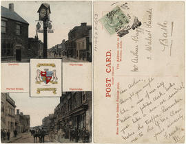
Cornhill and Market street, Highbridge.

Worcester. The Cross
![[Fifteenth Street looking east towards Grand Boulevard]](/uploads/r/null/7/3/73a89135f77f03c2170bc52234ba67e4d5b33dd68391be03e9ca3753fb8abd65/1332756e-55c4-4d2a-93f8-9e02d7c4bc28-A33961_142.jpg)
[Fifteenth Street looking east towards Grand Boulevard]

Granville St., Vancouver, B.C.
![[View of Granville Street looking north from Georgia Street]](/uploads/r/null/9/3/93cdc22fc78b058222ebcd2a39d045297fe3686a7d78b0534ebdfac34b3b040e/a61aca37-5984-401a-be53-da4de56e8b4b-A25142_142.jpg)
[View of Granville Street looking north from Georgia Street]
![[Looking north from the 600 Block Granville Street]](/uploads/r/null/7/4/74459c9848a63e2d601d52a13eff9816958744084dfa79226eb435c4f7fd0288/7bba87dc-839d-44ca-ad33-d2c9313d5948-A37360_142.jpg)
[Looking north from the 600 Block Granville Street]
![[View of Dupont Street, later Pender Street, Chinatown area]](/uploads/r/null/6/0/606e8b9b8cb0818a46e021cda095c9662964079d95d2021f028ca4b94e14f67b/c1f3750a-82c7-4c2c-b0c6-f71c0fff69c5-A02361_142.jpg)
[View of Dupont Street, later Pender Street, Chinatown area]

Shanklin Village
![[Granville Street near Pender Street, looking north, showing sign for Semi-Ready Tailoring]](/uploads/r/null/1/8/18e5f88a77032fa4077010395c66a954f9f6525eeb74e47c363fbc365a76424d/5e0ce98d-ca14-4d39-be49-d7caa1330521-A02360_142.jpg)
[Granville Street near Pender Street, looking north, showing sign for Semi-Ready Tailoring]
![[View of the 400 block Granville Street from West Hastings Street]](/uploads/r/null/2/0/20df825badcf9296013a9a6a322013c61383be7f3d730d0c03dad146eadce18b/fc7d3c2d-2dde-4bb6-8448-b1066425fd79-A02416_142.jpg)
[View of the 400 block Granville Street from West Hastings Street]
![Corner of Westminster Avenue [later Main Street] and Hastings Street, Vancouver, B.C.](/uploads/r/null/4/4/4464dc8796c1bba530d578b8f8a385d7f386457a7736e504a056429e78de7f68/3a75d8f7-fdee-41a3-8697-36d0015572fa-A02421_142.jpg)
Corner of Westminster Avenue [later Main Street] and Hastings Street, Vancouver, B.C.

Race riot damage on west side of 500 block Carrall Street
Looking east on Hastings Street, Birks building
![Carrall Street, looking north [showing the Hotel Alexandria, 37 Carrall Street]](/uploads/r/null/9/b/9b2acdaefcf68f3563137041fd54fdf3b37448daee7d57b23dbc5f89d914d066/47559481-9376-4e35-b2ad-a9f7fcd2bd95-A02408_142.jpg)
Carrall Street, looking north [showing the Hotel Alexandria, 37 Carrall Street]