
- AM427-S4-: CVA 289-265
- Item
- July 28, 1965
Part of William Orson Banfield fonds
462 results with digital objects Show results with digital objects
Part of William Orson Banfield fonds

Item shows Coal Harbour looking toward downtown.
![Harbour panorama [with] war canoe](/uploads/r/null/1/3/5/13571c1c3dc1e530a1e923e7264be75706d8af95af9a588dcf00ff1206d334c5/cd1f3b56-7afa-4c5c-ac2a-92ed07ed331a-2011-010_142.jpg)
Harbour panorama [with] war canoe
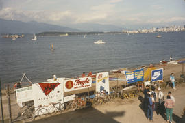
Harbour during the Blushes Beautiful Ski to Sea Relay Race
Harbour and bridge from Capitol Hill

'Greenhill Park' ship explosion in Vancouver Harbour

Granville, B.C. 1885 - C.P.R. plan
![Granville [Townsite], B.C. Aug., 1885](/uploads/r/null/1/a/4/1a45ddd637fe3f3726748d5096017a8461446b9a013c408ed2b1666c8433e1f9/405fdc0d-6d88-41b7-937f-36cc7f51518a-MAP553_142.jpg)
Granville [Townsite], B.C. Aug., 1885
Part of City of Vancouver Archives technical and cartographic drawing collection
Item is a fire insurance map of the "Coal Harbour" [south shore of Burrard Inlet] area. The Hastings Saw Mill Company and Coal Harbour Fishery are shown in detail. Other businesses along Front Street are identified including hotels and stores.

Part of Hubert William Lovell fonds
Photograph was taken in the summer.
![[Grain ships in Vancouver Harbour waiting to load grain]](/uploads/r/null/9/f/9f2d3f3a11fa665d2b9686746811b28a10898db2c7b0a189df714e3350a4e788/740c3740-7ce9-4588-aaef-b05f1037283a-A08765_142.jpg)
[Grain ships in Vancouver Harbour waiting to load grain]
Part of Major Matthews collection
Photograph is left section of a three-part panorama (Bo N161.2, Bo P442.1 and Bo P442.3).
Part of City of Vancouver fonds
This item is a print of one of seven images created by graphic designer and artist David Hornblow for the City of Vancouver street banner series known as "Waterfront Images". This print depicts a portion of a Canadian grain hopper car.
Hornblow, David
![Georgia Day [on the deck of a] Vancouver-Victoria boat in First Narrows](/uploads/r/null/6/6/668581126068bef64727574d042412d1492c0510d297779d4bfda0ebf271604a/5b6dd093-9969-4960-850f-995e137a5ca3-A03305_142.jpg)
Georgia Day [on the deck of a] Vancouver-Victoria boat in First Narrows


Freighter "Ixion" and C.P.R.'s "Princess Mary" leaving harbour
Part of Stuart Thomson fonds

Fraser River North Arm, New Westminster Harbor
Part of William Orson Banfield fonds
Fraser port : freightway to the Pacific, 1858-1985
Frank Waterhouse & Company's Pacific Ports
![[Four] idle tankers near Portovenere](/uploads/r/null/4/9/a/49a160c0e115c2c10cd349b5b8d207af7a66d75ebc0e3ca4c50a7edbca20ce86/08ab1ef1-ff92-4cbf-9bc9-4323addf96c4-CVA293-130_142.jpg)
[Four] idle tankers near Portovenere
![[Four] idle tankers near Portovenere](/uploads/r/null/9/1/e/91e7c32c1eea8c6d3b2a4dbf33f51e96258a34618bdd8720bfd4d6974f0537d5/babfaa6a-6c0e-4bde-b7e4-66feee47dfb6-CVA293-130_142.jpg)
[Four] idle tankers near Portovenere


![Fishing boats at Prince Rupert [docks]](/uploads/r/null/5/7/57cad72795de5981d5a1b74a4b6e885953b245c18485282f0028b8559053341c/2d2e9b4d-9594-40be-8441-6632a03ff306-A07220_142.jpg)
Fishing boats at Prince Rupert [docks]
Thor and Mikof boats indentified in photograph.

First Narrows, Burrard Inlet, B.C. showing Parthia and Burnaby shoals
Part of City of Vancouver Archives technical and cartographic drawing collection
Item is a map showing shorelines, estuaries of adjacent creeks, mud flats, tide levels and soundings in feet. Map notes velocity of current at First Narrows.
New Westminster (B.C.). Department of Public Works
![Filling of government dock at Victoria, B.C. [Victoria outer dock]](/uploads/r/null/a/c/ac3dfcbfd7931077bc2fd044d9ac56f115bc15a0a358e22caf0d0dd50edde8b7/dcf75c65-ad8b-4b52-b57c-bf2b8a6aefd3-A31777_142.jpg)
Filling of government dock at Victoria, B.C. [Victoria outer dock]
Part of Major Matthews collection
![Filling of government dock at Victoria, B.C. [Victoria outer dock]](/uploads/r/null/a/4/a407ab35e25717806ed19dee13e037e030e5e4a94cee438b0b27b6b923de43ce/82cdb86b-0638-46f6-8815-f9a538f91041-A31776_142.jpg)
Filling of government dock at Victoria, B.C. [Victoria outer dock]
Part of Major Matthews collection

False Creek interim harbour headline
Part of City of Vancouver Archives technical and cartographic drawing collection
Map shows interim and ultimate headline, interim headline, ultimate headline, and existing headline, as well as streets, lots, railway yards and waterfront industries in the False Creek area. Map was created for the "False Creek development" study, "Harbour headline" project.
![Evening anchorage [3 large ships and small sailboat in harbour at sunset]](/uploads/r/null/6/0/d/60d16998ae9bc1a2653fe1625d8dabcb4e58d9fb8720a1470541fd00dd6f360d/fb01b38d-d3f5-474d-95f0-9c270036e78a-CVA293-103_142.jpg)
Evening anchorage [3 large ships and small sailboat in harbour at sunset]
![Evening anchorage [3 large ships and small sailboat in harbour at sunset]](/uploads/r/null/8/7/2/8727d40fe77cecc8f1a9421b38a760afe0c9aa58d7af058a56e90ce73a12fdaf/9df717c8-8214-4ae5-a04e-784752c2a4ba-CVA293-103_142.jpg)
Evening anchorage [3 large ships and small sailboat in harbour at sunset]

Part of Major Matthews collection

Part of James Luke Quiney fonds

View shows Lions Gate Bridge and Stanley Park.
![[English Bay after heavy snowfall]](/uploads/r/null/9/8/98d57e6aa43d81b764d660589019a9777086ef8ffa1ac5d9463a527dee1dbf26/46e3a80b-3931-459d-9c09-b1bd42694079-A16571_142.jpg)
[English Bay after heavy snowfall]
Part of City of Vancouver fonds
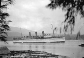
"Empress of Russia" entering harbour, First Narrows
Part of Stuart Thomson fonds
"Empress of Russia" entering harbour
Part of Stuart Thomson fonds
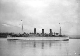
!["Empress of Japan" [entering harbour]](/uploads/r/null/5/4/54daa95b650752aac57e4cceb46eb7a800ab476a2d6485b7a3586dd536f82808/b5b1f904-8a7c-4d4a-8337-79ac1cbc3d25-A01178_142.jpg)
"Empress of Japan" [entering harbour]
Part of Stuart Thomson fonds
!["Empress of Japan" [entering harbour]](/uploads/r/null/b/a/ba6c6572d5ff93b5600b383a188a950baaeced82f6ca31580146901ef93f726a/796da2b6-d80c-419b-8ccf-b65e1eb87326-A01179_142.jpg)
"Empress of Japan" [entering harbour]
Part of Stuart Thomson fonds
!["Empress of Japan" [entering harbour]](/uploads/r/null/2/4/24ce4e142bf059fe41f6621fd36efaa86fbfaf57c84f79a0a1d35700523d7944/e5eaea3e-81da-4866-8dda-08316f84e16d-A01177_142.jpg)
"Empress of Japan" [entering harbour]
Part of Stuart Thomson fonds

Empress of China at dock, 1906, Vancouver, B.C.
!["Empress of Canada" [entering Burrard Inlet]](/uploads/r/null/9/4/94db9b96ed1cf51e6d7cc1d562628787707c23a528f090ccf8ee512396aed7a9/98f3b35c-e49f-42fa-a34d-9eb96318eda1-A00283_142.jpg)
"Empress of Canada" [entering Burrard Inlet]
Part of Stuart Thomson fonds
!["Empress of Canada" [entering Burrard Inlet]](/uploads/r/null/e/a/ea0c5910328c32658de02132a7a00d337a0995e4661e1e0c691882bef81b2912/7ef44123-7779-4370-abde-3644353aedd5-A00284_142.jpg)
"Empress of Canada" [entering Burrard Inlet]
Part of Stuart Thomson fonds
!["Empress of Asia" at C.P.R. Pier B-C [with "Melanope" alongside]](/uploads/r/null/0/f/0fb16442c7c62c275d85acaa7682f0d3fa8286edc35254c9405675c22e5550ad/b0542e8a-245e-4cf5-a9ab-330cf0dd2d68-A08348_142.jpg)
"Empress of Asia" at C.P.R. Pier B-C [with "Melanope" alongside]
Part of Major Matthews collection
J.S. Matthews' notes with print or negative in Archives.

Part of Harold D. Kalman fonds
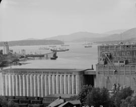
![[East half Granville Island before filling]](/uploads/r/null/7/7/779c84832492846bbaaf82b09675d06ff7c3ab6303167b3827dc162b403089ef/daa3991d-6801-47d2-a003-486fb768fb00-A31771_142.jpg)
[East half Granville Island before filling]
Part of Major Matthews collection

East half Granville Island before filling
Part of Major Matthews collection
File shows harbour, log boom and industrial shoreline.

East half Granville Island before filling
Part of Major Matthews collection
![[East half Granville Island before filling]](/uploads/r/null/3/5/35c9254407dcb353fee92a4f8f428fb575c8c83ae212ce77b57e6ecf0bbb2b9f/2b18b1d3-56f8-4e24-89f3-345aa9ea9358-A31772_142.jpg)
[East half Granville Island before filling]
Part of Major Matthews collection

East half Granville Island before filling
Part of Major Matthews collection
File shows harbour, log boom and industrial shoreline.