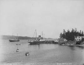
Unique waterway of Canada's Pacific Coast
- AM1519-: PAM 1975-104
- Item
- 1975
Item describes the exploration of a freshwater harbour on the Pacific Coast.
462 results with digital objects Show results with digital objects
Unique waterway of Canada's Pacific Coast
Item describes the exploration of a freshwater harbour on the Pacific Coast.

'Greenhill Park' ship explosion in Vancouver Harbour

Empress of China at dock, 1906, Vancouver, B.C.

View of Fisherman's Cove taken from highway to Horseshoe Bay
Part of Vancouver Express fonds
Vancouver Harbour : plan of south shore, Burrard Inlet between Heatley Ave. and Victoria Dr.
Part of City of Vancouver Archives technical and cartographic drawing collection
Item is a map which shows parcels of land along Burrard Inlet and district lots in downtown Vancouver. Piers, factories and mills along the waterfront are identified. Soundings are shown in feet.
![["Lady Cecilia" docked at harbour]](/uploads/r/null/1/2/12849060169b219d0d918c4fa6a5bc5ee3fa04eb4ffc689f2afacc52cd3d40d7/8cda520d-0c78-4b29-9d3c-a1d0564d1c4a-A01756_142.jpg)
["Lady Cecilia" docked at harbour]
Part of Stuart Thomson fonds
![["Lady Cecilia" docked at harbour]](/uploads/r/null/2/6/26b7ebe5c05ab80105c1df787e186e353667dcbdbecc67b47b659952e02e9dc6/8b9f7e20-3108-4850-9ec2-d1e854bd5c1c-A01748_142.jpg)
["Lady Cecilia" docked at harbour]
Part of Stuart Thomson fonds
![Selma Park & Pender Harbour [view from ship] Union Steamship Co.](/uploads/r/null/b/9/b9d40aa8469fc3a5ae14b34b0fdf85b5f9ec7cd8f40da6b11fce28104c4472f4/6fb1525d-e302-4ee4-805a-e2bf36aebc66-A01740_142.jpg)
Selma Park & Pender Harbour [view from ship] Union Steamship Co.
Part of Stuart Thomson fonds
The Port of Vancouver : Canada's key city of the West
Part of City of Vancouver Archives technical and cartographic drawing collection
Item is a brochure promoting Vancouver harbour as a hub of economic activity in the city. The brochure includes illustrations of harbour activity, facts about various aspects of the operations to show the harbour's capacity and facilities.
![Mr. G.B. Warren, Pacific Motor Boat, loading yachts on scow [False Creek]](/uploads/r/null/f/2/f232cac9c03fef859e1f5924b275b39d362d773c6832127117a54cac2812e910/5efc456e-cf3b-46c8-a964-4e3d5bb91ce3-A01562_142.jpg)
Mr. G.B. Warren, Pacific Motor Boat, loading yachts on scow [False Creek]
Part of Stuart Thomson fonds
![Mr. G.B. Warren, Pacific Motor Boat, loading yachts on scow [False Creek]](/uploads/r/null/3/d/3de4a6c7f897b524e96125c76b31a4f9cc8f0fdb760b732c70e777151e599f8e/538827c0-3fdd-4563-8064-633ec45e13e4-A01561_142.jpg)
Mr. G.B. Warren, Pacific Motor Boat, loading yachts on scow [False Creek]
Part of Stuart Thomson fonds
Imperial Gasoline signboard in background.
![Mr. G.B. Warren, Pacific Motor Boat, loading yachts on scow [False Creek South]](/uploads/r/null/3/d/3d64427c867440e7d963d876580d7a96d4e51be7df567c1fc70173c55e3642d4/bca9a4db-6ce1-43f2-a5a9-4093881390a7-A01560_142.jpg)
Mr. G.B. Warren, Pacific Motor Boat, loading yachts on scow [False Creek South]
Part of Stuart Thomson fonds
![V.R.C. [Vancouver Rowing Club] Four & Double Crews for St. Catherines taken for Province [Coa...](/uploads/r/null/4/1/412abfd7acce1adb4cf991702a000fc50078e41d8f421a8fa725952a221a01fa/94279fbc-2dbd-412c-a040-10e1780bac99-A01461_142.jpg)
Part of Stuart Thomson fonds

Vancouver Rowing Club Eight at V.R.C. spring regatta
Part of Stuart Thomson fonds
Photograph shows

Vancouver Rowing Club spring regatta University of Washington Eight
Part of Stuart Thomson fonds

Vancouver Rowing Club spring regatta at Coal Harbour
Part of Stuart Thomson fonds
Photograph shows spectators on wharf, arena in the background. The teams are the eights for the Vancouver Rowing Club and the University of Washington.
![[Coal Harbour and Downtown from the Causeway]](/uploads/r/null/d/f/5/df5783e376ce091eaa747d85bdac39ab081c295ffb29db71e675d1326a870c77/8b685d69-96da-4273-b4c4-226e0f99cfc5-CVA260-1224_142.jpg)
[Coal Harbour and Downtown from the Causeway]
Part of James Crookall fonds
![[Unidentified harbour]](/uploads/r/null/6/8/e/68eebf2b470b00f76d1035ce8d44fb3511a0a7f9ef2df6d93ae2a142fe43d1da/b3562e2a-137e-405e-b1fb-ef92f25870b8-CVA260-1127_142.jpg)
Part of James Crookall fonds

Part of James Crookall fonds

Part of James Crookall fonds

Part of City of Vancouver Archives technical and cartographic drawing collection
Item is a sheet with three nautical charts. The main chart depicts Burrard Inlet from Atkinson Point [Point Atkinson] in the west to the "townsite of Port Moody" in the east. The inset charts depict Vancouver Harbour and the Second Narrows.
![[Northward view of Downtown Vancouver from the tower of the Vancouver Block]](/uploads/r/null/7/e/7e88d0ca5a3c8b27417b0772731b3b9c8e8116caba7efef77325c3bfdf9ef14d/7ff76790-0eb3-4328-b584-8e7978589537-A63884_142.jpg)
[Northward view of Downtown Vancouver from the tower of the Vancouver Block]
Part of Major Matthews collection
Photograph also shows the upper floors and the roof garden of the second Hotel Vancouver, Burrard Inlet and the North Shore in the background.
Part of Major Matthews collection
Photograph also shows Coal Harbour, the second Hotel Vancouver under construction.

Part of Major Matthews collection
Photograph also shows Coal Harbour, the second Hotel Vancouver under construction and Holy Rosary cathedral and St. Andrew's Presbyterian Church.

Item is a photograph of an unidentified freighter loading lumber at a pier in Vancouver.

Troopship from Korea, Vancouver, May 11/52
Item is a photograph of the USNS Private Sadao S. Munemori, a US naval transport vessel, docked in Vancouver Harbour. There is a tugboat in the foreground.

Item is a photograph of a high angle view looking northeast over the C.P.R. train tracks at Vancouver Harbour.

Downtown Vancouver from high vantage point
Item is a photograph of downtown Vancouver looking northwest from the upper floors of an unidentified building. The view includes the Marine Building, Coal Harbour, Vancouver Harbour, and the north shore.
Part of City of Vancouver Archives technical and cartographic drawing collection
Item is a map showing dredging of Coal Harbour, with depth soundings given in feet (taken from Admiralty charts). The map hows which areas of land in Coal Harbour were dry at low water levels.
Canada. Department of Public Works
Vancouver Harbour, British Columbia
Part of City of Vancouver Archives technical and cartographic drawing collection
Item is a nautical chart of Burrard Inlet, including the southern portions of the North Arm of Burrard Inlet. The map shows depth soundings, harbour anchorages, headlines, beacons, buoys, bells, piers and wharves. The map also shows lot numbers, municipal boundaries and major street names of the southern portion of North Vancouver and the northern portions of Point Grey, Kitsilano, Mt. Pleasant, Fairview, Hastings Townsite, Burnaby and Port Moody from the Coquitlam municipal boundary in the east to the western boundary of the Vancouver harbour (between Point Atkinson and Point Grey) in the west. The item also includes a key map showing the location of the Vancouver Harbour in relation to northwestern Washington and Vancouver Island and an inset map showing lots surrounding the north arm of Burrard Inlet to the Inlailawatash Indian Reserve.
![Harbour panorama [with] war canoe](/uploads/r/null/1/3/5/13571c1c3dc1e530a1e923e7264be75706d8af95af9a588dcf00ff1206d334c5/cd1f3b56-7afa-4c5c-ac2a-92ed07ed331a-2011-010_142.jpg)
Harbour panorama [with] war canoe


Granville, B.C. 1885 - C.P.R. plan

Princess Elaine enters Vancouver Harbour on maiden voyage to join the C.P.R. Princess fleet

The rum-runner 'Trucilla' enters Vancouver Harbour
Harbour during the Blushes Beautiful Ski to Sea Relay Race
![Australian Cruiser New Zealand [HMS New Zealand]](/uploads/r/null/4/7/47f1ff409d6ea3b747698613fdd117f202fdf19eadad50ca1a784f48b12bf276/8ea6ae46-954d-4da1-9a45-b9af0017adba-A49469_142.jpg)
Australian Cruiser New Zealand [HMS New Zealand]
Part of H.A. Price collection
Photograph shows HMS New Zealand anchored in Vancouver Harbour. A gift from the people of New Zealand to the Imperial Government, HMS New Zealand was on a ten month tour of the Dominions before joining the Grand Fleet.
![[CPR steamships at dock and under sail]](/uploads/r/null/e/6/e6220a75a37e187c4130f03475ed21e9839e7f638daf714d1d0b3ec7491856bf/f14187fa-8e7f-4b23-933c-8c8697388a39-A49459_142.jpg)
[CPR steamships at dock and under sail]
Part of H.A. Price collection
Photograph shows one CPR steamship moored at the east side of Pier "D" while another steams out of Vancouver Harbour.
![HMS Hood at Vancouver [British warship in Vancouver Harbour on its Empire Tour]](/uploads/r/null/0/3/030e660a230121de6197a93d162bbe32e3b023da133be31d865d1ce8acf4208f/268a806f-d8cb-480f-b1ea-b7c75162b339-A49461_142.jpg)
HMS Hood at Vancouver [British warship in Vancouver Harbour on its Empire Tour]
Part of H.A. Price collection
Photograph shows HMS Hood at anchor in Vancouver Harbour. Vancouver was a port-of-call on the Hood's round-the-world Empire Tour.
![HMS Hood at Vancouver Liberty boat [Naval steam launch in Vancouver Harbour with passengers]](/uploads/r/null/e/6/e6d94ae19fe180c707b514e7e79d508c51794590f6e43392beed4b11c24678a9/26a69a5a-3181-4689-b3d0-dca774903bdd-A49462_142.jpg)
HMS Hood at Vancouver Liberty boat [Naval steam launch in Vancouver Harbour with passengers]
Part of H.A. Price collection
Photograph shows naval steam launch with civilian passengers in Vancouver Harbour.
![[View of Coal Harbour from the causeway]](/uploads/r/null/a/1/a11c5844a676582424273c284cfec188f2dfc6c90cb9dd46a741be593d2a3456/caed5a3c-25db-483c-8ad9-fde5e565c38b-A75614_142.jpg)
[View of Coal Harbour from the causeway]
Part of James Crookall fonds

Eagle Harbour, old logging buildings
Part of Hubert William Lovell fonds
Photograph was taken in the summer.

Part of Hubert William Lovell fonds
Photograph was taken in the summer.

Part of Hubert William Lovell fonds
Photograph was taken in the summer.
![Vancouver harbour from the roof garden [of David] Spencer's [Department] Store](/uploads/r/null/d/b/db5a883c9aac8bed679b57c2205d549efa86b2a28446fb64721146f1befa6a70/d5e169c6-2878-4aa0-ae91-fea056b71eac-CVA258-8_142.jpg)
Vancouver harbour from the roof garden [of David] Spencer's [Department] Store
Part of Hubert William Lovell fonds
Pier D, Empress of Russia, Deadman's Island and Brockton Point are visible in the distance. Photograph was taken in the summer.
![[View across Coal Harbour towrds Downtown]](/uploads/r/null/d/d/ddf2d63627f742e05eab0ed197b3b40bc910fd24a176af8b9a75db9e2dd8133c/db7f74b3-f519-43e2-af80-62d88342cfea-A74506_142.jpg)
[View across Coal Harbour towrds Downtown]
Part of James Crookall fonds
Photograph shows the Marine Building and the Hotel vancouver in the background
![[View of Vancouver Harbour]](/uploads/r/null/a/0/a0fce588a79be42430d0804a0fd716a8b7f75659abdc5d0bdda3fb6d0037a9d2/d31e0dfb-2197-47d3-9af5-ddbf27174a75-A76378_142.jpg)
Part of James Crookall fonds