
Vancouver, Canada
![Sheet 20 N.V. : White Cliff City [sic] and Eagle Harbour](/uploads/r/null/f/b/2/fb2ca0eac09bd01ce584d6b73e53ddc6e831b650fca057844dd9f698bc1545fb/4ae39779-c57b-4436-bb50-b339df3289c1-LEG1831_142.jpg)
Sheet 20 N.V. : White Cliff City [sic] and Eagle Harbour
![Sheet 19 N.V. : [West Vancouver?]](/uploads/r/null/c/3/1/c31b6c877bd8ee180b750559f16371bad467808c21b5ad79d3f339f15a42f2cc/440b4ffb-2c51-40d5-9dc0-5622630ac007-LEG1831_142.jpg)
Sheet 19 N.V. : [West Vancouver?]

Sheet 18 N.V. : West Vancouver to Horseshoe Bay

Sheet 17 N.V. : Inserts from sheets 13 and 18
![Sheet 16 N.V. : Capilano River to [ca. Queens Avenue] to [15th Street] to foreshore](/uploads/r/null/6/f/6/6f62b97a865379e80901e3a525e5496ab6750a5ca2d531bcad22a1e03bf80a38/85d7d67a-5d7d-42c9-b709-eedfe2c4429e-LEG1831_142.jpg)
Sheet 16 N.V. : Capilano River to [ca. Queens Avenue] to [15th Street] to foreshore

Sheet 15 N.V. : Mackay Creek to Capilano River north of Keith Road

Sheet 14 N.V. : Royal Avenue to DLs 880 and 881 to DL 617 to Boundary Road

Sheet 13 N.V. : Indian Arm to Capilano River

Sheet 12 N.V. : Deep Cove

Sheet 11 N.V. : Lower Seymour Creek
![Sheet 10 N.V. : [Seymour Heights]](/uploads/r/null/1/d/1/1d15e4ca3f7c6aebec06e8dfaf73fbbf9fe54dacb8d193238f30210354947064/e84baddc-7eee-42d6-b61a-5fa09a2451d2-LEG1831_142.jpg)
Sheet 10 N.V. : [Seymour Heights]
![Sheet 9 N.V. : Seymour River to Lynn Canyon to Hoskins Road to [Keith Road?]](/uploads/r/null/3/7/5/375911fd91c57f28aaa91e483da08e145effcd26c69d693ebf72f1bf590e9442/c9afad59-d672-4c8e-96b7-0bdd968fb8fc-LEG1831_142.jpg)
Sheet 9 N.V. : Seymour River to Lynn Canyon to Hoskins Road to [Keith Road?]

Sheet 8 N.V. : Hoskins Road to Smith Street to Royal Avenue to Twentieth Street

Sheet 7 N.V. : Lillooet Road to 19th Street to Sutherland Avenue to Burrard Inlet

Sheet 6 N.V. : Stephen Avenue to Twentieth Street to William Avenue to Sixteenth Street

Sheet 5 N.V. : Sutherland Avenue to Seventeenth Street to Chesterfield Avenue to Keith Road

Sheet 4 N.V. William Street to Twenty-eighth Street to Chesterfield Avenue to Seventeenth Street

Sheet 3 N.V. : Chesterfield Avenue to Twenty-eighth Street to Mackay Avenue to Seventeenth Street

Sheet 2 N.V. : Chesterfield Avenue to Seventeenth Street to Mackay Road to Burrard Inlet

Sheet 1 N.V. : St. David's Avenue to Eighth Street to Mahon Avenue to Burrard Inlet
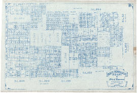
![Sheet 64 [Richmond] : Richmond south of [Granville Avenue] and No. 8 Road to New Westminster border](/uploads/r/null/3/1/c/31cd8c38faffa2f0d886e5143a64f3704e3da885ea91eac7de50e010cbd8a556/ccebc851-74f0-4b19-8495-5ffcc0a12d7b-LEG1831_142.jpg)
Sheet 64 [Richmond] : Richmond south of [Granville Avenue] and No. 8 Road to New Westminster border
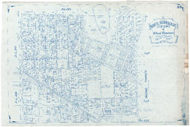
![Sheet 63 [Richmond] : No. 8 Road to Fraser River to Sea Island to [Granville Avenue]](/uploads/r/null/4/6/0/46097310b0a65d3af1e194fc80c8be804c9bd1e11056a29b4a25e8671bb21228/69ee944a-d808-4958-84c7-b350cf77d2d7-LEG1831_142.jpg)
Sheet 63 [Richmond] : No. 8 Road to Fraser River to Sea Island to [Granville Avenue]
![Sheet 62 [NW] : Brunette River to Tenth Avenue to Eighth Street to Fraser River](/uploads/r/null/8/c/0/8c00b096f6257381d8b28e6fe276a91bec30a8f112a0ac0c770cb6fc7550fb89/8a082b06-1a35-4b7d-a7d3-53c33798cd56-LEG1831_142.jpg)
Sheet 62 [NW] : Brunette River to Tenth Avenue to Eighth Street to Fraser River
![Sheet 61 [NW] : Eighth Street to [10th Avenue] to Queensborough to Fraser River](/uploads/r/null/9/b/a/9ba047f2b73538a9d1eddb7e8d5ea5d687f034574eff2ddf15493a00cf35653c/16ea2b00-2e9f-4aac-a1df-a2f0165f40ab-LEG1831_142.jpg)
Sheet 61 [NW] : Eighth Street to [10th Avenue] to Queensborough to Fraser River
![Sheet 59 [Burnaby and SW Coquitlam] : Brunett River to Burnaby Lake to [1st Street?] to Tenth Avenue](/uploads/r/null/4/5/7/4575001468a4185671851b6e02f3bd4603ba3eb657065ee4731379d82bf49f8a/8b22a519-1f78-4de2-bc8c-f1a418df5391-LEG1831_142.jpg)
Sheet 59 [Burnaby and SW Coquitlam] : Brunett River to Burnaby Lake to [1st Street?] to Tenth Avenue
![Sheet 58 [Burnaby] : First Street to [Robert Burnaby Park] to Eighteenth Street to Tenth Avenue](/uploads/r/null/6/6/0/6608ea7ff6335e1885858c781eb3d0de555e913156a9adb741e14729d577555d/06a72419-b6a7-4c88-9a57-00fec4856fef-LEG1831_142.jpg)
Sheet 58 [Burnaby] : First Street to [Robert Burnaby Park] to Eighteenth Street to Tenth Avenue
![Sheet 57 [Burnaby] : [Griffiths Drive?] to Byrne Road to New Wiggins Road to Fraser River](/uploads/r/null/2/1/0/2106d32e5955a9315c93b8840572adc53a67869629852cd56257e61d7b554b49/7c906e52-7226-43c8-96a6-097465eb9b8c-LEG1831_142.jpg)
Sheet 57 [Burnaby] : [Griffiths Drive?] to Byrne Road to New Wiggins Road to Fraser River
![Sheet 56 [Burnaby] : Canada Way to Deer Lake to [Dufferin Street to Rumble Street?]](/uploads/r/null/c/e/1/ce127e6a9b6913253ac82f9d6d157db18e884fcc848176fd65b207c15ee4e050/5109a4b1-a0ea-4a3a-8747-2dd57d752ee7-LEG1831_142.jpg)
Sheet 56 [Burnaby] : Canada Way to Deer Lake to [Dufferin Street to Rumble Street?]
![Sheet 54 [Burnaby] : Burnaby Lake to Still Creek to [Westminster Avenue to Gilpin Street]](/uploads/r/null/b/c/f/bcf238b64b0e82d038b7a297ca3e7c0d9da45f8ab622eece844dc49975f4a829/2f99abd0-5780-4ca1-b415-4cb10df3c85e-LEG1831_142.jpg)
Sheet 54 [Burnaby] : Burnaby Lake to Still Creek to [Westminster Avenue to Gilpin Street]
![Sheet 53 [Burnaby] : [Cliff Avenue?] to Francis Street to Beta Avenue to Johnstone Road](/uploads/r/null/4/4/8/448fb54643473178574cd746b60da48b9cfa0717d3a1fcf83f7f186275283178/57102446-401a-43a0-9ac0-aa51407da961-LEG1831_142.jpg)
Sheet 53 [Burnaby] : [Cliff Avenue?] to Francis Street to Beta Avenue to Johnstone Road
![Sheet 52 [Burnaby] : [Cliff Avenue?] to Burrard Inlet to Beta Avenue to [Francis Street]](/uploads/r/null/7/6/6/766074e0c7064b71ead7d0adc4e81ba4157a84eb78feb5eadf97046a67626fe6/8215258d-916e-491f-99a6-3b9640a01044-LEG1831_142.jpg)
Sheet 52 [Burnaby] : [Cliff Avenue?] to Burrard Inlet to Beta Avenue to [Francis Street]
![Sheet 50 [Burnaby] : [Antrim Road?] to Jubilee Road to Boundary Road to [Marine Way]](/uploads/r/null/b/c/f/bcfcdc3e5a34b9cb2d151f7ca97982970014d2254913bae08f91f1afdc151ae0/ac9cd205-6ea8-4e27-bd30-7143e2004b1d-LEG1831_142.jpg)
Sheet 50 [Burnaby] : [Antrim Road?] to Jubilee Road to Boundary Road to [Marine Way]
![Sheet 49 [Burnaby] : [Denbigh Avenue to Burke Street] to Boundary Road to Jubilee Street](/uploads/r/null/0/9/0/090a7af5f046e8ddc7b354737459148670d9ff4778a177007e11a0833b3ebf7e/cb71ebca-b838-499c-bd26-4542b018fa2a-LEG1831_142.jpg)
Sheet 49 [Burnaby] : [Denbigh Avenue to Burke Street] to Boundary Road to Jubilee Street
![Sheet 48 [Burnaby] : [Gamma Avenue?] to Wallace Street to Bnoundary Road to Moscrop Road](/uploads/r/null/b/2/5/b258f9afb494a760d1e8d6bc8b957c2e9f75d6510d7ac9fd940f25f9e6ca25a8/18fddce0-f135-4d3b-8fa6-01503715539b-LEG1831_142.jpg)
Sheet 48 [Burnaby] : [Gamma Avenue?] to Wallace Street to Bnoundary Road to Moscrop Road
![Sheet 47 [Burnaby] : Gamma Avenue to Pandora Street to Boundary Road to Wallace Street](/uploads/r/null/6/9/2/692cd2363e5c18e38de333bcc9baa6e1fb208d8543ebcccc18a56e2d722f6aae/a7d41f68-a56e-4143-994c-8a538cd84bae-LEG1831_142.jpg)
Sheet 47 [Burnaby] : Gamma Avenue to Pandora Street to Boundary Road to Wallace Street
![Sheet 46 [Burnaby] : [Beta Avenue] to Burrard Inlet to Boundary Road to Pandora Street](/uploads/r/null/6/4/0/640a63c92167081e5c9aa8a4400ddac3ee12d65a7fc431d7876a4d9c231ff282/285daa44-106a-4d65-962e-11c271fb8135-LEG1831_142.jpg)
Sheet 46 [Burnaby] : [Beta Avenue] to Burrard Inlet to Boundary Road to Pandora Street

Sheet 45 H.T. : Boundary Street to Burrard Inlet to Nanaimo Street to Pender Street
Sheet 44 H.T. : Boundary Road to Pender Street to Nanaimo Street to Ninth Avenue
Sheet 43 H.T. Boundary Road to Ninth Avenue to Nanaimo Street to Government Road
![Sheet 42 S.V. : Boundary Road to Government Road to [Duchess Street] to School Road](/uploads/r/null/1/9/f/19f97eb9c0c1f54c0626e037784329d1b53b8d06b7e1735915b0b85ecec96a4c/15d29110-32de-4fa6-8396-8b134a40e766-LEG1831_142.jpg)
Sheet 42 S.V. : Boundary Road to Government Road to [Duchess Street] to School Road
Sheet 41 S.V. Boundary Road to New Westminster Road to Wales Street to 46th Avenue

Sheet 40 S.V. : Boundary Road to 46th Avenue to Vivian Street to 56th Avenue

Sheet 39 S.V. Boundary Road to 56th Avenue to Victoria Road to Fraser River
Sheet 38 S.V. : Victoria Drive to Fifty-ninth Avenue to Fraser Street to Fraser River
Sheet 37 S.V. : Wales Street to Forty-third Avenue to Fraser Street to Fifty-ninth Avenue
![Sheet 36 S.V. : [Chambers Street] to Government Road to Knight Street to Forty-third Avenue](/uploads/r/null/c/8/7/c8717cec4116ee8e006673b056d7755ec1fbee4b2f57fcbf47598267a83a4b9d/82fe22d0-c322-4a08-a843-a90655c1e2a1-LEG1831_142.jpg)
Sheet 36 S.V. : [Chambers Street] to Government Road to Knight Street to Forty-third Avenue
Sheet 35 S.V. : Nanaimo Street to 15th Avenue to Knight Street to 29th Avenue

Sheet 34 S.V. : Knight Street to Twenty-fifth Avenue to Ontario Street to Fourtieth Avenue

Sheet 33 S.V. : Fraser Street to 41st Avenue to Oak Street to Page Road