
Sheet 13 : Ross Street to Twenty-ninth Avenue to Heather Street to Forty-ninth Avenue
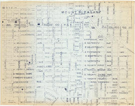
Sheet 12 : Prince Albert Street to East Seventeenth Avenue to Laurel Street to East Twenty-ninth Avenue
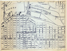
Sheet 11 : Clark Drive to Atlantic Street to Cambie Stree to East Sixteenth Avenue
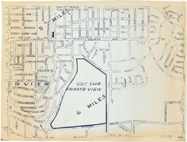
Sheet 10 : Clarendon Street to Forty-ninth Avenue to St. George Street to Fraser River

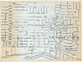
Sheet 9 : St. Margaret Street to Twenty-ninth Avenue to St. George St. to East Forty-ninth Avenue

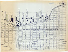
Sheet 8 : Nanaimo Street to Twelfth Avenue to St. George Street to Thirty-third Avenue

Sheet 7 : Penticton Street to East Georgia Street to Carolina Street to Twelfth Avenue
Sheet 6 : Penticton Street to Burrard Inlet to Princess Avenue to William Street
Sheet 5 : Boundary Road to Forty-ninth Avenue to Victoria Drive to Kent Avenue
Sheet 4 : Boundary Road to 24th Avenue to Victoria Drive to Forty-ninth Avenue
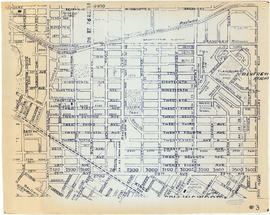
Sheet 3: Boundary Road to East Broadway to Lakewood Street to Galt Street
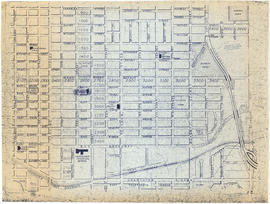
Sheet 2 : Boundary Road to Venables Street to Lakewood Street to East Fourteenth Avenue

Sheet 1 : Boundary Road to Burrard Inlet to Templeton Drive to Charles Street

City of Vancouver : west half

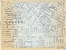
City of Vancouver : east half
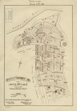
University Endowment Lands : plan of units nos. 1 and 2

University Endowment Lands : plan of units nos. 1 and 2

University Endowment Lands : plan of units no. 1 and 2

Municipality of South Vancouver

Guide map: Vancouver - New Westminster, Burnaby and North Shore municipalities

Preliminary plan of road and bulkhead for proposed diversion of airport road

Perspective of Greater Vancouver from Grouse Mountain (elevation 4000 ft.)

Plan showing Vancouver's grave and surrounding graves at Church
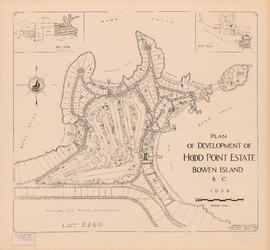
Plan of development of Hood Point Estate, Bowen Island, B.C., 1928
![Granville [Townsite], B.C. Aug., 1885](/uploads/r/null/1/a/4/1a45ddd637fe3f3726748d5096017a8461446b9a013c408ed2b1666c8433e1f9/405fdc0d-6d88-41b7-937f-36cc7f51518a-MAP553_142.jpg)
Granville [Townsite], B.C. Aug., 1885

Plan showing vicinity of Fisher Case, Nov 9th, 1949

British North America

Panoramic view of the City of Vancouver, British Columbia, 1898

Charte Von America

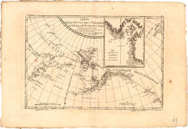
Carte de la riviere de Cook dans la partie N.O. de l'Amerique
Carte de la cote N.O. de l' Amerique et de la cote N.E. de l'Asie
![The Seechelt [Sechelt] Forest](/uploads/r/null/e/6/d/e6d1e8d1a7613c8e7ce050434f42ef80f8e00ca339edc6e23dc578f9a4154957/c9ad5fbf-94a8-4925-8b43-b0845d5bd699-MAP54_142.jpg)
The Seechelt [Sechelt] Forest

British Columbia : an historical illustrated map commemorating two centenaries, 1867-1967, 1866-1966

Lower Mainland, B.C. : land subdivision

Second Narrows crossing

Vancouver Island and Gulf of Georgia
![[Vancouver, B.C. : district lots]](/uploads/r/null/4/a/4a5c15633319c3754d3aa0cc525470bfebcf5a98ad8caeedf44b777194f300bd/2f055d65-47f7-4679-bb91-66b8f1843d2f-MAP531_142.jpg)
[Vancouver, B.C. : district lots]

North America. West Coast. Fraser River and Burrard Inlet

Queen's Reach, Jervis Inlet

British Columbia. Port Moody

Map showing location of single men receiving assistance by mail

Map showing location of single women receiving assistance by mail

Contour map showing surveyed lots, notes on vegetation and routes traveled on mountaineering expeditions

An Indian map. Vancouver

First Narrows, Burrard Inlet, B.C. showing Parthia and Burnaby shoals

Fraser River Delta, British Columbia

British Columbia railway belt

Burrard Inlet

Howe Sound and Howe Sound (southern portion)

North America. West Coast. Fraser River and Burrard Inlet