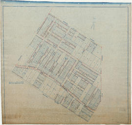
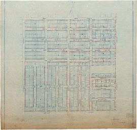
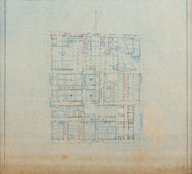
Water service map of South Vancouver : Wales Street to Churchill Street (Rupert Street) and New Westminster Road (Kingsway) to 46th Avenue (45th Avenue)
Water service map of South Vancouver : Vivian Street to Kerr Street and 56th Avenue (54th Avenue) to 67th Avenue (65th Avenue)
Water service map of South Vancouver : Vivian Street to Kerr Street and 46th Avenue (45th Avenue) to 56th Avenue (54th Avenue)
Water service map of South Vancouver : Vivian Street to Doman Street and 67th Avenue (65th Avenue) to North Arm of Fraser River
Water service map of South Vancouver : Victoria Drive to Wales Street and 35th Avenue (34th Avenue) to 46th Avenue (45th Avenue)
Water service map of South Vancouver : Victoria Drive to Vivian Street and 56th Avenue (54th Avenue) to 67th Avenue (65th Avenue)
Water service map of South Vancouver : Victoria Drive to Vivian Street and 46th Avenue (45th Avenue) to 56th Avenue (54th Avenue)
Water service map of South Vancouver : Victoria Drive to Vivan Street and 67th Avenue (65th Avenue) to North Arm of Fraser River
Water service map of South Vancouver : Victoria Drive to Slocan Street and 27th Avenue to 35th Avenue (34th Avenue)
Water service map of South Vancouver : Tyne Street to Park Street (Boundary Road) and Vanness Avenue to 46th Avenue (45th Avenue)
Water service map of South Vancouver : Tyne Street to Park Street (Boundary Road) and 56th Avenue (54th Avenue) to 67th Avenue (65th Avenue)
Water service map of South Vancouver : Tyne Street to Park Street (Boundary Road) and 46th Avenue (45th Avenue) to 56th Avenue (54th Avenue)
Water service map of South Vancouver : Slocan Street to Rupert Street and Vanness Avenue to School Road (School Avenue)
Water service map of South Vancouver : Rupert Street to Tyne Street and Vanness Avenue to School Road (School Avenue)
Water service map of South Vancouver : Point Grey boundary to Ontario Street and River Avenue (Marine Drive S.W.) to North Arm of Fraser River
Water service map of South Vancouver : Ontario Street to Fraser Street and River Avenue (Marine Drive) to North Arm of Fraser River
Water service map of South Vancouver : Ontario Street to Fraser Street and King Edward Avenue to 34th Avenue (33rd Avenue)
Water service map of South Vancouver : Ontario Street to Fraser Street and 61st Avenue (59th Avenue) to River Street (Marine Drive S.E.)
Water service map of South Vancouver : Ontario Street to Fraser Street and 51st Avenue (49th Avenue) to 61st Avenue (59th Avenue)
Water service map of South Vancouver : Ontario Street to Fraser Street and 43rd Avenue (41st Avenue) to 51st Avenue (49th Avenue)
Water service map of South Vancouver : Ontario Street to Fraser Street and 33rd Avenue to 41st Avenue
Water service map of South Vancouver : McHardy Street to Park Street (Boundary Road) and Government Street (29th Avenue) to Vanness Avenue
Water service map of South Vancouver : Knight Street to Victoria Drive and 61st Avenue (59th Avenue) to North Arm of Fraser River
Water service map of South Vancouver : Knight Street to Victoria Drive and 51st Avenue (49th Avenue) to 61st Avenue (59th Avenue)
Water service map of South Vancouver : Knight Street to Victoria Drive and 43rd Avenue (41st Avenue) to 51st Avenue (49th Avenue)
Water service map of South Vancouver : Knight Street to Victoria Drive and 34th Avenue (33rd Avenue) to 43rd Avenue (41st Avenue)
Water service map of South Vancouver : Knight Street to Victoria Drive and 22nd Avenue to 34th Ave (33rd Avenue)
Water service map of South Vancouver : Knight Street to Commercial Street and 15th Avenue (16th Avenue) to 22nd Avenue
Water service map of South Vancouver : Kerr Street to Tyne Street and 56th Avenue (54th Avenue) to 67th Avenue (65th Avenue)
Water service map of South Vancouver : Kerr Street to Tyne Street and 46th Avenue (45th Avenue) to 56th Avenue (54th Avenue)
Water service map of South Vancouver : Fraser Street to Sherbrooke Street and 43rd Avenue (41st Avenue) to 51st Avenue (49th Avenue)
Water service map of South Vancouver : Fraser Street to Knight Street and 61st Avenue (59th Avenue) to North Arm of Fraser River
Water service map of South Vancouver : Fraser Street to Knight Street and 51st Avenue (49th Avenue) to 61st Avenue (59th Avenue)
Water service map of South Vancouver : Fraser Street to Knight Street and 34th Avenue (33rd Avenue) to 43rd Avenue (41st Avenue)
Water service map of South Vancouver : Fraser Street to Knight Street and 25th Avenue to 34th Avenue (33rd Avenue)
Water service map of South Vancouver : Doman Street to Park Street (Boundary Road) and 67th Avenue (65th Avenue) to North Arm of Fraser River
Water service map of South Vancouver : Commercial Street to Nanaimo Street and Trout Lake to 27th Avenue
Water service map of South Vancouver : Churchill Street (Rupert Street) to Tyne Street and School Road (School Avenue) to 46th Avenue (45th Avenue)
Water service map of South Vancouver : Bridge Street (Cambie Street) to Main Street and 16th Avenue to 26th Avenue
Water service map of South Vancouver : Ash Street to Ontario Street and 61st Avenue (59th Avenue) to River Avenue (Marine Drive)
Water service map of South Vancouver : area bounded by Vanness Avenue, Government Street (29th Avenue), and McHardy Street
![[Water Street]](/uploads/r/null/8/1/4/814c10e6a983503d8911ebe194c5c8121d28096f5f92155f263101acf7a65b04/25036f14-97a6-45f7-85f0-e641806a1b09-CVA1095-11444_142.jpg)
![[Water Street]](/uploads/r/null/0/9/09aab3ca44ac6d555cbd25286482829eec12ba645f89938f1bc0e091fc0c85a7/6489d136-7708-4363-b554-9c309033c39e-A70152_142.jpg)

![[Water Street]](/uploads/r/null/a/1/a1e6b34203d909515b5cd2e4af46454e6b9eba02fdb0089b6ffd01f788ce2a0d/6ab019d4-c31f-49a7-a391-1c1b4b21fc15-A70145_142.jpg)
![Water St. to Cambie [St.]](/uploads/r/null/a/2/a236391199b0bac06623348f8ec846a055b41925c4cf00429a2ab00fa7737a53/0225a555-d5ae-460d-880a-a1dddc6ac241-A21913_142.jpg)
![Water St. to Abbot [from Cambie St.]](/uploads/r/null/8/1/816846fde658cd543f4ce4921769fde6a260c97108b16a8b263c47db261893a0/55f76791-f390-4984-9ff1-623eaea83a07-A21902_142.jpg)