Yale Hotel and Yale Gardens [tourist map of Vancouver]
- AM1594-: MAP 223
- Item
- [between 1936 and 1941]
Part of City of Vancouver Archives technical and cartographic drawing collection
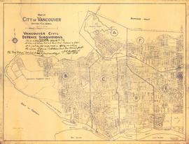
Item is a tourist brochure of Vancouver made up of a dial map with a street index. The map was designed to be folded and enclosed in the attached cover.


![Section 9 [Salisbury Drive to McGill and Wall Streets]](/uploads/r/null/2/c/a/2ca00124652bd05f6e2ba7a38be0913c343f9df3ba7b70bb934ceb836de2fa89/dd14b8fd-0710-4ff6-9a02-2a79e289941f-1972-581_142.jpg)
![Plate 6 [Carrall Street to Water Street to Abbott Street to Pender Street]](/uploads/r/null/2/9/d/29d9b87c8a0b2ec0ebe43b7a1b209cf540943a17fcdf02f7fbf229b97c9beb06/65cae868-4124-4b7f-bb47-c6364f18c039-1972-582_142.jpg)
![Plate 17 [Hamilton Street to Pender Street to Seymour Street to Georgia Street]](/uploads/r/null/d/b/0/db02a6582e4c80b48f4280307b3a1bf96e118648e3076fd16fe61c9a33d078a4/9e87cf0f-995c-4324-92af-170d1a2248d5-1972-582_142.jpg)
![Plate 19 [Hamilton Street to Georgia Stret to Seymour Street to Smithe Street]](/uploads/r/null/0/e/c/0ecea3ead6474f95320d3370c410bde1bef129fc8bcb8e54709f6f4aae7e3461/561bca07-f000-4835-ad8e-9e2bda093863-1972-582_142.jpg)
![Plate 20 [Canadian Pacific yards from Carrall to Cambie Streets]](/uploads/r/null/f/3/b/f3b975362fee829daa72ab5af0d232c1f708ace37eb7810d8d2b208654cc09de/6a8c2b21-697c-42dd-9a82-583843792237-1972-582_142.jpg)
![Plate 47 [Hornby Street to Pender Street to Thurlow Street to Georgia Street]](/uploads/r/null/0/6/8/0682899a1add7d3f6ef14e4aa250437377cc525aeea8cd8d3a1d64f81636b222/413a1cd4-4fee-46b5-b49c-96b3cd30f8ce-1972-582_142.jpg)
![Plate 50 [Broughton Street to Georgia Street to Cardero Street to Haro Street]](/uploads/r/null/3/c/e/3ce897611318249b82b6bfe65c193580dceecc9b6c7dc7dc4df4dda52f95d62d/a2a18677-a4cb-48c6-9c91-b4cfe4e24892-1972-582_142.jpg)
![Plate 57 [Bute Street to Haro Streeto to Broughton Street to Comox Street]](/uploads/r/null/b/8/0/b80af6c275a4f50383e980393c5bbb71ffac579306faacdd2f19e94537aef5d8/2b5f8d9c-f87a-46c4-a5bd-c747c3670b2b-1972-582_142.jpg)
![Plate 65 [Broughton Street to Comox Street to Cardero Street to Burnaby Street]](/uploads/r/null/e/2/0/e209dc577cce482ca7200491d48c2e215064c62f666afcd968fb767affacec39/860381c6-4d46-4fab-a34c-dc44bb7d05da-1972-582_142.jpg)
![Plate 70 [Hamilton Street to Helmcken Street to Seymour Street to Drake Street]](/uploads/r/null/1/8/d/18df5d1b1fa19f409d693219d2bbd713341ea2bfee9af2ec0129894f2bb937d4/0b5f965f-2534-4e51-808c-bf10c982b1f7-1972-582_142.jpg)
![Plate 79 [Canadian Pacific yards to Beach Avenue to Burrard Street to False Creek]](/uploads/r/null/0/d/b/0db6cb152921eb1a151cba66857c8735fd0fedc15a817296747c66d82f27c657/a98e998d-c944-4c90-866d-fd5d59533397-1972-582_142.jpg)

![Plate 101 [Alberta Street to False Creek to Bridge Street to Fifth Avenue]](/uploads/r/null/3/a/c/3ac4671c467690486217deca7d5b3609b605b6fc542b79fb134372abed97a952/1e879c50-27f7-4e55-8d48-ae8d72b27441-1974-100_142.jpg)
![Plate 102 [Front Street to False Creek to Cambie Street Bridge]](/uploads/r/null/2/3/4/23495fedf0cfd0840f946ff51151c2d620ac4381afedbd39cc496162211c108a/798a5687-2c56-4add-bf27-5adb8e27ebeb-1974-100_142.jpg)
![Plate 119 [Dock Street to Seventh Avenue to Burns Street to Tenth Avenue]](/uploads/r/null/d/7/c/d7cf9a44b79c3474cf22e547b284ddfb851d469419b4c16364c5bd62aacd6b8a/6ff5b121-a238-4b51-8586-2e9962088a05-1974-100_142.jpg)
![Plate 121 [Quebec Street to Eighth Avenue to Manitoba Street to Eleventh Avenue]](/uploads/r/null/a/f/1/af121e25c31c0cfec1192729732131e8c10fc3b73fef80730f442c4b8851d11e/1a24a04e-7d82-4800-96dd-ef72113c34a3-1974-100_142.jpg)
![Plate 122 [Scotia Street to Eighth Avenue to Quebec Street to Eleventh Avenue]](/uploads/r/null/8/8/1/881d5dea72196cae5eaf43f70c73e80c2fb405045a4bdf21ca39865bf3017c2a/f99553c0-92f4-46fe-8932-ac6c8ad65532-1974-100_142.jpg)