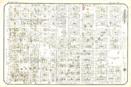
![Plate 6 [Carrall Street to Water Street to Abbott Street to Pender Street]](/uploads/r/null/2/9/d/29d9b87c8a0b2ec0ebe43b7a1b209cf540943a17fcdf02f7fbf229b97c9beb06/65cae868-4124-4b7f-bb47-c6364f18c039-1972-582_142.jpg)
Plate 6 [Carrall Street to Water Street to Abbott Street to Pender Street]
- AM1594-MAP 383-: 1972-582.05
- Item
- 1920
Part of City of Vancouver Archives technical and cartographic drawing collection
662 results with digital objects Show results with digital objects
Plate 6 [Carrall Street to Water Street to Abbott Street to Pender Street]
Part of City of Vancouver Archives technical and cartographic drawing collection
![Plate 6: Downtown [False Creek - Hastings Street - Richards Street - Georgia Street]](/uploads/r/null/d/d/b/ddbaf20b087e86cf7d4207d5d35455b0b7bf77324a6df070a9adb2a0bc587ecf/fa347988-8e1f-4026-b6f3-3901fc6f102b-MAP342a_142.jpg)
Plate 6: Downtown [False Creek - Hastings Street - Richards Street - Georgia Street]
Part of City of Vancouver Archives technical and cartographic drawing collection
Item is a map depicting an area bounded by the following streets: False Creek and Canadian Pacific Railway yards to Hastings Street West (south side only) to Richards Street (east side only) to Georgia Street (north side only).
![Plate 60 [Seymour Street to Smithe Street to Honby Street to Helmcken Street]](/uploads/r/null/7/8/a/78a3a8d6e7c29b8aec40ccaf7b114f0aa224e1e4a4499d4f189e1be81d78f87b/81df315a-bd3c-4c53-9dae-b5ec7ed40456-1972-582_142.jpg)
Plate 60 [Seymour Street to Smithe Street to Honby Street to Helmcken Street]
Part of City of Vancouver Archives technical and cartographic drawing collection
![Plate 61 [Hamilton Street to Smithe Street to Seymour Street to Helmcken Street]](/uploads/r/null/b/0/0/b009bace3394a162e6619dfa0970b61b03b6bf0b3992515ead5e5462fd22e200/188309c6-5b24-41f1-8468-04a807ba727e-1972-582_142.jpg)
Plate 61 [Hamilton Street to Smithe Street to Seymour Street to Helmcken Street]
Part of City of Vancouver Archives technical and cartographic drawing collection
![Plate 62 [Chilco Street to Burrard Inlet to Stanley Park boundary to Pendrell Street]](/uploads/r/null/f/c/b/fcb0376d9738d8c5ff62defc8484a52d81612329c2e61b2dd330894781a78564/4c60c9a5-b17b-43a3-9b79-d0a11f3b0b8c-1972-582_142.jpg)
Plate 62 [Chilco Street to Burrard Inlet to Stanley Park boundary to Pendrell Street]
Part of City of Vancouver Archives technical and cartographic drawing collection
![Plate 63 Denman Street to Comox Street to Stanley Park boundary to English Bay]](/uploads/r/null/6/9/c/69ce168db30e2419169b908adf2ebfb703b175281a691522e95f33f912e430a5/75ee95dc-33b3-4146-b0cd-144375a9b593-1972-582_142.jpg)
Plate 63 Denman Street to Comox Street to Stanley Park boundary to English Bay]
Part of City of Vancouver Archives technical and cartographic drawing collection
![Plate 64 [Cardero Street to Comox Street to Denman Street to Beach Avenue/Burnaby Street]](/uploads/r/null/a/c/d/acd75a8ee3db22c5eee70aac61d1b822c24e81e49c6ad60fb83edcb5bb790c11/b149dea3-0380-4dce-94e3-dfe7dd777d51-1972-582_142.jpg)
Plate 64 [Cardero Street to Comox Street to Denman Street to Beach Avenue/Burnaby Street]
Part of City of Vancouver Archives technical and cartographic drawing collection
![Plate 65 [Broughton Street to Comox Street to Cardero Street to Burnaby Street]](/uploads/r/null/e/2/0/e209dc577cce482ca7200491d48c2e215064c62f666afcd968fb767affacec39/860381c6-4d46-4fab-a34c-dc44bb7d05da-1972-582_142.jpg)
Plate 65 [Broughton Street to Comox Street to Cardero Street to Burnaby Street]
Part of City of Vancouver Archives technical and cartographic drawing collection
![Plate 65: Waterfront [Dunlevy Avenue - Burrard Inlet - Carrall Street - Alexander Street]](/uploads/r/null/7/2/c/72c683aaa1bbadfa6f2c4b0feda4d57c2bafa66267baf6282fef005407cde75b/41624a12-5460-4f35-9ba3-fb41fc638c6d-MAP342b_142.jpg)
Plate 65: Waterfront [Dunlevy Avenue - Burrard Inlet - Carrall Street - Alexander Street]
Part of City of Vancouver Archives technical and cartographic drawing collection
Item is a map depicting an area bounded by the following streets: Dunlevy Avenue (west side only) to Burrard Inlet to Carroll Street (east side only) to Alexander Street (north side only).
![Plate 66 [Bute Street to Comox Street to Broughton Street to Burnaby Street]](/uploads/r/null/2/2/3/223e29903c3144f4d83ac824acd2128ed2b15c2c045998f0342a6fc8058dd769/2c880230-1bc4-4138-a167-213a23ffff12-1972-582_142.jpg)
Plate 66 [Bute Street to Comox Street to Broughton Street to Burnaby Street]
Part of City of Vancouver Archives technical and cartographic drawing collection
![Plate 66: Waterfront [Hawks Avenue - Burrard Inlet - Railway/Alexander Street]](/uploads/r/null/d/c/4/dc440a03c6a086034e7dfa3a858bd234b53182da15fe4f1c1e0ded188a68deaa/c8e7ca9f-c845-4f43-9611-81770d1714e0-MAP342b_142.jpg)
Plate 66: Waterfront [Hawks Avenue - Burrard Inlet - Railway/Alexander Street]
Part of City of Vancouver Archives technical and cartographic drawing collection
Item is a map depicting an area bounded by the following streets: Hawks Avenue to Burrard Inlet to Dunlevy Avenue (east side only) to Railway Street/Alexander Street (north side only) and includes the Hastings Sawmill site.
![Plate 67: Strathcona [Dunlevy Avenue - Alexander Street - Carrall Street - Hastings Street]](/uploads/r/null/3/a/4/3a4f0595ff7c092f1ced15b4213d2fc08f47d3104a5e47b91741ef97f5eb23d5/6d3c8451-8460-489a-9551-c1709a3512da-MAP342b_142.jpg)
Plate 67: Strathcona [Dunlevy Avenue - Alexander Street - Carrall Street - Hastings Street]
Part of City of Vancouver Archives technical and cartographic drawing collection
Item is a map depicting an area bounded by the following streets: Dunlevy Avenue (west side only) to Alexander Street (south side only) to Carrall Street (east side only) to Hastings Street East (north side only).
![Plate 67 [Thurlow Street to Comox Street to Bute Street to Burnaby Street]](/uploads/r/null/9/e/6/9e61fbe5d4986742d82a6ce8b0046071a3cf90de1f96596cff7a9016bb5d0f61/54d9f7af-07dd-440f-bf88-47b7f80ea6dc-1972-582_142.jpg)
Plate 67 [Thurlow Street to Comox Street to Bute Street to Burnaby Street]
Part of City of Vancouver Archives technical and cartographic drawing collection
![Plate 68 [Hornby Street to Comox Street to Thurlow Street to Burnaby/Drake Streets]](/uploads/r/null/f/7/d/f7d9cd7561677ed01fa8e61e44f639546cb77d34d3ac06a4c35321f5bf60b671/00b69160-8d7f-4ca0-9ff7-438c2bb63517-1972-582_142.jpg)
Plate 68 [Hornby Street to Comox Street to Thurlow Street to Burnaby/Drake Streets]
Part of City of Vancouver Archives technical and cartographic drawing collection

Part of City of Vancouver Archives technical and cartographic drawing collection
Item is a map depicting an area bounded by the following streets: Campbell Avenue (west side only) to Burrard Inlet/Railway Street (south side only) to Dunlevy Avenue (east side only) to Hastings Street East (north side only).
![Plate 69 [Seymour Street to Helmcken Street to Hornby Street to Drake Street]](/uploads/r/null/3/7/3/37330eff1ce4aa559e86f0d5f0748a4c7ffcf627fc680de72302ebf9a5cb9df4/e0f35d9e-e540-40fb-a87d-026debb71dec-1972-582_142.jpg)
Plate 69 [Seymour Street to Helmcken Street to Hornby Street to Drake Street]
Part of City of Vancouver Archives technical and cartographic drawing collection
![Plate 69: Strathcona [Dunlevy Avenue - Hastings Street - Carrall Street - Union Street]](/uploads/r/null/f/f/c/ffcf222a9bf6fab0cd3ea82b3420fc4f37bad16058188497178263918754c7b8/33c1a3bf-91b9-40b2-ad5f-4fd60ba6befe-MAP342b_142.jpg)
Plate 69: Strathcona [Dunlevy Avenue - Hastings Street - Carrall Street - Union Street]
Part of City of Vancouver Archives technical and cartographic drawing collection
Item is a map depicting an area bounded by the following streets: Dunlevy Avenue (west side only) to Hastings Street East (south side only) to Carrall Street (east side only) to Union Street (north side only).
![Plate 7 [Main Street to Powell Street to Columbia Street to Pender Street]](/uploads/r/null/d/f/b/dfb6afa705be957fb1edcc4db4eebed9e70de2f7da4428a558a100303c04c15c/49c15b71-8829-4feb-b5c6-1643c02b3907-1972-582_142.jpg)
Plate 7 [Main Street to Powell Street to Columbia Street to Pender Street]
Part of City of Vancouver Archives technical and cartographic drawing collection
![Plate 7: West End [Cardero Street - Burrard Inlet - Coal Harbour/Park Road - Barclay Street]](/uploads/r/null/7/c/9/7c9620050dee0e734bfff1e37ce6e2e0affd0b3c0b799447714657aae517ae79/4b20302f-dc29-4512-858d-5524b7a4467f-MAP342a_142.jpg)
Plate 7: West End [Cardero Street - Burrard Inlet - Coal Harbour/Park Road - Barclay Street]
Part of City of Vancouver Archives technical and cartographic drawing collection
Item is a map depicting an area bounded by the following streets: Cardero Street (west side only) to Burrard Inlet to Coal Harbour/Park Road to Barclay Street (north side only).
![Plate 70 [Hamilton Street to Helmcken Street to Seymour Street to Drake Street]](/uploads/r/null/1/8/d/18df5d1b1fa19f409d693219d2bbd713341ea2bfee9af2ec0129894f2bb937d4/0b5f965f-2534-4e51-808c-bf10c982b1f7-1972-582_142.jpg)
Plate 70 [Hamilton Street to Helmcken Street to Seymour Street to Drake Street]
Part of City of Vancouver Archives technical and cartographic drawing collection
![Plate 70: Strathcona [Campbell Avenue - Hastings Street - Dunlevy Avenue - Prior Street]](/uploads/r/null/5/4/f/54fc6e91468353cb73652e34fc1b1e286183d4d266c40bc79156ecaab5c80535/2390323a-0ecb-429d-b48e-2b81d77e6e97-MAP342b_142.jpg)
Plate 70: Strathcona [Campbell Avenue - Hastings Street - Dunlevy Avenue - Prior Street]
Part of City of Vancouver Archives technical and cartographic drawing collection
Item is a map depicting an area bounded by the following streets: Campbell Avenue (west side only) to Hastings Street East (south side only) to Dunlevy Avenue (east side only) to Prior Street (north side only).
![Plate 71 [Canadian Pacific yards between False Creek and Mainland]](/uploads/r/null/e/a/5/ea54b234ef8ac9aac5e3c4b1fb1e4faabeda6dffb6f25fbfc5e7c1e7c4f8216f/1823de1f-abb5-4c9d-8453-fa6979933294-1972-582_142.jpg)
Plate 71 [Canadian Pacific yards between False Creek and Mainland]
Part of City of Vancouver Archives technical and cartographic drawing collection
![Plate 71: Strathcona [Dunlevy Avenue - Union Street - Carrall Street - False Creek]](/uploads/r/null/e/1/e/e1e17b6dd864399589334e3cc02e10b91e6045bf2502827ccbc1351fad878138/51e520fa-a92e-4a2a-988e-d39c94fd5b79-MAP342b_142.jpg)
Plate 71: Strathcona [Dunlevy Avenue - Union Street - Carrall Street - False Creek]
Part of City of Vancouver Archives technical and cartographic drawing collection
Item is a map depicting an area bounded by the following streets: Dunlevy Avenue (west side only) to Union Street (south side only) to the Royal Planing Mill at the foot of Carrall Street to False Creek. The map also includes the northern portion of the Main Street Bridge.
![Plate 72: Strathcona [Campbell Avenue - Prior Street - Dunlevy Avenue - False Creek]](/uploads/r/null/c/b/4/cb4fc6524bab520526ae25b539a4492607c4b2b8709fba844ea4c346b1d5a118/fa52c6ea-db12-4672-9d11-adbb454b48b6-MAP342b_142.jpg)
Plate 72: Strathcona [Campbell Avenue - Prior Street - Dunlevy Avenue - False Creek]
Part of City of Vancouver Archives technical and cartographic drawing collection
Item is a map depicting an area bounded by the following streets: Campbell Avenue (west side only) to Prior Street (sorth side only) to Dunlevy Avenue (east side only) to False Creek.
![Plate 72 [western portion of Beach Avenue]](/uploads/r/null/f/8/7/f87b18d10c1e70a78c4233b6cd2f014445fa13625e7854b728543a93ad9d0ce4/df6e3687-c48e-46ce-9407-344203d4b928-1972-582_142.jpg)
Plate 72 [western portion of Beach Avenue]
Part of City of Vancouver Archives technical and cartographic drawing collection
Part is a map sheet that contains two portions of the map: the first shows the area bounded by Cardero Street, Burnaby Street, and Beach Avenue. The second shows the structures south of Beach Avenue between Thurlow and Burrard Streets.
![Plate 73 [Broughton Street to Burnaby Street to Cardero Street to English Bay]](/uploads/r/null/d/4/d/d4d8344fb9fe03f24afb63b7902e1dc6b26c8aee04e7f37f3fa54e97373668ca/09d385e8-fefb-4816-8f4b-9b7cd544a65d-1972-582_142.jpg)
Plate 73 [Broughton Street to Burnaby Street to Cardero Street to English Bay]
Part of City of Vancouver Archives technical and cartographic drawing collection
![Plate 73: Grandview-Woodland [Clark Drive - Powell Street - Campbell Avenue - Keefer Street]](/uploads/r/null/5/0/7/507ddc3ef1aa399c73ca84e2b690640648ab01981fd50179861686e37317e9af/f1b0ab6a-3f8b-40a9-a9a6-b38cc96fe19b-MAP342b_142.jpg)
Plate 73: Grandview-Woodland [Clark Drive - Powell Street - Campbell Avenue - Keefer Street]
Part of City of Vancouver Archives technical and cartographic drawing collection
Item is a map depicting an area bounded by the following streets: Clark Drive (including 2/3 block immediately east) to Powell Street (south side only) to Campbell Avenue (east side only) to Keefer Street (north side only).
![Plate 74 [Bute Street to Burnaby Street to Broughton Street to English Bay]](/uploads/r/null/f/5/a/f5a676b2dbb5bd50aea3d8da4a8b6063dd0432ae34eab9bac9b63e229bc1c6c1/3a4811f6-9929-4b7e-8c1a-00b514e14dd0-1972-582_142.jpg)
Plate 74 [Bute Street to Burnaby Street to Broughton Street to English Bay]
Part of City of Vancouver Archives technical and cartographic drawing collection
![Plate 74: Grandview-Woodland [Victoria Drive - Pandora/Powell Street - McLean Drive - Harris Street]](/uploads/r/null/9/b/f/9bf7d9dc18befbdc73cfd7479296a7ab28bdf8f275f895820c265c8b5a89e603/a05665d0-5bba-4db1-8d9d-88f66da031b5-MAP342b_142.jpg)
Plate 74: Grandview-Woodland [Victoria Drive - Pandora/Powell Street - McLean Drive - Harris Street]
Part of City of Vancouver Archives technical and cartographic drawing collection
Item is a map depicting an area bounded by the following streets: Victoria Drive (west side only) to Pandora Street/Powell Street (south side only) to McLean Drive (including 2/3 block immediately west) to Harris Street (now Georgia Street) (north side only).
![Plate 75: Grandview-Woodland [Odlum Drive - Keefer Street - Campbell Avenue - Napier Street]](/uploads/r/null/d/d/f/ddf99a27b6bc1077ec66de8758edf2a9f41a7388e6184e8c9e82ef5d4cf9fd57/88852658-c386-40f2-a197-0595adac3e51-MAP342b_142.jpg)
Plate 75: Grandview-Woodland [Odlum Drive - Keefer Street - Campbell Avenue - Napier Street]
Part of City of Vancouver Archives technical and cartographic drawing collection
Item is a map depicting an area bounded by the following streets: Odlum Drive (west side only) to Keefer Street (now Frances Street) (south side only) to Campbell Avenue (east side only) to Napier Street (north side only).
![Plate 75 [Thurlow Street to Burnaby Street to Bute Street to False Creek]](/uploads/r/null/4/b/3/4b384cf689e0b4df8b172cc49ab4e4ece27aa86ac06485fa0a1a2561a10904cd/15596025-5e83-4f1c-9d78-cc0f7a05832f-1972-582_142.jpg)
Plate 75 [Thurlow Street to Burnaby Street to Bute Street to False Creek]
Part of City of Vancouver Archives technical and cartographic drawing collection
![Plate 76: Grandview-Woodland [Victoria Drive - Harris Street - Odlum Drive - Napier Street]](/uploads/r/null/5/7/c/57cb5e6b3d6a49f1703b9bfa23a10a57d04340bd679ee49ff65063df4c9435e5/a830b1e4-f967-48ec-ba67-16623a04bc69-MAP342b_142.jpg)
Plate 76: Grandview-Woodland [Victoria Drive - Harris Street - Odlum Drive - Napier Street]
Part of City of Vancouver Archives technical and cartographic drawing collection
Item is a map depicting an area bounded by the following streets: Victoria Drive (west side only) to Harris Street (now Georgia Street) (sorth side only) to Odlum Drive (east side only) to Napier Street (north side only).
![Plate 76 [Hornby Street to Burnaby/Drake Streets to Thurlow Street to Beach Avenue]](/uploads/r/null/7/8/2/78299212149d18634009b8f3c6d52450dceb47a2edec212c0f3d07f0e65dd5ad/17a1b420-b0c5-47fe-b4b8-27fe165e9ebf-1972-582_142.jpg)
Plate 76 [Hornby Street to Burnaby/Drake Streets to Thurlow Street to Beach Avenue]
Part of City of Vancouver Archives technical and cartographic drawing collection
![Plate 77: Grandview-Woodland [Victoria Drive - Burrard Inlet - Hawks Avenue - Powell/Pandora Street]](/uploads/r/null/f/b/9/fb91bc9dfc59ea435e57cf3d9999d29b49bed5605a2da9ef6dd4be1a84724e7c/bcf34a8c-a432-45d4-b8df-20f4420ee3bf-MAP342b_142.jpg)
Plate 77: Grandview-Woodland [Victoria Drive - Burrard Inlet - Hawks Avenue - Powell/Pandora Street]
Part of City of Vancouver Archives technical and cartographic drawing collection
Item is a map depicting an area bounded by the following streets: Victoria Drive (west side only) to Burrard Inlet to Hawks Avenue to Powell Street/Pandora Street (north side only).
![Plate 77 [Seymour Street to Drake Street to Hornby Street to Beach Avenue]](/uploads/r/null/1/e/2/1e2f280818ba9c268a0c3eb37f6c26a3d4e98c44809eaf72f0aa04233923a609/998d7dea-3511-482f-a646-6f87ea4550cd-1972-582_142.jpg)
Plate 77 [Seymour Street to Drake Street to Hornby Street to Beach Avenue]
Part of City of Vancouver Archives technical and cartographic drawing collection
![Plate 78 Canadian Pacific yards to Drake Street to Seymour Street to False Creek]](/uploads/r/null/8/1/c/81c7bdb672f0865def3028cba44861754379b4aa98b7dccf45208a5c0e846567/647f56a7-45c0-47e2-b351-acff47aac926-1972-582_142.jpg)
Plate 78 Canadian Pacific yards to Drake Street to Seymour Street to False Creek]
Part of City of Vancouver Archives technical and cartographic drawing collection
![Plate 78: Hastings-Sunrise [Renfrew Street - Burrard Inlet - Victoria Drive - Pandora Street]](/uploads/r/null/9/9/f/99f6e1ddf2cecabca417b5254b0a6cee1345be12a39fd8519f6eac05a2e99189/4e3bce45-60da-4a4b-967f-6308c5364dad-MAP342b_142.jpg)
Plate 78: Hastings-Sunrise [Renfrew Street - Burrard Inlet - Victoria Drive - Pandora Street]
Part of City of Vancouver Archives technical and cartographic drawing collection
Item is a map depicting an area bounded by the following streets: Renfrew Street (west side only) to Burrard Inlet to Victoria Drive (east side only) to Pandora Street (north side only).
![Plate 79 [Canadian Pacific yards to Beach Avenue to Burrard Street to False Creek]](/uploads/r/null/0/d/b/0db6cb152921eb1a151cba66857c8735fd0fedc15a817296747c66d82f27c657/a98e998d-c944-4c90-866d-fd5d59533397-1972-582_142.jpg)
Plate 79 [Canadian Pacific yards to Beach Avenue to Burrard Street to False Creek]
Part of City of Vancouver Archives technical and cartographic drawing collection
![Plate 79: Hastings-Sunrise [Boundary Road - Burrard Inlet - Renfrew Street - Pandora Street]](/uploads/r/null/4/4/5/4451afb6b7f7a82aa576e178f0b4a0513cebed2634ee040a086bfe8567cd026f/dd485ae3-a405-4ce1-b3d3-f919cedeabbb-MAP342b_142.jpg)
Plate 79: Hastings-Sunrise [Boundary Road - Burrard Inlet - Renfrew Street - Pandora Street]
Part of City of Vancouver Archives technical and cartographic drawing collection
Item is a map depicting an area bounded by the following streets: Boundary Road (west side only) to Burrard Inlet to Renfrew Street (east side only) to Pandora Street (north side only).
![Plate 8: West End [Cardero Street - Barclay Street - Park Road - Beach Avenue - Davie Street]](/uploads/r/null/6/d/6/6d680461017be540974f2eb8ba9641e6ea703be5860e413e63fdfe34f65ceead/e073c970-9088-45fe-8202-64066fbe2941-MAP342a_142.jpg)
Plate 8: West End [Cardero Street - Barclay Street - Park Road - Beach Avenue - Davie Street]
Part of City of Vancouver Archives technical and cartographic drawing collection
Item is a map depicting an area bounded by the following streets: Cardero Street (west side only) to Barclay Street (south side only) to Park Road to Beach Avenue to Davie Street (north side only).
![Plate 80 [Beatty Street to Georgia Street to Hamilton Street to Smithe Street]](/uploads/r/null/d/a/e/daee4ac4066a4e662fb048df52afe5dfc7adc6341a7c055973e46ba1453f8330/505c63b5-b54a-4d4f-bfa1-bce3b08a1f61-1972-582_142.jpg)
Plate 80 [Beatty Street to Georgia Street to Hamilton Street to Smithe Street]
Part of City of Vancouver Archives technical and cartographic drawing collection
Part of City of Vancouver Archives technical and cartographic drawing collection
Item is a map depicting an area bounded by the following streets: Renfrew Street (west side only) to Pandora Street (south side only) to Victoria Drive (east side only) to Charles Street (north side only).

Part of City of Vancouver Archives technical and cartographic drawing collection
![Plate 81: Hastings-Sunrise [Boundary Road - Pandora Street - Renfrew Street - Charles Street]](/uploads/r/null/f/0/7/f0744e15b129af8c3bd85a13d0377d637ca1c690e1ef2d8e6b7ae927a13c2e59/dd42b0ee-e0b0-423d-9012-7a40983757c0-MAP342b_142.jpg)
Plate 81: Hastings-Sunrise [Boundary Road - Pandora Street - Renfrew Street - Charles Street]
Part of City of Vancouver Archives technical and cartographic drawing collection
Item is a map depicting an area bounded by the following streets: Boundary Road (west side only) to Pandora Street (south side only) to Renfrew Street (east side only) to Charles Street (north side only).
![Plate 82: Mount Pleasant [Dock Street - False Creek - Ontario Street - Seventh Avenue]](/uploads/r/null/e/2/c/e2ca78f0ad54b1673d803cc4214dc77cee7e8aa213b4b29122939cdd499a9d80/e7417c55-5853-4c23-8b74-231793238e52-MAP342b_142.jpg)
Plate 82: Mount Pleasant [Dock Street - False Creek - Ontario Street - Seventh Avenue]
Part of City of Vancouver Archives technical and cartographic drawing collection
Item is a map depicting an area bounded by the following streets: the north end of Dock Street (now Windsor Street) (west side only) to False Creek to Ontario Street (east side only) to Seventh Avenue East (north side only).
![Plate 83: Grandview [Victoria Drive - Napier Street - False Creek - Fifth/Railway Avenue]](/uploads/r/null/b/9/8/b984a16dfedce4e626b39b698f5ff463c2901701cd1206d544afb60a287a919e/8ae46749-909a-44eb-bf3f-b1368761a6c3-MAP342b_142.jpg)
Plate 83: Grandview [Victoria Drive - Napier Street - False Creek - Fifth/Railway Avenue]
Part of City of Vancouver Archives technical and cartographic drawing collection
Item is a map depicting an area bounded by the following streets: Victoria Drive (west side only) to Napier Street (south side only) to False Creek to Fifth Avenue East/Railway Avenue (north side only).

Part of City of Vancouver Archives technical and cartographic drawing collection
Item is a map depicting an area bounded by the following streets: Renfrew Street (west side only) to Charles Street (north side only east of Nanaimo Street) to Victoria Drive (east side only) to Sixth Avenue East/Fifth Avenue East (north side only).
![Plate 85: Hastings-Sunrise [Boundary Road - Charles Street - Renfrew Street - Fifth Avenue]](/uploads/r/null/6/5/f/65f35b87dbff15ab0318d6f4aeaf673280f91790049238b06f2142733e611db3/f7918249-9c95-4c25-9d8c-06dec128faaf-MAP342b_142.jpg)
Plate 85: Hastings-Sunrise [Boundary Road - Charles Street - Renfrew Street - Fifth Avenue]
Part of City of Vancouver Archives technical and cartographic drawing collection
Item is a map depicting an area bounded by the following streets: Boundary Road (west side only) to Charles Street (south side only) to Renfrew Street (east side only) to Fifth Avenue Wast (north side only).

Part of City of Vancouver Archives technical and cartographic drawing collection
Item is a map depicting an area bounded by the following streets: Dock Street (now Windsor Street) (west side only) to Seventh Avenue East (south side only) to Ontario Street (east side only) to Sixteenth Avenue East/Fifteenth Avenue East (north side only)..
![Plate 87: Grandview [Victoria Drive - Fifth Avenue - Dock Street - Fifteenth Avenue]](/uploads/r/null/5/5/0/55042b95791267381179dcdde25a7b0f524d55257348c5b277741914b0c26fcb/84a77027-93c3-4f6e-8289-62cacb6d67cd-MAP342b_142.jpg)
Plate 87: Grandview [Victoria Drive - Fifth Avenue - Dock Street - Fifteenth Avenue]
Part of City of Vancouver Archives technical and cartographic drawing collection
Item is a map depicting an area bounded by the following streets: Victoria Drive (west side only) to Fifth Avenue East (south side only) to Dock Street (now Windsor Street) (east side only) to Fifteenth Avenue East (north side only).