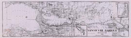
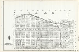
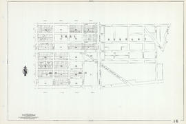
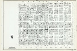
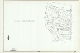
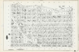
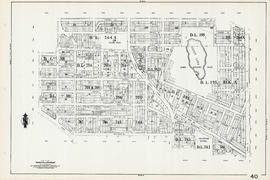
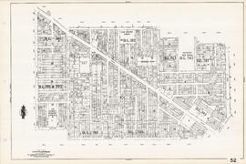
Print preview Close

Showing 1505 results

Archival description
City of Vancouver Archives technical and cartographic drawing collection Item
Print preview View:

1194 results with digital objects Show results with digital objects

Sheet 27 : University Endowment Lands and Drummond Drive to Camosun Street and Fourteenth Avenue to Fourth Avenue

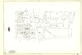
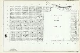
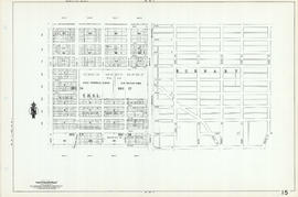
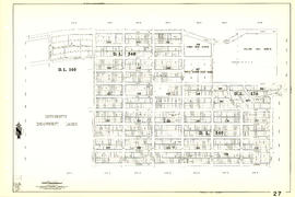
Item is a section showing the area from the University Endowment Lands and Drummond Drive to Camosun Street and Fourteenth Avenue to Fourth Avenue. Includes streets, blocks, lots and legal descriptions, and the locations of parks and schools.

Vancouver (B.C.). Engineering Services

Greater Vancouver target area. Civil defence survival instructions

Item is a pamphlet with instructions for evacuation of the city in case of nuclear attack. The text explains the effects a 5 megaton nuclear bomb explosion would have on the city and population. Instructions are given both for people who choose to stay in the Vancouver area and for people who choose to evacuate if a nuclear attack is anticipated. The verso of the pamphlet contains text and a map titled "Dispersal Routes for the Vancouver Zone".

Vancouver, British Columbia

Item is a topographical map showing lands alienated or covered by application under the Land Act, timber leases, native reserves, government reserves, and various boundaries, as well as campsites, picnic sites, forest service lookouts, post offices, settlements, schools, hospitals, mines, dykes, historic monuments, roads, trails, railways, power lines, phone lines, air harbour or seaplane anchorages, etc. Sheet contains an index map showing adjoining maps in the series.

Sheet 14 : Cassiar Street to Boundary Road and Pender Street to Eton Street

Item is a section showing the area from Cassiar Street to Boundary Road and Pender Street to Kitchener Street. Includes streets, blocks, lots and legal descriptions, and the locations of parks and retirement homes. Also shown are streets and blocks in the area from Boundary Road to Carleton Avenue in Burnaby.

Vancouver (B.C.). Engineering Services

Sheet 35 : Rupert Street to Ardley Avenue and Grandview Highway to Fifth Avenue

Item is a section showing the area from Rupert Street to Boundary Road and Grandview Highway to Fifth Avenue. Includes streets, blocks, lots and legal descriptions, and the locations of schools and railways. Also included are streets, blocks and railways in the area from Boundary Road to Ardley Avenue in Burnaby.

Vancouver (B.C.). Engineering Services

Vancouver, British Columbia

Item is a map showing New Westminster Land District, including lands alienated or covered by application under the Land Act; surveyed timber leases, licences, or berths; Indian reserves; Government reserves; provincial forest boundaries; tree farm licences; municipality boundaries; and park boundaries. Includes a key plan of maps published in the same publisher's series and a reliability diagram noting data sources.

Results 301 to 350 of 1505