![[Men's foot race]](/uploads/r/null/a/6/0/a60c7445934bf4547f879c4845f186f829a1060178d0ff0346324332c14d6c43/30b11f4f-608d-4941-87f6-2f89ac5803ac-CVA374-425_142.jpg)
- AM75-S1-: CVA 374-425
- Item
- [ca. 1920]
684 results with digital objects Show results with digital objects
![[Men's foot race]](/uploads/r/null/a/8/6/a86b2dadb8c81474c17a9d5eb03c93c7e3788a5c09aebc4dbdbc8a5f27c3939d/97c64de8-7087-4f8a-b845-a13695e2f822-CVA374-426_142.jpg)
![[Military Band parades at Deep Bay dock with "Lady Alexandra" in background]](/uploads/r/null/6/2/8/628a0f594543c69dc9bda80b8fdb5c3cf6d2fc5a4c9a361e7a5d58eff7aaba4a/79505a94-e6b8-4e50-9804-37e24c55af95-CVA374-322_142.jpg)
[Military Band parades at Deep Bay dock with "Lady Alexandra" in background]

[Miss Margaret Brain of Prince Rupert (Miss P.N.E. 1948) poses with life-ring aboard S.S. "Catala"]

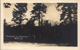
Moonlight on "Mount Melikan," Stuie, B.C.

Mount Gardner Park, Bowen Island, B.C.

Mount Strachan Lodge, Bowen Island, B.C.

Mountain scenery on Pacific Great Eastern Railway near Squamish, B.C.

![[Mr.] Hargreaves](/uploads/r/null/1/1/3/11303e964e42c6b0b8d24ac205d3e32dd9b9a8233d6812c2326b3217b8041c7c/25f962f5-8305-490d-bd3e-4fa1d2fe7c70-CVA374-289_142.jpg)
Head and shoulders portrait
![[Mr. R.M. Logan, Superintendent Engineer, at launching of S.S. "Chilkoot" (II)]](/uploads/r/null/6/3/a/63abd658b1fd682e8acd21da28cbe0965ad55fbebcfd4e004b8a3c2a7d927864/e5e95cdb-6e12-4202-9905-80d1e82533d2-CVA374-43_142.jpg)
[Mr. R.M. Logan, Superintendent Engineer, at launching of S.S. "Chilkoot" (II)]
Photograph shows the propeller
![[Mr. Rushton]](/uploads/r/null/0/4/3/04387530f56c7061e9525a9032b4bb6c97109221cbe6a5eb6d0d98195f14f4d1/5021128c-19bf-4311-8b97-4d8f27c8d75e-CVA374-284_142.jpg)
Head and shoulders portait

![[Mrs. Gordon Farrell, wife of President, at launch of S.S. "Chilkoot" (II)]](/uploads/r/null/c/7/9/c79b13a3c0c870e63e00258b2dd716e25450c5f3b4a1633f4482528d06912f76/67985905-ba2f-4a17-80af-8364b52110f0-CVA374-47_142.jpg)
[Mrs. Gordon Farrell, wife of President, at launch of S.S. "Chilkoot" (II)]
Photograph shows a small catapult with a bottle to christen the ship
![[M.S. "Bowen" (Howe Sound Ferries Ltd.)]](/uploads/r/null/e/f/8/ef8d96dbf32e4b9784ef30aef0c823b46339a211846be90cb0ef6b6219bc5fa4/fd19ff98-99d5-45a8-84b1-a8e65e5e75e5-CVA374-130_142.jpg)
[M.S. "Bowen" (Howe Sound Ferries Ltd.)]
![[M.S. "Bowen" (Howe Sound Ferries Ltd.)]](/uploads/r/null/1/0/b/10b71bf548a0fb30c56f231e6e537bd20b6a5818a1ac3f1ea4793e26b21b15a1/19177949-af09-4453-8ab8-f3b44e17a26c-CVA374-129_142.jpg)
[M.S. "Bowen" (Howe Sound Ferries Ltd.)]
![[M.V. "Bowen" (Howe Sound Ferries Ltd.) approaching dock at Whytecliff]](/uploads/r/null/8/0/6/806602210291beb29ffc7d01ac6706efb65d7a2855de92c6d9457d166e7d6876/7878e904-8c2f-4de3-9979-5bd7ef18fd5e-CVA374-128_142.jpg)
[M.V. "Bowen" (Howe Sound Ferries Ltd.) approaching dock at Whytecliff]
![[M.V. "Comox" (II) approaching Whytecliff]](/uploads/r/null/7/9/3/793dc4d3702d6cb44265bf143759966e7f2ff1b9e5e66fad7a2ba4fa2739b254/728d706e-bc2d-49ac-a23b-956b26358752-CVA374-61_142.jpg)
[M.V. "Comox" (II) approaching Whytecliff]
![[M.V. "Island King" at dock]](/uploads/r/null/4/2/3/423deeee3cd75683b988325e5d05470ae79fc4296b639cf68e8e386ea446ddff/b823c1b6-dc6f-4b0f-a1f2-6dce00c7441e-CVA374-59_142.jpg)
![[M.V. "Lady Rose"]](/uploads/r/null/7/a/2/7a2b3ef88aebda3a091b707c1594d50174e1813645ba8d028723dda752c09d77/745b2527-3bfb-4e36-a647-fba658ebc4dd-CVA374-117_142.jpg)
![[M.V. "Lady Rose"]](/uploads/r/null/6/d/a/6daf0450ba3a1773d759562cae01e81799edd99439b7afcd7c19662ed086e10c/4c65eb42-bd9e-45b9-bbe9-e7f1a30b6d02-CVA374-118_142.jpg)
![[M.V. "Lady Rose" at Snug Cove wharf]](/uploads/r/null/e/1/9/e19b48d38dc8cc076e92018a10cd426e2ea60ef88a1e28e750fb0e0268c193b5/b0105362-dada-491c-8b6a-5335cb3644f5-CVA374-353_142.jpg)
[M.V. "Lady Rose" at Snug Cove wharf]


![[Native woman drying seaweed]](/uploads/r/null/d/2/f/d2f953ce074036b4575438ebd489812fa959585bb9c10cdbb170c1cf4782dbe3/12dd0098-8ea4-4b60-afd7-38c8c96b364f-CVA374-216_142.jpg)
Item is a photograph showing an Indigenous woman drying seaweed. The caption "Indian Squaw" is written on the back of the print.


![New Clubhouse [at Bowen Island Resort]](/uploads/r/null/5/8/2/58260d0e9720b259199e15517e9c473594a46b6fc37893220d68fd6968d5259d/9e84046c-6443-40aa-9e33-468af7d3b967-CVA374-352_142.jpg)
New Clubhouse [at Bowen Island Resort]
![New Clubhouse [foundation under construction at Bowen Island Resort]](/uploads/r/null/0/7/6/076d2280584581981268a9bad171d7626c2b956250b7197b20a20025f52aee1b/e2e7100d-5b1d-4bc8-a897-cabc37c40e01-CVA374-349_142.jpg)
New Clubhouse [foundation under construction at Bowen Island Resort]
![New Clubhouse [under construction at Bowen Island Resort]](/uploads/r/null/a/4/7/a474a29cb4e97592bd0c941b972359657004365c0e231d0b247a83692403ced9/543a35ba-ee76-4e55-81fe-f436775df0f7-CVA374-351_142.jpg)
New Clubhouse [under construction at Bowen Island Resort]
![New Clubhouse [under construction at Bowen Island Resort]](/uploads/r/null/c/7/7/c779e71053fdbc182a91f4e11e3cf5457a41bf3ad8e5888969d25008d3ad3eb1/23773a58-066b-484e-89f3-fdcbaa2d2506-CVA374-350_142.jpg)
New Clubhouse [under construction at Bowen Island Resort]
Newspaper advertisements 1946-1948
Newspaper advertisements 1948-1950
Newspaper advertisements 1948-1951
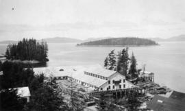
![Nimpkish Lumber Co. of Englewood [B.C.]](/uploads/r/null/c/b/2/cb2fe578a87f402430db1c27da14c7be2b4626b37d5cb3b3750ef0d181cb587b/9ccc9979-8ea3-4b85-88d3-ae4139aaf2ba-AM75P-84_142.jpg)
Nimpkish Lumber Co. of Englewood [B.C.]

No. 1 Picnic Grounds, Bowen Island, B.C.

Northerly portion Vancouver Island
Item is a map of northern Vancouver Island and the adjacent British Columbia coast showing Crown and reserve lands, timber leases, district, park, and provincial forest boundaries, cities, municipalities, villages, post offices, hospitals, roads, railways, seaplane ports and anchorages, airports, elevations of some geographical features, and marine distances in nautical miles.

Item is a copy of a British Columbia Department of Lands map of British Columbia north of the 55th parallel. Map shows cities and towns, smaller settlements, post offices, railways, roadways, trading posts, ferries, hospitals, telegraph lines, government agents' offices, mining and sub-mining recording offices, hatcheries, falls and rapids, drainage flow, and park, provincial, and international boundaries. An inset map shows the far northwest area not shown on the primary map.
![[Northland Navigation Co. Ltd. Vessel "Alaska Prince" at Northland Dock]](/uploads/r/null/e/a/9/ea9d648f923cb3febe5ad77b5fc1cb268e5d4e90bca9aa106a58b582db69360d/a701f6e5-5035-4d96-a00e-c55822927c43-CVA374-142_142.jpg)
[Northland Navigation Co. Ltd. Vessel "Alaska Prince" at Northland Dock]

Observation Room T.S.S. "Cardena"
Photograph shows wicker chairs


[On board S.S. "Comox" for preview run of new service from Whytecliffe Park to Bowen Island]
photograph shows James S. Eckman and others