![[Panoramic view of downtown, Vancouver from Granville and Hastings Streets]](/uploads/r/null/2/1/6/216cf899114250d1b31f38600b649f3b49bbd0c5882c6b5a6a9519d124d69cd5/addbb40b-0fc9-430e-8ebb-76d531606378-PANP92_142.jpg)
[Panoramic view of downtown, Vancouver from Granville and Hastings Streets]
- AM54-S4-: PAN P92.2
- Item
- [ca. 1909]
Part of Major Matthews collection
Photograph is almost a 360 degree view. Buildings and some landmarks are identified in ink on print. This is a cropped version of PAN P92.1.
Written on the back of the print in what appears to be Major J.S. Matthews writing:
"Building permits issued.
Court House, superstructure, 7 Dec 1907 (addition, 30/3/1912)
excavation, 8 Mar 1907
Dominion Trust 21 Apr 1908
Carter-Cotton Bldg (Province Bldg) 5 Oct 1908 (addition Pender St 14/11/10)
Street cars and vehicles:- left hand rule of the road until 1921.
Have not investigated but this looks July or August 1908 or perhaps July-Aug 1909"
![[Panoramic view of downtown, Vancouver from Granville and Hastings Streets]](/uploads/r/null/b/6/b/b6b44d6ac0fb2fd61907ae9bad2a5792f8dce904b90fa1406d9c99ea2d36ee94/a76ddde8-2b68-4786-82cb-14470e682cd1-PANP92_142.jpg)
![[Panoramic view of downtown, Vancouver from Granville and Hastings Streets]](/uploads/r/null/0/6/5/06580a3600086447b57072066927ba44f3c0dc4a7a9332d2e22592909ad9480e/c2c55e1f-01d3-47c6-b79d-aa85a7835684-PANP92_142.jpg)
![[Panoramic view of the West End from the Royal Alexandra Apartments at Bute and Comox]](/uploads/r/null/9/8/985335a21dea98e63e4ae59b265cd5facd76b274c32c24c513f0b0599777699c/93f413d8-dc73-483c-a3b8-fec37b879343-A63165_142.jpg)
![[Panoramic view of Vancouver looking east, south and west from the Post Office tower]](/uploads/r/null/3/4/3440da1e98108d2cb1b9e915b9d5784f1ce26f037ac1f6597fb6f283670ef6fa/d87fd6ce-c19b-43e2-af52-69db5b1e0d1e-A63166_142.jpg)

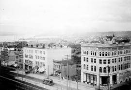
![Part of Cordova Street [looking east from Abbott Street] Vancouver](/uploads/r/null/a/f/af5f017adc7f7bf40db1773e103563deff369929783ec4585e5c4cdf4100179c/f39eaff7-6871-4690-883c-ee19636e93e3-A36978_142.jpg)


![[People entering streetcar on Main Street at 25th Avenue]](/uploads/r/null/7/3/73e5b03273a4342e33703d759e95195f161d4b05b3c73be4d76ba5118bebd463/d73b91e1-7630-459f-ae97-2cd75375f37e-A04880_142.jpg)
![[Pioneer Place, corner of Carrall Street and Hastings]](/uploads/r/null/f/1/f1fb96f366d0ef2e66033ee2509c84a10397ec618516e4e5310b9894be9473e6/3e478109-296b-4515-b3d2-92aa140f5d14-A10284_142.jpg)


![[Power lines over intersection of Cambie and Pender Streets]](/uploads/r/null/5/6/567541cd1d6b32e46f96fe47ea2ea6f11a047a332ba8dfa7097f0d7126b1bb63/f0b55b3c-8dee-4642-bf4f-0be7267e5a57-A08573_142.jpg)

![[Road construction along Granville Street at Pender Street, looking north]](/uploads/r/null/7/4/741560202d677bb2d779ef3460dbc6bb95b11c6dc843a7591a7e5fa56855e1e0/b4117812-ec1e-4184-a433-8150bf7f7cb9-A09787_142.jpg)
![[Road construction on Granville Street]](/uploads/r/null/8/f/8f888f1e62cbef60fce6f6f97689dc8bb599e4335a008755f6da0e420acd109e/47e59ae2-654d-460b-9a53-76aca21cdbc6-A09784_142.jpg)
![[Road paving on 41st Avenue east of the Boulevard]](/uploads/r/null/c/3/c3a53f6959e33bff79d0c7e151703d2dc212af40db9a6b80b653644e87ee8a57/c27b962e-f073-4882-9a20-def769f8026d-A37222_142.jpg)
![[Robson Street at Cambie Street looking east]](/uploads/r/null/4/0/40ed8d90c9a40624839bcf34a47a48602cdb377b3635dbdd2901a7daae9ec033/e0a6d9cd-524a-4b0c-a328-d2d1d6cfddc9-A37208_142.jpg)

![[Sidewalk construction on Main Street at East 35th Avenue]](/uploads/r/null/9/7/9717d4dcf8f6cb6e0e4bc87440f673d337b65aca4287db4e2d6294b71206d038/f5456cfa-3256-4f97-a89c-2370b3c97520-A09815_142.jpg)
![[Soldiers marching along Pender Street]](/uploads/r/null/5/b/5b2c20f872e1557b9f36ae33fcfaec8406d180d9fe7526661edcd8a59ef65306/0e7bae00-fc68-401c-9653-3940b358a9e0-A32175_142.jpg)
![[Southeast view of 37th Avenue in Shaughnessy]](/uploads/r/null/3/b/3be537432c63de3d5aafd5433ff7720b77b6ebf44e980c7db45332d9d362620a/823c6062-d341-4568-801d-b948633953dd-A63969_142.jpg)
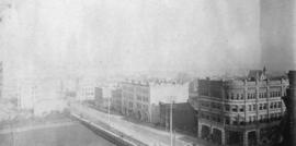
![[Southern view of Granville Street from Cordova Street]](/uploads/r/null/2/b/2b76881fc3110b0e7912926877db882d580ff3291083ad3f74326be70b1541b6/f4906735-55dd-4cd5-a832-8fedea2149ad-A24568_142.jpg)
![[Southern view of Samuel and Fitzgerald McCleery's farms - District Lots 315 and 316]](/uploads/r/null/2/9/e/29e5e2ee1ab72e418f96f7141a35b69a66da2b5808f04d8af443c2fdae390ef2/d22eb2ef-a370-4cc4-99f3-9ddec8fddaf8-LP355_142.jpg)
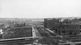
![[Southern view of West Boulevard from 39th Avenue]](/uploads/r/null/8/5/85d616b21986fa99fa58983b05163d1e230f61d8282bf8a60422a2ee24615fb1/515220b4-9888-4e57-a16b-b9e10ad22237-A25958_142.jpg)

![[Sperling Avenue looking east]](/uploads/r/null/f/9/f920da06add889342c9a54d316497cf061e5c872aa3e486d9fb36a80d8574efb/b6b9d303-f8c5-4376-9205-f4d4682e0afd-A09329_142.jpg)
![[Sperling Avenue looking east]](/uploads/r/null/a/b/ab3bfc916b6f2fbf01857de7d3408c89a440eaebcb36d3c2cc2e077f3a24345b/4e8da1c5-f7c0-4f8f-ae87-e51a89a9e770-A09328_142.jpg)

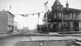
![[Street car outside the Winram Block, 17th and Main St.]](/uploads/r/null/e/1/e14e644a588b3f93678f4c964d20100150b12ddfe3bf74e33850981e29b76c8b/a52e4081-8f51-4943-a4c5-3fadd9085e6b-A19271_142.jpg)
![[Street cars and taxicabs on Hastings Street]](/uploads/r/null/e/3/e3460b082958ce0fb70de47b3e1459bdb3ce0a26a86c14d8c3200e76490c633e/2bb3fbd4-de88-4667-a78d-09fa1c22a6be-A09848_142.jpg)
![[Street in Chilliwack, B.C.]](/uploads/r/null/0/8/082181d30263f8c29364b1165b9fb2fe22e18a52d4a30822f6f3731bc517fba4/6f277c2d-4ce1-4020-a8dd-aca1f84efe60-A08226_142.jpg)
![[Streetcar line construction on Powell Street looking west from Westminster Avenue (Main Street)]](/uploads/r/null/d/8/d8884536bf5d76c43435e3bd2e7aff38b879a22cfe27532fd0b24b7c5482ac4a/cad8152b-7719-4bcc-973d-a082d6e82242-A37512_142.jpg)
![[Streetcar line construction on Westminster Avenue (Main Street)]](/uploads/r/null/c/d/cd6ae92c940a945bf869cecbbd6cfc810a1c0b210fb431de7ab96c3a0f746f48/2485f482-524d-4662-b9df-0eae6874feac-A37510_142.jpg)
![[Streetcar line construction on Westminster Avenue (Main Street)]](/uploads/r/null/2/e/2e11f1b88aede4c0a2ce506bae1ec7c0a9a7fee2726e6e29c6c23f0c6b448cb1/e5f93bcf-7245-4739-999d-c179ae971e63-A37511_142.jpg)
![[Surveyors on street in South Vancouver]](/uploads/r/null/b/0/b09502a2af3b99222d80fd5668c89eb6ad7f009934c53dd430cadad418ffe532/5b53049e-48db-4876-9ec4-b4adcbb0e6e0-A19303_142.jpg)