
North Arm of Fraser River - Point Grey sheet

Burrard Inlet - Dollarton sheet

Burrard Inlet - Second Narrows sheet

Burrard Inlet - Barnet sheet

Burrard Inlet - Port Moody sheet

Fraser River - triangulation control
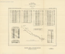
North Arm of Fraser River - triangulation control

Burrard Inlet - triangulation control

Map of City of Vancouver. British Columbia
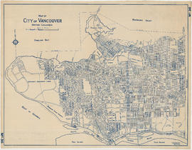
Map of City of Vancouver. British Columbia
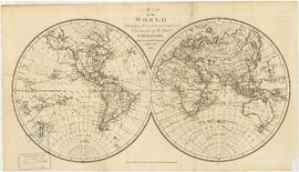
Map of the world

North America

Map of Greater Vancouver Water District
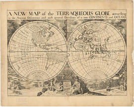
A new map of the terraqueous globe

A new map of the terraqueous globe

Plan of a 9.783 acre portion of Kitsilano Indian Reserve, District Lot 3610, Group one, New Westminster District

Plan of a 9.783 acre portion of Kitsilano Indian Reserve, District Lot 3610, Group one, New Westminster District [annotated]

Plan of a 9.783 acre portion of Kitsilano Indian Reserve, District Lot 3610, Group one, New Westminster District [annotated]

Coal Harbour, Vancouver, B.C.

Plan of a 9.783 acre portion of Kitsilano Indian Reserve, District Lot 3610, Group one, New Westminster District [annotated]

British Columbia

Composite aerial mosaic of metropolitan Vancouver

Plan of district lots 264, 265, 266 and 552, North Vancouver, British Columbia

Plan of the Town of Port-Moody, British Columbia
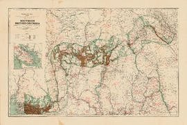
![South Western Districts [of British Columbia]](/uploads/r/null/d/0/c/d0ceafbed0c6a061cca38316066e937eb832289e737bebc70e29bbbd8db278b4/9724c086-f8fa-4751-8cfe-808fa27e04d2-MAP115_142.jpg)
South Western Districts [of British Columbia]

Plan of Vancouver Harbour and False Creek, Vancouver, B.C., showing proposed improvements as outlined in Jos. R. Roy's reports dated 15th Sept. 1906

Carte particuliere de la cote du Nord-Ouest de l' Amerique reconnue par les fregates Francaises la Boussole et l'Astrolabe en 1786, 2e. feuille

New Westminster
Southern British Columbia showing disposition of lands within the Railway Belt

Plan of the City of Vancouver, B.C.

Plan of Point Grey Municipality

Map of the city of Vancouver, British Columbia

Portions of New Westminster District and Vancouver Island

Proposed route of Grouse Mountain Highway

Southerly portion. Vancouver Island
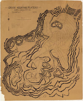
Grouse Mountain Plateau, North Vancouver, B.C.

Map of the south-western part of British Columbia

Vancouver Harbour, British Columbia, 1932

Vancouver, British Columbia

Vancouver

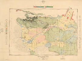
Geological map of parts of Nanaimo and New Westminster mining divisions

Plan of West Vancouver Municipality
Fraser River Delta, British Columbia

British Columbia
![Plan of Point Grey Municipality [ward boundaries]](/uploads/r/null/a/c/a/aca691b3d6e49d092070fc230a88f5ca7bd346fc8c5894892d7cdc5a79b535ee/9a14b192-1858-43aa-ab28-d0b03a2304eb-MAP360_142.jpg)
Plan of Point Grey Municipality [ward boundaries]

Plan of government subdivision at Point Grey, B.C.

Plan of the City of Vancouver, B.C.

Vancouver Harbour. British Columbia

Warehouse and store sites : very centrally located

North America. West Coast. Fraser River and Burrard Inlet