
Mike Harcourt and Theresa Galloway at drinking fountain
- COV-S477-3-F111-: CVA 775-188-: CVA 775-188.19
- Part
- Oct. 1, 1986
Part of City of Vancouver fonds
379 results with digital objects Show results with digital objects
Mike Harcourt and Theresa Galloway at drinking fountain
Part of City of Vancouver fonds

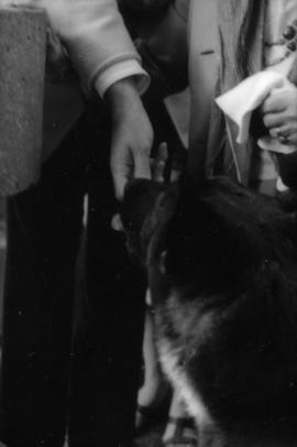
Theresa Galloway and police dog Sport at drinking fountain
Part of City of Vancouver fonds

Theresa Galloway and police dog Sport at drinking fountain
Part of City of Vancouver fonds

Theresa Galloway and police dog Sport at drinking fountain
Part of City of Vancouver fonds

Theresa Galloway and police dog Sport at drinking fountain
Part of City of Vancouver fonds

Theresa Galloway and police dog Sport at drinking fountain
Part of City of Vancouver fonds
Police dog Sport at drinking fountain
Part of City of Vancouver fonds

Constable Rob Bosley and police dog Sport at drinking fountain
Part of City of Vancouver fonds

Constable Rob Bosley and police dog Sport at drinking fountain
Part of City of Vancouver fonds

Constable Rob Bosley and police dog Sport at drinking fountain
Part of City of Vancouver fonds

Constable Rob Bosley and police dog Sport at drinking fountain
Part of City of Vancouver fonds

Part of City of Vancouver fonds
![[Homes by Sharp, Thompson, Berwick and Pratt Architects on Knight Road]](/uploads/r/null/1/3/13bdd14942b6872910266ee6c0394fd551cca6f42c9373a635985fe80ed9e7cd/fcc13dd3-1709-4fc8-8af7-060022e4dc0b-A42453_142.jpg)
[Homes by Sharp, Thompson, Berwick and Pratt Architects on Knight Road]
Part of City of Vancouver fonds

Marpole : land value per square foot : increments of $0.50 : map
Part of City of Vancouver fonds
Item is a map annotated to show land value for the area bounded by Granville Street, Oak Street, 70th Avenue, and S.W. Marine Drive. Base map shows streets and block numbers.

Marpole : land value per square foot : increments of $1.50 : map
Part of City of Vancouver fonds
Item is a map annotated to show land value for the area bounded by Granville Street, Oak Street, 70th Avenue, and S.W. Marine Drive. Base map shows streets and block numbers.

Marpole : property ownership : map
Part of City of Vancouver fonds
Item is a map annotated to show property ownership type for the area bounded by Granville Street, Oak Street, 70th Avenue, and S.W. Marine Drive. Base map shows streets and block numbers.

Marpole : building value per square foot of land : map
Part of City of Vancouver fonds
Item is a map annotated to show building value for the area bounded by Granville Street, Oak Street, 70th Avenue, and S.W. Marine Drive. Base map shows streets and block numbers.

Marpole : building conditions : map
Part of City of Vancouver fonds
Item is a map showing conditions of buildings by type for the area bounded by French Street, Oak Street, 71st Avenue, and S.W. Marine Drive.
![Government precinct : property ownership and land use [recto]](/uploads/r/null/6/a/2/6a25fbf79bc6b4a56deec88a9932e272e019da9efa1114cb1170a05787ec642f/6e89a1f3-b054-48d7-8a88-687079cb8bf3-LEG1200_142.jpg)
Government precinct : property ownership and land use [recto]
Part of City of Vancouver fonds
Map recto showing property ownership and land use for the area bounded by Oak Street, Yukon Street, Broadway, and 13th Avenue. Base map shows streets and topographical contour lines.

Rupert Street to Boundary Road
Part of City of Vancouver fonds

Welwyn Street to Rupert Street
Part of City of Vancouver fonds
![Sheet No. 56 [Ontario Street to SW Marine Drive to Ash Street to Fraser River]](/uploads/r/null/1/9/8/19805cc3ca1a36e79b75812124f4d19bc1cba5d9c9a5cbfda7eb2e5d00efe39d/792d979d-2b3f-44fb-8739-651d77bbef08-LEG1153_142.jpg)
Sheet No. 56 [Ontario Street to SW Marine Drive to Ash Street to Fraser River]
Part of City of Vancouver fonds

Part of City of Vancouver fonds
![Sheet No. 55 [Boundary Road to Sixty-sixth Avenue to ca. Tyne Street to Fraser River]](/uploads/r/null/3/a/c/3ac8590cc5a2246cce9796841569265201d54e629168c61ff788739a6da3a3d7/87ee0a66-62dc-4480-a8a7-583ba87ea320-LEG1153_142.jpg)
Sheet No. 55 [Boundary Road to Sixty-sixth Avenue to ca. Tyne Street to Fraser River]
Part of City of Vancouver fonds
![Sheet No. 54 [Boundary Road to Fifty-eighth Avenue to Tyne Street to Sixty-sixth Avenue]](/uploads/r/null/4/9/2/4925e281903d682f1a68e9722289d297d3b67f69de4977aca839c40d77ac6c47/d1cab1e4-ba00-4e71-a0b0-055f4b10f9bb-LEG1153_142.jpg)
Sheet No. 54 [Boundary Road to Fifty-eighth Avenue to Tyne Street to Sixty-sixth Avenue]
Part of City of Vancouver fonds
![Sheet No. 53 [Boundary Road to Forty-seventh Avenue to Tyne Street to Fifty-fifth Avenue]](/uploads/r/null/b/7/3/b738974ae4282e40f18c767c7add7909d5db6c15a03431d6482d0335fc8b7f1a/cac7c189-dcac-4f56-84f9-d36f083feb73-LEG1153_142.jpg)
Sheet No. 53 [Boundary Road to Forty-seventh Avenue to Tyne Street to Fifty-fifth Avenue]
Part of City of Vancouver fonds
![Sheet No. 52 [Boundary Road to Kingsway Avenue to Latta/Tyne Street to Forty-seventh Avenue]](/uploads/r/null/c/9/7/c9787c126bdd66e5fc93cd8e14abf9607c95b53c53ee51abfd56c5c1a3e1ff34/96e57a2c-bfc4-4471-8028-0f0277ff2039-LEG1153_142.jpg)
Sheet No. 52 [Boundary Road to Kingsway Avenue to Latta/Tyne Street to Forty-seventh Avenue]
Part of City of Vancouver fonds
![Sheet No. 51 [Boundary Road to Wellington Avenue to Joyce Street to Kingsway Avenue]](/uploads/r/null/0/8/9/089ba7d6dc97c2ea4343f6b95d25598d2dcbe135f9e1a39fceb3f0adc8b046fb/5a9b9f26-50d0-4a58-89c6-49c394b4947b-LEG1153_142.jpg)
Sheet No. 51 [Boundary Road to Wellington Avenue to Joyce Street to Kingsway Avenue]
Part of City of Vancouver fonds
![Sheet No. 48 [Tyne Street to Fifty-fifth Avenue to Carlton Street to Sixty-fourth Avenue]](/uploads/r/null/f/b/3/fb3b99f3c4012f98adfd3626254e61dc507170d72f08abc8122e4a4bca973e22/f9fb5f40-d7ae-4820-9beb-cf412855a2a1-LEG1153_142.jpg)
Sheet No. 48 [Tyne Street to Fifty-fifth Avenue to Carlton Street to Sixty-fourth Avenue]
Part of City of Vancouver fonds
![Sheet No. 50 [Boundary Road to Twenty-ninth Avenue to Rupert Street to Austrey/Vanness Avenue]](/uploads/r/null/5/2/9/52934c0a1ba6dd8c80559e3eeb8424dd638f7ee32fb05e5e51366bc0871c77b8/b9b3b18a-094e-4fab-bf6c-26680026d8e9-LEG1153_142.jpg)
Sheet No. 50 [Boundary Road to Twenty-ninth Avenue to Rupert Street to Austrey/Vanness Avenue]
Part of City of Vancouver fonds
![Sheet No. 49 [Tyne Street to Sixty-third Avenue to Carlton Street to Fraser River]](/uploads/r/null/7/b/7/7b781c0eb1728d147d6b43104b88ede85b451ab4dd87a8cd6e48bbc8c2620897/2b41070d-7d73-42b7-9111-a4e302573fe1-LEG1153_142.jpg)
Sheet No. 49 [Tyne Street to Sixty-third Avenue to Carlton Street to Fraser River]
Part of City of Vancouver fonds
![Sheet No. 46 [Latta Street to School Road to Carlton Street to Waverley Avenue]](/uploads/r/null/3/6/f/36f5f844e9ea290b57847087296d896d5a12daf000d786ac01e881e0499c5510/28507a18-a9f9-4492-bd9a-2ddfa8ede098-LEG1153_142.jpg)
Sheet No. 46 [Latta Street to School Road to Carlton Street to Waverley Avenue]
Part of City of Vancouver fonds
![Sheet No. 47 [Tyne Street to Waverley Avenue to Carlton Street to Fifty-fifth Avenue]](/uploads/r/null/0/2/d/02d2ea6dd58f76cb1dea69e2e248d07d34d83ace41aaf53673576a79d3434798/dd8d0471-5263-4163-b660-ffa7aad783f9-LEG1153_142.jpg)
Sheet No. 47 [Tyne Street to Waverley Avenue to Carlton Street to Fifty-fifth Avenue]
Part of City of Vancouver fonds
![Sheet No. 45 [Wessex/Joyce Street to Austrey/Euclid Avenue to Dundee Street to Forty-first Avenue]](/uploads/r/null/7/c/f/7cf9f762e9c215503c62d537372c957a9c5fe447703761c2c7a7c44cd0ed7540/8febd995-e66b-4dd3-a147-3ccad6cb2e8a-LEG1153_142.jpg)
Sheet No. 45 [Wessex/Joyce Street to Austrey/Euclid Avenue to Dundee Street to Forty-first Avenue]
Part of City of Vancouver fonds
![Sheet No. 43 [Moss Street to Twenty-ninth Avenue to Clarendon Street to Kingsway Avenue]](/uploads/r/null/2/f/e/2fed326a9408f52a6de451db8803f3ca1188e78d05a8232190e3902890c62b9c/fc9322a5-4780-49f8-8405-d209103ce7f0-LEG1153_142.jpg)
Sheet No. 43 [Moss Street to Twenty-ninth Avenue to Clarendon Street to Kingsway Avenue]
Part of City of Vancouver fonds
![Sheet No. 44 [McHardy Street to Twenty-ninth Avenue to Moss Street to Horley Street]](/uploads/r/null/d/6/a/d6a3dc99a6b3f692c3fe9b210801b14df90ac6e9b951db09a961de7c7339c058/cb39b884-ce77-4369-b117-9c92e8ece5c6-LEG1153_142.jpg)
Sheet No. 44 [McHardy Street to Twenty-ninth Avenue to Moss Street to Horley Street]
Part of City of Vancouver fonds
![Sheet No. 41 [Carlton Street to Fifty-seventh Avenue to Nanaimo Street to Sixty-fifth Avenue]](/uploads/r/null/4/a/5/4a51356de1ddb79cb9aa5c6fc573bbbcf9640d4469550b5080b5981b049eace0/0ba2e77f-80d3-4101-84f9-df784bee297c-LEG1153_142.jpg)
Sheet No. 41 [Carlton Street to Fifty-seventh Avenue to Nanaimo Street to Sixty-fifth Avenue]
Part of City of Vancouver fonds
![Sheet No. 42 [Carlton Street to Sixty-fifth Avenue to Nanaimo Street to Fraser River]](/uploads/r/null/c/0/f/c0f25974b8cca0a9e6f1e4c1214f703f6abd3815da448a70c658b3c96348b904/cc4651ef-1513-4f8b-a413-bf5022a25c83-LEG1153_142.jpg)
Sheet No. 42 [Carlton Street to Sixty-fifth Avenue to Nanaimo Street to Fraser River]
Part of City of Vancouver fonds
![Sheet No. 39 [Carlton Street to Forty-first Avenue to Nanaimo Street to Forty-eighth Avenue]](/uploads/r/null/d/5/e/d5e393f2166d9b7af78a6d4e999cc8e2574558679d5be4506435016449640c50/af107c2d-81ff-4512-8506-f4be16caafd4-LEG1153_142.jpg)
Sheet No. 39 [Carlton Street to Forty-first Avenue to Nanaimo Street to Forty-eighth Avenue]
Part of City of Vancouver fonds
![Sheet No. 40 [Carlton Street to Forty-eighth Avenue to Nanaimo Street to Fifty-seventh Avenue]](/uploads/r/null/3/9/c/39c1f6a2674fda099f176d8500afe7bbadf4c2a8c241368656998837f098c9b6/7d092c70-6d84-4079-80f4-dd352813f3f1-LEG1153_142.jpg)
Sheet No. 40 [Carlton Street to Forty-eighth Avenue to Nanaimo Street to Fifty-seventh Avenue]
Part of City of Vancouver fonds
![Sheet No. 38 [Dundee Street to Kingsway Avenue to Nanaimo Street to Forty-first Avenue]](/uploads/r/null/5/2/9/52963d94b3d53640e63b18df48d3cf38d6a4e213048f0b41c02a1dcfd1695ec0/955b099b-ddfb-4694-b03f-0954f0b7b4df-LEG1153_142.jpg)
Sheet No. 38 [Dundee Street to Kingsway Avenue to Nanaimo Street to Forty-first Avenue]
Part of City of Vancouver fonds
![Sheet No. 36 [Nanaimo Street to Vanness Avenue to Victoria Drive to Twenty-ninth Avenue]](/uploads/r/null/f/8/7/f876ce80d3d7719835f1740ffd5ec24e39293234d35e1fdd02b34dacc10fd167/6ebdf698-b423-4a30-8ab8-8a1e88e5a0da-LEG1153_142.jpg)
Sheet No. 36 [Nanaimo Street to Vanness Avenue to Victoria Drive to Twenty-ninth Avenue]
Part of City of Vancouver fonds
![Sheet No. 37 [Clarendon Street to Twenty-ninth Avenue to Victoria Drive to Thirty-fourth Avenue]](/uploads/r/null/a/b/6/ab6efd7a6bec72799096363dfc7969a55894ca128e07675ca394f1ca94b22127/bbdcfcaf-3e5b-4324-ac44-281237a8ab0d-LEG1153_142.jpg)
Sheet No. 37 [Clarendon Street to Twenty-ninth Avenue to Victoria Drive to Thirty-fourth Avenue]
Part of City of Vancouver fonds
![Sheet No. 33 [Nanaimo Street to Fifty-ninth Avenue to Argyle Street to SE Marine Drive]](/uploads/r/null/1/f/a/1fadb50e0328ff5a5cdb22e049550f8bc6741c172d879888cdacf80132a66d0d/b730dccb-b953-40c8-b960-934fdfa8f476-LEG1153_142.jpg)
Sheet No. 33 [Nanaimo Street to Fifty-ninth Avenue to Argyle Street to SE Marine Drive]
Part of City of Vancouver fonds
![Sheet No. 34 [Nanaimo Street to Sixty-seventh Avenue to Argyle Street to Fraser River]](/uploads/r/null/4/c/e/4cea52478f5099520495a787924b11f0ff477b8b48574b8e8905d63a98366708/56538ddf-f8b2-4cea-8988-cc060ec6cbee-LEG1153_142.jpg)
Sheet No. 34 [Nanaimo Street to Sixty-seventh Avenue to Argyle Street to Fraser River]
Part of City of Vancouver fonds
![Sheet No. 35 [Nanaimo Street to Sixteenth Avenue to Hull Street to Vanness Avenue]](/uploads/r/null/6/8/1/681f22c0529af4757ca252e416474a12ac016f3e57bd04c57d99fcd77d23c66e/840c8d95-974e-4552-a959-904ea3e79db4-LEG1153_142.jpg)
Sheet No. 35 [Nanaimo Street to Sixteenth Avenue to Hull Street to Vanness Avenue]
Part of City of Vancouver fonds
![Sheet No. 32 [Nanaimo Street to Fifty-first Avenue to Argyle Street to Fifty-ninth Avenue]](/uploads/r/null/5/8/6/586ccfe3e78aa195aec1125840004dca9cdad39ff21423ae7ae38411d4ff1c91/ae917ac2-eda7-473b-9ffd-277203da6027-LEG1153_142.jpg)
Sheet No. 32 [Nanaimo Street to Fifty-first Avenue to Argyle Street to Fifty-ninth Avenue]
Part of City of Vancouver fonds
![Sheet No. 31 [Nanaimo Street to Forty-fourth Avenue to Argyle Street to Fifty-second Avenue]](/uploads/r/null/4/8/f/48f36eed341fe71f50f9b4074d459ea64b1a49ab764ed157afeb63415c573ec1/ad7fbffd-b136-4956-b224-91c82cb90d0a-LEG1153_142.jpg)
Sheet No. 31 [Nanaimo Street to Forty-fourth Avenue to Argyle Street to Fifty-second Avenue]
Part of City of Vancouver fonds
![Sheet No. 30 [Nanaimo Street to Thirty-eighth Avenue to Argyle Street to Forty-fourth Avenue]](/uploads/r/null/0/4/c/04c81fa78038ea8e9afe60c42a48709118e464bd7169040f912fa001d4a2ac5f/9677b04c-f76b-442a-a233-54772c02084d-LEG1153_142.jpg)
Sheet No. 30 [Nanaimo Street to Thirty-eighth Avenue to Argyle Street to Forty-fourth Avenue]
Part of City of Vancouver fonds
![Sheet No. 26 [Argyle Street to Sixty-first Avenue to Ross Street to Fraser River]](/uploads/r/null/d/8/5/d85899ed4866e6864ca8c8685292167d48ba2555e0908db68dc75c7b8647c258/2f5594d4-3328-447e-80b4-00d6c79954d5-LEG1153_142.jpg)
Sheet No. 26 [Argyle Street to Sixty-first Avenue to Ross Street to Fraser River]
Part of City of Vancouver fonds